Ophir Mining District (Auburn Mining District; Duncan Hill Mining District), Placer Co., California, USAi
| Regional Level Types | |
|---|---|
| Ophir Mining District (Auburn Mining District; Duncan Hill Mining District) | Mining District |
| Placer Co. | County |
| California | State |
| USA | Country |
This page is currently not sponsored. Click here to sponsor this page.


Latitude & Longitude (WGS84):
38° 53' 26'' North , 121° 7' 22'' West
Latitude & Longitude (decimal):
Locality type:
Köppen climate type:
Location: A Au-Ag-Pb-Cu mining area located in sec. 18, T12N, R8E, MDM. The center of this district is about two miles west of the old town area of Auburn. Discovered in 1851. The district is oblong shaped and covers several square miles. It trends west-northwest and is about 5 miles long by 2 miles wide. Access is via paved rural roads.
This lode-gold district is located in southwestern Placer County, in the vicinity of the old town of Ophir and includes many individual mines developed along a west-northwest-trending belt of quartz veins, which formed at the contact between granitic and metavolcanic rocks a few miles west of the town of Auburn. It is the most productive lode-gold district in Placer County. It extends east to Auburn and west to Gold Hill and also includes what was known as the Duncan Hill Mining District, which was centered about half way between the towns of Ophir and Auburn. It adjoins the Penryn District on the NE.
The district is situated among hills that are subdivided by semi-rural residential development. Vegetation consists of a mixture of grass and oak woodland. The topography of the area underlain by the metavolcanic rock is rugged in places, while that underlain by the quartz diorite is more subdued.
History: Gold-bearing surface gravels were discovered at Ophir and Auburn in 1848 and for several years yielded substantial amounts of the mineral. The quartz veins were then developed, and the Ophir and Duncan Hill districts were organized. Appreciable amounts of high-grade gold ore were recovered during the 1860's, 1870's, and 1880's, but mining activity in the district declined after that. The mines were active again from the early 1900's through the 1930's with substantial production, but little has been done since. The value of the total output of the district is estimated at more than $5 million (period values).
Gold-bearing surface gravels were discovered at Ophir and Auburn in 1848 and for several years yielded substantial amounts of the mineral. The quartz veins were then developed, and the Ophir and Duncan Hill districts were organized. Appreciable amounts of high-grade gold ore were recovered during the 1860's, 1870's, and 1880's, but mining activity in the district declined after that. The mines were active again from the early 1900's through the 1930's with substantial production, but little has been done since. The value of total output of the district is estimated at more than $5 million (period values).
Processing of ores from this district in the early days was hindered by the presence of abundant sulfides. A chief period of production was in the 1870's. From the mid-1930's to 1942, the district was also very productive, but between 1942 to 1959, less than 100 ounces per year were produced (Koschmann and Bergendahl, 1968). Mining activity subsequent to that time is not known, but is assumed to have been very minor.
There are at least 50 known lode mines in the Ophir District. The most productive mines were the Bellevue, Crater Hill, Gold Blossom, Hathaway, Oro Fino (Oro Fina), and Three Star. The Crater Hill may have been the largest producer in the district (estimated by Clark to be $750,000 [period values]). The Oro Fina was the last-worked important producer in the district as of the 1930's.
Amalgamation and flotation processes were used at mines in this district. Concentrates (sulfide minerals) were typically shipped elsewhere for processing.
Geology: The mineralized zone is on the NE flank of a granodiorite and quartz-diorite stock that is intrusive into amphibolite schist. A series of west-northwest-striking and south-dipping quartz veins occur in the granitic rocks or along the granitic rock-amphibolite schist contact. A few veins are in the amphibolite. The ore contains free gold in places with
often abundant pyrite, galena, and chalcopyrite; much of the ore is base. Milling ore ranged from ½ to 1 ounce of gold per ton. Considerable high-grade ore was taken close to the surface during the early day's. The veins range from one to five feet in thickness, and several were mined to depths of more than 1,000 feet. The ore shoots had stoping lengths of up to 250 feet.
The Ophir District is situated at the western edge of the Sierra Nevada metamorphic belt. Here, metamorphosed Jurassic island-arc volcanic rocks have been intruded by quartz diorite of the Lower Cretaceous Penryn Pluton (Olmsted, 1971; Wagner and others, 1981). The mines of the district are developed in a system of quartz veins along and adjacent to the contact between the plutonic rock and metavolcanic rock. Both types of rock serve as hosts for the quartz veins. Younger igneous dikes of dioritic composition intrude the plutonic and metavolcanic rocks and are also associated with the quartz veins in places.
In general, the vein system of the district strikes west-northwest, and dips of individual veins are about 40-80SW. There is a lesser set of veins within the central part of the system, which strike northeast and dip 20-60SE. Lindgren (1892) reported that the westerly striking set of veins was more important economically. Thicknesses of veins in the district range from a few inches up to 10 or 20 feet; the average is about one foot. Several veins are traceable for 1.5 miles or more. The veins are present in both the quartz diorite and metavolcanic rocks, and commonly cross the contact. In the quartz diorite, the hanging walls of the quartz veins typically are composed of the diorite dikes mentioned above, although some ore bodies are not associated with dikes. The dikes are seldom over 1-2 feet thick and in some places are altered to amphibolite (Lindgren, 1892).
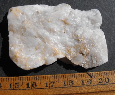
The veins are typically characterized by ribbon structure and contain vugs and cavities locally, which are strong evidence for origination of the veins by filling of open fissures rather than by replacement of wallrock. Undulatory extinction and comminution of quartz in the veins suggest movements along some of the veins. Gangue consists almost entirely of quartz with very minor calcite and chalcedony.
Lindgren (1892) reported that the wallrocks of quartz diorite and amphibolite are intensely altered; the zones of alteration are a few inches to a few feet wide and are composed of grayish to white fine-grained rock where formerly metavolcanic rock and grayish green rock where formerly quartz diorite. Alteration minerals in the quartz diorite and metavolcanic wall rock consist of aggregates of carbonate (mostly calcite), sericite, and euhedral pyrite. Pyrite is more abundant in the altered rock than in the veins and unaltered rock. Lindgren (1892) interpreted the alteration to be similar in both types of wallrock and was the result of carbonatization. In some places, the altered rock contains small amounts of gold and silver even though no quartz veins are present. In other places, small veinlets of quartz traverse the rock.
Lindgren (1892) observed that the character of the ores in the two main types of host rock are somewhat different. Those in the quartz diorite are low grade, rich in silver, and very extensive. Those in the metavolcanic rock are richer, contain less silver, and are of small extent (commonly present as ?pockets?).
Concentration of sulfides was generally considered an indicator of richness of the gold-quartz ore; galena is an especially good indicator. Milling ore contained 1.5 to 3% sulfides. Pyrite is the most common sulfide.
Of note near the northwest edge of the district are the orientations of a third set of veins, which were developed at the Three Star Mine and a few other mines. This vein system trends north-northeast rather than west-northwest.
Geologic structures: Regional structure include the Bear Mountains Fault Zone.
Mineralogy: Mineralization is Cretaceous lode Au veins in amphibolite and granitic rocks. Ore bodies are generally tabular. Mineral occurrence model information: Model code: 273; USGS model code: 36a; Deposit model name: Low-sulfide Au-quartz vein; Mark3 model number: 27. Host rocks include the Early Cretaceous (Chronological age: 139) quartz diorite of the Penryn pluton; the Late Jurassic amphibolite of the Copper Hill Volcanics; and Cretaceous diorite dikes. Controls for ore emplacement included quartz veins filling fractures developed in quartz diorite and metamorphosed mafic to intermediate volcanic rock. Lindgren (1892) observed that where the quartz veins intersected zones of metavolcanic rock enriched in pyrite and copper sulfides (termed "iron belts"), the veins were more enriched in gold. Also, some localities where veins intersected were the sites of pockets or rich ore shoots. Local alteration includes carbonatization, calcite, sericite, pyrite, minor chlorite formed as selvages a few inches to a few feet wide in wallrock immediately adjacent to quartz veins. Local rocks include Mesozoic granitic rocks, unit 3 (Sierra Nevada, Death Valley area, Northern Mojave Desert and Transverse Ranges)
The ore bodies of the Ophir District are developed in gold-bearing quartz veins emplaced in quartz diorite of the Lower Cretaceous Penryn Pluton and in older Jurassic metavolcanic rocks, which are mafic to intermediate composition. In places, dioritic dikes are associated with the quartz veins. The veins are present in three sets. The dominant set trends west-northwest, has dips mainly to the southwest, and was the most important source of gold in the district. A second set, which intersects the central part of the dominant set, trends northeast, with dips to the southeast. The third set is minor and trends northerly along the west edge of the district.
The quartz veins are typically characterized by ribbon structure and contain vugs and cavities locally, which are strong evidence for origination of the veins by filling of open fissures rather than by replacement of wallrock. Undulatory extinction and comminution of quartz in the veins suggest movements along some of the veins. Gangue consists almost entirely of quartz with very minor calcite and chalcedony. Ore was typically found in shoots that extended down-dip within the quartz veins. Where the veins intersect zones of metavolcanic rock enriched in pyrite and copper sulfides (termed ?iron belts?), miners observed that the veins were more enriched in gold.
Ore consists mainly of native gold (electrum) and sulfides that are auriferous and argentiferous. The ore bodies are noteworthy for their high silver content. Concentration of sulfides was generally considered an indicator of richness of the gold-quartz ore; galena is an especially good indicator. Milling ore typically contained 1.5 to 3% sulfides, with pyrite the most common sulfide. Narrow zones of altered wallrock adjacent to the quartz veins also contain sulfides, some of which carry minor amounts of gold and silver.
An extensive summary of the lode-gold deposits of the Ophir District was presented by Lindgren (1892).
Commodity Information: The district is notable for the large proportion of silver in the ore - most native gold mined was in the form of electrum. Gold seldom exceeded .700 in fineness and was as low as .500 to .600; the average fineness in California was about .850 (Lindgren, 1892). Regarding sulfides, Lindgren (1892) reported that gold was typically found in the pyrite, while silver was found in the tetrahedrite, galena, and sphalerite. Some specimen gold was produced in this district. Ore Materials: Native gold (mainly as electrum), auriferous and argentiferous sulfides (pyrite, chalcopyrite, galena, sphalerite, arsenopyrite, tetrahedite, molybdenite), native silver, stibnite, tellurides, selenides. Gangue Materials: Quartz, calcite, chalcedony.
Workings Information: This district contains numerous small underground mines, which were developed along the extensive system of quartz veins that cut the Penryn Pluton and Jurassic metavolcanic rocks. Workings typically consisted of shafts, adits, drifts, and crosscuts with associated stoping of the ore shoots. The Crater Hill Mine may have the deepest workings in the district; the shaft was at least 800 feet deep in the early 1890's. Logan (1936) reported, however, that the shaft of the Oro Fina Mine reached a depth of 860 feet on a 72-degree incline during the 1930's. Workings of most mines were probably limited to less than 500 feet deep.
Waring (1915) provided a figure that shows the claims of the district as of the early 20th century.
Production Information: Clark (1970) estimated production in this district to be in excess of $5 million (period values), which may include both lode and placer sources. Koschmann and Bergendahl (1968) estimated lode production to be about 255,500 ounces of Au.
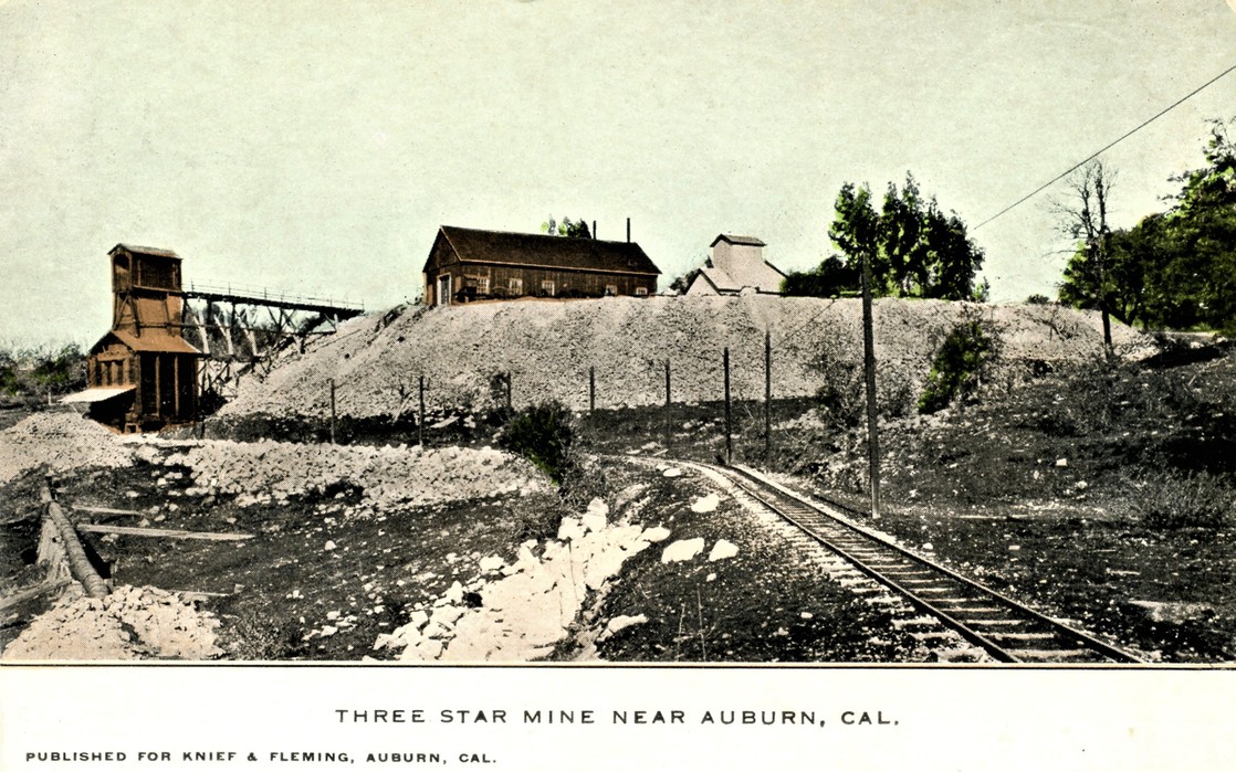
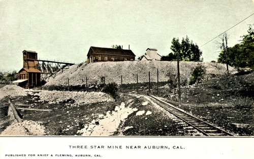
Mines: Belmont, Black Ledge, Centenial ($150,000+), Conrad ($50,000), Crater ($750,000), Doig, Eclipse ($100,000+), Gold Blossom ($216,000+), Grass Ravine, Green ($150,000+), Green Emigrant ($150,000+), Hathaway ($336,000), Julian, Mina Rica ($55,000), Moore ($180,000), Oro Fino ($500,000+), Pine Tree, Rock Creek ($200,000 ?), St. Lawrence, St. Patrick ($148,000+), Three Stars ($415,000).
Select Mineral List Type
Standard Detailed Gallery Strunz Chemical ElementsCommodity List
This is a list of exploitable or exploited mineral commodities recorded from this region.Mineral List
Mineral list contains entries from the region specified including sub-localities22 valid minerals.
Detailed Mineral List:
| ⓘ Acanthite Formula: Ag2S Reference: Logan, Clarence August (1936), Gold mines of Placer County: California Journal of Mines and Geology, California Division Mines (Report 32): 32(1): 11, 22; Pemberton, H. Earl (1983), Minerals of California; Van Nostrand Reinholt Press: 108. |
| ⓘ Arsenopyrite Formula: FeAsS Reference: Lindgren, Waldemar (1894a), The gold-silver veins of Ophir, California: USGS 14th. Annual Report, part 2: 273; Murdoch, Joseph & Robert W. Webb (1966), Minerals of California, Centennial Volume (1866-1966): California Division Mines & Geology Bulletin 189: 87. |
| ⓘ Calcite Formula: CaCO3 Reference: USGS (2005), Mineral Resources Data System (MRDS): U.S. Geological Survey, Reston, Virginia, loc. file ID #10310713. |
| ⓘ Chalcopyrite Formula: CuFeS2 Localities: Reported from at least 10 localities in this region. Reference: U.S. Geological Survey, 2005, Mineral Resources Data System: U.S. Geological Survey, Reston, Virginia. |
| ⓘ 'Chlorite Group' Reference: USGS (2005), Mineral Resources Data System (MRDS): U.S. Geological Survey, Reston, Virginia, loc. file ID #10310713. |
| ⓘ Chromite Formula: Fe2+Cr3+2O4 Description: Occurs as nodular masses coated by pennine, kämmererite and good crystals of uvarovite. Reference: Melhase, John (1935c), Some garnet localities of California: Mineralogist: 3(11): 23; Murdoch, Joseph & Robert W. Webb (1966), Minerals of California, Centennial Volume (1866-1966): California Division Mines & Geology Bulletin 189: 141. |
| ⓘ Clinochlore Formula: Mg5Al(AlSi3O10)(OH)8 Reference: Melhase, John (1935c), Some garnet localities of California: Mineralogist: 3(11): 23; Murdoch, Joseph & Robert W. Webb (1966), Minerals of California, Centennial Volume (1866-1966): California Division Mines & Geology Bulletin 189: 141. |
| ⓘ Clinochlore var. Chromium-bearing Clinochlore Formula: Mg5(Al,Cr)2Si3O10(OH)8 Reference: Melhase, John (1935c), Some garnet localities of California: Mineralogist: 3(11): 23; Murdoch, Joseph & Robert W. Webb (1966), Minerals of California, Centennial Volume (1866-1966): California Division Mines & Geology Bulletin 189: 141. |
| ⓘ Clinochlore var. Pennine Formula: Mg5Al(AlSi3O10)(OH)8 Reference: Melhase, John (1935c), Some garnet localities of California: Mineralogist: 3(11): 23; Murdoch, Joseph & Robert W. Webb (1966), Minerals of California, Centennial Volume (1866-1966): California Division Mines & Geology Bulletin 189: 141. |
| ⓘ Copper Formula: Cu Reference: Lindgren, Waldemar (1894a), The gold-silver veins of Ophir, California: UGS 14th. Annual Report, part 2: 272; Murdoch, Joseph & Robert W. Webb (1966), Minerals of California, Centennial Volume (1866-1966): California Division Mines & Geology Bulletin 189: 158; Pemberton, H. Earl (1983), Minerals of California; Van Nostrand Reinholt Press: 49. |
| ⓘ Galena Formula: PbS Localities: Reported from at least 18 localities in this region. Reference: U.S. Geological Survey, 2005, Mineral Resources Data System: U.S. Geological Survey, Reston, Virginia. |
| ⓘ Gold Formula: Au Localities: Reported from at least 79 localities in this region. Reference: U.S. Geological Survey, 2005, Mineral Resources Data System: U.S. Geological Survey, Reston, Virginia. |
| ⓘ Gold var. Electrum Formula: (Au,Ag) Localities: Reference: Lindgren, Waldemar (1894a), The gold-silver veins of Ophir, California: UGS 14th. Ann. Report, part 2: 205; Murdoch, Joseph & Robert W. Webb (1966), Minerals of California, Centennial Volume (1866-1966): California Division Mines & Geology Bulletin 189: 205; Pemberton, H. Earl (1983), Minerals of California; Van Nostrand Reinholt Press: 27. |
| ⓘ Hausmannite Formula: Mn2+Mn3+2O4 Reference: Fairbanks, Harold W. (1890), Geology of the Mother Lode region: California Mining Bureau. Report 10: 47; Murdoch, Joseph & Robert W. Webb (1966), Minerals of California, Centennial Volume (1866-1966): California Division Mines & Geology Bulletin 189: 215. |
| ⓘ Kalinite Formula: KAl(SO4)2 · 11H2O Description: Occurs in slates. Reference: Hanks, Henry Garber (1884), Fourth report of the State Mineralogist: California Mining Bureau. Report 4, 410 pp.: 68; Murdoch, Joseph & Robert W. Webb (1966), Minerals of California, Centennial Volume (1866-1966): California Division Mines & Geology Bulletin 189: 293. |
| ⓘ Malachite Formula: Cu2(CO3)(OH)2 Localities: Reference: U.S. Geological Survey, 2005, Mineral Resources Data System: U.S. Geological Survey, Reston, Virginia. |
| ⓘ Marcasite Formula: FeS2 Reference: U.S. Geological Survey, 2005, Mineral Resources Data System: U.S. Geological Survey, Reston, Virginia. |
| ⓘ Molybdenite Formula: MoS2 Localities: Reference: U.S. Geological Survey, 2005, Mineral Resources Data System: U.S. Geological Survey, Reston, Virginia. |
| ⓘ Muscovite Formula: KAl2(AlSi3O10)(OH)2 Localities: Reference: Murdoch, Joseph & Robert W. Webb (1966), Minerals of California, Centennial Volume (1866-1966): California Division Mines & Geology Bulletin 189: 256. |
| ⓘ Muscovite var. Mariposite Formula: K(Al,Cr)2(Al,Si)4O10(OH)2 Reference: Murdoch, Joseph & Robert W. Webb (1966), Minerals of California, Centennial Volume (1866-1966): California Division Mines & Geology Bulletin 189: 256. |
| ⓘ Muscovite var. Phengite Formula: KAl1.5(Mg,Fe)0.5(Al0.5Si3.5O10)(OH)2 Reference: Murdoch, Joseph & Robert W. Webb (1966), Minerals of California, Centennial Volume (1866-1966): California Division Mines & Geology Bulletin 189: 256. |
| ⓘ Muscovite var. Sericite Formula: KAl2(AlSi3O10)(OH)2 Reference: USGS (2005), Mineral Resources Data System (MRDS): U.S. Geological Survey, Reston, Virginia, loc. file ID #10310713. |
| ⓘ Pyrargyrite Formula: Ag3SbS3 Description: Occurs in gold-quartz. Reference: Pemberton, H. Earl (1983), Minerals of California; Van Nostrand Reinholt Press: 140. |
| ⓘ Pyrite Formula: FeS2 Localities: Reported from at least 23 localities in this region. Reference: U.S. Geological Survey, 2005, Mineral Resources Data System: U.S. Geological Survey, Reston, Virginia. |
| ⓘ Quartz Formula: SiO2 Localities: Reported from at least 68 localities in this region. Reference: U.S. Geological Survey, 2005, Mineral Resources Data System: U.S. Geological Survey, Reston, Virginia. |
| ⓘ Quartz var. Chalcedony Formula: SiO2 Localities: Spanish Mine [1] (Central Consolidated Mine; Central Cons.; Spanish & Humbug Cons. claims; Humbug Mine; Spanish vein), Ophir, Ophir Mining District (Auburn Mining District; Duncan Hill Mining District), Placer Co., California, USA Ophir Mining District (Auburn Mining District; Duncan Hill Mining District), Placer Co., California, USA Description: Fine geodal masses. Reference: Murdoch, Joseph & Robert W. Webb (1966), Minerals of California, Centennial Volume (1866-1966): California Division Mines & Geology Bulletin 189: 317. |
| ⓘ Silver Formula: Ag Localities: California Mine (California deposit), Auburn, Ophir Mining District (Auburn Mining District; Duncan Hill Mining District), Placer Co., California, USA Gold Blossom Mine (Gold Blossom shaft; Gold Blossom vein; Marion lode; Ohio claim; Back Action claim; Gold Blossom No. 2 claim), Ophir, Ophir Mining District (Auburn Mining District; Duncan Hill Mining District), Placer Co., California, USA Ophir Mining District (Auburn Mining District; Duncan Hill Mining District), Placer Co., California, USA Reference: Lindgren, Waldemar (1894a), The gold-silver veins of Ophir, California: USGS 14th. Annual Report, part 2: 264, 272; Murdoch, Joseph & Robert W. Webb (1966), Minerals of California, Centennial Volume (1866-1966): California Division Mines & Geology Bulletin 189: 339; Pemberton, H. Earl (1983), Minerals of California; Van Nostrand Reinholt Press: 46. |
| ⓘ Sphalerite Formula: ZnS Localities: Reported from at least 6 localities in this region. Colour: Yellowish Description: Transparent. Reference: Lindgren, Waldemar (1894a), The gold-silver veins of Ophir, California: USGS 14th. Annual Report, part 2: 273; Murdoch, Joseph & Robert W. Webb (1966), Minerals of California, Centennial Volume (1866-1966): California Division Mines & Geology Bulletin 189: 343. |
| ⓘ Stibnite Formula: Sb2S3 Localities: Reference: Waring, Clarence A. (1917), Placer County: Report 15 of the State Mineralogist, California State Mining Bureau: 350; Logan, Clarence August (1936), Gold mines of Placer County: California Journal of Mines and Geology, California Division Mines (Report 32): 32(1): 35-37; Pemberton, H. Earl (1983), Minerals of California; Van Nostrand Reinholt Press: 130. |
| ⓘ 'Tetrahedrite Subgroup' Formula: Cu6(Cu4C2+2)Sb4S12S Localities: Reported from at least 6 localities in this region. Description: Occurs with other sulfides. Reference: Lindgren, Waldemar (1894a), The gold-silver veins of Ophir, California: UGS 14th. Annual Report, part 2: 273; Murdoch, Joseph & Robert W. Webb (1966), Minerals of California, Centennial Volume (1866-1966): California Division Mines & Geology Bulletin 189: 364. |
| ⓘ Uvarovite Formula: Ca3Cr2(SiO4)3 Description: Occurs as good crystals. Reference: Melhase, John (1935c), Some garnet localities of California: Mineralogist: 3(11): 23; Murdoch, Joseph & Robert W. Webb (1966), Minerals of California, Centennial Volume (1866-1966): California Division Mines & Geology Bulletin 189: 141. |

Gallery:
List of minerals arranged by Strunz 10th Edition classification
| Group 1 - Elements | |||
|---|---|---|---|
| ⓘ | Copper | 1.AA.05 | Cu |
| ⓘ | Gold | 1.AA.05 | Au |
| ⓘ | var. Electrum | 1.AA.05 | (Au,Ag) |
| ⓘ | Silver | 1.AA.05 | Ag |
| Group 2 - Sulphides and Sulfosalts | |||
| ⓘ | Acanthite | 2.BA.35 | Ag2S |
| ⓘ | Arsenopyrite | 2.EB.20 | FeAsS |
| ⓘ | Chalcopyrite | 2.CB.10a | CuFeS2 |
| ⓘ | Galena | 2.CD.10 | PbS |
| ⓘ | Marcasite | 2.EB.10a | FeS2 |
| ⓘ | Molybdenite | 2.EA.30 | MoS2 |
| ⓘ | Pyrargyrite | 2.GA.05 | Ag3SbS3 |
| ⓘ | Pyrite | 2.EB.05a | FeS2 |
| ⓘ | Sphalerite | 2.CB.05a | ZnS |
| ⓘ | Stibnite | 2.DB.05 | Sb2S3 |
| ⓘ | 'Tetrahedrite Subgroup' | 2.GB.05 | Cu6(Cu4C2+2)Sb4S12S |
| Group 4 - Oxides and Hydroxides | |||
| ⓘ | Chromite | 4.BB.05 | Fe2+Cr3+2O4 |
| ⓘ | Hausmannite | 4.BB.10 | Mn2+Mn3+2O4 |
| ⓘ | Quartz | 4.DA.05 | SiO2 |
| ⓘ | var. Chalcedony | 4.DA.05 | SiO2 |
| Group 5 - Nitrates and Carbonates | |||
| ⓘ | Calcite | 5.AB.05 | CaCO3 |
| ⓘ | Malachite | 5.BA.10 | Cu2(CO3)(OH)2 |
| Group 7 - Sulphates, Chromates, Molybdates and Tungstates | |||
| ⓘ | Kalinite | 7.CC.15 | KAl(SO4)2 · 11H2O |
| Group 9 - Silicates | |||
| ⓘ | Clinochlore | 9.EC.55 | Mg5Al(AlSi3O10)(OH)8 |
| ⓘ | var. Chromium-bearing Clinochlore | 9.EC.55 | Mg5(Al,Cr)2Si3O10(OH)8 |
| ⓘ | var. Pennine | 9.EC.55 | Mg5Al(AlSi3O10)(OH)8 |
| ⓘ | Muscovite | 9.EC.15 | KAl2(AlSi3O10)(OH)2 |
| ⓘ | var. Mariposite | 9.EC.15 | K(Al,Cr)2(Al,Si)4O10(OH)2 |
| ⓘ | var. Phengite | 9.EC.15 | KAl1.5(Mg,Fe)0.5(Al0.5Si3.5O10)(OH)2 |
| ⓘ | var. Sericite | 9.EC.15 | KAl2(AlSi3O10)(OH)2 |
| ⓘ | Uvarovite | 9.AD.25 | Ca3Cr2(SiO4)3 |
| Unclassified Minerals, Rocks, etc. | |||
| ⓘ | 'Chlorite Group' | - | |
List of minerals for each chemical element
| H | Hydrogen | |
|---|---|---|
| H | ⓘ Malachite | Cu2(CO3)(OH)2 |
| H | ⓘ Muscovite var. Mariposite | K(Al,Cr)2(Al,Si)4O10(OH)2 |
| H | ⓘ Clinochlore var. Pennine | Mg5Al(AlSi3O10)(OH)8 |
| H | ⓘ Clinochlore var. Chromium-bearing Clinochlore | Mg5(Al,Cr)2Si3O10(OH)8 |
| H | ⓘ Kalinite | KAl(SO4)2 · 11H2O |
| H | ⓘ Muscovite var. Sericite | KAl2(AlSi3O10)(OH)2 |
| H | ⓘ Muscovite | KAl2(AlSi3O10)(OH)2 |
| H | ⓘ Clinochlore | Mg5Al(AlSi3O10)(OH)8 |
| H | ⓘ Muscovite var. Phengite | KAl1.5(Mg,Fe)0.5(Al0.5Si3.5O10)(OH)2 |
| C | Carbon | |
| C | ⓘ Malachite | Cu2(CO3)(OH)2 |
| C | ⓘ Calcite | CaCO3 |
| O | Oxygen | |
| O | ⓘ Quartz | SiO2 |
| O | ⓘ Malachite | Cu2(CO3)(OH)2 |
| O | ⓘ Muscovite var. Mariposite | K(Al,Cr)2(Al,Si)4O10(OH)2 |
| O | ⓘ Chromite | Fe2+Cr23+O4 |
| O | ⓘ Clinochlore var. Pennine | Mg5Al(AlSi3O10)(OH)8 |
| O | ⓘ Uvarovite | Ca3Cr2(SiO4)3 |
| O | ⓘ Clinochlore var. Chromium-bearing Clinochlore | Mg5(Al,Cr)2Si3O10(OH)8 |
| O | ⓘ Hausmannite | Mn2+Mn23+O4 |
| O | ⓘ Kalinite | KAl(SO4)2 · 11H2O |
| O | ⓘ Quartz var. Chalcedony | SiO2 |
| O | ⓘ Calcite | CaCO3 |
| O | ⓘ Muscovite var. Sericite | KAl2(AlSi3O10)(OH)2 |
| O | ⓘ Muscovite | KAl2(AlSi3O10)(OH)2 |
| O | ⓘ Clinochlore | Mg5Al(AlSi3O10)(OH)8 |
| O | ⓘ Muscovite var. Phengite | KAl1.5(Mg,Fe)0.5(Al0.5Si3.5O10)(OH)2 |
| Mg | Magnesium | |
| Mg | ⓘ Clinochlore var. Pennine | Mg5Al(AlSi3O10)(OH)8 |
| Mg | ⓘ Clinochlore var. Chromium-bearing Clinochlore | Mg5(Al,Cr)2Si3O10(OH)8 |
| Mg | ⓘ Clinochlore | Mg5Al(AlSi3O10)(OH)8 |
| Mg | ⓘ Muscovite var. Phengite | KAl1.5(Mg,Fe)0.5(Al0.5Si3.5O10)(OH)2 |
| Al | Aluminium | |
| Al | ⓘ Muscovite var. Mariposite | K(Al,Cr)2(Al,Si)4O10(OH)2 |
| Al | ⓘ Clinochlore var. Pennine | Mg5Al(AlSi3O10)(OH)8 |
| Al | ⓘ Clinochlore var. Chromium-bearing Clinochlore | Mg5(Al,Cr)2Si3O10(OH)8 |
| Al | ⓘ Kalinite | KAl(SO4)2 · 11H2O |
| Al | ⓘ Muscovite var. Sericite | KAl2(AlSi3O10)(OH)2 |
| Al | ⓘ Muscovite | KAl2(AlSi3O10)(OH)2 |
| Al | ⓘ Clinochlore | Mg5Al(AlSi3O10)(OH)8 |
| Al | ⓘ Muscovite var. Phengite | KAl1.5(Mg,Fe)0.5(Al0.5Si3.5O10)(OH)2 |
| Si | Silicon | |
| Si | ⓘ Quartz | SiO2 |
| Si | ⓘ Muscovite var. Mariposite | K(Al,Cr)2(Al,Si)4O10(OH)2 |
| Si | ⓘ Clinochlore var. Pennine | Mg5Al(AlSi3O10)(OH)8 |
| Si | ⓘ Uvarovite | Ca3Cr2(SiO4)3 |
| Si | ⓘ Clinochlore var. Chromium-bearing Clinochlore | Mg5(Al,Cr)2Si3O10(OH)8 |
| Si | ⓘ Quartz var. Chalcedony | SiO2 |
| Si | ⓘ Muscovite var. Sericite | KAl2(AlSi3O10)(OH)2 |
| Si | ⓘ Muscovite | KAl2(AlSi3O10)(OH)2 |
| Si | ⓘ Clinochlore | Mg5Al(AlSi3O10)(OH)8 |
| Si | ⓘ Muscovite var. Phengite | KAl1.5(Mg,Fe)0.5(Al0.5Si3.5O10)(OH)2 |
| S | Sulfur | |
| S | ⓘ Sphalerite | ZnS |
| S | ⓘ Galena | PbS |
| S | ⓘ Pyrite | FeS2 |
| S | ⓘ Chalcopyrite | CuFeS2 |
| S | ⓘ Acanthite | Ag2S |
| S | ⓘ Tetrahedrite Subgroup | Cu6(Cu4C22+)Sb4S12S |
| S | ⓘ Molybdenite | MoS2 |
| S | ⓘ Marcasite | FeS2 |
| S | ⓘ Stibnite | Sb2S3 |
| S | ⓘ Arsenopyrite | FeAsS |
| S | ⓘ Kalinite | KAl(SO4)2 · 11H2O |
| S | ⓘ Pyrargyrite | Ag3SbS3 |
| K | Potassium | |
| K | ⓘ Muscovite var. Mariposite | K(Al,Cr)2(Al,Si)4O10(OH)2 |
| K | ⓘ Kalinite | KAl(SO4)2 · 11H2O |
| K | ⓘ Muscovite var. Sericite | KAl2(AlSi3O10)(OH)2 |
| K | ⓘ Muscovite | KAl2(AlSi3O10)(OH)2 |
| K | ⓘ Muscovite var. Phengite | KAl1.5(Mg,Fe)0.5(Al0.5Si3.5O10)(OH)2 |
| Ca | Calcium | |
| Ca | ⓘ Uvarovite | Ca3Cr2(SiO4)3 |
| Ca | ⓘ Calcite | CaCO3 |
| Cr | Chromium | |
| Cr | ⓘ Muscovite var. Mariposite | K(Al,Cr)2(Al,Si)4O10(OH)2 |
| Cr | ⓘ Chromite | Fe2+Cr23+O4 |
| Cr | ⓘ Uvarovite | Ca3Cr2(SiO4)3 |
| Cr | ⓘ Clinochlore var. Chromium-bearing Clinochlore | Mg5(Al,Cr)2Si3O10(OH)8 |
| Mn | Manganese | |
| Mn | ⓘ Hausmannite | Mn2+Mn23+O4 |
| Fe | Iron | |
| Fe | ⓘ Pyrite | FeS2 |
| Fe | ⓘ Chalcopyrite | CuFeS2 |
| Fe | ⓘ Marcasite | FeS2 |
| Fe | ⓘ Chromite | Fe2+Cr23+O4 |
| Fe | ⓘ Arsenopyrite | FeAsS |
| Fe | ⓘ Muscovite var. Phengite | KAl1.5(Mg,Fe)0.5(Al0.5Si3.5O10)(OH)2 |
| Cu | Copper | |
| Cu | ⓘ Chalcopyrite | CuFeS2 |
| Cu | ⓘ Malachite | Cu2(CO3)(OH)2 |
| Cu | ⓘ Tetrahedrite Subgroup | Cu6(Cu4C22+)Sb4S12S |
| Cu | ⓘ Copper | Cu |
| Zn | Zinc | |
| Zn | ⓘ Sphalerite | ZnS |
| As | Arsenic | |
| As | ⓘ Arsenopyrite | FeAsS |
| Mo | Molybdenum | |
| Mo | ⓘ Molybdenite | MoS2 |
| Ag | Silver | |
| Ag | ⓘ Gold var. Electrum | (Au,Ag) |
| Ag | ⓘ Silver | Ag |
| Ag | ⓘ Acanthite | Ag2S |
| Ag | ⓘ Pyrargyrite | Ag3SbS3 |
| Sb | Antimony | |
| Sb | ⓘ Tetrahedrite Subgroup | Cu6(Cu4C22+)Sb4S12S |
| Sb | ⓘ Stibnite | Sb2S3 |
| Sb | ⓘ Pyrargyrite | Ag3SbS3 |
| Au | Gold | |
| Au | ⓘ Gold var. Electrum | (Au,Ag) |
| Au | ⓘ Gold | Au |
| Pb | Lead | |
| Pb | ⓘ Galena | PbS |
References
Sort by
Year (asc) Year (desc) Author (A-Z) Author (Z-A)Irelan, William, Jr. (1888b), Eighth annual report of the State: California Mining Bureau. (Report 8), 946 pp.: 460-462.
Hobson, John B. (1890), Ophir mining district, California Mining Bureau (Report 10): 10: 427-433.
Lindgren, Waldemar (1892), Gold-silver veins at Ophir: USGS 14th Annual Report, part 2: 249-284.
Lindgren, Waldemar (1894a), The gold-silver veins of Ophir, California: UGS 14th. Ann. Report, part 2: 243-284; […(abstract): Mining and Scientific Press: 71: 216, 233 (1895); Journal of Geology: 4: 373-374 (1896); …Nature: 53: 466 (1896)]: 273.
Lindgren, Waldemar (1894b), Description of the gold belt; description of the Sacramento sheet. USGS Geologic Atlas, Sacramento folio (Folio No. 5), 3 pp.
Waring, Clarence A. (1919), Butte, Placer, Sacramento, Yuba Counties: California Bureau of Mines (Report 15): 15: 319.
Logan, Clarence August (1936), Gold Mines of Placer County: California Journal of Mines and Geology, California Division Mines (Report 32): 32(1): 28-31.
Lydon, P. A. (1959), Geology along U. S. Highway 40: Mineral Information Service: 12(8): 1-9.
Murdoch, Joseph & Robert W. Webb (1966), Minerals of California, Centennial Volume (1866-1966): California Division Mines & Geology Bulletin 189: 87, 269, 545.
Koschman, A.H. and Bergendahl, M.H. (1968) Principal gold-producing districts of the United Sattes. USGS Professional Paper 610, 283 pp.
Clark, Wm. B. (1970a) Gold districts of California: California Division Mines & Geology Bulletin 193: 102-103.
Olmsted, F.H. (1971), Pre-Cenozoic geology of the south half of the Auburn 15-minute quadrangle, California: U.S. Geological Survey Bulletin 1341, 30 p.
Pemberton, H. Earl (1983), Minerals of California; Van Nostrand Reinholt Press: 29 (map 2-17), 80, 134.
USGS (2005), Mineral Resources Data System (MRDS): U.S. Geological Survey, Reston, Virginia, loc. file ID #10310713.
USGS 7.5-minute Auburn, California, quadrangle topo map.
Other Databases
| Link to USGS MRDS: | 10310713 |
|---|
Localities in this Region
- California
- Placer Co.
- Ophir Mining District (Auburn Mining District; Duncan Hill Mining District)
- Auburn
- Big Pine Mine (T.W.A.)
- Bouck property
- Butts Mine
- California Mine (California deposit)
- Davenport Mine
- Duncan Hill
- Booth Mine
- Brush Fence Mine
- Butcher Boy claim
- Centennial Mine (Centennial vein)
- Conrad Mine
- Crandell Mine (Cradall; Crandall; Cox & Dunton Mine; Cox claim; Denton claim; Sacramento claim; North Star; Florence May)
- East Extension Shurtleff; East Extension Conrad and New Hope Mine (E. Ext. Shurtleff / E. Ext. Shurtleff; E. Ext. Conrad and New Hope)
- Gold Leaf claim
- Golden Stag Mine (Monahan Mine)
- Green Mine
- Hope Mine
- Lizard Mine (Lizzard Cons.; Lizzard Consolidated)
- Lundquist Mine (Lindquist claim)
- Malmberg Mine
- Mina Rica Mine (Minna Ricca)
- Mollie Mine (Mollie Stark)
- Moore Mine
- Pine Tree Mine (Pine Tree vein)
- R. H. Lee claim
- Unnamed Zn occurrence [1]
- Eclipse Consolidated Mine (Eclipse Mine; Morning Star claim)
- Gold Placers Inc. Mine
- Gold Recoveries Corporation placer
- Golden Arcadia Mine (Golden Acacia)
- Haskell Placer Mine (Hassler Placer Mine; Gaylord)
- Little Banner Mine
- Major occurrence
- Marguerite Mine
- Oro Fino and Floyd claims (Oro Fino & Floyd claims)
- Salig Mine
- Salsic Mine
- Slosson occurrence
- Unnamed Au-Cu-Ag prospect [1]
- Unnamed Au mine [7]
- Unnamed Au occurrence [53]
- Elders Corner
- Gold Hill
- Auburn
- Ophir Mining District (Auburn Mining District; Duncan Hill Mining District)
- Placer Co.
- California
- Placer Co.
- Ophir Mining District (Auburn Mining District; Duncan Hill Mining District)
- Gold Hill
- Belmont vein
- Colorado and Trio Mine (Colorado & Trio; Trio)
- Grass Ravine and Workman Mine (Grass Ravine; Grass Ravine vein)
- Harry East property
- Lambert & Rhodes Mine (Karl; Albert; Plate; Emmet; Henery; Gladie)
- Landis & Gaylord occurrence
- Pacific Mine
- Reciprocity Mine
- Reported Au occurrence [93]
- Unnamed Au-Ag occurrence [1]
- Unnamed Au-Cu mine [1]
- Unnamed Au drift mine [83]
- Newcastle
- Ophir
- 88 Quartz Mine
- Adams Mine
- Belvoir vein
- Black Jack claim
- Black Spanish No. 2 Mine
- Blue Eagle Mine (June Bug)
- Boulder Mine (Bowlder Mine)
- Bullion Mine (Oro Fina; Bullion No. 1-2)
- California-Crandell vein (California-Crandall vein; California vein)
- Cooper claim
- Crater Hill Mine (Crater Hill Consolidated Mine; Crater Hill Cons.; Crater Hills Mine; Crater Mine; Crater vein)
- Doig Consolidated Mine (Doig Mine; Doig Cons.; St. Patrick Mine)
- Dois vein
- Dolores and Black Spanish Mine (Dolores & Black Spanish lode claim)
- Enterprise Mine
- Eureka Mine
- Franklin Mine (Franklin claim; Quinn claim; Quincy claim)
- Globe Consolidated Mine (Globe Cons. Mine)
- Gold Blossom Mine (Gold Blossom shaft; Gold Blossom vein; Marion lode; Ohio claim; Back Action claim; Gold Blossom No. 2 claim)
- Good Hope Mine
- Grass Ravine vein
- Hathaway - Plant 2 vein
- Hathaway Mine (Buttes Mine)
- Hill claim
- Julian Mine (Bowlder; Schnabel)
- Kittler Consolidated Mine (Kittler Cons.; Orpheum Mining Company)
- Morning Star and Rocky Ridge Mine (Morning Star Mine)
- New Era and Brush Fence Mines (New Era Brush Fence Mines)
- Oro Fina Mine (Bullion; Bullion Nos. 1-2)
- Peachy Consolidated Mine (Peachy Cons.)
- Pinkeye and Demijohn claims (Pinkeye & Demijohn claims)
- Quinn Mine (Green-Walter; Good Friday Cornucopia Mine [Alamath shaft])
- Razzle Dazzle Mine
- Red Ravine placer claim
- Rocky Ridge Mine (Rocky Ridge vein)
- Spanish Mine [1] (Central Consolidated Mine; Central Cons.; Spanish & Humbug Cons. claims; Humbug Mine; Spanish vein)
- St. Lawrence Mine
- White Cloud claim
- Gold Hill
- Ophir Mining District (Auburn Mining District; Duncan Hill Mining District)
- Placer Co.
Other Regions, Features and Areas containing this locality
North America PlateTectonic Plate
- Foothills-Wallowa DomainDomain
This page contains all mineral locality references listed on mindat.org. This does not claim to be a complete list. If you know of more minerals from this site, please register so you can add to our database. This locality information is for reference purposes only. You should never attempt to
visit any sites listed in mindat.org without first ensuring that you have the permission of the land and/or mineral rights holders
for access and that you are aware of all safety precautions necessary.


Salsic Mine, Auburn, Ophir Mining District, Placer Co., California, USA