Cue Goldfield, Cue, Cue Shire, Western Australia, Australia
This page is currently not sponsored. Click here to sponsor this page.

Key
Lock Map


| Latitude & Longitude (WGS84): | 27° 25' 28'' South , 117° 53' 49'' East |
|---|---|
| Latitude & Longitude (decimal): | -27.42455,117.89698 |
| GeoHash: | G#: qe5gfz9bq |
| Locality type: | Ore Field |
| Köppen climate type: | BWh : Hot deserts climate |
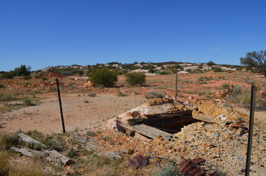
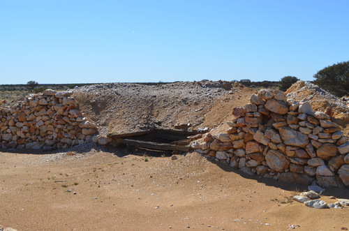
For the purposes of Mindat the Cue Goldfield encompasses the area north-east and north-west of Cue. The locations are both east and west of the Great Northern Highway in a 10 kilometre radius from the town. To the east the mines are north of the Cue-Wondinong Road, and westwards of the town the mines are north of the Cue-Beringarra Road, but before the Cuddingwarra group of pits. The Day Dawn goldfield borders to the south from here. Within this area are innumerable shafts, diggings, mullock heaps and tracks. The area historically contained five batteries at Cue One, Salisbury, Light of Asia, Gem of Cue and Cue Victory mines. There are at least forty major mines, operating from 1894 to 1920, when the area fell silent.
It is contained in a north east to east trending greenstone belt, intruded by granitoids. The greenstone consists of interlayered andesite to diactic volcanic rocks, ultramafic rocks, and komatiite, layered gabbro and sediments. There is also a significant intrusion of tonalite. A number of north-east striking shears and faults cut the succession. Parts of the field contain low plateaus of remnant laterite duricrust.
The gold is found in quartz veins hosted by granite, striking north-east or north north-west, dipping north-west or west, 200 to 1000 metres long, and up to 2 metres wide. These can reach up to 10 metres wide locally at cross reef intersections, or where the strike diverges. The veins reach 200 metres in depth. The granite hosted quartz veins show nuggety gold, over distances as short as a few metres. When metal detectors first became available, thousands of nuggets were recovered from the area. The gold is typically native, with minor sulphides or alteration minerals. The gold is erratic in distribution.
Commodity List
This is a list of exploitable or exploited mineral commodities recorded from this region.Mineral List
Mineral list contains entries from the region specified including sub-localities9 valid minerals.
Rock Types Recorded
Note: this is a very new system on mindat.org and data is currently VERY limited. Please bear with us while we work towards adding this information!
Rock list contains entries from the region specified including sub-localities
Select Rock List Type
Alphabetical List Tree DiagramLocalities in this RegionShow map
Australia
- Western Australia
- Western Australia
This page contains all mineral locality references listed on mindat.org. This does not claim to be a complete list. If you know of more minerals from this site, please register so you can add to our database. This locality information is for reference purposes only. You should never attempt to
visit any sites listed in mindat.org without first ensuring that you have the permission of the land and/or mineral rights holders
for access and that you are aware of all safety precautions necessary.
References
Sort by Year (asc) | by Year (desc) | by Author (A-Z) | by Author (Z-A)
Western Mining Pty Ltd (2014), Cue Project, 2014


Tasmania Gold Mine, Cue Goldfield, Cue, Cue Shire, Western Australia, Australia