Cataby, Dandaragan Shire, Western Australia, Australiai
| Regional Level Types | |
|---|---|
| Cataby | Town |
| Dandaragan Shire | Shire |
| Western Australia | State |
| Australia | Country |
This page is currently not sponsored. Click here to sponsor this page.

Neighbouring regions:
Type:
Mindat Locality ID:
272613
Long-form identifier:
mindat:1:2:272613:0
GUID (UUID V4):
40b3db8a-c8fd-467e-8058-825bc5692275
Other Languages:
Dutch:
Cataby, West-Australië, Australië
Estonian:
Cataby, Lääne-Austraalia, Austraalia
Samogitian:
Catabis
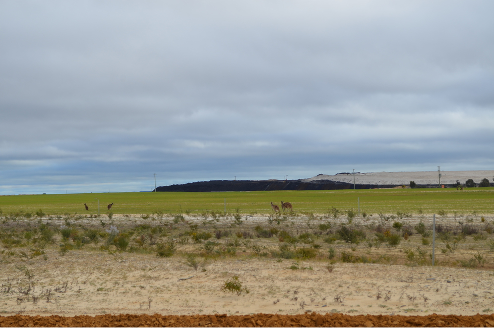
Cataby is a small settlement approximately 170 kilometres (ca. 106 mi) north of Perth, Western Australia on the Brand Highway. The area was once called West Dandaragan, with the town of Dandaragan located 17 km to the east.
The Cataby Important Bird Area, which supports an important breeding population of the short-billed black cockatoo, lies 2 km south-east of the town.
Tronox have a titanium mine site at Cooljarloo, near Cataby. Concentrate is transported by road train to the processing facility at Chandala, near Muchea.
The area has also been explored for mineral sands.
The town was threatened by a bushfire in 2010, which closed the Brand Highway for a few hours; the fire was contained shortly afterward.
Select Mineral List Type
Standard Detailed Gallery Strunz Chemical ElementsMineral List
Mineral list contains entries from the region specified including sub-localities4 valid minerals.
Rock Types Recorded
Note: data is currently VERY limited. Please bear with us while we work towards adding this information!
Rock list contains entries from the region specified including sub-localities
Select Rock List Type
Alphabetical List Tree DiagramDetailed Mineral List:
| ⓘ Ilmenite Formula: Fe2+TiO3 Localities: |
| ⓘ 'Leucoxene' |
| ⓘ Quartz Formula: SiO2 |
| ⓘ Rutile Formula: TiO2 Localities: |
| ⓘ Zircon Formula: Zr(SiO4) Localities: |
Gallery:
List of minerals arranged by Strunz 10th Edition classification
| Group 4 - Oxides and Hydroxides | |||
|---|---|---|---|
| ⓘ | Ilmenite | 4.CB.05 | Fe2+TiO3 |
| ⓘ | Quartz | 4.DA.05 | SiO2 |
| ⓘ | Rutile | 4.DB.05 | TiO2 |
| Group 9 - Silicates | |||
| ⓘ | Zircon | 9.AD.30 | Zr(SiO4) |
| Unclassified | |||
| ⓘ | 'Leucoxene' | - | |
List of minerals for each chemical element
| O | Oxygen | |
|---|---|---|
| O | ⓘ Ilmenite | Fe2+TiO3 |
| O | ⓘ Quartz | SiO2 |
| O | ⓘ Rutile | TiO2 |
| O | ⓘ Zircon | Zr(SiO4) |
| Si | Silicon | |
| Si | ⓘ Quartz | SiO2 |
| Si | ⓘ Zircon | Zr(SiO4) |
| Ti | Titanium | |
| Ti | ⓘ Ilmenite | Fe2+TiO3 |
| Ti | ⓘ Rutile | TiO2 |
| Fe | Iron | |
| Fe | ⓘ Ilmenite | Fe2+TiO3 |
| Zr | Zirconium | |
| Zr | ⓘ Zircon | Zr(SiO4) |
Fossils
There are 1 fossil localities from the PaleoBioDB database within this region.BETA TEST - These data are provided on an experimental basis and are taken from external databases. Mindat.org has no control currently over the accuracy of these data.
| Occurrences | 1 | ||||||
|---|---|---|---|---|---|---|---|
| Youngest Fossil Listed | 1.81 Ma (Pleistocene) | ||||||
| Oldest Fossil Listed | 2.59 Ma (Pleistocene) | ||||||
| Stratigraphic Units |
| ||||||
| Fossils from Region | Click here to show the list. | ||||||
| Fossil Localities | Click to show 1 fossil locality |
Other Databases
| Wikipedia: | https://en.wikipedia.org/wiki/Cataby,_Western_Australia |
|---|---|
| Wikidata ID: | Q5051134 |
| GeoNames ID: | 11776184 |
Localities in this Region
- Western Australia
- Dandaragan Shire
Other Regions, Features and Areas that Intersect
This page contains all mineral locality references listed on mindat.org. This does not claim to be a complete list. If you know of more minerals from this site, please register so you can add to our database. This locality information is for reference purposes only. You should never attempt to
visit any sites listed in mindat.org without first ensuring that you have the permission of the land and/or mineral rights holders
for access and that you are aware of all safety precautions necessary.


Cooljarloo mineral sands mine, Cataby, Dandaragan Shire, Western Australia, Australia