Dunbar, East Lothian, Scotland, UKi
| Regional Level Types | |
|---|---|
| Dunbar | Town |
| East Lothian | Council Area |
| Scotland | Country |
| UK | Country |
This page is currently not sponsored. Click here to sponsor this page.


Latitude & Longitude (WGS84):
56° 0' 7'' North , 2° 31' 0'' West
Latitude & Longitude (decimal):
Type:
Köppen climate type:
Mindat Locality ID:
2913
Long-form identifier:
mindat:1:2:2913:4
GUID (UUID V4):
3322209e-cdbc-4579-bff4-2788cc8fed59
Dunbar is a town on the North Sea coast in East Lothian, Scotland, UK.
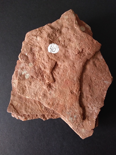
In the area, volcanic necks (pipes) are exposed in the cliffs and on the intertidal wave-cut platform. These structures mark the sites of former underground channels that fed early Carboniferous (Dinantian) volcanos. Erosion has since removed the volcanos so that the pipes are now seen at various levels below the original surface of eruption. The rocks in them consist mainly of tuffs, with subordinate agglomerates and alkali-basaltic intrusions. They are surrounded by sediments of Upper Old Red Sandstone and Lower Carboniferous age through which the original feeder channels penetrated.
Select Mineral List Type
Standard Detailed Gallery Strunz Chemical ElementsMineral List
Mineral list contains entries from the region specified including sub-localities1 valid mineral.
Rock Types Recorded
Note: data is currently VERY limited. Please bear with us while we work towards adding this information!
Rock list contains entries from the region specified including sub-localities
Select Rock List Type
Alphabetical List Tree DiagramDetailed Mineral List:
| ⓘ 'Biotite' Formula: K(Fe2+/Mg)2(Al/Fe3+/Mg/Ti)([Si/Al/Fe]2Si2O10)(OH/F)2 |
| ⓘ Quartz Formula: SiO2 |
| ⓘ Quartz var. Agate |
| ⓘ Quartz var. Chalcedony Formula: SiO2 |
Gallery:
List of minerals arranged by Strunz 10th Edition classification
| Group 4 - Oxides and Hydroxides | |||
|---|---|---|---|
| ⓘ | Quartz var. Agate | 4.DA.05 | SiO2 |
| ⓘ | var. Chalcedony | 4.DA.05 | SiO2 |
| ⓘ | 4.DA.05 | SiO2 | |
| Unclassified | |||
| ⓘ | 'Biotite' | - | K(Fe2+/Mg)2(Al/Fe3+/Mg/Ti)([Si/Al/Fe]2Si2O10)(OH/F)2 |
List of minerals for each chemical element
| H | Hydrogen | |
|---|---|---|
| H | ⓘ Biotite | K(Fe2+/Mg)2(Al/Fe3+/Mg/Ti)([Si/Al/Fe]2Si2O10)(OH/F)2 |
| O | Oxygen | |
| O | ⓘ Biotite | K(Fe2+/Mg)2(Al/Fe3+/Mg/Ti)([Si/Al/Fe]2Si2O10)(OH/F)2 |
| O | ⓘ Quartz var. Chalcedony | SiO2 |
| O | ⓘ Quartz | SiO2 |
| F | Fluorine | |
| F | ⓘ Biotite | K(Fe2+/Mg)2(Al/Fe3+/Mg/Ti)([Si/Al/Fe]2Si2O10)(OH/F)2 |
| Mg | Magnesium | |
| Mg | ⓘ Biotite | K(Fe2+/Mg)2(Al/Fe3+/Mg/Ti)([Si/Al/Fe]2Si2O10)(OH/F)2 |
| Al | Aluminium | |
| Al | ⓘ Biotite | K(Fe2+/Mg)2(Al/Fe3+/Mg/Ti)([Si/Al/Fe]2Si2O10)(OH/F)2 |
| Si | Silicon | |
| Si | ⓘ Biotite | K(Fe2+/Mg)2(Al/Fe3+/Mg/Ti)([Si/Al/Fe]2Si2O10)(OH/F)2 |
| Si | ⓘ Quartz var. Chalcedony | SiO2 |
| Si | ⓘ Quartz | SiO2 |
| K | Potassium | |
| K | ⓘ Biotite | K(Fe2+/Mg)2(Al/Fe3+/Mg/Ti)([Si/Al/Fe]2Si2O10)(OH/F)2 |
| Ti | Titanium | |
| Ti | ⓘ Biotite | K(Fe2+/Mg)2(Al/Fe3+/Mg/Ti)([Si/Al/Fe]2Si2O10)(OH/F)2 |
| Fe | Iron | |
| Fe | ⓘ Biotite | K(Fe2+/Mg)2(Al/Fe3+/Mg/Ti)([Si/Al/Fe]2Si2O10)(OH/F)2 |
Other Databases
| Wikipedia: | https://en.wikipedia.org/wiki/Dunbar |
|---|---|
| Wikidata ID: | Q1002133 |
Localities in this Region
- Scotland
- East Lothian
Other Regions, Features and Areas containing this locality
This page contains all mineral locality references listed on mindat.org. This does not claim to be a complete list. If you know of more minerals from this site, please register so you can add to our database. This locality information is for reference purposes only. You should never attempt to
visit any sites listed in mindat.org without first ensuring that you have the permission of the land and/or mineral rights holders
for access and that you are aware of all safety precautions necessary.
References


Dunbar, East Lothian, Scotland, UK