Mid-Continent Mine, Treece, Picher Field, Cherokee County, Kansas, USAi
| Regional Level Types | |
|---|---|
| Mid-Continent Mine | Mine (Inactive) |
| Treece | Town (Abandoned) |
| Picher Field | - not defined - |
| Cherokee County | County |
| Kansas | State |
| USA | Country |
This page kindly sponsored by Dana Slaughter


Latitude & Longitude (WGS84):
37° 0' 15'' North , 94° 51' 39'' West
Latitude & Longitude (decimal):
Type:
Mine (Inactive) - last checked 2024
Deposit first discovered:
1920
Köppen climate type:
Nearest Settlements:
| Place | Population | Distance |
|---|---|---|
| Treece (historical) | 138 (2018) | 1.6km |
| Commerce | 2,483 (2017) | 7.9km |
| Quapaw | 906 (2011) | 8.5km |
| North Miami | 382 (2017) | 9.8km |
| Baxter Springs | 4,028 (2017) | 11.4km |
Mindat Locality ID:
3766
Long-form identifier:
mindat:1:2:3766:5
GUID (UUID V4):
ef239be7-13b8-4c8d-bcef-639ab4ca66b8
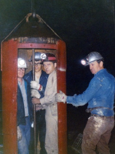
A former Pb-Zn occurrence/mine located in the NE¼SE¼SW¼ sec. 11, T35S, R23E, 6th. Principal Meridian, on private land (fee ownership). Discovered in 1920. First produced in 1922. Owned by the heirs of Hannah E. Wright (100%), Kansas (1976). MRDS database stated accuracy for this location is 100 meters. Toward the end of the Tri-State District's life this mine was operated as a fee-dig site by Chink Enders.
The ore body is 6 meters thick, 300 meters wide, 600 meters long and with a depth-to-top of 95 meters (minimum of 88 meters). Ore body No. 1 is breccia fill. Ore body No. 2 is tabular & disseminated. Ore body No. 3 is a hydrothermal replacement deposit. The primary ore control was fracturing. The secondary control was a contact zone. Wallrock alteration is intense (silicification; dolomitization). The average thickness of unconsolidated material is 5 meters. Local rocks include rocks of the Cherokee Group (Phanerozoic/Paleozoic/Carboniferous Pennsylvanian - Early [Desmoinesian]; gray to brown sandstone and sandy shale with minor limestone and about 10 commercially important coal beds. Total approximate thickness ranging from 350 feet to 500 feet in outcrop).
Workings include unspecified underground openings.
Deposit: This mine is a part of the Picher field back-up file record 060 shale is not a part of the Boone formation but is important to localization of ore bodies. Record 080 columns 59-62 and 69-71 strike and did not apply to stratiform type ore bodies grade and tonnage matrix information from all sources has be ledgered. See ledgers for information on individual mines. Record 120 columns 64-76 no reliable information available record 151-152 percent recovery based on extrapolation of c recoveries in the Viburnum Trend and estimates of Dr. Roger Clifford (umr) record 151 columns 64-69 plant capacity based on 25 year mill record 151 columns 70-80 no reliable information available record 140 ore to be hoisted at the mine and trucked to mill constructed near Blue Mound church in Kansas.
Select Mineral List Type
Standard Detailed Gallery Strunz Chemical ElementsCommodity List
This is a list of exploitable or exploited mineral commodities recorded at this locality.Mineral List
12 valid minerals.
Rock Types Recorded
Note: data is currently VERY limited. Please bear with us while we work towards adding this information!
Select Rock List Type
Alphabetical List Tree DiagramDetailed Mineral List:
| ⓘ Calcite Formula: CaCO3 |
| ⓘ Chalcopyrite Formula: CuFeS2 |
| ⓘ Dolomite Formula: CaMg(CO3)2 |
| ⓘ Enargite Formula: Cu3AsS4 References: |
| ⓘ Galena Formula: PbS |
| ⓘ Gypsum Formula: CaSO4 · 2H2O References: |
| ⓘ Gypsum var. Selenite Formula: CaSO4 · 2H2O References: |
| ⓘ Ktenasite Formula: ZnCu4(SO4)2(OH)6 · 6H2O |
| ⓘ Malachite Formula: Cu2(CO3)(OH)2 References: |
| ⓘ Marcasite Formula: FeS2 |
| ⓘ Pyrite Formula: FeS2 |
| ⓘ Quartz Formula: SiO2 |
| ⓘ Sphalerite Formula: ZnS |
Gallery:

List of minerals arranged by Strunz 10th Edition classification
| Group 2 - Sulphides and Sulfosalts | |||
|---|---|---|---|
| ⓘ | Sphalerite | 2.CB.05a | ZnS |
| ⓘ | Chalcopyrite | 2.CB.10a | CuFeS2 |
| ⓘ | Galena | 2.CD.10 | PbS |
| ⓘ | Pyrite | 2.EB.05a | FeS2 |
| ⓘ | Marcasite | 2.EB.10a | FeS2 |
| ⓘ | Enargite | 2.KA.05 | Cu3AsS4 |
| Group 4 - Oxides and Hydroxides | |||
| ⓘ | Quartz | 4.DA.05 | SiO2 |
| Group 5 - Nitrates and Carbonates | |||
| ⓘ | Calcite | 5.AB.05 | CaCO3 |
| ⓘ | Dolomite | 5.AB.10 | CaMg(CO3)2 |
| ⓘ | Malachite | 5.BA.10 | Cu2(CO3)(OH)2 |
| Group 7 - Sulphates, Chromates, Molybdates and Tungstates | |||
| ⓘ | Gypsum | 7.CD.40 | CaSO4 · 2H2O |
| ⓘ | var. Selenite | 7.CD.40 | CaSO4 · 2H2O |
| ⓘ | Ktenasite | 7.DD.20 | ZnCu4(SO4)2(OH)6 · 6H2O |
List of minerals for each chemical element
| H | Hydrogen | |
|---|---|---|
| H | ⓘ Gypsum | CaSO4 · 2H2O |
| H | ⓘ Ktenasite | ZnCu4(SO4)2(OH)6 · 6H2O |
| H | ⓘ Malachite | Cu2(CO3)(OH)2 |
| H | ⓘ Gypsum var. Selenite | CaSO4 · 2H2O |
| C | Carbon | |
| C | ⓘ Calcite | CaCO3 |
| C | ⓘ Dolomite | CaMg(CO3)2 |
| C | ⓘ Malachite | Cu2(CO3)(OH)2 |
| O | Oxygen | |
| O | ⓘ Calcite | CaCO3 |
| O | ⓘ Dolomite | CaMg(CO3)2 |
| O | ⓘ Gypsum | CaSO4 · 2H2O |
| O | ⓘ Ktenasite | ZnCu4(SO4)2(OH)6 · 6H2O |
| O | ⓘ Malachite | Cu2(CO3)(OH)2 |
| O | ⓘ Quartz | SiO2 |
| O | ⓘ Gypsum var. Selenite | CaSO4 · 2H2O |
| Mg | Magnesium | |
| Mg | ⓘ Dolomite | CaMg(CO3)2 |
| Si | Silicon | |
| Si | ⓘ Quartz | SiO2 |
| S | Sulfur | |
| S | ⓘ Chalcopyrite | CuFeS2 |
| S | ⓘ Enargite | Cu3AsS4 |
| S | ⓘ Galena | PbS |
| S | ⓘ Gypsum | CaSO4 · 2H2O |
| S | ⓘ Ktenasite | ZnCu4(SO4)2(OH)6 · 6H2O |
| S | ⓘ Marcasite | FeS2 |
| S | ⓘ Pyrite | FeS2 |
| S | ⓘ Sphalerite | ZnS |
| S | ⓘ Gypsum var. Selenite | CaSO4 · 2H2O |
| Ca | Calcium | |
| Ca | ⓘ Calcite | CaCO3 |
| Ca | ⓘ Dolomite | CaMg(CO3)2 |
| Ca | ⓘ Gypsum | CaSO4 · 2H2O |
| Ca | ⓘ Gypsum var. Selenite | CaSO4 · 2H2O |
| Fe | Iron | |
| Fe | ⓘ Chalcopyrite | CuFeS2 |
| Fe | ⓘ Marcasite | FeS2 |
| Fe | ⓘ Pyrite | FeS2 |
| Cu | Copper | |
| Cu | ⓘ Chalcopyrite | CuFeS2 |
| Cu | ⓘ Enargite | Cu3AsS4 |
| Cu | ⓘ Ktenasite | ZnCu4(SO4)2(OH)6 · 6H2O |
| Cu | ⓘ Malachite | Cu2(CO3)(OH)2 |
| Zn | Zinc | |
| Zn | ⓘ Ktenasite | ZnCu4(SO4)2(OH)6 · 6H2O |
| Zn | ⓘ Sphalerite | ZnS |
| As | Arsenic | |
| As | ⓘ Enargite | Cu3AsS4 |
| Pb | Lead | |
| Pb | ⓘ Galena | PbS |
Other Databases
| Link to USGS MRDS: | 10291307 |
|---|
Other Regions, Features and Areas containing this locality
This page contains all mineral locality references listed on mindat.org. This does not claim to be a complete list. If you know of more minerals from this site, please register so you can add to our database. This locality information is for reference purposes only. You should never attempt to
visit any sites listed in mindat.org without first ensuring that you have the permission of the land and/or mineral rights holders
for access and that you are aware of all safety precautions necessary.
References


Mid-Continent Mine, Treece, Picher Field, Cherokee County, Kansas, USA