| Locality type: | Mine |
| Classification |
|---|
|
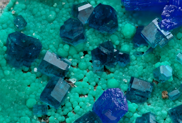
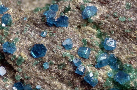
| Species: | Langite |
| Formula: | Cu4(SO4)(OH)6 · 2H2O |
| Confirmation |
|---|
|
| Validity: | Believed Valid |
| Associated Minerals Based on Photo Data: |
|---|
|
| Linarite | ⓘ3 photos of Langite associated with Linarite at this locality. |
| Malachite | ⓘ2 photos of Langite associated with Malachite at this locality. |
| Brochantite | ⓘ2 photos of Langite associated with Brochantite at this locality. |
| Data |
|---|
|
| Mineral Data: | Click here to view Langite data |
| Locality Data: | Click here to view Bergmannstrost Mine (Lindenbach Mine), Bad Ems, Bad Ems-Nassau, Rhein-Lahn-Kreis, Rhineland-Palatinate, Germany |
| Photo Gallery | View Gallery (4 photos) |
| Data Identifiers |
|---|
|
| Mindat Occurrence Record ID: | 235432 |
| Long-form Identifier: | 1:3:235432:3 |
| GUID (UUID V4): | ab10889e-29b2-4851-b76b-99919b9f8711 |
| Nearest other occurrences of Langite |
|---|
|
|
| 3.4km (2.1 miles) | ⓘFriedrichssegen Mine, Friedrichssegen, Lahnstein, Rhein-Lahn-Kreis, Rhineland-Palatinate, Germany |
| 7.0km (4.3 miles) | ⓘLead and silver smelter slag locality, Braubach, Loreley, Rhein-Lahn-Kreis, Rhineland-Palatinate, Germany |
| 16.9km (10.5 miles) | ⓘÄquivalenz adit, Wellmich, Sankt Goarshausen, Loreley, Rhein-Lahn-Kreis, Rhineland-Palatinate, Germany |
| 19.1km (11.9 miles) | ⓘWerlau, Sankt Goar, Hunsrück-Mittelrhein, Rhein-Hunsrück-Kreis, Rhineland-Palatinate, Germany |
| 27.4km (17.0 miles) | ⓘApollo Mine, Raubach, Puderbach, Neuwied, Rhineland-Palatinate, Germany |
| 31.6km (19.6 miles) | ⓘReichensteinerberg Mine, Puderbach, Puderbach, Neuwied, Rhineland-Palatinate, Germany |
| 33.6km (20.9 miles) | ⓘCaspar quarry, Ettringen, Vordereifel, Mayen-Koblenz, Rhineland-Palatinate, Germany |
| 42.9km (26.7 miles) | ⓘBendisberg Mine, St Jost, Langenfeld, Vordereifel, Mayen-Koblenz, Rhineland-Palatinate, Germany |
| 43.2km (26.8 miles) | ⓘClemenslust Mine, Linz am Rhein, Linz am Rhein, Neuwied, Rhineland-Palatinate, Germany |
| 45.6km (28.3 miles) | ⓘVirneberg Mine, Rheinbreitbach, Unkel, Neuwied, Rhineland-Palatinate, Germany |
| References |
|---|
|
|


Bergmannstrost Mine, Bad Ems, Bad Ems-Nassau, Rhein-Lahn-Kreis, Rhineland-Palatinate, Germany