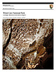
 | | Report (issue) | | National Park Service U.S. Department of the Interior Natural Resource Program Center Wind Cave National...National Park Geologic Resources Inventory Report Natural Resource Report NPS/NRPC/GRD/NRR—2009/087 THIS...ON THE COVER: On the Candlelight Tour Route in Wind Cave boxwork protrudes from the ceiling in the Council...Austin, inside photo by Even Blackstock Wind Cave National Park Geologic Resources Inventory Report Natural...March 2009 U.S. Department of the Interior National Park Service Natural Resource Program Center Denver |  | | Journal (article/letter/editorial) | | 1. Entrance sign to the Crater of Diamonds State Park in Arkansas. Midwest Places of Geologic Interest...predominantly of calcite. Crater of Diamonds State Park: 209 State Park Road, Murfreesboro, 71958; http://www.c...about 100 million years ago. Crowley’s Ridge State Park: 2092 AR-168 North, Paragould, 72450; http://www...pegmatites. 92 ROCKS & MINERALS leysridge/. This park is located on Crowley’s Ridge, a narrow ridge composed...eastern Mississippi Embayment. Devil’s Den State Park: 1333 W. AR-74, West Fork, 72774; http://www.arkansasstateparks |  | | Report (issue) | | Denver, Colorado 9 ^University of South Dakota Vermillion, South Dakota INTRODUCTION This bibliography...references on geology of the Black Hills in South Dakota and Wyoming. For purposes of this report, the... the area does not include the Bad Lands of South Dakota nor the bulk of the Powder River Basin in Wyoming...included in the bibliography. References for South Dakota are more complete than those for Wyoming. Both...potential and geology of the Black Hills National Forest, South Dakota and Wyoming, with a section on Salable | 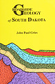 | | Book | | logyoO0000grie &N ROADSIDE % JEOLOGY of South Dakota John Paul Gries Mountain Press Publishing...Gries, John Paul, 1911- Roadside geology of South Dakota / John Paul Gries. p. cm. Includes bibliographical...(pbk. : alk. paper) 1. Geology—South Dakota—Guidebooks. 2. South Dakota— Guidebooks. I. Title. QE163.G68...interpreting the details of the surface geology of South Dakota. My model is Nathaniel Horatio Darton, geologist...depth to groundwater in the western half of South Dakota. Even in this day of gadgetry, field studies |  | | Journal (issue) | | the Geology and Resources of the Black Hills of Dakota with Atlas, Washington. 1879-1880, quarto, pp....Preliminary Report of Ex plorations in Nebraska and Dakota. in the Years 1855-56-57. Washington. I 875. Oc...Black Hills, and adjacent pans of the Nebraska and Dakota regions was originally as an appendix to the Humphrey...topographic and geographic features from Kansas in the south to the Canadian border on the north. The map extends...com PO Box 455 • Poncha Springs, Colorado 81242 USA Phone: 719-539-4113 • Fax 719-539-4542 SUMMER 2002 |  | | Report (chapter) | | protect them. In other countries and especially in the USA, there were many more such sites protected by a number...doing so other than through land ownership. In the USA the situation was completely different. The westward...resulted in the extensive National Parks created by statute and the cultural and national monuments protected...focusing in particular on Great Britain and the USA because this is where most of the interest was manifest...called, was the world’s first ‘geological theme park’. It was an educational attraction with full scale |  | | Book (edition) | | COVER -- Pairburn agates from South Dakota. Photo courtesy South Dakota School of Mines Museum. > 1...includes 1 SOUTH DAKOTA • MICHIGAN • ILLINOIS • IOWA WISCONSIN • OHIO • KANSAS • NORTH DAKOTA NEBRASKA...2 KANSAS Foreword 4 How To Use This Book SOUTH DAKOTA 6 New Finds ................ Fairburn Type...AGATE BEDS 11 OELRICHS AGATE BED .. 12 THE CUSTER AREA ......... Tepee Canyon Agate ... Garnets ...RED RIVER VALLEY .... 32 NORTH DAKOTA .. 30 WESTERN NORTH DAKOTA Badlands and Buttes........... Gems | 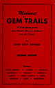 | | Book (edition) | | EDITION SOUTH DAKOTA MINNESOTA KANSAS • INDIANA • • MISSOURI ILLINOIS • NORTH DAKOTA • OHIO...includes SOUTH DAKOTA • MICHIGAN • ILLINOIS • IOWA WISCONSIN • OHIO • KANSAS • NORTH DAKOTA NEBRASKA...Jasper 25 Golden Barite - 13 Black Agates The Custer Area Tepee Canyon Agate Page 8 12 Ardmore Agate...32 State Park Agates 31 _. Minnesota 32 Wisconsin 39 Nebraska 40 North Dakota 43 Indiana...you are a tourist in the IMack Hills of Soutli Dakota, the highest mountain region east of the Rockies | 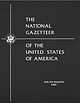 | | Report (issue) | | THE NATIONAL GAZETTEER. OF THE UNITED STATES OF AMERICA SOUTH DAKOTA 1989 THE NATIONAL GAZETTEER OF...STATES OF AMERICA SOUTH DAKOTA 1989 "The Pulpit," Badlands National Park, South Dakota. Apparently named...complex features characteristic of South Dakota Badlands. In South Dakota, the term "badlands" is generally...that is often spectacularly carved by water and wind into unusual landforms. On older maps of the area...Geological Survey.) THE NATIONAL GAZETTEER OF THE UNITED STATES OF AMERICASOUTH DAKOTA 1989 U.S. GEOLOGICAL |  | | Journal (issue) | | search for ancient Kentish Man Betteshanger Country Park—Field trip to Black Gold or Fossil Fool_The state...Cliff End.. (Field trip to ) Dinosaures - a theme park in France Columnar Basalt Echinodermata Eclipse...Muck above the Chalk (feedback from…) North Western USA Fossil Sights #1 3 11 12 13 02 08 08 01 03 12 06...editions 01-13 cont... North Western USA Fossil Sights #2 North Western USA Fossil Sights #3 Old Chalk Pits...that got away. The Ostracods. Focus on Paracus National Park, Peru Peters Pit, Wouldham. Trip to _ May 12th |  | | Report (volume) | | Hot Springs Quadrangle Fall River and Custer Counties, South Dakota 7 ' -. ... . . . ..-.._ r^ O OQ...Hot Springs Quadrangle Fall River and Custer Counties, South Dakota By DON E. WOLCOTT GEOLOGY AND URANIUM...QUADRANGLE, FALL RIVER AND GUSTER COUNTIES, SOUTH DAKOTA By DON E. WOLCOTT ABSTRACT The Hot Springs...flank of the Black Hills in parts of Fall River and Custer Counties, S. Dak. Exposed sedimentary rocks, about...through Cretaceous age crop out within the area. The "Dakota" hogback, a dissected belt of uplands about 4 miles |  | | Book | | ere MerieresUm ee Tt:JER LENE yi Vii Chapter 1 South Dakotas Faiburn, Beginning the Exploration... Chapter...and for tending to business while I explored South Dakota. Project Coordinator: Marcia Lorenzen Project...is named for the small community of Fairburn, South Dakota. The agate is known for its spectacular variety...just across the South Dakota line. I have heard of them being found from as far south as Gordon, Nebraska...are blessed with huge areas of National Grasslands and Black Hills National Forest lands that are open to |  | | Book (volume) | | Missouri, Montana, Nebraska, North Dakota, — ; Oregon, South Dakota, Washington, and Wyoming ~ AllanW...Georgia, Kentucky, Mississippi, North Carolina, South Carolina, Tennessee, Virginia, and West Virginia... Missouri, Montana, Nebraska, North Dakota, Oregon, South Dakota, Washington, and Wyoming VOLUME 4:...Missouri, Montana, Nebraska, North Dakota, Oregon, South Dakota, Washington, and Wyoming by Allan W...Minnesota Missouri Montana Nebraska North Dakota Oregon South Dakota Washington vi Contents Wyoming 5505 |  | | Book (edition) | | Minor time divisions are not included except for national parks where the terms significance. Adapted from...President, Director of National Book Program Alfred C. Grisanti Assistant Director of National Book Program Paul...Contents Preface xi Acknowledgments xiii U.S. National Parks Location Map xiv Part | ScENERY DEVELOPED...The Geologic View of Time 5 1. Grand Canyon National Park Geologic Features 10 Box 1.1 How Rocks Are...CLASSIFIED Geologic History 5. Canyonlands National Park 7 13 19 Box 1.2 AN OUTLINE OF THE GEOLOGIC |  | Martin, James E., Sawyer, J. Foster, Fahrenbach, Mark D., Tomhave, Dennis W., Schulz, Layne D. (2004) Geologic Map of South Dakota, South Dakota Geological Survey. | Map | | General Map 10 South Dakota Geological Survey o o o o 103 104 o 101 102 N O R T H D K...meltwater streams which flowed into Glacial Lake Dakota. Thickness up to 30 ft (9 m). Outwash, undifferentiated...siltstone, shale, limestone, dolomite, calcarenite, chert, and brecciated beds. Thickness 394-1,175 ft (120-358...limestone and dolomite containing brown to gray chert. Solution features include collapse breccia, sinkholes...schist, pyritic biotite schist, and locally massive chert beds. Thickness approximately 2,000-4,000 ft (610-1 |  | | Book (edition) | | ~ ele Or WHITMAN COLLEGE LIBRARY GEOLOGY OF NATIONAL PARKS PENROSE MEMORIAL LIBRARY Whitman College...Class of 1957 25th ~ Reunion Fund GEOLOGY OF NATIONAL PARKS Third Edition Ann G. Harris Youngstown...eastern tip of Anacapa Islands in Channel Islands National Park, California. The bedrock is volcanic. Photograph...Photograph courtesy Channel Islands National Park Collection. The drawings by Genevieve Shimer on pages 1...475, and 497 are maps of the national parks from A Guide to the National Parks—Their Landscape and Geology |  | | Report (issue) | | STATE OF SOUTH DAKOTA Nils Boe, Governor MINERALOGY OF THE BLACK HILLS by WILLARD LINCOLN ROBERTS...Associate in Mineralogy Museum of Geology, South Dakota School of Mines and Technology and GEORGE RAPP...Department of Geology and Geological Engineering, South Dakota School of Mines and Technology With the Editorial...Mineralogy South Dakota School of Mines and Technology BULLETIN NUMBER 18 of the South Dakota School of...of Mines and Technology Rapid City, South Dakota PUBLICATIONS STAFF F. L. Partlo J. T. Thomas President |  | | Book | | Igneous Rocks and General Geology Blacks Hills, South Dakota to Bear Lodge Mountains, Wyoming July 1-7, 1989...the geology and resources of the Black Hills of Dakota: U.S. Geographical and Geological Survey of the...and North Dakota G e o l o g i c a l Survey 58202 U.S.A. U n i v e r s i t y o f North Dakota, Grand Forks...Region. Hot S p r i n g s Mammoth S i t e and Wind Cave.................. Frank R. Karner and Richard...Hydrothermal Events. Bear Lodge Mountains, Crook County. Wyoming Gordon A. J e n n e r .............. |  | | Report (volume) | | ........................................ North Dakota........................................................ South Carolina......................................:.................... South Dakota..........Arkansas, California, Colorado, New Mexico, Oregon, South Dakota, Tennessee, and Texas; to list all the literature...Catalogue of the mineral localities of South Carolina: South Carolina Geol. Survey, ser. 4, Bull. 2,...1908. Scott, Samuel, Map of the Black Hills of South Dakota and Wyoming, with full descriptions of mineral |  | | Journal (article/letter/editorial) | | two medium sized specimens of boxwork from Onyx Cave. An x-ray diffraction analysis shows that perhaps...entire cave, and always filled with cave clay. "Some caves have minute amounts of this and Wind Cave in South...South Dakota has an abundance. It is relatively rare when found in any substantial quantities."— letter...letter from Mrs. R. W . Schmidt, Onyx Cave, Eureka Springs, Ark. What an interesting specimen is this boxwork...east side of Highway 101 in Mendocino County, 5.4 miles south of Laytonville or 4.8 miles north of the |  | | Journal (article/letter/editorial) | | and structure of nanocrystalline Fe and Mn oxide cave deposits: Implications for trace element mobility...63130, USA Center for Materials Innovation, Washington University, Saint Louis, MO 63130, USA a r t...trace elements in soils and aquatic systems. Pautler Cave in Southwest Illinois contains Fe and Mn oxide deposits...exist in the cave: Fe and Mn precipitation where anoxic groundwater enters the oxic cave passage (seep...(seep deposition) and direct deposition from the cave stream. Seep waters have higher concentrations of Ca2+ |  | | Report (issue) | | Cavern development How caves are formed Cave maps...... . Erosional cave features... . Phreatic features Vadose...features Depositional cave featuree Breakdown Other features. . The cave environment Cave temperature Man and...and the cave environment Fauna Wyoming geologic history and origins of caves Limestone deposition Paleokarst...Overview Perspective. . . . . . . . . . . . Part II-Cave descriptions Southeastern Wyoming Laramie Range...Black Hills and vicinity. . . . . Wind River and Owl Creek Mountains Wind River Mountains Owl Creek Mountains |  | | Report (volume) | | Hills National Forest, South Dakota and Wyoming U.S. GEOLOGICAL SURVEY BULLETIN 1580 SOUTH DAKOTA WYOMING...Potential and Geology of the Black Hills National Forest, South Dakota and Wyoming We st from. Washington...Potential and Geology of the Black Hills National Forest, South Dakota and Wyoming By ED DEWITT, J. A. REDDEN... In pocket 1. Geologic map of the Black Hills National Forest and adjacent area (scale 1:250,000) 2...map for locatable commodities in the Black Hills National Forest and adjacent area (scale 1:250,000) 3. |  | | Report (issue) | | front cover Left: Entrance to Donaldson Cave in Spring Mill State Park (John M. Day) Right, top to bottom:...(John M. Day) Passageway in Hamer Cave in Spring Mill State Park (Richard L. Powell) CONTENTS Introduction...from Indianapolis, Indiana, to Spring Mill State Park near Mitchell, Indiana............................................... 8 Stop 1, Spring Mill State Park Nature Center adjacent to Spring Mill Lake................................. 8 Stop 2, Donaldson Cave.................................................. |  | | Report (issue) | | El Capitan, Guadalupe Mountains National Park. Photo National Park Service. iv Contents PREFACE 9...Cottonwood Cave 24 Slaughter Canyon caves 25 McKittrick Hill caves 25 CAVE METEOROLOGY 25 CAVE GEOMORPHOLOGY...Passage forms 31 Karren forms 31 CAVE HYDROLOGY 32 DESCRIPTION OF CAVE DEPOSITS CLASTIC DEPOSITS 33 Breakdown...43 Textural features 45 Dissolution features 48 CHERT 50 22 33 ENDELLITE-MONTMORILLONITE-PALYGORSKITE...55 BAT GUANO 56 ANIMAL BONES 57 STRATIGRAPHY OF CAVE DEPOSITS 57 STRATIGRAPHIC PROBLEMS 57 STRATIGRAPHIC |
|


