 | | Journal (article/letter/editorial) | | MS 973, Denver Federal Center, Denver, Colorado 80225, USA ABSTRACT ASTER (Advanced Spaceborne Thermal...of the Alligator Ridge and Bald Mountain gold districts in White Pine County (Nutt, 2000; Nutt and Hart...fragments, Chaotic unit (Tch), Water Canyon, Bald Mountain district Quartz-bearing lithologies: jasperoid...jasperoid in Joana Limestone (Mjj), Mooney Basin, Bald Mountain district jasperoid in Joana Limestone (Mj) near...spectra of surfaces in the Alligator Ridge–Bald Mountain area identified as containing either quartz |  | | Journal (article/letter/editorial) | | Inc. Economic Geology, v. 102, pp. 1129–1155 Bald Mountain Gold Mining District, Nevada: A Jurassic Reduced...Denver Federal Center, Denver, Colorado 80209 Abstract The Bald Mountain mining district has produced...Carlin-type Au deposits in the Carlin, Battle Mountain-Eureka, Getchell, and Independence (Jerritt Canyon)...porphyry Cu-Au deposits (Fig. 1A) include the Battle Mountain district (Theodore, 2000) and the world-class...has low Au (Dilles and Profett, 2000). The Bald Mountain mining district is in east-central Nevada, about |  | | Report (issue) | | the U.S. Government. U.S. Geological Survey, Menlo Park, CA TABLE OF CONTENTS Contributions to the gold...understanding the crustal structure near the Battle Mountain-Eureka mineral trend from geophysical constraints...characterization to interpretation of 40Ar/39Ar dates on illite from Carlin-type gold deposits: Insights from Jerritt...and gold deposition in the Betze deposit, Eureka County, Nevada M. B. Woitsekhowskaya and S.G. ftters....243 Pluton related gold deposits in the Battle Mountain Mining District Pluton-related Au in the Battle |  | | Report (issue) | | Bldg., 2600 corridor, 18th and CSts.,NW. DENVER, Colorado-Federal Bldg., Rm. 169,1961 Stout St. LOS ANGELES...California-Federal Eldg., Rm. 7638,300 N. Los Angeles St. MENLO PARK, California-Bldg. 3 (Stop 533), Rm. 3128. 345 Middlefield...ROLLA, Missouri-1400 Independence Rd. DENVER, Colorado-Map Distribution, Bldg. 810, Federal Center FAIRBANKS...Polymetallic Veins and Replacement Deposits Part I Bald Mountain Gold Mining Region, Northern Black Hills, South...Dakota By JAMES J. NORTON Gold Deposits in the Park City Mining District, Utah By CALVIN S. B ROM FIELD |  | Arehart, G. B., Chakurian, A. M., Tretbar, D. R., Christensen, J. N., McInnes, B. A., Donelick, R. A. (2003) Evaluation of Radioisotope Dating of Carlin-Type Deposits in the Great Basin,Western North America, and Implications for Deposit Genesis. Economic Geology, 98 (2) 235-248 doi:10.2113/gsecongeo.98.2.235 | Journal (article/letter/editorial) | | are as follows: AB = Bald Mountain (includes Alligator Ridge and Bald Mountain); BM = Barneys Canyon...what has been variously described as sericite, illite, and/or clay minerals. (The term sericite is used...Kbearing, Fe-poor mica; generally it structurally is illite or muscovite). Because of the fine-grained nature...reasoning. A regional study of altered shales and illite veins led Wilson and Parry (1990) to suggest that...indicated by destruction of K feldspar and formation of illite (sericite) in some ore zones in sedimentary rocks |  | | Journal (article/letter/editorial) | | Survey, Mail Stop 905, P. O. Box 25046, Denver, Colorado 80225 Abstract Carlin-type deposits in the Alligator...The study area is east and southeast of the Bald Mountain mining district (Fig. 2b), which contains gold...regional geologic map (Rigby, 1960), the White Pine County geologic map (Hose and Blake, 1976), and studies...Ilchik (1990a). Nutt et al. (2000) describe the Bald Mountain and Alligator Ridge districts. This paper’s...115°30' 40° Casino 40° MSR BM AR Buck Mtn 0 Bald Horseshoe Mtn Saga Mining District OP Eureka |  | | Report (issue) | | Bldg., 2600 corridor, 18th and CSts.,NW. DENVER, Colorado-Federal Bldg., Rm. 169,1961 Stout St. LOS ANGELES...California-Federal Eldg., Rm. 7638,300 N. Los Angeles St. MENLO PARK, California-Bldg. 3 (Stop 533), Rm. 3128. 345 Middlefield...ROLLA, Missouri-1400 Independence Rd. DENVER, Colorado-Map Distribution, Bldg. 810, Federal Center FAIRBANKS...WHIPPLE Gold Deposits of the Boulder County Gold District, Colorado By JAMES A. SAUNDERS Part I is Chapter...Ferry County. 3. Hydrothermal deposits Nevada. 4. Hydrothermal deposits Washington Ferry County. I. Geological |  | | Report (volume) | | Lawson-DumontFall River District Clear Creek County Colorado By C. C. HAWLEY and FRANK BAKER MOORE GEOLOGICAL...of the Lawson-Dumont-Fall River district, Clear County, Colo. 2. ~ap showing major faults (veins) of the...LAWSONDUMONT-FALL RIVER DISTRICT, CLEAR CREEK COUNTY, COLORADO By C. C. HAWLEY and FRANK BAKER MooRE...the Front Range mineral belt, is in Clear Creek County, Colo., just west of the highly productive Central...Lawson syncline, the Dumont anticline, and the Bald Mountain syncline. Lineations, such as mineral alinements |  | | Report (volume) | | ___________________________ Mount Pisgah-Call Mountain syncline_______________________ Upper Wild Creek-Jonas...Creek-Jonas anticline___________________________ Broad Mountain anticline__________________________________ Stony...syncline_______________________________________ Bald Mountain-Unionville anticline__________________________...syncline_____________________________________ Summer Mountain anticline________________________________ Larrytown...location map of some uranium occurrences in Carbon County, Pa. Page FIGURE 1. Index map showing location |  | | Journal (article/letter/editorial) | | MICHAEL J. GOBLA 19055 East Bethany Place Aurora, Colorado 80013 gobla@copper.net Unless otherwise noted...Indian Queen mine ca. 1905 at Farlin, Beaverhead County. 208 ROCKS & MINERALS Downloaded by [University...mines at Butte in Silver Bow County and the Black Pine mine in Granite County have produced many fine crystal...collector, Crystal Park in Beaverhead County, the pegmatites of Jefferson County, and the Snowbird mine...mine in Mineral County continue to be productive sources of mineral specimens. The Montana Gold Rush After |  | | Report (volume) | | Green River Formation, Sand W ash Basin, Northwest Colorado U.S. GEOLOGICAL SURVEY BULLETIN 1911 Sedimentology...Green River Formation, Sand Wash Basin, Northwest Colorado By HENRY W. ROEHLER Wave-dominated shorelines...along Hardgrove Rim, 8 miles north of Maybell, Colorado U.S. GEOLOGICAL SURVEY BULLETIN 1911 DEPARTMENT...Green River formation, Sand Wash Basin, northwest Colorado I by Henry W. Roehler. p. em. - (U.S. Geological...3:1911 1. Sedimentology-Colorado. 2. lakes-Shorelines. 3. Lithofacies-Colorado. 4. Green River Formation |  | | Report (issue) | | . . . . . . . . . . . . . . . . . . . . . . 1 County Listings. . . . . . . . . . . . . . . . . . . .... . . . . . . . 4 Mineral Localities Listed by County . . . . . . . . . . . . . . . . . . . . . . . .... . . . . . . . . . . . . . . . . . . 7 Beaver County . . . . . . . . . . . . . . . . . . . . . . . ... . . . . . . . . . . . . . . . . . 7 Box Elder County . . . . . . . . . . . . . . . . . . . . . . . .... . . . . . . . . . . . . . . . . . . 10 Cache County . . . . . . . . . . . . . . . . . . . . . . . |  | | Journal (article/letter/editorial) | | mineralization in the southwestern Nevada volcanic field, USA S t e p h e n B. C a s t o r a a n d S t e v e n...School of Mines, Universityof Nevada, Reno, NV 89557. USA bDepartment of Geological Sciences, Mackay School...School of Mines, Universityof Nevada, Reno. NV 89557, USA (Received August 27, 1991; accepted after revision...mineralization in the southwestern Nevada volcanic field, USA. Ore Geol. Rev., 7: 193-223. The southwestern Nevada...stages: the main stage (ca. 15-13 Ma); the Timber Mountain stage (ca. 13-9 Ma ); and the late stage (ca. |  | | Journal (issue) | | Columbia County Permit denied; spacing unit violation. 352 ARCO SEV4 sec. 27 Columbia County 44-27 T...009-00191 Columbia County Location; 2,360. NEV4 sec. 4 T.5 N.,R. 5 W. Columbia County SEI/4 sec. 6 354...354 ARCO Columbia County 44-6 T. 6 N., R. 5 W. 009-00193 Columbia County Application; 3,000. 353 ARCO...sec. 7 355 ARCO Columbia County 31- 7 T. 6 N., R. 5 W. 009-00194 Columbia County Application; 3,000. SWI/4... 21 356 ARCO Columbia County 13-21 T. 6 N., R. 5 W. 009-00195 Columbia County Application; 3,000. D |  | | Journal (article/letter/editorial) | | OP PAPERS SUBMITTED TO THE MEETING OF THE ROCKY MOUNTAIN SECTION AT SALT LAKE CITY, UTAH, MAY 8-10, 1952...(Black Hills region) and southeastern (Laramie Mountain region) Wyoming. During Middle and Upper Pennsylvanian...sedimentation into Lower Permian. The Laramie Mountain region was a northward prong of this element evidenced...northern and western Wyoming. THRUST FAULTS SOUTH OF PARK CITY, UTAH* A. A. Baker, B. J. Sharp, and M. D....one above the other, have been mapped south of the Park City district, Utah, between Bonanza Flat and Pine |  | | Report (issue) | | 15-Minute Quadrangle, Eagle and Summit Counties, Colorado By OGDEN TWETO and THOMAS S. LOVERING G E 0 L...PAPER 9 56 Prepared in cooperation with the Colorado Mining Industrial Development Board Geology of...Continued Minturn Formation- Continued .Jacque Mountain Limestone Member ........ . Changes in thickness.... . . . . In pocket Index map of west-central Colorado showing geographic setting of the Minturn quadrangle.... . . . . . . . . . . 44 Photograph of Jacque Mountain Limestone Member of the Minturn Formation.... |  | | Report (issue) | | DEPARTMENT OF THE INTERIOR U.S. GEOLOGICAL SURVEY Menlo Park, California CONTENTS Page Abstract........................................ ..14 Bingham (West Mountain) mining district ................ .14 Mercur (Camp...Stratigraphic sections of comparable parts of the South Mountain and Bingham nappes in the Stockton 7 1/2minute...Characteristic identifying features of Oquirrh Mountain nappes .........................................the Stockton district are located in the South Mountain nappe at the leading edge of the Stockton thrust |  | | Report (volume) | | Eureka Gulch Area Central City District Gilpin County Colorado GEOLOGICAL SURVEY BULLETIN This report concerns...Eureka Gulch Area Central City District Gilpin County Colorado By P. K. SIMS, F. W. OSTERWALD, and E. W. TOOKER...OF CLEAR CREEK, GILPIN, AND LARIMER COUNTIES, COLORADO GEOLOGICAL SURVEY BULLETIN 1032-A This report...23 24 27 29 31 IV GEOLOGY AND ORE DEPOSITS, COLORADO ILLUSTKATJONS PLATE 1. Geologic maps of the Eureka...map showing location of Eureka Gulch area, Gilpin County, Colo_________________-.._____--___---__----__3 |  | | Report (issue) | | • • • • • • • • • • • • •• 34 Bald Mountain . . . . . . • . • • . . . . . . . . . . . .... . . . . . . . . . . . . . . . . • . . Walker Mountain area . . .. .. . Mines and occurrences. . . .... . . . . . . . . . . . . . . . .. 74 Casper Mountain . . . . . . . . . . . . . . . . . . . .. . .....• • . . • . . . . . . .. 79 Garrett (Sellers Mountain) . ... . . . . . . . . . . • • • • • • • • • •.... Placer descriptions ...... . .....•.••. Elk Mountain district ......... ... . •• .. Gold Hill district |  | | Journal (article/letter/editorial) | | variations have been noted in the gazetteer. Where county boundary lines have been changed since a reference...written, the locality has been listed under the county in which it is found today. A fairly extensive...United States. rences in the United States. Part 3: Colorado and U.S. Geological Survey, Washington, BulUtah:... Washington, and Wyoming, and Part 3 covering Colorado and Utah, have been assigned the same item number...Radioactivity of the Thermal Waters of Yellowstone National Park. U.S. Geological Survey, Washington, Bulletin, No | 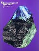 | | Journal (issue) | | Cooper Nottingham, England Anthony R. Kampf L.A. County Mus. of Nat. Hist. Los Angeles, CA Joseph A. Mandarino...W. Pinch & J. D. Grice The M eikle m ine, Elko County, N e v a d a ....................................by M. Jensen The Ross H annibal m ine, Lawrence County, South D a k o ta ...............................part by the Denver Museum of Natural History, the Colorado Chapter of the Friends of Mineralogy, and the... Smithsonian Institution, Washington, DC 20560, USA IMA E-mail address: http://www.dst.unipi.it/ima/ |  | | Journal (article/letter/editorial) | | oxidationeventwasaccompanied by the destructionof detrital illite in the Pilot Shale and depositionof alunite _ barite...rich, silty carbonaterocks,and high concentrations Bald Mountainportionof the district(Smith, 1976). ofAg...hydrologyandcanbe either stratiformor discordant. ore. The Bald Mountain area was examined in the Wall-rockalteratio...mineralization was confined to western White Pine County, Nevada, about 80 km four pods,designated,from...association trusionlocatedbetween Big and Little Bald Moun- productionof the AlligatorRidge district.The |  | | Report (volume) | | coinciding, in part, with the southwest margin of the Colorado Plateau. The structure is probably a grabem in...natural gas produced from continental deposits in Colorado and Utah. Lake deposits also carry less common...Morrison Formation. Borrego Formation __________ Bald Mountain Lake Beds Member of Esmeralda Formation. Name...Southwestern Wyoming and adjacent areas in Utah and Colorado. Eastern Wyoming, central Montana, adjacent areas...Manhattan district, Nevada.. Artillery Mountains, County, Ariz. Western Mojave Desert, Calif San Luis |  | | Journal (article/letter/editorial) | | Carlin-type gold mining districts located in the Battle Mountain–Eureka trend, Nevada. It is composed of one main...80225, USA M. W. Hitzman . E. P. Nelson Department of Geology and Geological Engineering, Colorado School...School of Mines, Golden, CO 80401, USA Introduction The Gold Bar district is located in the southern Roberts...Roberts Mountains in Eureka County, Nevada (Fig. 1a). It is composed of five Carlin-type gold deposits...U T A H EUREKA County Gold Bar - Eureka Districts Gold Bar District LANDER County 0 50 Tonkin Springs |  | | Report (issue) | | 31 University of Nevada Press, Reno, Nevada 89557 USA Copyright © 2004 by University of Nevada Press Photographs... Majuba Hill Mine, Antelope district, Pershing County. N. Prenn collection. Photograph by J. Scovil....Goodsprings (Yellow Pine) Mining District, Clark County John C. Kepper 91 References 467 Contributors...Pyromorphite after Galena with Conichalcite Gold, Round Mountain Mine Quartz, Lovelock area Acanthite Grossular...Almandine-Spessartine Annabergite Gypsum Quartz, Petersen Mountain Heterogenite Quartz (amethyst), faceted Arsenolite |
|
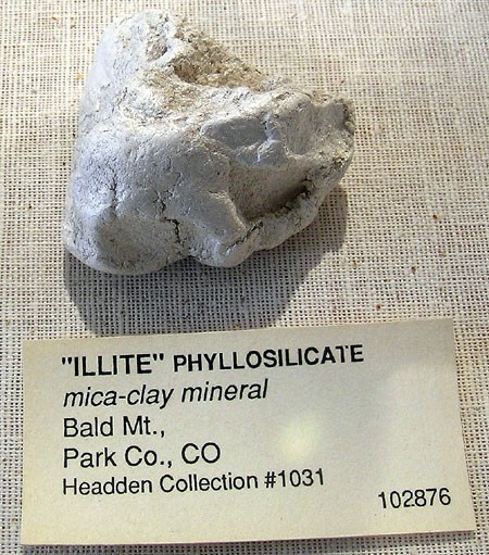


Bald Mountain, Park County, Colorado, USA