| Locality type: | Mine |
| Classification |
|---|
|
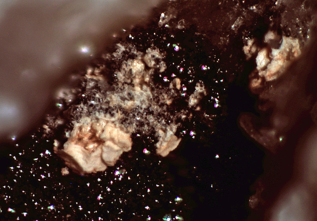
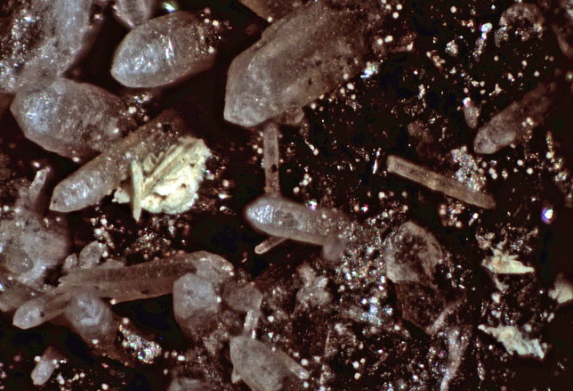
| Species: | Massicot |
| Formula: | PbO |
| Confirmation |
|---|
|
| Validity: | Confirmed |
| Confirmation Methods: | Visually Identified |
| Associated Minerals Based on Photo Data: |
|---|
|
| Hematite | ⓘ3 photos of Massicot associated with Hematite at this locality. |
| Quartz | ⓘ2 photos of Massicot associated with Quartz at this locality. |
| Data |
|---|
|
| Mineral Data: | Click here to view Massicot data |
| Locality Data: | Click here to view Champie Mine (Lehman Mine; Lehman Copper Mine; Lone Star Mine; UFO claims; Cersa Moje 1-7 claims; Rhoades-Iola claims), Copperopolis, Castle Creek Mining District, Bradshaw Mountains (Bradshaw Range), Yavapai County, Arizona, USA |
| Photo Gallery | View Gallery (2 photos) |
| Data Identifiers |
|---|
|
| Mindat Occurrence Record ID: | 1016741 |
| Long-form Identifier: | 1:3:1016741:0 |
| GUID (UUID V4): | 21235c73-1abc-48de-84fa-87e66e4ea06f |
| Nearest other occurrences of Massicot |
|---|
|
|
| 62.6km (38.9 miles) | ⓘPotter-Cramer Mine, Vulture Mining District, Maricopa County, Arizona, USA |
| 63.7km (39.6 miles) | ⓘTonopah-Belmont Mine, Belmont Mountain, Tonopah, Osborn Mining District, Maricopa County, Arizona, USA |
| 69.4km (43.1 miles) | ⓘMoon Anchor Mine, Hummingbird Springs, Osborn Mining District, Maricopa County, Arizona, USA |
| 80.2km (49.8 miles) | ⓘEvening Star Mine (Silver Queen Mine; Old Queen group), Tiger Wash, Tonopah, Osborn Mining District, Maricopa County, Arizona, USA |
| 95.3km (59.2 miles) | ⓘSilver Butte Mine (Collom property), North Peak, Payson Mining District (Green Valley Mining District), Mazatzal Mountains, Gila County, Arizona, USA |
| References |
|---|
|
|


Champie Mine, Copperopolis, Castle Creek Mining District, Bradshaw Mountains, Yavapai County, Arizona, USA