 | | Journal (article/letter/editorial) | | 00:52 01 June 2016 Wyoming Mineral Locality Index Figure 1. Index map of Wyoming counties, with exposures...exposures of Precambrian and volcanic rocks. 1 he Wyoming mineral locality index is designed to provide mineral...interesting mineral occurrences in the state of Wyoming. Five publications were used extensively in compiling...(about 19131, Esterbrook copper district, Albany County. John Taylor collection. An ideal and inexpensive...1 inch equals 4 miles) of the entire state of Wyoming in book form. The Wwming Atlas and Gazetteer can |  | | Book (edition) | | minerals and gems. It is obvious, though, that malachite, an ore of the heavy metal copper, or hematite...corundum (aluminum oxide), carbonates such as malachite (copper carbonate), phosphates such as apatite...banded agate. Cross section of unpolished green malachite, a copper carbonate marked with curved bands...mine, Racooche Valley, White Co. 1866 Vs White County Daniel Light form, % mi. NE Less than 1887 ...Alabama has yielded a 4i%4 carat diamond from Shelby County, 30 miles south of Birmingham, found about 1900 |  | | Report (issue) | | THE GEOLOGICAL SURVEY OF WYOMING Gary B. Glass, Executive Director and State Geologist ADVISORY BOARD...Governor Terry P. Roark,President, University of Wyoming Donald B. Basko, Oil and Gas Supervisor Appointed...Cheyenne, Wyoming. This and other publications available from: The Geological Survey of Wyoming P.O. Box...University Station LaIanlle, Wyoming 82071 (307) 766·2286 Front Cover - Wyoming gold. Gold buttons in the...by Phyllis A. Ranz.) THE GEOLOGICAL SURVEY OF WYOMING Gary B. Glass, State Geologist BULLETIN 68 THE |  | | Report (volume) | | the State lists begin with Alabama and end with Wyoming. Under each State the minerals found there are...Wisconsin.........Prof. W. 0. Hotchkiss, Madison. Wyoming.........Mr. C. E. Jamison, Cheyenne. Those members...See Bauxite and Hallpysite. Asbestos. Tallapoosa County, with corundum deposits near Dudleyville; not found...commercial quantity or quality. Asphalt. Colbert County, small quantity has been shipped from near Leighton;...following localities: Bibb County, Pratts Ferry; Calhoun County, near Tampa; Clay County, T. 20, Pv. 7 E.; Jefferson |  | | Report (issue) | | COPPER. NOTES ON COPPER DEPOSITS IN CHAFFEE, FREMONT, AND JEFFERSON COUNTIES, COIO. By WALDEMAR LINDGREN...really obtained as a by-product; that from San Juan County slightly exceeded 1,500,000 pounds. The copper...short tons, of which one-half came from San Juan County. It may be said that Colorado does not contain...249 tons of copper ores in 1906; the yield of Fremont and Jefferson counties is negligible. Although...GEOLOGY, 1907, PART I. been shown in South Dakota,* Wyoming,6 New Mexico,0 and Arizona,d and it is the purpose |  | | Report (issue) | | Sweetwater Canyon Wilderness Study Area, Fremont County, Wyoming U.S. GEOLOGICAL SURVEY BULLETIN 1757-D...Sweetwater Canyon Wilderness Study Area, Fremont County, Wyoming By WARREN C. DAY, RANDALL H. HILL, and...Bureau of Mines W. DAN HAUSEL Geological Survey of Wyoming U.S. GEOLOGICAL SURVEY BULLETIN 1757 MINERAL RESOURCES...RESOURCES OF WILDERNESS STUDY AREAS-SOUTHERN WYOMING DEPARTMENT OF THE INTERIOR DONALD PAUL MODEL,...Study Area, Fremont County, Wyoming. (Mineral resources of wilderness study areas Southern Wyoming ; ch. D) |  | | Journal (article/letter/editorial) | | quartz, Manhan River mine, Easthampton, Hampshire County, Massachusetts. Marvin Rausch specimen, Jeff Scovil...branch of the Calumet and Hecla mine, Houghton County, Michigan. A. E. Seaman Mineral Museum (Michigan...JulyIAugust: Vanadinite and wulfenite, Old Yuma mine, Pima County, Arizona. Les Presmyk specimen, Jeff Scovil photo...Point claim, Lake George intrusive center, Teller County, Colorado. Dave Bunk specimen, Jeff Scovil photo...Rhodochrosite, area 28, level 20, Eagle mine, Gilman County, Colorado. Dave Bunk specimen on loan to the Colorado |  | | Report (volume) | | ............................................. Wyoming..................................................Samuel, Map of the Black Hills of South Dakota and Wyoming, with full descriptions of mineral resources, etc...See Bauxite and Halloysite. Asbestos. Tallapoosa County, with corundum deposits near Dudleyville; not found...commercial quantity or quality. Asphalt. Colbert County, small quantity has been shipped from near Leighton;...following localities : Bibb County, Pratts Ferry; Calhoun County, near Tampa; Clay County, T. 20 S., R. 7 E.; |  | | Journal (article/letter/editorial) | | Diamond Mines, at (or near) Murfreesboro, Pike County, Arkansas. At the mines, I was kindly given permission...how he pinpoints his findings: It is in Somerset County near Great Moose Pond on the banks of Goodwins...locally as Pebbley Beach. Cohasset is in Norfolk County on the south shore of Massachusetts Bay, about...1951, about 12 miles southeast of Ely, St. Louis County, Minnesota—south of Birch Lake. The minerals include...rock with some tiny veins of bornite with some malachite stain. Well, yesterday I was puttering around | 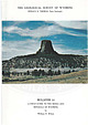 | | Report (issue) | | THE GEOLOGICAL SURVEY OF WYOMING HORACE D. THOMAS, State Geologist BULLETIN 51 A FIELD GUIDE TO THE...ROCKS AND MINERALS OF WYOMING by William H. Wilson THE GEOLOGICAL SURVEY OF WYOMING HORACE D. THOMAS,...' 0 MINERALS OF WYOMING By WILLIAM H. WILSO. UN IVERSITY OF WYOMING LARAMIE, WYOMING A GUST, 1965 This...the Department of Geology at the University of Wyoming ( 19 17-631. For more than fift y years his life...life has been devoted toward the understanding of Wyoming geology. but perhaps more important has been his |  | | Journal (article/letter/editorial) | | the big ones."—on label! Globe, in southern Gila County, is in central Arizona. COLORADO — "Enclosed are...identified. They are all from southwestern Fremont County in the Hayden Creek area of Colorado. Pegmatite...sanidine xls (dark gray with bluish opalescence). Fremont County is in central Colorado. DELAWARE—"The enclosed...silvery-white muscovite. Wilmington, in N / E New Castle County, is in northern Delaware. MAINE—"The enclosed specimen...not fluorescent. Bangor, in southern Penobscot County, is in southern Maine. ROCKS AND MINERALS MISSOURI—"I |  | | Report (volume) | | Del Norte County; Trinity River, Trinity County; Spanish Creek and Gopher Hill, Plumas County; Placerville...Dorado County; Cherokee Flats, Yankee Hill,and Oroville, Butte County; French Corral, Nevada County; Indian...Indian Gulch and Volcano, Amador County; and Alpine Creek, Tulare County. Other western localities are:...Diamond Basin, Ada County, Idaho; Curry County, Oreg.; and Nelson Hill, near Glacier County, Mont. The Great...Pierce County; Oregon, Dane County; Kohlsville, Washington County; Saukville, Ozaukee County; Eagle, |  | | Journal (article/letter/editorial) | | quarry, Howard, Fremont County. C-O-L-O-R-A-O-O CALCITE BARBARA L. MUNTYAN Ouray County Museum Ouray...marble (from the Yule quarry at Marble in Gunnison County) that has been used for many of the great monuments...elongated. highly mineralized zone running from Boulder County in the northeast diagonally across the state to...inches, East orebody, Mineral Farm mine, Ouray County. Traces of calcite remain at the base of the cast...calcite, 3 by 2 inches, Goodfro no. 2 mine, Ouray County. For many mineral collectors, calcite is right |  | | Report (volume) | | .............. The Atlantic gold district, Fremont County, Wyo........................... Introduction...railroad map of Wyoming........................... 2. Map of part of Fremont County, Wyo., showing situation...in the development of the mineral resources of Wyoming and desirous that reliable information concerning...City, Miners Delight, and Atlantic City, in Fremont County, and of parts of the North Laramie Mountains...the Atlantic gold district being in west-central Wyoming about 20 miles south of Lander, and the North Laramie |  | | Book (edition) | | mmed at Broken Arrow aud Trout creek, in Sc. Clair county. The strata in this field are more faulted und...prong of Canoe creek, in St. Clair county, to Ha\sop creek, in Bibb county, a distance of 60 miles. Down to...to Helena, in Shelby county, the field has an average width of 5 or 6 miles. Below that point the width...miles being in the latitud" of Blocton, in Bibb county. The south ern end of this field has a greater...Jefferson county; Helena, Montevallo, and Brierfield, Shelby county; and at Blocion. Bibb county. The Warrior |  | | Journal (article/letter/editorial) | | mineral in a few pegmatites at Atolia, San Bernardino County, California and also in pegmatites north of the...earth type of pegmatite as at Barringer Hill, Llano County, Texas where large masses weighing up to four hundred...mineral at St. Peter's Dome near Pike's Peak, El Paso County, Colorado. CRYOLITE, a fluoride of sodium and aluminum...Section Hill in the Eight Mile Park area of Fremont County, Colorado. DOLOMITE, calcium, magnesium carbonate...crystals have been found at Hiddenite, Alexander County, North Carolina. SIDERITE, iron carbonate, occurs |  | | Journal (issue) | | experiencing remnants of winter while the rest of the county can feel spring in the air. This means it’s time...deposits, the most familiar ones are azurite, malachite, chrysocolla, cuprite, and a host of other colorful...46, No.2 Page 7 Figs. 4, 5: Two specimens of malachite replacing azurite from Milpillas (3 cm tall; 6...defined a high grade oxidized deposit with azurite, malachite, and other copper minerals under 300 to 500 m...followed by new finds of mind-boggling azurite, malachite, brochantite, and other minerals. However, once |  | | Report (issue) | | Geology of the South Pass Area, Fremont County, Wyoming By RICHARD W. BAYLEY, PAUL DEAN PROCTOR,· and...geologic map of the Atlantic City district, Fremont County, Wyo -------------------Geologic map and cross... 31 GEOLOGY OF THE SOUTH PASS AREA, FREMONT COUNTY, WYOMING By RICHARD W. BAYLEY, PAUL DEAN PROCTOR...the south end o;f the Wind R!i\ner Rang.e in Fremont County, Wyo. Laramide uplift and erosion exposed the...near the south end of the Wind River Range in Fremont County, Wyo., about 28 miles south of the town of |  | | Journal (article/letter/editorial) | | oxide. A very few specimens of the crystallized malachite were found, and sphalerite was also reported....Minerals of Franklin and Sterling Hill, Sussex County, New Jersey, reprinted from the paper by Charles...in which are included quartz, bomite, pyrite, malachite and a number of others. 5. Preamble to the Constitution... Mass., where diaspore, tourmaline, a little malachite, epidote and fairly plentiful margarite were found;...Goethite. Plans are under way to adopt the Washington County Agate, sometimes called Potosí Agate, for our official |  | | Report (volume) | | WILDERNESS PRIMITIVE AREAS AN AREA NEAR POPO AGIE, WYOMING GEOLOGICAL SURVEY BULLETIN 1391-A Mineral Resources...Area Near the Popo Agie Primitive Area, Fremont County, Wyoming By ROBERT C. PEARSON, U.S. GEOLOGICAL SURVEY...AREA NEAR THE POPO AGIE PRIMITIVE AREA, FREMONT COUNTY, WYOMING By ROBERT C. PEARSON, U.S. Geological Survey...1972, of a part of Shoshone National Forest in Fremont County, Wyo., that lies east and south of the Popo...places elsewhere in the area, or in the State of Wyoming, where they are more accessible and are closer |  | | Report (volume) | | Cement, Oklahoma 3 Elk Ridge, Utah 5 Lance Creek, Wyoming 5 Lone Tree deposit, San Rafael Swell, Utah 5 Maybell...Colorado 5 Palangana salt dome, Texas 5 Poison Basin, Wyoming 5 South Texas 6 Temple Mountain, Utah 6 Deposits...materials 8 Copper Mountain, Wyoming 8 Crooks Gap, Wyoming 8 Gas Hills, Wyoming 8 Lisbon Valley, Utah 9 Deposits...Mexico 9 Rifle Creek, Colorado 9 Shirley Basin, Wyoming 10 White Canyon, Utah 10 Contents Ill Geology...River Basin, Wyoming 11 Mauch Chunk, Pennsylvania 11 Monument Hill, Powder River Basin, Wyoming 11 Monument |  | | Journal (article/letter/editorial) | | June 15–16—Riverton, WY. Wyoming State Mineral and Gem Show 2013, Fremont County FairOrthoclase - Orogrande...gemshow@gmail.com. June 21–23—Bloomington, IN. Lawrence County Rock Club, Inc.’s 48th Annual Gem, Mineral, and...Indianapolis Gem, Mineral and Fossil Show, Hancock County 4-H Fairgrounds. Info.—Cheryl Hamilton, 317/8976639...Sunday http://geoinfo.nmt.edu/museum/ Linarite & Malachite Hansonburg, NM - Jeff Scovil Jeff Scovil Photo |  | | Journal (article/letter/editorial) | | Camp Bird mine, level 2, Sneffels district, Ouray County. Raines-Pettem collection, photographer unknown...with another 50 million pounds mined in San Juan County (Henderson 1926). During the twentieth century...green colors of even small amounts of azurite and malachite still served to draw a prospector’s eye to a promising...are limited to the Red Mountain district in Ouray County. Figure 2. Colorado mineral belt (COMB) with copper...deposits are located outside the COMB mainly in Baca County, in the southeastern part of the state. Precambrian |  | | Journal (article/letter/editorial) | | the Copper Deposits near Montpelier, Bear Lake County, Idaho," U.S. Geol. Survey Bull. 430, pp. 112-121...Waldemar, "Notes on Copper Deposits in Chaffee, Fremont, and Jefferson Counties,Colorado," U.S. Geol. Survey...otherweathering productsto showthe presence of copper. The malachite, where found, comprisesbut a small part of the...there appearsto be greater concentrationof the malachite. Whether or not the two mineralsare of contemporaneous...region the sandstoneoutcropscarry surfacestainsof malachite which probablyis being precipitatedfrom groundwaters |  | | Report (issue) | | WYOMING STATE GEOLOGICAL SURVEY Ronald C. Surdam, State Geologist GUIDE TO PROSPECTING AND ROCK HUNTING...HUNTING IN WYOMING by W. Dan Hausel Information Pamphlet 11 LARAMIE, WYOMING 2004 WYOMING STATE GEOLOGICAL...Freudenthal, Governor Randi S. Martinsen, University of Wyoming Don J. Likwartz, Oil and Gas Supervisor Ronald...Assistant This and other publications available from: Wyoming State Geological Survey P.O. Box 1347 Laramie,...use this publication should contact the Editor, Wyoming State Geological Survey at (307) 766-2286. TTY |
|


