 | | Report (Issue volume) | | State of Washington ARTHUR B. LANGLIE, Governor Department of Conservation and Development W. A. GALBRAITH...GLOVER, Supervisor Bulletin No. 37 INVENTORY OF WASHINGTON MINERALS PART II METALLIC MINERALS By MARSHALL...Volume 2 - MAPS STATE PRINTING PLANT. OLYMPIA, WASHINGTON lll!UI For sale by Department of Conservation...volumes-text and maps) $4.50. INVENTORY OF WASHINGTON MINERALS PART II METALLIC MINERALS Volume 1...Bulletin 33, "Nonmetallic Mineral Resources of Washington," published in 1936. Since then the catalogue | 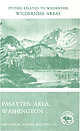 | | Report (volume) | | MINERAL RESOURCES OF THE PASAYTEN WILDERNESS AREA, WASHINGTON Pistol Peaks Mo~ur:ent ea Blackcap Mountafn...Pasayten Wilderness Area, viewed across Ptarmigan Creek from Many Trails Peak. Mount La go "" \~'',~... Mineral Resources of the Pasayten Wilderness Area, Washington By MORTIMER H. STAATZ, PAUL L. WEIS, ROWLAND...area UNITED STATES GOVERNMENT PRINTING OFFICE, WASHINGTON : 1971 UNITED STATES DEPARTMENT OF THE INTERIOR...of Documents, U.S. Government Printing Office Washington, D.C. 20402 Stock Number 2401-1131 STUDIES |  | | Report (issue) | | use for it, write to the Geological Survey at Washington and ask for a frank to return it UNITED STATES...Director Bulletin 849 1 THE MOOSE PASS-HOPE DISTRICT KENAI PENINSULA, ALASKA BY RALPH TUCK Investigations...PRINTING OFFICE WASHINGTON : 1933 For sale by the Superintendent of Documents, Washington, D.C. Price...and industries. ..._. ... ._.__ ...... 474 Mining conditions. _________ __-.._._ ___.____________-... Stratigraphy __.......__._ __________ 476 Slate and graywacke __ _----___.___ -..__ . _. Volcanic |  | | Book (volume) | | DAS2. Orca Book Publishers PO Box 468 Custer, WA USA 98240-0468 Dedicated to Simon Deane 1951 - 1997...province 2.3 A network of civilization developed 2.4 Mining built the province 2.5 The little guy is still...Vancouver area 9.2 Georgia Strait 9.3 Howe Sound — Whistler Valley 9.4 Fraser Valley 9.5 Fraser River 9.6...Gemstone and Mineral Sites and takes in Cache Creek, Ashcroft, Merritt and Princeton. Within this area...dioxide or SiO,, which is what glass, sand and quartz are all made from) is one of the most common compounds |  | | Book (edition) | | HOUSE PUBLISHERS 143 l .Harrison Avenue, Blaine, WA, USA 98230-5005 (604) 538-J 114 Fax (604) 538-2262 www.... . . . . . . 7 ROCKS 1 HIGHWAY 99 NORTH 1. Whistler: black tusk crystals . . . . . . . . . . . . ...jade . . . . . . . . . . . . . . . . . . . 5. Hale Creek: ammonite, fossils. . . . . . . . . . . . . . ..... . . . . . . . . . . . . . . . . . 8. Mystery Creek: fossils. . . . . . . . . . . . . . . . . . . .... 10. Ruby Lougheed Creek FSR: jasper, garnet . . . . . . . . . . 11. Gamet Creek FSR: garnet . . . . |  | | Report (issue) | | use for it write to the Geological Survey at Washington and ask for a frank to return it UNITED STATES...Mendenhall, Director Bulletin 857 C THE GURRY DISTRICT, ALASKA BY RALPH TUCK Mineral resources of Alaska...PRINTING OFFICE WASHINGTON : 1934 For sale by the Superintendent of Documents, Washington, D. C. ------...PLATE 1. Geologic reconnaissance map of the Curry district, Alaska_____ 2. A, Eocene coal-bearing rocks and...showing the distribution of timber in the Curry district._________________---______-----_'______-_---ii |  | | Journal (volume) | | Mountain caldera, Ochoco National Forest, Crook County, Oregon 25 Field trip guide to the Oligocene Crooked...Crooked Basin and the ancestral Crooked River, Crook County, Oregon 73 Portland, Oregon, geology by tram, train...Baker City field office is relocating to the Baker County Court House. We have also moved the Nature of the...are the Oregon Lidar Consortium and the FEMA Coos County Multi-hazards Mapping Program. Both programs underscore...oregongeology.org Baker City Field Office: Baker County Courthouse, 1995 3rd Street, Baker City, Oregon |  | | Report (issue) | | THE PO&T WELLS GOLD~LODE DISTRICT. By B. L. JoKNsoN. INTRODUCTION. SCOPE OJI' REPORT. The object of...of the Port Wells district. Before the geology and mineral resources of the district are considered a...economic development of the mineral deposits of the district will be given. This will be followed by a description...WORX IN '1'lllll DISTRICT. The earliest rocordect exploration o{ the Port Wells district was made in June... 196 MINERAL llESOUllCES O.F ALASKA, 1913, district. In the following year (1899) the H&ITiman Ala |  | | Journal (article/letter/editorial) | | at 07:53 01 January 2015 Bournonite Yaogangxian Mine, Chenzhou, Hunan Province, China T here are certain...clearly the most prolific being the Yaogangxian mine, Hunan Province. (Additional locality information...zinkenite, tetrahedrite, carbonates, barite, and quartz. Bournonite is almost unknown from the eastern...Hawk mine, Blue Hill, Maine; New York City, New York; an unspecified locality in Chester County, Pennsylvania;...Pennsylvania; the Cofer deposit in the Mineral district of Louisa County, Virginia, where it occurs with tetrahedrite; |  | | Journal (article/letter/editorial) | | recovered from an interesting array of important mining districts; it is currently available from Mexico...miargyrite, polybasite, silver, calcite, dolomite, and quartz. There are essentially no significant pyrargyrite...However, the development of numerous gold and silver mining districts in the westem states during the latter...Colorado mining districts. Sparse though good crystals were found in the early years of mining in the Jo...Jo Reynolds mine and in smaller though well-formed crystals in the siliceous vein exploited in the Nabob |  | | Report (issue) | | Hemingfordian assemblages in the Kramer Borate district are isolated from their stratigraphic successors...Barstovian mammalian faunas. Data in figure from: Whistler/ 1965; Lewis, 1964, 1968; Lindsay, 1972; Byers...different times and at different places within this district-wide basin. Local tectonism and local sedimentation...Subordinate framework grains include sanidine; volcanic quartz that is limpid and commonly displays bipyramidal...bipyramidal crystal morphologies; oxyhornblende; plutonic quartz having undulatory extinction and trains of vacuoles |  | | Report (issue) | | of the Arizona Geological society, society for Mining, Metallurgy and Exploration Inc., and the U. s...We also want to thank collectively, all of the mining companies and staff who graciously allowed us to...Talapoosa and Olinghouse districts and the Gooseberry mine. Northeast of Lovelock we pass through Roberts'...mineral belt. The Preble, Pinson, Getchell, Rabbit Creek and Chimney mines will be seen in the distance....visible at 2:00 just after turning onto 1-80 is WASHINGTON HILL. Argillic to advanced argillic alteration |  | | Journal (article/letter/editorial) | | samples for the entire ~9 km length of 13 McCord Creek, which drains the Taurus deposit, and those from...µg/L) in some low-pH water samples from McCord 21 Creek and drainages around Bluff, and a few near neutral...values (440 to 1,250 μS/cm) are from sites in McCord Creek, 235 which drains the Taurus deposit, one stream...the Bluff occurrence, and one tributary of Big Creek south of Taurus, draining a large area that 237...with relatively lower 241 pH values are McCord Creek and one north of Taurus. 242 Jo ur 232 The |  | | Report (issue) | | GEOLOGY AND EARTH RESOURCES DIVISION OLYMPIA, WASHiNGTON 98504 METAL MINES OF WASHINGTONPRELIMINARY REPORT...DERKEY NANCY L. JOSEPH and RAYMOND LASMANIS WASHINGTON DIVISION OF GEOLOGY AND EARTH RESOURCES OPEN...Earth Resources standards and nomenclature. 1, WASHINGTON STATE DEPARTMENT OF Natural Resources Brian...DERKEY NANCY L. JOSEPH and RAYMOND LASMANIS WASHINGTON DIVISION OF GEOLOGY AND EARTH RESOURCES OPEN...standards and nomenclature. • CONTENTS Page Page County and site name Kelly Camp Kettle Key East Knob |  | | Journal (article/letter/editorial) | | Black Hills in the extreme western part of the slate. The uplift and subsequent erosion of the Black...secondary phosphate minerals. Although some pegmatite mining for feldspar still continues (Jacobson 1994). the...except for the Homestake mine, which has operated for more than 120 years, most mining in the area peaked in...and fewer chances to obtain any. However, some mining, mineral exploration, and mineral collecting continues...FiridofGt~rnSphultirite ut IIIP Bulinut Zinc Mine, St. Luwrence County, tditor of NPW b r k ” unrl iipptwwl |  | | Journal (article/letter/editorial) | | Range, Cortez Range, Austin mining district, and at Mount Hamilton and Whistler Mountain are of Jurassic...early Cretaceous age. The Ruby Hill stock, Eureka mining dist)rict is latest Cretaceous, the Bingham Canyon...Belknap Volcanics and Diatremes Intrusive, Marysvale District Bullion Canyon Volcanics (BASSETT et al., 1963)...Mountain, and all the intrusives in Iron and Washington Counties, Utah. On the time scale of KULP (1961b)...agreement are at Three Peaks in the Iron Springs district, Utah, and at Boulder City, Nevada. At Three Peaks |  | Box, Stephen E., Karl, Susan M., Jones, James V., Bradley, Dwight C., Haeussler, Peter J., O’Sullivan, Paul B. (2019) Detrital zircon geochronology along a structural transect across the Kahiltna assemblage in the western Alaska Range: Implications for emplacement of the Alexander-Wrangellia-Peninsular terrane against North America. Geosphere, 15. 1774-1808 doi:10.1130/ges02060.1 | Journal (article/letter/editorial) | | Survey, 904 W. Riverside Avenue, Spokane, Washington 99203, USA U.S. Geological Survey, 4210 University...Anchorage, Alaska 99508, USA 3 GeoSep Services, 1521 Pine Cone Road, Moscow, Idaho 83843, USA 1 2 CITATION:...| Kahiltna assemblage in western Alaska Range Creek fault separates the northwesternmost outliers of...B plasma, mass spectrometer (ICP-MS) at the Washington State University Geoanalytical kilometers Late...Kahiltna northwestern succession: Upper Cretaceous Whistler petrofacies Kahiltna southeastern succession: |  | | Book | | should be made to the Superintendent of Documents, Washington, D. C. Many of the publications referred to are...Tertiary and Pleistocene formation of Oregon, Washington and California, 1905. 4b. Environment of the...Tertiary formations of California, Oregon and Washington. 5. Ashburner, Charles Albert. Coal Production...1-16, 1835. 6c. W. Elkhorn Mountain and Rock Creek District of the Blue Mountains, Oregon. Eng. & Mg. Jour...silver ores in this region. Barrel!, Robt. "Gold Mining 6d. 5 in Oregon." Mines and minerals. Vol. |  | | Journal (issue) | | Cover picture: The Brandywine Falls are close to Whistler, British Columbia. The drop of the falls is approximately...which is at odds with the fact that we can still mine them today. Here I will explore, to what extent...such colours as Hollister Green Slate dark, Burlington Slate, Oxford Slate (brown), Oxford Blue Stone (blue)...Natural ochres from Sia Mine, Cyprus range from yellow to red/purple. Industrial mining of ochres tends to...sedimentary environments. eg. iron rich sands in the Ochre mine in Roussillion, France. Yellow grading into red |  | | Report (issue) | | suggested by the presence of quartz veins stained with iron, the Valdez district for many years received relatively...gold seekers must have passed in sigfet of the quartz vein outcropping on the north shore of the inlet...as the Cliff mine. A few men, however, persistently kept up the search for gold quartz, and some veins...lacking. The Cliff mine became productive in 1910 and proved a very profitable mining venture. Its success...possibility of developing here a new auriferous lode district. As a result, several hundred lode claims were |  | Bullock, Liam, Parnell, John, Perez, Magali, Feldmann, Joerg, Armstrong, Joseph (2017) Selenium and Other Trace Element Mobility in Waste Products and Weathered Sediments at Parys Mountain Copper Mine, Anglesey, UK. Minerals, 7 (11) 229 doi:10.3390/min7110229 | Journal (article/letter/editorial) | | and Weathered Sediments at Parys Mountain Copper Mine, Anglesey, UK Liam A. Bullock 1, * ID , John Parnell...Mountain copper mining district (Anglesey, North Wales) hosts exposed pyritic bedrock, solid mine waste spoil...economic reserves in this and similar base metal mining sites. Selenium is sourced from the pyritic bedrock...across bedrock and weathered deposits. Man-made mine waste deposits show enrichment of As, Bi, Cu, Sb...pyrite; gold; copper 1. Introduction Historic mining sites and associated tailings can be a significant |  | | Journal (article/letter/editorial) | | counties, Texas, has produced the early Uintan Whistler Squat local fauna from the basal conglomerate...KlAr 1: Alamo Creek Basalt, 40, 44, 39, 43 m .y. KI Ar2 : Tuff directly underlying Whistler Squat Quarry...41372), 49, 46 m.y. KI Ar 3 : micaceous tuff above Whistler Squat Quarry and below Strawberry Tuff, 43 m.y...(41443),0.6 miles east ofJunction (41444); B, Whistler Squat Quarry #2 (41372); C, Serendipity (41745);... small areas on the Agua Fria Quadrangle near Whistler Squat. There is no basal Tertiary conglomerate |  | | Journal (article/letter/editorial) | | B. Engineer Mine C. Atlin Camp D. Barkerville Wells Area E. Likely Area F. Stirrup Creek G. Dease Lake...Toodoggone Camp I. Bridge River Camp J. Harrison Gold Mine K. Hedley Camp (including Olalla) L. Stewart Camp...showing mining divisions and localities mentioned in the article. Map by William Besse. Mining divisions:...crystal 2 mm high, 5th level, Governor vein, Engineer mine, Taku Arm, Tagish Lake. This pseudohexagonal crystal...Mauthner specimen and photo. Columbia. Mining, especially gold mining, brought a population to many parts |  | | Report (issue) | | -----------------------------------------Clark County-----------------------------------------------...---------------------------------------Lincoln County-----------------------------------------------...----------------------------------Southern Nye County-----------------------------------------------...----------------------------------Northern Nye County-----------------------------------------------...-------------------------------------Esmeralda County----------------------------------------------- |  | | Book (volume) | | ASHTABULA COUNTY CONNEAUT, area pits, quarries, rd. cuts, etc.⎯cone-in-cone Calcite. CLERMONT COUNTY MILFORD...MILFORD, area creek gravels and alluvial deposits, rare⎯Diamond. CLINTON COUNTY WILMINGTON, area of Todd’s...mineral deposit⎯Hematite. COSHOCTON COUNTY AREA, townships of Washington, Virginia, Bedford, Jackson, Jefferson...Keene, Mill Creek and Tuscarawas, as hard dark gray to black nodules⎯flint. CUYAHOGA COUNTY CHAGRIN FALLS...Geauga Co. line), area quarries⎯oilstone. DELAWARE COUNTY DELAWARE, area Co. exposures of blue clay, as clusters |
|


