 | | Book (volume) |
| carbonate spars free from cobaltiferous ores, especially an 8-meter (25-ft.) vein at the diorite contact, worked...mica. The iron deposits of Dobschau still yield an annual production of about 35,000 tons, but the cobalt...' This Kupferschiefer is cases. lean in this district, carrying only 1.4% of copper, and no silver,...fissures known as 'rucken' in the Mansfeld copper district also contain occasional nickelite, together with... known examples of this type is the cobalt district of Schneeberg, in Saxony, a mountainous region |
 | | Report (volume) |
| BERYLLIUM AND TUNGSTEN DEPOSITS OF THE IRON MOUNTAIN DISTRICT SIERRA AND SOCORRO COUNTIES NEW MEXICO BY RICHARD...of Discovery Gulch.......................... West Slope area........................................................... Reserves and outlook for the district...................... Beryllium deposits........ IV Page Mining claims in the Iron Mountain district, Sierra and Socorro Counties, N. Mex.... In pocket...pocket Geologic map of the Iron Mountain district. Sierra and Socorro Counties, N. Mex.... In pocket Geologic |
 | | Journal (article/letter/editorial) |
| SOCIETY OF GEOLOGISTS MAY, 1944 No. ROCK," AN UNUSUAL BEARING RICHARD TACTITE. 3 BERYLLIUM•...bandsof silicatemineralsand finely crystalline fluorite. Concentricbandingaboutfluorite-richpod-likemasses...remarkablepyrometasomatic depositsin.the Iron Mountain district, New Mexico, have from time to time drawn the...and semi-permanent structures,is situatedat the west base of the mountain ten miles north of Winston...thorough prospectingof all promisingparts of the district prior to the writer'sarrival,wasmostgenerous |
 | | Journal (issue) |
| 2022 EUREKA! U Self-Collected Minerals V With an Introduction and Epilog by Wendell Wilson A Supplement...Bookstore at www.MineralogicalRecord.com Front cover: Fluorite on Amazonite 7.5 cm, from the Smoky Hawk claim...Back cover: Top row, from left: Fluorite, 6.7 cm, from the Weisseck, Austria. Collected by Reinhold Bacher;...Sahatany Valley, Madagascar. Collected by Federico Pezzotta; Antonio Miglioli photo. Fluorite, 7.4 cm...Ben DeCamp photo. Iolite, 4 cm, from the Entia Valley, Australia. Collected by George Stacy; Jeff Scovil |
 | | Book |
| Mount Malosa, Chilwa alkaline province, Zomba district. "Illite" is the name of a series of incompletely...COLUMBIA Ice River complex. The Ice River complex is an intrusive body of alkaline igneous rocks where sodalite...ilmenite specimens have come from an unusual calcite vein-dike occurrence with an exposure very near, indeed...2008, when extensive blasting for construction of an extension to High,, ay 5 revealed veins of massive...(Weibel, 1980). The Maderanertal drainage flows west-southwest from a mountain massif to join the Reuss |
 | | Journal (issue) |
| Bariand Paris, France Werner Lieber Heidelberg, West Germany Olaf Medenbach Bochum, Germany Eric Offermann...F. J. Parker Tveitite from the Barringer Hill District, Texas..................................387 byW...b. Location c. Your name and mailing address d. “ AM” (for “ Amateur” ) if you have never been paid for...slide competition. e. “PRO” if you do not qualify as an amateur as defined above. 2. Maximum of two entries...All slides received which are not indicated by “ AM” will be placed in the professional category. From |
 | | Journal (article/letter/editorial) |
| banded tactite composed chiefly of magnetite, fluorite, chlorite, and diopside. The most coarsely crystallized...this species in 1892. The only known occurrence is West Cheyenne Caiion, El Paso County, Colorado. Genthelvite...through the replacement of limestone. ft represents an early-stage product of pyrometasomatism. Bodies of...magnetite-fluorite tactite in which layers of magnetite alternate with layers composed of fluorite and silicate...(a temporary mining camp), as well as on the west slope of the mountain about three-tenths of a mjle |
 | | Report (issue) |
| minerals_________ Beryllium as an essential constituent in minerals..__ Beryllium as an accessory constituent...Lincoln County__-__-----_-----_-----___ Tern Piute district....... __ ___ ... Mineral County____-_______________...magnesite deposits. __ Pershing County __ Rocks in the West Humboldt Range ..~ Limerick Canyon area... ________...sampling____ _________ Tungsten area, Mill City district ___ Sutton beds of local usage _______ George...mine___________ Aeroplane (Moonlight) mine. Round Valley area___________ Results of sampling.__________ |
 | | Report (volume) |
| claims-____-___-_____________-__--___________ Deposits in Star district, Beaver County, by D. C. Cox_ _______________...claims _____---__.______ Deposits in Thomas Range district, Juab County, by M. H. Staatz, V. R. Wilmarth...mine__-___--_----i----_---__------Index map of Star district---.-----------.--------------Index map of Thomas...tHe Star- district, BeaverXoUnty, Utah-. 2, Fluorspar produced in the Thomas Range district, Juab County...- -------- 26 ,... 3. Minor occurrences of fluorite in Utah,______________________ 50 FLUORSPAR |
 | | Report (issue) |
| Pe > J anes ai a - i; cata Safran , Fi rl an _ ae le 2 ns ae : a : ¥ oe a 7) | ie Soe al...communications to the Geological Society of America 419 West 117 Street, New York 27, N. Y. The Memoir Series...Newtoun Gland MO WeneGsesyaris Walbraconal roughinras an Cre en ta EEA re Pe ee reat mcr Ranctreatys Sse...Ker Cy Se de Pe eee ek Sa cee nN athe crite ea AN Pik 2 A caer erin ee ee eee COON aren ras oo Oe...ame iG a eer a Ree A ee ee NevadaiGity —'Grass: Valley) iter ore ae ee Shasta County a eee cere asses |
 | | Report (volume) |
| Classification___:________________________ Lake Valley limestone ______________________ Distribution and...Subdivisions___________._______________ Mountains and ridges west of the great fault_________ Agglomerate and igneous...Victorio Mountains ___________________________ Fluorite Ridge ____________..________________ Pony Hil...volcanism, and uplift______________ Quaternary valley filling_______________________ 101 101 Mineral...Southeastern townships___^___________'. ________ West-central townships______________________ Southwestern |
 | | Report (issue) |
| THE DARWIN SILVER-LEAD MINING DISTRICT, CALIFORNIA. By ADOLPH KNOPF. INTRODUCTION. Most of the lead...the eastern part of the State. The Cerro Gordo district has been by far the most productive, having yielded...years $7,000,000 in argentiferous lead. The Darwin district has probably yielded between $2,000,000 and $3...000. The geologic features of the Cerro Gordo district have recently been described by the writer,1 and...present report to describe those of the Darwin district. The data on which this report is based were obtained |
 | | Journal (issue) |
| Nelly Bariand Paris, France Wemer Lieber Heidelberg, West Germany Olaf Medenbach Bochum, Germany Eric Offermann...and location b. Your name and mailing address c. “AM” for “ amateur” or “ PRO” for “ professional.” Only...Record a complete set of Goldschmidt’s Atlas der Kristallformen, an invaluable reference which should provide...BANNOCKBURN ELDORADO' H WY 7 O T T A W A MADOC AM / X \ \ CD \ HW Y 401 -------------------------...Sizes W rite F o r B im o n th ly Lists Call us for an appointment when you're in Honolulu JO HN J. M E |
 | McANULTY, W. N., SEWELL, C. R., ATKINSON, D. R., RASBERRY, J. M. (1963) Aguachile Beryllium-Bearing Fluorspar District, Coahuila, Mexico. Geological Society of America Bulletin, 74 (6) 735 doi:10.1130/0016-7606(1963)74[735:abfdcm]2.0.co;2 | Journal (article/letter/editorial) |
| Texas Aguachile Beryllium-Bearing Fluorspar District, Coahuila, Mexico Abstract: Reactions of fluorine-...Aguachile district, Coahuila, Mexico. Bertrandite(Be4OH2Sii2O 7) is intermingled with fluorite in the "lower"...20 ppm beryllium in ionic (?) combination with fluorite. A pluglike mass of quartz microsyenite, younger...analcite diabase are present elsewhere in the district. The hydrothermal fluids probably were late emanations...Bertrandite mineralization followed two generations of fluorite and appears to have been essentially contemporaneous |
 | | Book |
| The EarlyGermanGeologistsand Entrepreneursin South West Africa The People- Mineralogists,Geologistsand Collectors...Central Escarpment- The Nauchas-Gamsberg-Hakos Area West and South of Rehoboth The Central and South-CentralDeposits...House W°Ntdhoek FOREWORD Namibia is endowed with an exceptionally rich mineralogical heritage, which...alike to our beautiful country to study it and gain an understanding and appreciation of this aspect of...indication of the incredible variety and of German South-West Africa(Deutsch- uniqueness of mineralsfrom Tsumeb |
 | | Report (volume) |
| others on any subject, uncreative though it may be, is an essential step in any orderly research. In this instance...mention. This compilation has been in progress as an avocation at intervalssome of them very long-since...galena that had been recently found in the Tenmile district, Summit County. In his booklet, which today would...of references at the end of the volume will give an idea of the enormous mass of available knowledge...primary sulfides became prominent, together with an increasing knowledge of the nonmetallic gangue minerals |
 | | Report (issue) |
| MOLYBDENITE IN THE ROCKY BAR DISTRICT, IDAHO. By FRANK C. SCHRADER. INTRODUCTION. This paper describes...Short Line Railroad, and about 9 miles in an air line west of Rocky Bar and 12 miles northwest of Featherville...Roaring River molybdenite area, in the Rooky Bar district. half the year and inaccessible till about the...allied timber suitable MOLYBDENITE IN ROCKY BAR DISTRICT, IDAHO. 89 for mining purposes and for lumbering...lumbering. It also contains considerable good forage and an abundance of excellent water and has long been used |
 | | Journal (article/letter/editorial) |
| following pages are presented the tentative conclusionsof an unfinished investigation.] HISTORY AND LOCALITIES...the Burro Mountains led to the rediscoveryof the district. As 464 TURQUOISE IN NEW MEXICO 465 to...Index map showing position of the Burro turquoise district. Company,had no prehistoricdumps to mark them...has been publishedregarding the geology of the district. The turquoise deposits are situated fifteen miles...andesite and dacite dikes also occur. Acrossthe Mangus Valley to the east are sedimentary rocks: limestone, shale |
 | | Journal (article/letter/editorial) |
| albite and phlogopite are associated with it; fluorite and quartz form adjacent masses. The customary...dikesthat cut metadiorite; (2), in lens-likemassesalong an inclined contact bet•veen limestone and metadiorite...occursin a string of pegmatiticlensesthat lie within an intrusive metadioriteparallel to its inclined contactwith...wherethe mineralization may be more closelyrelatedto an adjacent intrusive. In contrastto the ordinary simple... deposits,the intrusivehistory of the Orearia district is somewhat involved. Six different in- trusivesoccur |
 | | Report (volume) |
| Characteristic bluff of Ordovician (Manitou) dolomite on the slope southeast of Whitehouse Mountain; C, Banding characteristic...the Mississippian (Leadville) limestone on east slope of Whitehouse Mountain, total thickness about 200...limestone matrix, both of which are well marbleized, west slope of Crystal Peak east of Bear Basin; B, Limestone...VII Page PLATE 7. A, Indurated Mancos shale on west slope of Cinnamon Mountain, showing typical mode of...Bear Basin._._._.-._____._._-______ 8. A, East slope of Big Bear Mountain; B, Photomicrograph showing |
 | | Report (issue) |
| sturfy of the geol- ogy, ore deposits, andJttines itt an area ofthe Sa watch Range UNITED STATES GOVERNMENT...------------Hubnerite-molybdenite veins __ ----------Quartz-fluorite veins _____ --------------Quartz-bery1-pyrite...--- - - - -- -- -- - - -- -- - --- Tincup mining district ________ ------------------Chief economic s.nd...------------------TinCUP----------~--------------------- West Gold Hill ________________________ _ m 35 35 36...Mines and prospects-Continued Quartz Creek mining district ____________________ _ Chief economic and geologic |
 | | Book (edition) |
| the West, ern States to civilization. . . it is clear that 1825 mining opened the West- . —Charles...W. E. Ford (1932) A textbook of mineralogy, with an extended treatise on crystallography and physical...W. F. Hunt, and L. S. Ramsdell (1951) Mineralogy, an P. F. E. . . . introduction to the study of...Hawkins. Paul Ramdohr (1948) Klockmann's Lehrbuch der Mineralogie, neu herausgegeben von Paul Ramdohr,...Winchell (1951) Elements of optical mineralogy: An of minerals. 1. introduction to microscopic petrography; |
 | | Report (volume) |
| , '' (A) Tungsten resources of the Blue Wing district, Lemhl County, Idaho, by Eugene Callaghan and...Geologic map of productive part of the Blue Wing district, Lemhi County, Idaho............ In pocket 2....topographic map of the principal part of the Lone Pine district, Washoe County., Nev............................location and geologic setting of the Mount Vernon district......................... 60 12. Geologic map and...map of Idaho showing location of the Blue Wing district................................ 2. Maps of prospect |
 | | Journal (issue) |
| MINERAL NAMES The new book will be published as an update of Minerals o f California, Bulletin 189 (last...sells for 50 French francs (about $8.50 U.S.), plus an additional 20 Ff for airmail. They do accept Visa... LOCATION Trumbull Peak is located on the western slope of the Sierra Nevada Range in NEV4 Sec. 9, T3S,...Merid ian, about 67 km northeast of Merced and 8 km west of El Portal, the gateway to the Yosemite National...area is located about 200 meters down the steep slope to the northwest. There are no physical landmarks |
 | | Report (issue) |
| Caballos Mountains...................... Lake Valley district..................... Mimbres Mountains.......Caballos Mountains and adjoining regions. Lake Valley............................... Mimbres Mountains...Canyon, 18 miles northeast of Las Cruces, N. Mex.; B, West face of Sandia Mountains at Bernalillo, N. Mex....XV. Views on east side of San Andres Mountains, west of Alamogordo, N. Mex.: A, View looking east out...in Goodfortune Canyon................... XVI. A, West face of Caballos Mountains near Apache Canyon, Sierra |


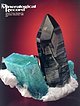
West slope, Hocharn, Große Fleiß valley, Heiligenblut am Großglockner, Spittal an der Drau District, Carinthia, Austria