 | | Journal (article/letter/editorial) | | Figure 1: View of Mt. Antero towards the southeast, taken by the U . S. Geological Survey geologist D...is probably the oldest existing photograph of Mt. Antero. Courtesy of U . S . G . S . AQUAMARINE, PHENAKITE...N E R A L S F R O M the Mt. Antero mineral locality, Chaffee County, Colorado, are well known throughout...1885, Reverend Roselle Theodore Cross of Denver, Colorado, wrote to George F . Kunz, the noted New York...locality. . . . I bought all the man had but one" (Colorado Historical Society). This greatly interested Kunz | 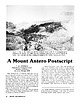 | | Journal (article/letter/editorial) | | Figure I : View of Mt. Antero towards the southeast, taken by the U . S. Geological Survey geologist...oldest existing photograph of Mt. Antero. Courtesy of U.S.G.S. A Mount Antero Postscript E . WM. HEINRICH...of pegmatite prospecting on Mount Antero, Chaffee County, Colorado, gives a detailed account of fine...single type of beryllium deposit found in the Mount Antero area. Less well publicized is the discovery of...Gulch. The fracture-filling veins cut the Mount Antero granite, the Mount Pomeroy quartz monzonite, and |  | | Journal (issue) | | Julius Weber Mamaroneck, New York COLORADO ISSUE #2 Articles Colorado locality index.............................. 323 by B. L. Muntyan What’s new in Colorado minerals? ......................................339 by M. I. Jacobson The San Juan Mountains of Colorado ..................................349 by J. A...10 cm tall, from the Yucca Hill claim, Park County, Colorado. Richard A. Kosnar specimen; photo by John...Natural History for conceiving the idea of a second Colorado issue and for helping a great deal in bringing |  | | Journal (issue) | | Colorado Springs Mineralogical Society Founded in 1936 July 2015 PICK&PACK Vol 55 ...... Number 6 Inside...Jacobson Topic: Pegmatitic Rare-earth Minerals of Colorado: Species and Identification Refreshments provided...editor for Rock & Minerals since 1984, the author of Antero Aquamarines (1993) and other books, and is currently...Friends of Mineralogy, Colorado Chapter. Mark has collected rare earth minerals in Colorado, Texas, Wyoming...Minerals of Colorado: Species and Identification Most of the pegmatitic rare-earth minerals in Colorado are found |  | Collins, Donley S., Cobban, Robert R., Foord, Eugene E., Murphy, Jack A. (1989) Bibliography for update and revision of U.S.G.S. Bulletin 1114, Minerals of Colorado -- a 100 year record, by Edwin B. Eckel, Part A - Paper copy --Bibliography data file disks. Open-File Report Vol. 1989 (89-206) US Geological Survey doi:10.3133/ofr89206a | Report (issue) | | Survey Denver, Colorado Department of Geology, Denver Museum of Natural History Denver, Colorado NOTE FOR...revision of U.S.G.S. Bulletin 1114, Minerals of Colorado A 100 year record, by Edwin B. Eckel By Donley...Prepared in cooperation with Friends of Mineralogy - Colorado Chaptar, and the Denver Museum of Natural History...references dealing with the mineralogy of the state of Colorado. It is part of a more than 10 year effort to update...and revise U.S.G.S. Bulletin 1114, Minerals of Colorado: A 100 year record, by Edwin B. Eckel (1961). |  | | Report (volume) | | minerals Name Composition Remarks Absite- Thorian brannerite- - - - - - - - ·· Abukumalite - (Y, Ce, Ca) 5...- 7(Ca, Na2)0 · RE 20 3 • 11 B20a · 7H20 - - Brannerite- - - - - (U, Ca2Th, Y) (Ti, Fe) 2 Os - - - -...and Mineral Resources. Colorado School Mines Mineral Industries Bull.-Colorado School of Mines, Mineral...Colo. Colorado School Mines Quart-Colorado School of Mines, Quarterly. Golden, Colo. Colorado Sci. Soc...Soc. Proc.-Colorado Scientific Society, Proceedings. Denver, Colo. Commonwealth Bur. Soils, Tech. Comm |  | | Book (volume) | | ...........................................59 Colorado ...............................................................548 Table of Maps Page Alabama County Map ...................................................................................4 Alaska County and Stream Map ......................................................................22 Arizona County Map .............................................................32 Arizona – Maricopa Co. Saddle Mt. Site Map ...................................... |  | | Report (issue) | | the major product (as at Climax and Henderson, Colorado, and Questa, New Mexico), or is a co- or byproduct...XVT XVA XWA XWI XWY ALASKA ARIZONA CALIFORNIA COLORADO GEORGIA IDAHO MAINE MISSOURI MONTANA NEVADA NEW...of the Pine Grove-B la*n Mountain area. Beaver County, Utah: U. S. Geological Survey Open-File Report...molybdenum system, southern wah wah Mountains, Beaver County, Utah (abstract): American Institute of Mining...Beryllium deposits of the Mount Antero region, Chaffee County, Colorado: U.S. Geological Survey Bulletin |  | | Book | | mid-1957, of vvhich 70% is in New Mexico, 16% in Colorado, Utah, and Arizona, and 8% in Wyo1ning. These...siliceous and Ruoritic types, and the oxidized Colorado Plateau deposits are desc1ibed vvith those that...origin, e.g., Blind River, \i\litwatersrand, and Colorado Plateau. The writer has attempted to present equitably.... . . . . . . . . . . . . . . . . . . . . . . Colorado Plateau . . . . . . . . . . . . . . . . . . ..... . . . . . . . . . . . . . . . . . . . . . . Colorado . . . . . . . . . . . . . . . . . . . . . . . |  | | Book (volume) | | ...........................................47 Colorado ................................................rights, so remember you were told. If in doubt, a county map will tell you who the legal owner is. Good...Cumberland Plateau and climaxing in 2,407 ft. Cheaha Mt. This crystalline or mineral region is composed primarily...gemmy qualities for cutting and polishing. AUTAUGA COUNTY PRATTVILLE, N. 6 mi., and just E of the Birmingham...were well known to prehistoric Indians.) BARBOUR COUNTY BAKER HILL, SE 1 mi. : 1 in a deep ravine, as a |  | | Book (volume) | | ...........................................47 Colorado ................................................rights, so remember you were told. If in doubt, a county map will tell you who the legal owner is. Good...Cumberland Plateau and climaxing in 2,407 ft. Cheaha Mt. This crystalline or mineral region is composed primarily...gemmy qualities for cutting and polishing. AUTAUGA COUNTY PRATTVILLE, N. 6 mi., and just E of the Birmingham...were well known to prehistoric Indians.) BARBOUR COUNTY BAKER HILL, SE 1 mi. : 1 in a deep ravine, as a |  | | Book | | MINES AND MINERALS OF THE GREAT AMERICAN RIFT (COLORADO-NEW MEXICO) Sine —_—< ¢ te om At _SHT 40...MINES AND MINERALS OF THE GREAT AMERICAN RIFT (COLORADO-NEW MEXICO) Richard Walker Holmes and Marrianna...Mines and minerals of the Great American Rift (Colorado-New Mexico). Bibliography: p. Includes index...index. 1. Mines and mineral resources—Colorado. 2. Mines and mineral resources—New Mexico. I. Kennedy, Marrianna...minerals of the Great American Rift in New Mexico and Colorado. Great American Rift is the name we use for a |  | | Journal (issue) | | since it will be held at the giant Los Angeles County Fairgrounds in Pomona, let’s just call it the “Pomona...Section of Geological Society o f America: Boulder, Colorado, Geological Society o f America Centennial Field...section with serendibite near Johnsburg, Warren County, New York (Schaller and Hildebrand, 1955; Grew...Ridge, CO 80033 303-421-3646 (by appointment) Colorado & Worldwide Specimens Collector’s Stope Jim &...By appointment only. Our mines produce choice Colorado minerals. Worldwide minerals. Green Mountain |  | | Book (edition) | | abbreviations: Rep. (republic), prov. (province), co. (county), munic. (municipio), pref. (prefecture), dept...always included in text, except in the cases of the USA, UK, and the provinces Ontario and Quebec in Canada...Other geographical abbreviations used are as follows: Mt. (mount or mountain), Mts. (mountains), R. (river)...6(5) - 5.8(4) - low-grade high-pressure quartzite on Mt. Ochi. near Karystos, Euboia, and near 3.77(8) -...Uintah County. Utah. and m (2.B. acanthite group). Monoclinic, C2/m, a,b,c Rio Blanco County. Colorado |  | | Journal (issue) | | mineral localities: the Gold Hill mine, Tooele County, Utah ...........................................The Wagon Wheel Gap fluorspar mine, Mineral County, Colorado ............................................The Gold Hill mine is located in western Tooele County, Utah, in the north end of the Deep Creek M ountains...Mineralization in the Gold Hill mining district, Tooele County, Utah. Utah Ge ological and Mining Survey, Bulletin...(1918) Notes on Gold Hill and vicinity, Tooele County, Utah. Economic Geology, 13, 247-274. NOLAN, T | | | Journal (issue) | | ince it will be held at the giant Los Angeles County Fairgrounds in Pomona, let ·s just call it the...photo by John Rakovan. Thr Mh1rrulogira/ Hrcord. w1h,mt' 26. Mar< h-Apr,/, /'J/95 Figure 6. Amethyst on...Sectio11 of Geological Society of America : Boulder. Colorado, Geological Society of America Centennial Field...section with serendibite near Johnsburg, Warren County, New York (Schaller and Hildebrand, 1 955; Grew...80401 303-233-4 188 Largest Comprehensive Stock in Colorado Stanley Kor,eb 1 38 1 2 W. Dakota Avenue Lakewood |  | | Journal (issue) | | Anhaeusser Minerals of the Linwood mine, Scott County, Iowa ............. 231 by P. L. Garvin & D. M...Arsenopyrite Betafite Biotite Bornite Braggite Brannerite Brookite Calaverite Calcite "Carbon" Cassiterite...main uranium-bearing minerals are uraninite and brannerite with minor amounts of coffinite and uraniferous...minerals. ' MINERALS OF THE LINWOOD MINE SCOTT COUNTY, lowA Paul L. Garvin Department of Geology · Cornell...River just east of the town of Buffalo in Scott County, Iowa. The"mine's beginnings can be traced back | | | Journal (issue) | | Anhaeusser Minerals of the Linwood mine, Scott County,Iowa ..................... 231 by P. L. Garvin...Arsenopyrite Betafite Biotite Bornite Braggite Brannerite Brookite Calaverite Calcite “Carbon” Cassiterite...main uranium-bearing minerals are uraninite and brannerite with minor amounts of coffinite and uraniferous...postpaid Keith Proctor 88 Raven Hills Court, Colorado Springs, CO 80919-1316 Telephone: (719) 598-1233...River just east of the town of Buffalo in Scott County, Iowa. T h e‘m ine’s beginnings can be traced back |  | | Journal (issue) | | R. Kampf Natural History Museum of Los Angeles County George Robinson National Museums of Canada Arthur...Vanadinite from the J. C. Holmes claim, Santa Cruz County, A rizona........................................currence. Sometimes a village or township and a county, or a village and a state have the same name and...hap pens that the village or city is not in the county of the same name nor even in the state. For example...minerals. Chester is also a large city in Delaware County. We have frequently run across minerals from Chester |  | | Journal (issue) | | M. Pryce and J. Chester The Amity Area, Orange County, New Y o rk ............................... 85...115-year-old Oriental mine in Alleghany, Sierra County, California. In August, about five months after...357-6338_______ See me in wholesale at: Tucson (Feb. 9-12), Colorado Springs (June 9-11), Newcastle, PA (July 7-9)...reported. Other associations include molybdenite, brannerite, pyrite and gold. One paragenetic assemblage...Sulfates Sphalerite Barite-celestine Oxides Epsomite Brannerite Chromite Goethite Hematite Heterogenite Magnetite |  | | Journal (issue) | | (1992) Minerals of the Black Pine mine, Granite County, Montana. Mineralogical Record, 23 (6), 477-483...$7 v.8/#6 California Issue Benitoite, Gold L.A. County Museum, Himalaya mine $7 Hydroxylherderite (Brazil)...Beryl, etc) $7 v .10/#6 Colorado-II Issue Locality Index, Amazonite, Mt. Antero, Sweet Home v .ll/# 5...Shavano Peak (CO) v.1 3 /# 4 Diamond (CO), Quartz (MT), Jeanbandyite. Bancroft (Ont.) v,15/#l Darwin (CA)...Steamboat, Majuba Hill. White Caps $7 v .16/#3 Colorado-Ill Issue! Leadville, Rico, Cresson Vug, Pikes |  | | Book (edition) | | Encyclopedia of minerals Sagiiache County Pu blic Library Saguache , Colorado DEMCO For Reference Not to...Wendell E. Wilson Library Saguache County Public Saguache, Colorado VAN NOSTRAND REINHOLD New York ...rile 1) -l see eke4 | ase re KO 4! dat wi 6 eae Mt: = So injaih, ag ur t- Gee Vice, ‘3 emd wih fH e4agi"”...Cal and Kerith Graeber Cureton Mineral Company Colorado School of Mines Charles and Marcelle Weber Dan...JH JL JP 1X JZ, KE LC LH LM LE MA MC MJ MP MR MS MT MW Gary Nagin Harvey Gordon Harvard Mineralogical | | | Book (edition) | | Encyclopedia of minerals ~~cbe County Public Library Saguache, Colorado OEMCO For Refere nee Not to...Sagtiache Co1tntr Publlc I...ibran' Saguache, Colorado ~ VANNOSTRAND REINHOLD ~ - - - - N e w York...Cal and Kerith Graeber Cureton Mineral Company Colorado School of Mines cw Charles and Marcelle Weber...Michael P. Cooper MR Mark Rogers MS Marshall Sussman MT Michigan Technological University MW = Marcelle Weber...the Fuemrol No. 2 mine, Temple Mountain, Emery County, Utah; also sparsely disseminated in uraniferous |  | | Book | | Netherlands. Special regulations for readers in the USA — This publication has been registered with the Copyright...made in the USA. All other copyright questions, including photocopying outside of the USA, should be referred...granites as in many other regions of the world (Colorado Mineral Belt, Great Basin, W. Rumania, etc.)....low-grade material has been established there (58.5 Mt ore with 0.93 ppm Au, 8.5 ppm Ag, 0.7% Zn, 0.3% Pb;...a considerable resource of low-grade ore (min. 3 Mt Cu) and appears shortly to postdate (or possibly |  | | Report (issue) | | the site of a former landfill at Fort Carson, Colorado. Tellurium is a critical component for the development...Photograph of the Mountain Pass Mine in San Bernardino County, California, which was the only active producer...Creek (Ottawa County) 6 Oklahoma OKD980629844 1900 n.a. 1967 9/8/1983 Cherokee County 7 Kansas...Madison County Mines 7 Missouri MOD098633415 1840 n.a. Historical 9/29/2003 Newton County Mine Tailings...Jefferson County Mining 7 Missouri MON000705443 1800 n.a. Historical 9/23/2009 Washington County Lead |
|


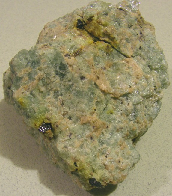
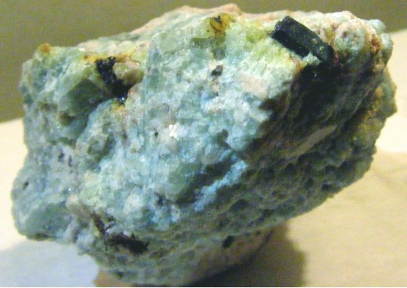


Mt Antero, Chaffee County, Colorado, USA