| Classification |
|---|
|
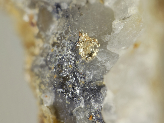
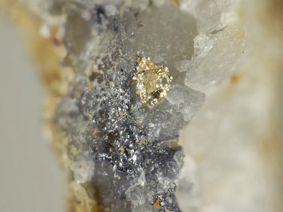
| Species: | Gold |
| Formula: | Au |
| Confirmation |
|---|
|
| Validity: | Believed Valid |
| Associated Minerals Based on Photo Data: |
|---|
|
| Arsenopyrite | ⓘ2 photos of Gold associated with Arsenopyrite at this locality. |
| Galena | ⓘ2 photos of Gold associated with Galena at this locality. |
| Data |
|---|
|
| Mineral Data: | Click here to view Gold data |
| Locality Data: | Click here to view Straßegg (Straßeck), Gasen, Weiz District, Styria, Austria |
| Photo Gallery | View Gallery (10 photos) |
| Data Identifiers |
|---|
|
| Mindat Occurrence Record ID: | 301860 |
| Long-form Identifier: | 1:3:301860:6 |
| GUID (UUID V4): | eece065f-2be7-4a8f-822f-872e2b963064 |
| Localities for Gold in this Region |
|---|
|
| Pramerkogel, Straßegg (Straßeck), Gasen, Weiz District, Styria, Austria |
| Nearest other occurrences of Gold |
|---|
|
|
| 0.5km (0.3 miles) | ⓘPramerkogel, Straßegg (Straßeck), Gasen, Weiz District, Styria, Austria |
| 11.9km (7.4 miles) | ⓘSilberloch Mine, Völlegg, Fischbach, Weiz District, Styria, Austria |
| 21.8km (13.6 miles) | ⓘMagnesite deposit, Sattlerkogel, Veitsch, Sankt Barbara im Mürztal, Bruck-Mürzzuschlag District, Styria, Austria |
| 23.5km (14.6 miles) | ⓘBlasenkogel (Blasenberg), Rettenegg, Weiz District, Styria, Austria |
| 25.9km (16.1 miles) | ⓘMur river, Peggau, Graz-Umgebung District, Styria, Austria |
| 28.4km (17.7 miles) | ⓘLöffelbachgraben (Puchegg), Vorau, Hartberg-Fürstenfeld District, Styria, Austria |
| 30.0km (18.7 miles) | ⓘKnappenkeusche, Steinhaus am Semmering, Spital am Semmering, Bruck-Mürzzuschlag District, Styria, Austria |
| 31.5km (19.6 miles) | ⓘSteinhaus am Semmering, Spital am Semmering, Bruck-Mürzzuschlag District, Styria, Austria |
| 32.7km (20.3 miles) | ⓘMur River, Leoben, Leoben District, Styria, Austria |
| 33.6km (20.9 miles) | ⓘTalergraben (Thalergraben), Trattenbach, Neunkirchen District, Lower Austria, Austria |
| References |
|---|
|
|


Straßegg, Gasen, Weiz District, Styria, Austria