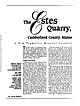
 | Thompson, Woodrow B., Bearss, Gene T., Falster, Alexander U., Simmons, William B., Nizamoff, Jams W. (2000) The Estes Quarry, Cumberland County, Maine: A New Pegmatite Mineral Locality. Rocks & Minerals, 75 (6) 408-418 doi:10.1080/00357520009605667 | Journal (article/letter/editorial) | | August 2013 Cumberland Countv. Mahe A New Pegmatite M ineral Locality T he Estes quarry in southwestern...southwestern Maine exposes a granite pegmatite hosting more than forty mineral species. This locality contains...highly mineralized pegmatites in Maine and New Hampshire. The quarry has yielded fine specimens of eosphorite...Hlstory The Estes quarry is located on Route 5 in West Baldwin, Cumberland County, Maine (fig. 1). It...& Son Excavation Contractors of West Baldwin. This is a working quarry with high rock walls and unstable |  | Korsakov, Andrey, Rezvukhina, Olga, Jaszczak, John, Rezvukhin, Dmitriy, Mikhailenko, Denis (2019) Natural Graphite Cuboids. Minerals, 9 (2) 110 doi:10.3390/min9020110 | Journal (article/letter/editorial) | | University, 1400 Townsend Drive, Houghton, MI 49931-1295, USA; jaszczak@mtu.edu Correspondence: korsakov@igm.nsc...Meteor Crater area, Winslow, Coconino Co., Arizona, USA (samples from J.A. Jaszczak’s collection). Two series...(Northern Kazakhstan), the Estes Quarry (West Baldwin, Cumberland County, ME, USA), the Maksyutov complex...taenite, Ilm = ilmenite, Sul = sulphides, Po = pyrrhotite, Py = pyrite, Rt = rutile, Chl = chlorite, Zrn...[58] 950–1000 ◦ C, 4–5 GPa [61] Estes Quarry, West Baldwin, Maine (USA) Ab c, s, f up to 1 mm unknown |  | | Journal (article/letter/editorial) | | FRoM ThE SELLECk RoAd oCCURRENCE, wEST pIERREpoNT, ST. LAwRENCE CoUNTy, NEw yoRk. S. C. Chamberlain1, M...at the well-known Selleck Road occurrence east of West Pierrepont, New York, revealed a suite of minerals...parking area at the western base of the first east-west ridge. The various mineralized contacts contained...this study. These include cassiterite, pyrite, pyrrhotite, sphalerite, gypsum, rhodochrosite, zircon, and...new mineral from the De-Mix quarry, Mont Sainte-Hilaire, Rouville County, Quebec. The structural formula |  | | Journal (article/letter/editorial) | | perovskite, titanite, spinel, ilmenite, magnetite, pyrrhotite, pentlandite, millerite, pyrite, calcite, chlorite...(Taughannock Creek) and harzburgitic (Portland Point quarry) affinities. The yellow garnet is grossular. Phlogopite...macrocrysts. Millerite, pyrite, and most of the pyrrhotite are the products of a late sulfurization process...olivine. Very rare polysulfide globules, such as pyrrhotite that contains flamelike exsolution lamellae of...Roscherite 0 Palerrno, NH V Dunton Quarry, ME Black Mountain, ME Estes Quarry, ME v Martin Prospect, ME 1 |  | | Journal (article/letter/editorial) | | Cruzeiro mine, Minas Gerais, Brazil. Los Angeles County Museum of Natural History specimen, Harold and... near Badger Creek, north of Coaldale, Fremont County, Colorado. Dave Bunk specimen, Jeff Scovil photo...manganoan, Argentine vein, Idarado mine, San Miguel County, Colorado. Dave Bunk specimen, Ed Raines photo...15 Albite. Maine, 4 12 Alexandrite, Hematitia, Minas Gerais, Brazil, 23 Almandine, Maine, 412 Alunite...Arsenic, Madagascar, 256 Arsenopyrite, Colorado, 337; Maine, 412 Art, see Robinson, S., see Equit, E. Arupite |  | Falster, Alexander U., Simmons, William B., Webber, Karen L., Dallaire, Donald A., Nizamoff, James W., Sprague, Raymond A. (2019) The Emmons Pegmatite, Greenwood, Oxford County, Maine. Rocks & Minerals, 94 (6) 498-519 doi:10.1080/00357529.2019.1641021 | Journal (article/letter/editorial) | | 1996. THE EMMONS PEGMATITE Greenwood Oxford County, Maine The Emmons pegmatite, noted for its many phosphates...WEBBER MP2 Research Group Maine Mineral & Gem Museum 99 Main Street Bethel, Maine 04217 alexander.falster@gmail...Hebron, Maine 04238 phosphate@gmail.com RAYMOND A. SPRAGUE* 33 Roger Street Lewiston, Maine 04240 *...Deceased 16 April 2019. HE MINERALOGY AND ORIGIN OF MAINE PEGMATITES have been a principal focus of our research...in 2014 from New Orleans, Louisiana, to Bethel, Maine, greatly facilitated resumption of our study of |  | | Journal (article/letter/editorial) | | exposed in a small portion of the north face of the quarry. Miaroles up to several inches iicross abound in...KUNZITEBEARING PEGMATITE IN THE PALA DISTRICT, SAN DlEGO COUNTY, CALIFORNIA. J. Fisher, 380 Pennsylvania Ave.,...north to northwest and dips at a low angle to the west. Thickness appears highly variable but averages...Katerina mine, Hiriart Mountain, Pala, San Diego County, California. J. Fisher specimen and photo. Heavy-mineral...MINERALIZATION OF PEGMATITES IN THE WAUSAU COMPLEX, MARATHON COUNTY, WISCONSIN. S. L. Hanson', A. U. FalsterZ, W B |  | | Other Paper | | MAGNET COVE, HOT SPRING COUNTY, ARKANSAS: COLLECTOR AND PROFESSIONAL OBSERVATIONS, STORIES AND PHOTOGRAPHS...and J. Michael Howard MAGNET COVE, HOT SPRING COUNTY, ARKANSAS: COLLECTOR AND PROFESSIONAL OBSERVATIONS...Introduction…………………………………………………………………... 17 Kimzey Calcite Quarry………………………………………………………. 18 Perovskite Hill………………………………………………………………...Locations………………………………………………………………... 21 Diamond Jo Quarry…………………………………………………………... 21 Eudialyte Syenite...Minerals……………………………………………………………….. 24 Martin Marietta Jones Mill Quarry………………………………………….. 27 Pseudoleucite Crystals and |  | | Book (volume) | | 0 n101ercai o of Maine j f·~ ....__ :,,. . - .._"' ..;. .. ~ L-- -~ \. • .J_..::.; I Volume...History, Gems, and Geology edited by Vandall T. King Maine Geological Survey DEPARTMENT OF CONSERVATION Robert...Robert G. Marvinney, State Geologist of Maine Volume 2: Mining History, Gems, and Geology Edited by...Resources Information, Maine Geologi,cal Survey Robert G Marvinney, State Geologist Maine Geological Survey...DEPARTMENT OF CONSERVATION 2000 Copyright ©2000 by the Maine Geological Survey, Department of Conservation. All |  | | Report (volume) | | .............................................. Maine.................................................................................................. West Virginia..........................................vanadium minerals in the high plateau region of the West. The present bulletin, like the earlier work, gives...Charlottesville. Washington___Prof. Henry Landes, Seattle. West Virginia_.Dr. I. C. White, Morgantown. Wisconsin____Prof...See Bauxite and Halloysite. Asbestos. Tallapoosa County, with corundum deposits near Dudleyville; not found |  | | Book (volume) | | ...........................................207 Maine ..............................................................................................525 West Virginia ........................................................548 Table of Maps Page Alabama County Map ...................................................................................4 Alaska County and Stream Map ......................................................................22 Arizona County Map .......................................... |  | | Book (edition) | | South and in the States and Ter ritories of the far West. These changes, for the most part, have been progressive...mmed at Broken Arrow aud Trout creek, in Sc. Clair county. The strata in this field are more faulted und...prong of Canoe creek, in St. Clair county, to Ha\sop creek, in Bibb county, a distance of 60 miles. Down to...to Helena, in Shelby county, the field has an average width of 5 or 6 miles. Below that point the width...miles being in the latitud" of Blocton, in Bibb county. The south ern end of this field has a greater |  | | Book | | a omnes ype ess odoe g. From other claims in the West Kootanie SUE TAMES Grae c SPE eee a: 8 eam Raney...Graphite.—Lot 3, range II. of Grenville, Argenteuil county, Q.—Coll., R. Bell, 1856. (1228.) — columnar.——Lot...Ottawa county, Q.— Coll., H. G. Monae 1877. (1249.) — Walker’s property, Buckingham, Ottawa county, Q.—Coll...Ottawa county, Q.—Coll., Table-case 49, E. D. Ingall, 1891. (5186.) — Lochaber, Ottawa county, Q. (1254...Denbigh, Addington county, O. (1238.) Native Arsenic.—Seven miles up Watson Creek, west side of the Fraser |  | | Book (volume) | | ...........................................177 Maine...............................................................................................429 West Virginia .........................................rights, so remember you were told. If in doubt, a county map will tell you who the legal owner is. Good...mountainous, constituting the southern end of the Cumberland Plateau and climaxing in 2,407 ft. Cheaha Mt...gemmy qualities for cutting and polishing. AUTAUGA COUNTY PRATTVILLE, N. 6 mi., and just E of the Birmingham |  | | Book (volume) | | ...........................................177 Maine...............................................................................................431 West Virginia .........................................rights, so remember you were told. If in doubt, a county map will tell you who the legal owner is. Good...mountainous, constituting the southern end of the Cumberland Plateau and climaxing in 2,407 ft. Cheaha Mt...gemmy qualities for cutting and polishing. AUTAUGA COUNTY PRATTVILLE, N. 6 mi., and just E of the Birmingham |  | | Journal (article/letter/editorial) | | .............................. 434 Virginia and West V irginia.........................................canyon (No. 22). Ice-front of Muir glacier from the west (No. 30). Ice-front of Muir glacier. Ice-front of...shale, and sandstone in young rock series; looking west (No. 249). 93. Valley tributary to the Gens de Larg...river, 112 miles above its m o u th ; look ing west by south (No. 42). 94. Lower side of gulch and topography...(No. 20). 98. Valdes and mountains on north, mount West in right, from east beach and foot of delta (No |  | | Report (issue) | | (1985) as that part of the "Churchill province" west of Hudson Bay. Rocks exposed along the western margin...Sibbald, 1978). Since the Archean Wyoming craton lies west of the Superior craton in the continental United...genetic models. They described (figs. 1 and 2), from west to east, the Cree Lake zone (composed of the Virgin...plutons are more abundant than supracrustals. To the west, the Virgin River domain is also dominated by granitoid...pillow and massive lavas (Green and others, 1985). Baldwin and others (1985) reported a U-Pb age of about |  | | Report (issue) | | this type. The ore minerals are arsenopyrite, pyrrhotite, pyrite, chalcopyrite, galena, sphalerite and...the ore minerals are mainly galena, sphalerite, pyrrhotite, pyrite, and minor amounts of chalcopyrite. The...part of N ev da. Battle Mountain is bounded n the west by Buffalo Valley, on the south and east b the Reese...elsewhere it is g nerally less than 2,000 feet. The west and north slop s of the range are extremely rugged...the Battle Mountain area: Buffalo Valley on the west, Reese River valley on the east, and the Humboldt |  | | Report (issue) | | in the middle Precambrian Estes Conglomerate, Nemo District, Lawrence County, South Dakota A preliminary...Quartzite Benchmark Iron-formation Estes Conglomerate Radioactivity in the Estes Conglomerate Conclusions Acknowledgments...and Estes and Greenwood areas 5 Explanation for Figures 2 through 5 8 2. Geology of the Estes area...Orientation of bedding in the Estes area 10 4. Orientation of cleavage in the Estes area, sec. 2 11 5. Geology...sample localities 13 6.--Gamma-ray survey of Estes area made with conventional scintillometer held |  | | Report (volume) | | of the North American continent, Greenland, the West Indies and adjacent islands, Hawaii, Guam, and other...Geological Society of Jamaica. University of the West Indies, Department of Geology. Kingston, Jamaica...of Kentucky Geol. Survey County Rept. - Kentucky Geological Survey County Report. University of Kentucky...Analysts. Houston, Tex. Los Angeles County Mus. Contr. Sci. - Los Angeles County Museum Contributions in Science...Science. Los Angeles County Museum of Natural History. Los Angeles, Calif. Los Angeles County Mus. Nat. History |  | | Journal (issue) | | ................. MISCELLANEOUS CHIPS FROM THE QUARRY .................................................OF CALIFORNIA—Tomasz J. Turley THERE’S GOLD IN MAINE—Mrs. Cecil J. Smith PROF. C. S. HURLBUT, JR. TO...7-3185) ROCKS AND MINERALS 641 CHIPS FROM THE QUARRY A RUSH TRIP TO SOUTH CAROLINA On Tuesday, August...headed northward towards the gold mine in York County. It was a most enjoyable trip, the mine was reached...Ave., North, Minneapolis, Minn. Oct. 3-9, 1965—West Oxford Agricultural Society, Inc., 2nd Annual Lapidary |  | | Book (volume) | | cut purplish pink elbaite tourmaline (30.89 ct), Maine; round brilliant red-orange spessartine garnet (16...Colorado; colorless scheelite (19.66 ct), Kern County, California; octagonal step cut violetish pink...Vivid blue matched benitoite gems from San Benito County, California, consisting of 52 benitoites and 75...of the East, and the Sierras and Cascades of the West, for examples, dense forest covers extend over thousands...Cantlin, Ellis, [D; Jeannette B. Carillo, Gem Center USA, EI Paso, TX; Gary Christopher, The Prospectors Cache |  | | Journal (article/letter/editorial) | | pegmatite was mined at Barringer Hill in Llano County in the early 1900s but was flooded by Lake Buchanan...on "The Weeks Pegmatite Mine, Wakefield, Carroll County, New Hampshire" (March/April 1991). i i • I...66, May/June 1991 197 LOCALITIES BY COUNTY Bastrop County KEY mm T * ? — — — — best occurrence..."specimen quality" questionable occurrence Angelina County Lufkin, 1 mile N of Lufkin in railroad cuts, in...(petrified wood) (Folk et al., 1961). Baylor County Aransas County Aransas Pass area, Intercoastal Canal |  | | Journal (issue) | | etusllUIII. jo,,. !bece,,,/.e,, l9J/..2. CHIPS FROM THE QUARRY .................................................Land Expedition, 1934-1937, which made studies in West Antarctica, under the leadership of John Rymill...1908-1910, were cirried on in the general region of West Antarctica ROCKS AND MINERALS explored in part...1928-1929, did considerable aerial photography in West Antarctica. The Second Byrd Antarctic Expedition...23-December 5, 1935, crossed the entire length of West Antarctica from Dundee Island to Little America |  | | Report (issue) | | logs, Nevada Test Site and Hot Creek Valley, Nyo County, Nev., by D. L. HealeY------------------------...Economic geology Iron deposits of the Estes Creek area, Lawrence County, S.Dak., by R. W. BayleY---------...--High-calcium limestone deposits in Lanc~ster County, southeastern Pennsylvania, by A. E. Becher and...Adobe Range, Elko Hills, and adjacent areas, Elko County, Nev., by K. B. Ketner-- 93 102 105 Paleontology...the White Knob Limestone (Mississippian), Custer County, Idaho, by Betty Skipp and B. L. Mamet-------- |
|


