 | | Report (issue) | | CHARACTERISTICS, AND GEOCHEMISTRY OF GOLD-BEARING QUARTZ VEINS IN THE KLAMATH MOUNTAINS IN THE REDDING 1x2 DEGREE...DEGREE QUADRANGLE, NORTHERN CALIFORNIA by Miles L. Silberman1 and Joanne Danielson2 Open-File Report 91-595...College, Redding, California 96003 Geologic Setting, Characteristics and Geochemistry of Gold-Bearing Quartz...Veins in the Klamath Mountains in the Redding 1x2 Degree Quadrangle, Northern California Miles L. Silberman...ounces of gold have been produced from several geological terranes of the Eastern Klamath Mountains in the |  | | Report (volume) | | Geology of Lode Gold Districts in the Klamath Mountains, California and Oregon By PRESTON E. HOTZ GEOLOGICAL... CONTENTS Abstract _______ Introduction Klamath Mountains province __________ Geology _______ _ Subjacent...Subjacent rocks _ Page 1 3 4 6 , _ Eastern Klamath belt 6 __ _ 7 Duzel and Gazelle Formations ______...Formation Central metamorphic belt ___________ Salmon and Abrams Formations ____ _ Western Paleozoic...Paleozoic and Triassic belt _____ 8 9 10 11 Stuart Fork Formation of Davis and Lipman (1962) ___ 11 Areas |  | | Report (issue) | | C3 A3 NO. 193 C.2 GOLD DISTRICTS OF CALIFORNIA BULLETIN 193 California Division of Mines and...Geology Sacramento, California, 1970 GOLD By William B. DISTRICTS OF CALIFORNIA Clark Geologist...Geologist, California Division of Mines & Geology, Sacramento, California UNIVERSITY LIBRARY U.C DAVIS '~'^...though Nugget. This 201 -ounce (troy) cluster of gold on display in the Division of Mines and Geology...Geology San Francisco's Ferry Building. Melted down as gold, it would be worth tome seven or eight The Fricof |  | | Report (volume) | | Nome and Norton Bay regions 3 30 Copper River district 3 30 Logarithm tables 3 Regulations 30 3 Instructions...II. Ore deposits. 888 pp., 82 pls. Old tungsten mine at Trumbull, Conn., by W. H. Hobbs, pp. 7-22, pls...Preliminary report on the lead and zinc deposits of the Ozark region, by H. F. Bain, with an introduction by C...23-22S, pls. vi-xxv. The ore deposits of the Rico Mountains, Colorado, by F. L. Ransome, pp. 229-398, pls...Geology and ore deposits of Elkhorn mining district, Jefferson County, Mont., by W. H. Weed, with an appendix |  | | Book (volume) | | ..........................................39 California ...............................................rights, so remember you were told. If in doubt, a county map will tell you who the legal owner is. Good...Prior to the California gold rush of 1849, this portion of Alabama experienced its own gold rush, largely...largely unprofitable, although gold may still be panned in the regional streams. Most of the rest of the...gemmy qualities for cutting and polishing. AUTAUGA COUNTY PRATTVILLE, N. 6 mi., and just E of the Birmingham |  | | Book (volume) | | ..........................................39 California ...............................................rights, so remember you were told. If in doubt, a county map will tell you who the legal owner is. Good...Prior to the California gold rush of 1849, this portion of Alabama experienced its own gold rush, largely...largely unprofitable, although gold may still be panned in the regional streams. Most of the rest of the...gemmy qualities for cutting and polishing. AUTAUGA COUNTY PRATTVILLE, N. 6 mi., and just E of the Birmingham |  | | Book (volume) | | ..........................................49 California ..............................................................548 Table of Maps Page Alabama County Map ...................................................................................4 Alaska County and Stream Map ..................................Co. Mining Districts ............................................................22 Arizona County Map.........................23 Arizona – Cochise Co. Mining Districts .................................... |  | | Report (issue) | | Redding 1° x 2° quadrangle), Humboldt and Trinity Counties, California By Jerry R. Hassemer *, Miles L....spectroscopy methods ............. Gold (Au) ......................... Gold (Au), Tellurium (Te), and Thallium...Hayfork 30' x 1° quadrangle, Humboldt and Trinity Counties, California .......... in pocket TABLES Table 1...Hayfork 1:100,000 quadrangle, Humboldt and Trinity Counties, California .................. 31 ii Table 9...Hayfork 1:100,000 quadrangle, Humboldt and Trinity Counties, California .................. 47 Table 10. Results |  | | Report (issue) | | THE LOS BURROS DISTRICT, MONTEREY COUNTY, CALIFORNIA. By JAMES M. HILL. INTRODUCTION. The following...prospects of the Los Burros district, in the southwestern part of Monterey County, Calif., are based on observations...properties and the caretaker at the Buclimo mine. The district lies on the west side of the rugged Coast...Coast Range, near the south line of Monterey County, in Tps. 23 and 24 S., R. 25 E. Mount Diablo meridian...are near the Government mail trail between Jolon, east of San Antonio River, and Gorda, a small ranching | 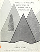 | | Report (issue) | | MINES AND MINERAL RESOURCES OF TRINITY COUNTY, CALIFORNIA ^^^^gz^^^^sHi LIBRARY ^ tnSF DAVIS [...Archive in 2012 with funding from University of California, Davis Libraries http://www.archive.org/det... and MUt&ial TRINITY denounce*, o^ COUNTY CcUifi&isua By J. C. O'BRIEN, Mining Engineer, Retired...Retired and Geology California Division of Mines COUNTY REPORT 4 California Division of Mines and Geology...Quicksilver by Fe?ielon F. Davis sections , STATE OF CALIFORNIA. THE RESOURCES AGENCY. DEPARTMENT OF CONSERVATION |  | | Report (volume) | | ............................................ California....................................................................................... 102 District of Columbia ....................................to refer to Geological Survey Bulletin 507, "The mining districts of the western United States," and to...abundant it may have been completely exhausted by mining or quarrying. Deposits of minerals that are widely...because they occur in sufficient quantity to warrant mining for their usual products, but because they furnish |  | | Book (edition) | | .- ,: --- . :i! __;,;,,~ • ·. I ..' - ros I Gold Prospectors Ass ociation of America P. 0. Box 891509...- Temecula, CA 92589 (909) 699-4749 - 1994 Mining Guide TABLE OF CONTENTS INrRoDUCI'ION ••••••••........................................ AR 1-3 California .................................................... . 1994 Mining Guide INTRODUCTION IMPORTANT - PLEAsE READ! The 1994 GPM Mining Guide is designed...listed from north to south), directions and mining commen ts; gold-producing areas, general prospecting regulations |  | | Book (volume) | | the southern end of the Appalachian chain of mountains. These ranges extend into the northeast corner...where Brasstown Bald, a part of the Nantahala Mountains achieve the highest elevation in the state at...in the northwest, where the Lookout and Sand mountains loom over rich agricultural valleys, Georgia easily...Plateau, the Appalachian Valley, the Appalachian Mountains, the Piedmont Plain (about 30% of the state),...lie some of the oldest crystalline rocks in the East, both igneous and metamorphic, strongly mineralized |  | | Report (volume) | | Bulletin 808 GEOLOGY OF THE DE QUEEN AND CADDO GAP QUADRANGLES, ARKANSAS BY HUGH D. MISER AND A. H...series (Lower Cretaceous)____________________ Trinity formation_________________________________ Gulf...syncline._________---____--_-___--.-_- Cross Mountains anticline.-_------._-- Page 95 96 96 97 99 99..._______________________-_-_-_---- 143 144 146 147 147 147 Mining and treatment of diamond-bearing material._____-_...marcasite__-______.________________________________ Copper, gold, and silver.______________________________________ |  | | Report (volume) | | it helpful to refer to Survey Bulletin 507, "The mining districts of the western United States," and to...abundant, it may have been completely exhausted by mining or quarrying. Deposits of minerals of wide distribution...because they occur in sufficient quantity to warrant mining for their usual products but because they furnish...Arkansas..........Dr. A. H. Purdue, Nashville, Tenn. California........Mr. William H. Storms, San Francisco....See Bauxite and Hallpysite. Asbestos. Tallapoosa County, with corundum deposits near Dudleyville; not found |  | | Report (volume) | | 1902. Minneapolis, Minn. American Institute of Mining Engineers: Transactions, vols. 31 and 32, 1902...Gazette, vols. 32 and 33, 1902. Chicago, 111. California Academy of Sciences: Proceedings, 3d series,... vol. 2, no. 1, 1902. San Francisco* Cal. California, University of, Department of Geology: Bulletin...Canada. Canadian Mining Institute: Journal, vol. 5, 1902! Ottawa, Canada, Canadian Mining Review, vol. 21... 2 and 3, 1902. Cincinnati, Ohio. . ' Colorado Mining Bureau: Bulletin, no". 5; Eeport, 1902. Denver |  | | Report (issue) | | Ul Cover design by Arthur Isom. Diagrammatic east-west cross section of the United States. iv 'R...prepared during the last 20 years by geologists and mining engineers of the U.S. Geological Survey and the...Gus H. Goudarzi .... . . Alabama ........ . Adams Gap and Shinbone Creek Roadless Areas, Alabama, by T...E. Williams ...... . ............. . Dragoon Mountains Roadless Area, Arizona, by Harald Drewes and T... . . . . . . . . . . ....... ........ Bell Star East and West Roadless Areas, Arkansas, by Mary 43 H |  | | Report (volume) | | anonymous papers, placed at the end of Part I Co. county cos. · counties CORPORATE AUTHORS. Am G American...Natural Histor: Cal Ac Sc California Academy of Sciences Cal M As California Miners' Association Cal St...St :M Bur California State Mining Bureau Can G S Canada, Geological Survey Can :M Br Canada, Mines Branch...Aspects of modern petrology: Harker, 11 Association of gold with other metals: Pearce, 90b Biologic evolution:...Adams (F D), 18 Federal Government, relation to the mining industry: Hayes, 06 Fossil insects: Cockerell, |  | | Book | | stumble over a valuable nugget and stake your own mining claim? Indeed it to is, and author book Jay...prospecting, he points out, is in abandoned mining districts, where valuable mineral ores are present...commercial ores and secondary minerals by state, county, township, and geologic range. For easy identification...address Harper 6 Row, Publishers, Incorporated, 49 East 33rd Street, New York 16, N. Y. * FIRST EDITION...RANSOM 1875-1948 An to the Eastern '‘Schoolmarm” Mining Camps of the Old West I I a s I \ h K |  | | Report (volume) | | JARBIDGE, CONTACT, AND ELK MOUNTAIN MINING DISTRICTS ELKO COUNTY, NEVADA BY F. C. SCHRADER WASHINGTON...47 47 48 48 West system______ ____ ________..__ East system______ .. ___________ Cross system_______... 58 __.____ 64 4 CONTENTS. The Jarbidge district Continued. Page. Description of properties._________...the west system of veins______________ 66 Pavlak mine. ________1_______ 67 Location _ _ ___________ 67...property _ _ St. Joe group __ Free Gold group __ ____________ Ozark group |  | | Book (edition) | | YEAR 1687"—DAVID T. DAY, CHIEF OF THE DIVISION OF MINING STATISTICS AND TECHNOLOGY WASHINGTON GOVERNMENT...exten sive deposits, such as coal and iron fields, gold belts, etc., are mentioned in general terms. 688...and consump tion, or better and cheaper means of mining, extraction, and convey ance to market, may in...correspondence has been carried on with geologists, mining engineers, and other local authorities, and various...ALABAMA—Mined. Mineralogical name. Coal, var. bitu minous. Gold. Common name. Remarks. Coal, bituminous coal |  | | Report (volume) | | 250-12,460 ft, sec. 14, T. 45 S., R. 27 E., Lee County, Fla. Named for the nearby Able Canal. The Able...H-20, northwest of Wattsville, northern Accomack County, Va. Reference sections: facies E and F, sand pits...Wattsville, Persimmon Point, and Accomack, Accomack County, Va. The informal Accomack beds of Mixon and others...and west of the Ames Ridge shoreline in Accomack County, Va., and are well developed from Wallops Station...Turnpike exchange, Annandale quadrangle, Fairfax County, Va. The Accotink Schist, here named, is the lower |  | | Report (volume) | | Bulletin No. 3,1892, a preliminary report on the lower gold belt; Bulletin No. 4,1892, report on the geology...XI-XII, 1893. Minneapolis. American Institute of Mining Engineers: Transactions, Vol. XX, 1892; XXI, 1893...Advancement of Science: Reports 1891 and 1892. London. California Academy of Science: Proceedings, 2d ser., Vol...Occasional Papers, IV, 1893. San Francisco. California State Mining Bureau: Eleventh Report, State Mineralogist...Institute: Journal, Vol. XI, Part I, 1892. Denver, Mining and Scientific Review, Vols. XXVIII-XXIX, 1892; |  | | Report (volume) | | .......... GOLD AND SILVER: Auriferous gravels in the Weaverville quadrangle, California, by J. S. Diller.......................... Gold lodes of the Weaverville quadrangle, California, by H. G. Ferguson.. Mineral...Mineral resources of the Inyo and White mountains, California, by Adolph Knopf............................................. 121 Survey publications on gold and silver................................ 133.............. Copper deposits of the White Mesa district, Ariz., by J. M. Hill............ Survey publications |  | | Report (volume) | | vols. 13, 14. Tulsa, Okla. I American Institute of Mining and Metallurgical Engineers: Year Book 1929; Techniea:J...Techniea:J. Publications 158-385. New York. See also Mining and Metallurgy. J American Journal of Science,...Paleontology, vol. 15, nos. 54-58, 62. Ithaca, New York. California Academy of Sciences: Pr\o ceedings, 4th ser....Francisco, Calif. California, Department of Natural Resources, Division of Mines and Mining: Bulletin, nos...nos. 102, 103 ; Mining in California, vols. 25, 26. San Francisco, Calif. 3 4 BIBLIOGRAPHY OF NORTH |
|


