| Locality type: | Quarry |
| Classification |
|---|
|
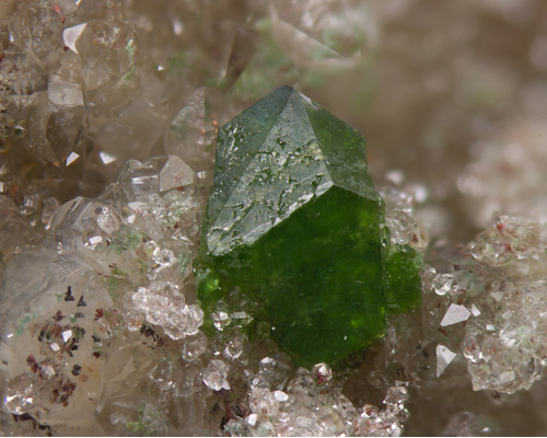
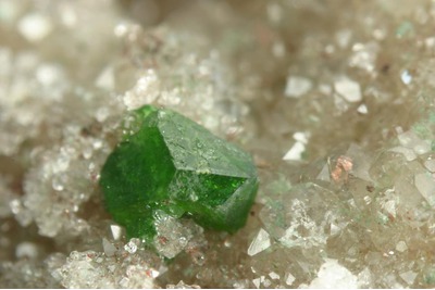
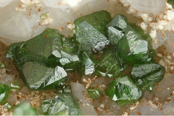
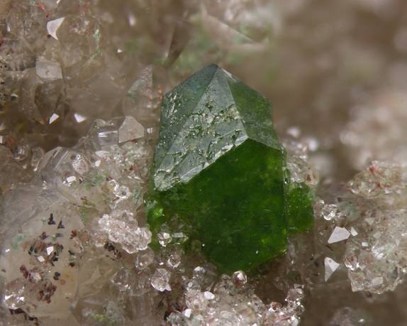
| Species: | Duftite |
| Formula: | PbCu(AsO4)(OH) |
| Confirmation |
|---|
|
| Validity: | Believed Valid |
| Associated Minerals Based on Photo Data: |
|---|
|
| Quartz | ⓘ4 photos of Duftite associated with Quartz at this locality. |
| Copper | ⓘ3 photos of Duftite associated with Copper at this locality. |
| Data |
|---|
|
| Mineral Data: | Click here to view Duftite data |
| Locality Data: | Click here to view Point 8.0, Borstein, Reichenbach, Lautertal (Odenwald), Bergstraße, Darmstadt, Hesse, Germany |
| Photo Gallery | View Gallery (8 photos) |
| Data Identifiers |
|---|
|
| Mindat Occurrence Record ID: | 349233 |
| Long-form Identifier: | 1:3:349233:8 |
| GUID (UUID V4): | e091dde5-18f4-4564-870a-610f49bc5bd0 |
| Nearest other occurrences of Duftite |
|---|
|
|
| 0.4km (0.2 miles) | ⓘPoint 5.0, Borstein, Reichenbach, Lautertal (Odenwald), Bergstraße, Darmstadt, Hesse, Germany |
| 0.6km (0.4 miles) | ⓘPoint 3.0, Borstein, Reichenbach, Lautertal (Odenwald), Bergstraße, Darmstadt, Hesse, Germany |
| 1.8km (1.1 miles) | ⓘPoint 14.0, Hohenstein, Reichenbach, Lautertal (Odenwald), Bergstraße, Darmstadt, Hesse, Germany |
| 3.2km (2.0 miles) | ⓘPoint 20.0, Katzenstein, Raidelbach, Lautertal (Odenwald), Bergstraße, Darmstadt, Hesse, Germany |
| 47.4km (29.4 miles) | ⓘStahl quarry, Dörrmorsbach, Haibach, Aschaffenburg District, Lower Franconia, Bavaria, Germany |
| 58.2km (36.2 miles) | ⓘSchmitt dolomite quarry, Altenmittlau, Freigericht, Main-Kinzig-Kreis, Darmstadt, Hesse, Germany |
| 59.4km (36.9 miles) | ⓘGrüner Löwe Mine, Imsbach, Winnweiler, Donnersbergkreis, Rhineland-Palatinate, Germany |
| 60.0km (37.3 miles) | ⓘKatharina I Mine, Imsbach, Winnweiler, Donnersbergkreis, Rhineland-Palatinate, Germany |
| 60.6km (37.7 miles) | ⓘSegen Gottes Mine, Huckelheim, Westerngrund, Aschaffenburg District, Lower Franconia, Bavaria, Germany |
| 75.7km (47.0 miles) | ⓘVereinigung Mine, Eisenbach, Selters, Limburg-Weilburg, Giessen Region, Hesse, Germany |
| References |
|---|
|
|


Point 8.0, Borstein, Reichenbach, Lautertal, Bergstraße, Darmstadt, Hesse, Germany