| Locality type: | Adit |
| Classification |
|---|
|
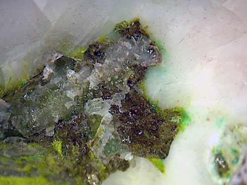
| Species: | Calcite |
| Formula: | CaCO3 |
| Confirmation |
|---|
|
| Validity: | Believed Valid |
| Associated Minerals Based on Photo Data: |
|---|
|
| Sulvanite | ⓘ14 photos of Calcite associated with Sulvanite at this locality. |
| Tangeite | ⓘ7 photos of Calcite associated with Tangeite at this locality. |
| Quartz | ⓘ3 photos of Calcite associated with Quartz at this locality. |
| Malachite | ⓘ2 photos of Calcite associated with Malachite at this locality. |
| Sphalerite | ⓘ1 photo of Calcite associated with Sphalerite at this locality. |
| Data |
|---|
|
| Mineral Data: | Click here to view Calcite data |
| Locality Data: | Click here to view South Thorpe Hills copper prospect, Greeley Mining District, Tooele County, Utah, USA |
| Photo Gallery | View Gallery (4 photos) |
| Data Identifiers |
|---|
|
| Mindat Occurrence Record ID: | 430935 |
| Long-form Identifier: | 1:3:430935:2 |
| GUID (UUID V4): | a28acae4-46a7-42de-b924-88dcee4f2d64 |
| Nearest other occurrences of Calcite |
|---|
|
|
| 3.9km (2.4 miles) | ⓘNorth Topliff Hill Clay Prospect, Topliff Hill, Greeley Mining District, Tooele County, Utah, USA |
| 4.1km (2.5 miles) | ⓘGreat Blue Prospect No. 2, Topliff Hill, Greeley Mining District, Tooele County, Utah, USA |
| 4.3km (2.7 miles) | ⓘUSSR and M South Prospect, Topliff Hill, Greeley Mining District, Tooele County, Utah, USA |
| 4.4km (2.8 miles) | ⓘGreat Blue Prospect No. 1, Topliff Hill, Greeley Mining District, Tooele County, Utah, USA |
| 5.0km (3.1 miles) | ⓘDeseret Quarry No. 1, Greeley Mining District, Topliff Hill, Tooele County, Utah, USA |
| 9.1km (5.7 miles) | ⓘUnknown Prospect (MRDS - 10012725), Sunshine Mining District, Utah County, Utah, USA |
| 9.4km (5.8 miles) | ⓘUnknown Prospect (MRDS - 10012727), Sunshine Mining District, Tooele County, Utah, USA |
| 9.6km (6.0 miles) | ⓘWells Canyon, Oquirrh Mountains, Utah County, Utah, USA |
| 9.7km (6.0 miles) | ⓘUnknown Prospect (MRDS - 10012732), Sunshine Mining District, Tooele County, Utah, USA |
| 9.8km (6.1 miles) | ⓘUnknown Mine (MRDS - 10012731), Sunshine Mining District, Utah County, Utah, USA |
| References |
|---|
|
Anthony, John Williams, Bideaux, Richard A., Bladh, Kenneth W., Nichols, Monte C. (1990) Handbook of Mineralogy Vol. 1 - Elements, Sulfides, Sulfosalts. Mineral Data Publishing, Tucson, Arizona. |


South Thorpe Hills copper prospect, Greeley Mining District, Tooele County, Utah, USA