 | | Report (volume) | | Geologic Reconnaissance of the Yukon Flats District Alaska f GEOLOGICAL SURVEY BtLLETIN 1111-H G eologic...eologic Reconnaissance of the Yukon Flats District Alaska Sy JOHN R. WILLIAMS CONTRIBUTIONS GEOLOGICAL...CoaL________________________________________________________ Gold --_---_-_--_---_-------_--____--___---_--_-_-----_-----...GEOLOGIC RECONNAISSANCE OF THE YUKON FLATS DISTRICT, ALASKA By JOHN R. WILLIAMS ABSTRACT The Yukon Flats district...approximately 13.700 square miles in northeastern Alaska. It is bordered by the Yukon-Tanana Plateau, the |  | | Report (Issue volume) | | industrial mineral industries are included. Volume II, Area Reports: Domestic, contains chapters on the minerals...summary of domestic nonfuel minerals. Volume ill, Area Reports: International, contains the latest available...Survey of Alabama. Alaska: Division of Geological and Geophysical Surveys, Alaska Department of Natural..... ... ... ... . . . . .... . .... . .. . . 43 Alaska, by Tom L. Pittman . . . . . . . . . . . . . ....which 329), which placed the collection of min- Mine Safety and Health Administration), eral statistics |  | | Report (volume) | | SURVEY W. E. Wrather, Director Bulletin 955-D GOLD PLACERS AND THEIR GEOLOGIC ENVIRONMENT IN NORTHWESTERN...___________________________________________ Trout Creek Glacier.^. ___---__- _ Page 126 126 127 127 127...128 128 129 130 130 _.____--_._ 130 Crooked Creek Glacier._____________-___---___________--_.Materials...___________________ South Platte River drainage area.--_-_-__--_-_----__-_--________ Topographic fea...deposits------___--_-----_-_------_--------_---_ Fourmiie Creek drainage ar'ea__-_--_--_-__-_------_--___-_-_-_-_ |  | | Report (volume) | | D. WALCOTT, DIRECTOR GEOGRAPHIC DICTIONARY OF ALASKA BY MARCUS BAKER SEC03ST3D EIDITIOIT PKEPAHE...Survey. CHARLES S. SLOANE, Secretary, Bureau of the Census. Maj. WILLIAM D. BEACH, General Staff, War Department...years ago determined to prepare a dictionary of Alaska geographic names and appointed a committee which...approve the second 'edition of the Dictionary of Alaska Geographic Names, which has recently, been prepared...forms contained therein. GEOGRAPHIC DICTIONARY OF ALASKA. By MARCUS BAKER. Second edition, prepared by JAMES |  | | Report (issue) | | Indian Spring. The main range is higher, and Jefferson Peak, east of Round Mountain, has an elevation...shown in the northwestern part of the Manhattan area. The border of the range is more clearly defined...South of Belmont a range of low hills extends southeast, connecting the Toquima Range with its eastern...not flat enough to be called a peneplain, but an area whose gentle relief indicates that it is a relic...the south end of the range, as far as Shoshone Creek, a short distance north of Round Mountain, no stream |  | | Report (volume) | | Mineral Resources of the Mount Jefferson Primitive Area, Oregon GEOLOGICAL SURVEY BULLETIN 1230-D...1230-D Mineral Resources of the Mount Jefferson Primitive Area, Oregon By GEORGE W. WALKER and ROBERT C....0-D An evaluation of the mineral potential of the area ~NITED STATES GOVERNMENT PRINTING OFFICE, WASHINGTON...System, but the act provided that each primitive area should be studied for its suitability for incorporation...Mount Jefferson primitive area, Oregon. The area discussed in the report corresponds to the area under |  | Cathrall, John B., Albanese, Mary, VanTrump, George, Mosier, E.L., Lueck, Larry (1989) Geochemical signatures, analytical results, mineralogical data, and sample locality map of placer and lode gold, and heavy-mineral concentrates from the Fortymile mining district, Eagle quadrangle, Alaska. Open-File Report Vol. 1989 (89-451) US Geological Survey doi:10.3133/ofr89451 | Report (issue) | | data, and sample locality nap of placer and lode gold, and heavy-mineral concentrates from the Fortymile...Fortymile mining district, Eagle quadrangle, Alaska By 19 1 John B. Cathrall , Mary Albanese , George VanTrump...DFC, Box 25046, MS 973, Denver, CO 80225 State of Alaska, Department of Natural Resources, Division of Geological...and Geophysical Surveys, 794 University Ave., Fairbanks, AK 99701 1989 CONTENTS Page Introducti on............................... 1 Reliability of Gold Analyses....................................... |  | | Report (issue) | | on the northeast side of the peak. Two creeks, Jefferson and Shoshone, flow northwestward from the upper...Toquima Range. 1 A description of the Sunnyside mine by F. L. Ransome2 was published in 1909. At that...Loftus4 gives the early production of the different gold mines. The only publication dealing with the tungsten...discovered in February, 1906. Rich ore showing free gold was found at the surface, but the lack of vein quartz...contributed a large part of the output. At first the gold was obtained by dry washing; then water for hydraulicking |  | | Report (issue) | | counties: Broadwater, Jefferson, Meagher, Powell, and Lewis and Clark. * Gold was discovered in the region...the 1860's, and since then the Forest has produced gold, silver, copper, lead, zinc, molybdenum, and phosphate...the only mineral production within the Forest is gold from small-scale placer operations, although exploration...estimates are given for each deposit type (table G3). Gold and copper are the commodities most likely to be...SUMMARY CHAPTER A. The Helena National Forest study area by R.G. Tysdal and Steve Ludington Introduction |  | | Report (volume) | | Cambrian (?) rocks___________r_________________________ Gold Hill formation______________1 _____________ Ordovician... 98 Arsenical minerals______________________ 99 Gold of the arsenical ores____________'. _________. 105...Tertiary rocks________ _____ __ 114 Ores in the Gold Hill formation_________________ 114 Limestone ores...121 The gravel____________________________ 123 ; Gold content ____________________________ 124 Character...prospect____________________,.____ 136 Buckeye prospect Wall mine _______________________________ Maris mine_ __ _ |  | Stark, J. T., Johnson, J. H., Behre, C. H. Jr., Powers, W. E., Howland, A. L., Gould, Don B. (1949, January) Geology and Origin of South Park, Colorado. GSA Memoir 33. Geological Society of America doi:10.1130/mem33 | Report (issue) | | . . . . . . . 7 Block diagram of the South Park area . .. . .. . . . . . . . . . . . . . . . . . . ..... . . 117 Generalized section across the Chase Creek Basin faults. . . . . . . . . . . . . . . . . ............ .. ... .. ..... . . 142 Contour map of area east of Como ......... . ......... . .... . ......wide, measured from the encircling divides. T he area thus delimited is approximately 1400 square miles...belt of mountain slope; the true Park or flatland area contains approximately 900 square miles. South Park |  | | Journal (article/letter/editorial) | | assembling localities who where information area be Birds may of faunal in my found had a...of groups of stimulation Alexander, in that area has brought effort of Museum on zoological the...Thousand Creek Hot Springs (Mus. Vert. Zool.); Virgin Valley (Mus. Vert. Zool.); Big Creek at base of...); Pinon Range (Univ. Mich. Mus.); Lower Annie Creek (Univ. Mich. River Valley Mus.); Humboldt (Univ...Mus.); Maggie Lower Maggie (Univ. Mich. Mus.); Creek; 10 miles of southwest (Univ. Mich. Mus.); Midas |  | | Report (issue) | | including one each for the States of Alaska and Hawaii. The area of the other 48 States is divid·~d into...11 parts and one each for parts 10, 13, 14, 15 (Alaska), and 16 (Hawaii and other Pacific areas). These...in this part would be 12353000. DRAINAGE AREA The drainage area, in square miles, is the latest figure...showing area covered by the volumes in the series on surface-water supply. index is shaded. The area covered...Station name Periods of record Station \ Drainage area number (sq mi) Daily or monthly figures (calendar |  | | Report (issue) | | including one each for the States of Alaska and Hawaii. The area of the other ..J.8 States is di,'ided...shown in this index is 0145. DRAINAGE AREA The drainage area, in square miles, is the latest figure...Geological Survey reports. Note.--Indexes for Alaska and Hawaii are contained in separate circulars...0100 Salmon Creek near Naselle, Wash . . . . . . . . . . . . . . . . . . . . 0105 Lane Creek near Naselle...tributary near South Bend, Wash .. 0111 Williams Creek near South Bend, Wash .............. . 0112 WILLAPA |  | | Report (volume) | | and of its south boundary 387 miles. The gross area of th~ State, as cq:r;np~ted. by ·square degr~es...bod1es of water leaves 103,658 square _m~les of land area. TOPOGRAPHY. 1~ ~general terms, .the ea~tern...mmencedabout 1860; and was induced by the discovery of gold placers in South Park and in the Arkansas Valley...Population by censuses, 1860-1900. Census. Popula. tion . Increase. Census. Population . Per cent. Per...455 144,588 29,237 24,092 13,076 City. Cripple Creek .................. .. Boulder ................. |  | | Report (issue) | | including one each for the States of Alaska and Hawaii. The area of the other 48 States is divided into...number shown in this index is 145. DRAIN AGE AREA The drainage area, in square miles, is the latest figure...Geological Survey reports. ' Note.--Indexes for Alaska and Hawaii are contained in separate circulars...shaded. The part ~ Station name Station,Drainage area number (sq mi) Pacific slope basins north of Columbia...•.•.• 100 105 Salmon Creek near Naselle, Wash ••..•..•••••.•.•••• 106 Lane Creek near Naselle, Wash., |  | August, M.H., Jacoboni, J.M., Jeton, A.E., Parker, R.S., Pupacko, Alex, Ruddy, B.C., Smith, J. LaRue, Redmond, K.T. (1992) Hydrologic and climatic data bases used to assess potential effects of climate change on water resources of American River, Carson River, and Truckee River basins, California-Nevada, and of Gunnison River basin, Colorado. Open-File Report Vol. 1992 (92-627) US Geological Survey doi:10.3133/ofr92627 | Report (issue) | | data-collection sites in Gunnison River basin and surrounding area, Colorado 38 10. U.S. Soil Conservation Service...(SNOTEL) sites in Gunnison River basin and surrounding area, Colorado 43 12. U.S. Soil Conservation Service...snow-course sites in Gunnison River basin and surrounding area, Colorado 50 14. Remote Automatic Weather Stations...data-collection sites in American River basin and surrounding area, California, and in Carson River and Truckee River...stations in Truckee River basin and surrounding area, California and Nevada 70 18. Washoe County, Nev |  | Langille, H.D., Plummer, F.G., Dodwell, Arthur, Rixon, T.F., Leiberg, J.B. (1903) Forest conditions in the Cascade Range Forest Reserve, Oregon. Professional Paper 9. US Geological Survey doi:10.3133/pp9 | Report (issue) | | FOREST RESERVE, BY H. D. LANGILLE ................ Area examined ........................................................................................ Area examined ..................................................................... 22 IV. A, Mount Jefferson, from Grizzly Flat; B, Mount Washington.........tollgate; B, Cattle grazing in reserve within the area upon which grazing is prohibited..................between ranges ten (10) and eleven (11) east to the southeast corner of township four (4) south, range ten (10) |  | | Report (issue) | | 1946-64 for: 8. Huge Creek near Wauna ........................ 9. Skookum Creek near Wickersham ................. 10. Day Creek near Lyman ......................... 11. Pilchuck Creek near Bryant...........and the mountains is usually abrupt in much of the area. Drift-plain remnants also form the Kitsap Peninsula...Sound proper on the east. The peninsula covers an area of 582 square miles and lies mostly below an altitude...and Bald Hills, in the southern part of the study area, rise to altitudes generally less than 2,500 feet |  | | Report (issue) | | American relatives of the Belt series Con. Canada and Alaska Summary Belt paleogeography References cited Index...formations in Metaline quadrangle and Salmo map area (Park and Cannon, 1943) 24 14. Results of X-ray...series in Montana are present in many places from Alaska to northern Mexico. Too little is known to warrant...geosynclinal basin may have extended in Belt time from Alaska as far south as Mexico. Perhaps at times this basin...Willis H. Nelson, assisted by J. P. Dobell, mapped an area close to Missoula, Mont., that is of vital significance |  | | Report (issue) | | being generated normally out of a low-pressure area in the Al eutians, will approach the coast from...the north and north\Vest around a high pressure area off the coast. The heaviest precipitation occurs...with separation of the two occurring at a drainage area d 500 square miles. In the initial phase of the...streams (drainage area less than 500 sq mi) , or principal streams (drainage area greater than 500 sq...characteristics to basin characteristics, such as drainage area, topography, and eli- mate; by relating a short | 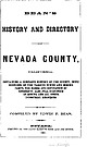 | | Book | | made on Treasonable Terms, Gold and Silver Bullion Bought and Sold, Gold Dust received for Assay or...the mining counties of Cal ifornia ; its mines of gold of enormous product, eclipsing all others in the...wealth to enrich the nation ; its thousand ledges of gold-bearing rock that stripe its territory, inviting...the theme is inspiring and tempting to the pen, be mine the lot to tell in the briefest way, the order of...the Middle Yuba, and its southern Bear river. Its area is about 1,200 square miles, or about the size of |  | | Report (issue) | | and Flood Control District (Denver metropolitan area). By 1981, most of those sites had been terminated...information, including station number and name, drainage area, period of record, and mean-annual flow, for the... 11 12 13 14 15 16 Station Name 164 Bear Creek at Morrison, Colo. 1887-91 1895-1901 1902 1919-...880 1.53 44.0 4.10 3.95 158 Drainage Area (mi 2 ) Plum Creek near Louviers, Colo. South Platte River...at Littleton, Colo. Tarryal 1 Creek below Rock Creek, near Jefferson, Colo. South Platte River below |  | | Report (issue) | | California) to more than 240 inches in southeastern Alaska. INTRODUCTION Background Runoff is that part...as the average depth in inches over the drainage area. Maps of the average annual runoff in the United...others, 1984). A cataloging unit is a geographic area representing part or all of a surface-drainage basin...was sometimes used to estimate the runoff for the area contributing runoff to the reach between the gages...used only if the percentage increase in drainage area between the stations was large. Where no satisfactory | 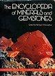 | | Book | | but the resulting fragments would no longer be gold. There are three main types of sub-atomic particle...the section on isotopes). Let us take an example. Gold is an element; it can combine with other elements...into other more fundamental If you wished to hoard gold, you could start with a single atom. This would...(which, by con- aoe Gadolinium oe ermanium Gold | Hafnium vention, means their average weights)...made with a field-ion microscope, shows a tiny area of the crystal’s surface magnified five million |
|


