 | | Report (issue) |
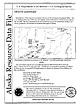
| Department of the Interior ~ U.S. Geological Survey Iditarod quadrangle Descriptions of the mineral occurrences... prospects, and mineral occurrences throughout Alaska. ID018 ID020 ID026 ID027 ID028 013 ID035 ID032...mineral occurrences in the Iditarod 1:250,000 quadrangle, southwest Alaska This and related reports are...S. Government. OPEN-FILE-REPORT 96-540 site District Mt. Joaquin McGrath Site type Prospect ARDFno...Miller, M.L USGS 5/25/94 site District Yankee Creek Innoko Site type Mine ARDFno. ID002 Quad-250 |
 | | Report (issue) |
| RESOURCES OF THE LAKE CLARK-IDITAROD REGION. By PHILIP S. SMITH. INTRODUCTION. The area described in this report...has for convenience been called the Lake Clark-Iditarod region. It is roughly quadrilateral and is bounded...Lake Clark and on the northwest by the town of Iditarod that is, it extends from latitude 60° to 62° 30'...270) shows the relation of this area to the southwestern part of Alaska. Different parts of this region...degrees of thoroughness. Thus the region around Iditarod was examined by Maddren in 1910 and by Eakin in |
 | | Report (volume) |
| Placer Deposits of Alaska By EDWARD H. COBB GEOLOGICAL SURVEY BULLETIN 1374 An inventory of the...the placer mines and prospects of Alaska, their history and geologic setting UNITED STATES GOVERNMENT...and method of presentation __ Definitions _-____ Alaska Peninsula region Aleutian Islands region ________...Anchorage district _ Redoubt district ___-_ _ Valdez Creek district __ _ Willow Creek district Yentna district...district _____________ _ ____ __________ _____ Copper River region __ _ _ _ Chistochina district Nelchina |
 | | Report (issue) |
| has long attached to deposits of iron ore in an area that centers about 25 miles northwest of Nome. A...groups of claims are held in the iron-bearing district. Three of these the Mogul, Monarch, and Galena...at half a dozen other places in the same general area. The Monarch group was reached easily in a day's...MINERAL RESOURCES OF ALASKA, 1914. GEOLOGY. The bedrock of the iron-bearing area consists chiefly of...undifferentiated members of the group. There is a small area of Tertiary sedimentary rocks, including thin coal |
 | | Book (volume) |
| .............................................1 Alaska..................................................GENERAL AREA: c county gravel pits along the Cahaba R.⎯gemmy minerals, petrified wood; d area limestone...Celestite, marble; e SIXMILE (hamlet on Sixmile Cr.), area of abandoned mines⎯Barite (crystallized, massive...massive & nodular), Fluorite. CENTREVILLE: c area stream gravel, road cuts, banks, etc.⎯siliceous gemstones;...Limonite, and some Calcite crystals. WOODSTOCK, area⎯Vivianite. BLOUNT COUNTY BLOUNTSVILLE: c W 1 mi |
 | | Report (volume) |
| of Metallic and Nonmetallic Mineral Deposits of Alaska Compiled From Published Reports of Federal and...of metallic and nonmetallic mineral deposits of Alaska, compiled from published reports of Federal and...resources Indexes. 2. Mines' and mineral resources Alaska. I. Kachadoorian, Reuben, 1921-, rjoint author...quadrangle.__.___________-__-___-___-____---_-__ Bethel quadrangle.________________________-___-_-_---___-___-_...quadrangle.___________________________________________ Iditarod quadrangle.;__-__-_:-__________.__.__.__________l---- |
 | | Report (issue) |
| Geology of the Eastern Part of the Alaska Range and Adjacent Area GEOLOGICAL SURVEY BULLETIN 989-D...989-D "Geology of the Eastern Part of the Alaska Range and Adjacent Areas," by Fred H. Mofflt, presents...part of Alaska by the geologist most eminently qualified to do so. Mr. Moffit's first work in Alaska for...two brief intervals (1917-18; 1933) field work in Alaska was continuous each season until 1944. Compulsory...geology of this interesting and important section of Alaska. Here he has pooled the information gleaned from |
 | | Journal (article/letter/editorial) |
| secondary phosphate minerals. Although some pegmatite mining for feldspar still continues (Jacobson 1994). the...the Homestake mine, which has operated for more than 120 years, most mining in the area peaked in the...and fewer chances to obtain any. However, some mining, mineral exploration, and mineral collecting continues...the most complete location guides to mines in the area are those provided by the U.S. Bureau of Mines (1954...I946 FiridofGt~rnSphultirite ut IIIP Bulinut Zinc Mine, St. Luwrence County, tditor of NPW b r k ” unrl |
 | | Journal (article/letter/editorial) |
| with its representation of mining tools clearly proclaim Montana’s mining origins. Montana’s production...published describing the occurrence, collecting, mining, and cutting of the two state gemstones. Figure...2. Granville Stuart established Montana’s first mining camp at Gold Creek in 1860. Geologic Provinces...Figure 1. Postcard view showing the Indian Queen mine ca. 1905 at Farlin, Beaverhead County. 208 ROCKS...igneous, and metamorphic rocks of many types. This area of the state contains skarns, pegmatites, and metallic |
 | | Report (issue) |
| description of the geology, mining history, and production of the major gold-mining districts in 21 States...relations ---------------------------History of gold mining and trends in production_ J\labama -----------...- Tallapoosa County --------------------------Alaska -----------------------------------------Cook Inlet-Susitna...J\la:ska region ------------------Southwestern Alaska region ------------------1'ukon region -------...(to nearest 1,000 ounces) of 25 principal gold-mining districts of the United States-through 1959--- |
 | | Book (volume) |
| pegmatite exposures, such as Aquamarine, Beryl, some Ruby-red Corundum, Spodumene and Topaz. Georgia has been...mi. E of Jackson-Banks Co. lineBeryl. MAYSVILLE, area gravels along adjoining Co. linerock crystal. ...States BARTOW COUNTY AREA, Saltpeter Cave, as floatjasper. CARTERSVILLE: area barite pitsBarite, Geodes... Goethite, Hematite, Limonite, Iron minerals; area mines, as important producersBarite, Manganese...EMERSON: extensive area depositsBarite, Graphite; US 41 bridge over the Etowah R., area Barite pitsBarite |
 | | Report (issue) |
| OTHER MAFIC-ULTRAMAFIC METALLOGENIC PROVINCES IN ALASKA (WEST OF THE 141st MERIDIAN) By Jeffrey Y. Foley1...Mines, Alaska Field Operations Center. Present address: 3301 C Street, Suite 525, Anchorage, Alaska, 99503-3935...Introduction Metallogenic provinces Northern and western Alaska Western Brooks Range metallogenic province Seward...province Southeastern Yukon-Koyukuk Basin margin and Ruby Geanticline metallogenic province Yukon-Tanana Uplands...metallogenic province Alaska Range Eastern Alaska Range metallogenic province Central Alaska Range metallogenic |
 | | Report (issue) |
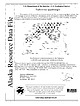
| mines, prospects and mineral occurrences throughout Alaska. 153 00 63 00 TL004 TL005 TL006 * (i|:4 TL069...Talkeetna 1:250,000-scale quadrangle, southcentral Alaska This and related reports are accessible through...110631 Anchorage, AK 99511 Location of map area in Alaska This report is preliminary and has not been...REPORT 99-139 ZUSGS science for a changing world Alaska Resource Data File TL001 Site name(s): Boedeker;...occurrence. Geophysical and geological mapping by the Alaska Division of Geological and Geophysical Surveys |
 | | Journal (article/letter/editorial) |
| JamesA. Noblefor the resultsof yearsof work in the mine and laboratory. Noble'sresultsin generalagree with...in magnetite. In someof the outlyingparts of the mine there is no closerelationbetweengold and arsenopyrite...associations of native gold. In the Bridge River district Cairnesx4 found free gold commonwith acicularcrystalsof...a studyof assaysof ore from theGeorgeGold-Copper Mine of Stewart,BritishColumbia, showsthat gold is associated...amountof arsenopyrite in the ore. In someareasof the mine arsenopyrite carriesmore gold than in others,but |
 | | Report (issue) |
| the Alaska Range, in the upper Copper River basin. The other gold-bearing streams are Ruby Gulch, Chisna...Chisna rocks. 137 138 MINERAL RESOURCES OF ALASKA, 1917. Fault blocks of similar conglomerate (see...that extends from the head of Ruby Creek westward to John Grosh Gulch, and an N. Red conglomerate\ ...conglomerate that caps the ridge at the head of Miller Gulch. The conglomerate of the fault blocks is not known...conglomerate on the ridge above Miller Gulch and Big Four Gulch is called "wash" by the miners, owing |
 | | Report (issue) |
| D. Kleinkopf ............................. 199 Stibnite-quartz deposits, by R.R. Seal, II, J.D. Bliss...mineralized areas prior to mining, and conditions that result from mining and mineral processing. Other...as climate, and anthropogenic factors (including mining and mineral processing methods) mostly modify the...exploration, and assessment of abandoned mine lands and mine-site remediation. This compilation presents...from mining, mineral processing, and smelting. For example, the environmental signature of a mine site |
 | | Report (issue) |
| Heavy Metals Program 1970 J J NOTE STEWART GULCH (SEC. 1, T. 4 N., R. 3 E.) IS MISLABELED ON THE...AS PLATE 5 IN THIS REPORT. STEWART GULCH IS THE NEXT UNNAMED GULCH TO THE NORTH, ON THE LINE BETWEEN...7 OF THE ABOVE TOWNSHIP. CREEK. THE MISLABELED GULCH SHOULD BE THE NORTH FORK OF WHITETAIL THE CORRECT...TEXT AND IN ALL EARLIER LITERATURE ON THE RUBY BASIN DISTRICT. COLOR KEY FOR ALL MAPS IN THIS REPORT....... 45 Mining Districts ....................... 49 4.1 Bald Mountain Mining District ......... |
 | | Report (issue) |
| Professor Edwin H . Oshier, Head of the Department of Mining Engineering, made the photographs included in this...7 Bibliography . . . . . 229 Appendix: 252 Mine Index iii NOTATIONS AND ABBREVIATIONS CHEMICAL...working on Black Hills minerals. The geographical area covered is more extensive than the title indicates...data on each known meteorite recovered from the area. An extensive and, it is hoped, fairly complete...public and private collections. In the Black Hills area itself, two may be mentioned. The Museum of Geology |
 | | Report (issue) |
| Terror and Keystone Mines, Keystone The Uncle Sam Mine, Hoist and Mill, Perry Part of One of the Homestake...Homestake Open Cuts, Lead Lead City Blacktail Gulch, Gayville Rubj^ Basin, looking west from Sugar Loaf Hill...The Cleopatra Mine and Cyanide Plant The Etta Mine near Keystone The Hidden Fortune Mine near Lead The...The McMackin Mine near Custer Spodumene Crystals, Etta mine, near Keystone Marble Quarry near Custer.....Cambrian Shales and Sandstones, Deadwood Stewart Mine on Lower Quartzite, near Terry Deadwood The Golden |
 | | Book (volume) |
| pegmatite, shoreline, quarry, gravel pit, prospect, mine, etc.). Let’s take, as an example, under the heading...corresponding entry is as follows: 7. Orella Station area (a former watering stop of the Chicago, Burlington...cross tracks and go 3 miles west through Badlands area (negotiable for autos but four-wheel drive is recommended)...the directions, the first portion—Orella Station area—initially directs the reader to the closest municipality...follows that dim road westward for 3 miles through an area of badlands that can be traveled by auto, although |
 | | Report (volume) |
| ; Garland Peyton, director, division of mines, mining, and geology, department of natural rnsources,...the generous support of thousands of individual mine operators, distributors, and consurnors, as wdl...Bituminous-coal mining suffered the largest increase in its fotulity rate, mainly because of a series of mine disast;ars...Govnr.mn ('.nt C(lncern eel with d ofcnst~. 'l'ho Mining u.n...strategic 1ni1rnrnlH from Ln.tiu A..merica four mining engineers of the Bureau o_f l\,1itH>H hu.ve bee |
 | | Book (volume) |
| sparkling sapphires of Montana, and the jades of Alaska, British Columbia, and Wyoming, are worldrenowned... 5 = fii? i a j — » ya y _— ’* : i mine in. q)! Y eit iia -...Furcron, Chief Geologist of the Department of Mines, Mining and Geology; on the State of Michigan by Robert...by Howard A. Millar. Fred M. Bahovec of Baranof, Alaska, provided data on gemstones found in that region;...operator of the Little Three Mine at Ramona, and Ralph R. Potter of the Himalaya Mine at Mesa Grande provided |
 | | Report (Issue volume) |
| of nonfuel minerals and a chapter on trends in mining and quarrying in the metals and industrial mineral...mineral industries are included. Volume II, Area Reports: Domestic, contains chapters on the minerals industry...summary of domestic nonfuel minerals. Volume ill, Area Reports: International, contains the latest available...Survey of Alabama. Alaska: Division of Geological and Geophysical Surveys, Alaska Department of Natural..... ... ... ... . . . . .... . .... . .. . . 43 Alaska, by Tom L. Pittman . . . . . . . . . . . . . . |
 | | Journal (volume) |
| "^'^^S'''^^^''^ 107 V, '^'^M^i^ JULY TO DECEMBER 1913 Mining and 429 MARKET STREET Scientific Press SAN FRANCISCO...Mines, Ltd., company report Abosso mine. West Africa Acacia Mining Co., Colorado 270, Editorial. Accident.... . Queen Co.'s mine, Arizona Accident Gold Mining Co., Subil mine, French Gulch, Rules, Copper California...Accidents, coal-mine in United States Compensation for Workingmen's compensation Acid mine water Acidity...apreciatlon. On fissure veins i Ahmeek Copper Mining . . . Co., . .F. . . 620 386 366 1 978 |


