 | | Book (volume) | | eol em M est -WSouth of Region Mining MINING . DISTRICT CAMBORNE F)PLATE I( rontispiece )(A.37 CA ...London w.c.2 423 Oxford Street, London wl P.O. Box 569 , London s.E.1 13a Castle Street, Edinburgh 2 109 St... Cardiff 39 King Street, Manchester 2 Tower Lane, Bristol 1 2 Edmund Street, Birmingham 3 80 Chichester...Geological Survey. Previous accounts of the mining district, notably by Borlase in 1758 and Pryce in 1778...the official geological survey resumed in this district. At the turn of the century it had become clear |  | | Book (volume) | | helf_. _ _ __ Cat._•~ - - - (5495) IVU2667/ZJ 3000(2) 12/34 J.P. G46 I, IN'.::T:TUTE OF 0 , r-.c•-' I...Geological Survey. Previous accounts of the mining district, notably y Borlase in 1758 and Pryce in 1778,...one-inch sheet memoirs, each with a mining appendix, but no regional treatment of e mining geology was attempted...1. St. Just district .. 60 Botallack-Pendeen (p. 60; Morvah-Sancreed (p. 93). INDEX 2. St. Ives district...Gwinear district .. St. Erth-Gwithian (p. 140); Gwinear Downs (p. 150). 14() 4. Mount's Bay district . |  | | Book (volume) | | Volume I 1956 20 I 7 reprint 0 z z ~ w z g 2. < u -- BRITISH GEOLOGICAL S'LTRVEY ECONOMICMEMOIRSOF...Geological Survey. Previous accounts of the mining district, notably by Borlase in 1758 and Pryce in 1778...the official geological survey resumed in this district At the tum of the centmy it had become clear that...one-inch sheet memoirs, each with a mining appendix, but no regional treatment of the mining geology was attempted...CORNWALL ......................... l. St. Just district ............................................. |  | | Report (issue) | | Majesty the Queen in Right of Canada, 2000 Catalogue No. M41-8-57E ISBN 0-660-17726-9 Available in Canada...cm by 5 cm. National Mineral Collection specimen no. 45683. Photograph by H. Gary Ansell. GSC 1999–003A...6 cm across. National Mineral Collection specimen no. 66493. Photograph by H. Gary Ansell. GSC 1999–003B...37 39 39 Cobalt district Cobalt district silver mines Road log to the Cobalt district mines Townsite mine...Trout Lake mine Elk Lake - Gowganda - Shining Tree area Mines along highways 65 and 560 Moose Horn mine |
|
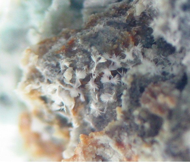


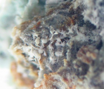
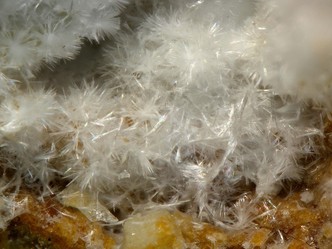


Adit No. 2, Nagy-Lápafő area, Parádsasvár, Pétervására District, Heves County, Hungary