 | | Journal (article/letter/editorial) | | New Hampshire Mineral Locality Index Downloaded by [University of Newcastle, Australia] at 15:01 05...entrance and arch of the Palermo mine, North Groton, Grafton County. Rob Lawrence photo, courtesy Bob Whitmore...Whitmore. 242 ROCKS & MINERALS lthough New Hampshire, the Granite State, is one of our smaller states...reading Jackson (1844) on the mineralogy of New Hampshire that even at this early date there was already...activity produced new localities, renewed some old localities, and resulted in new minerals being discovered | 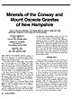 | | Journal (article/letter/editorial) | | Minerals of the Conway and Mount Osceola Granites of New Hampshire Some of the best collecting in the...has been in central and northcentral New Hampshire in the Conway and Osceola granites. P E T E R B. S...central and north-central re gions of New Hampshire, are part of the Mesozoic White Mountain plutonic-volcanic...plutonic-volcanic series. The Conway Granite is a biotite granite that is typically pink or tan and made up of...biotite, and fayalite. The contacts between the Conway and Mount Osceola granites are generally gradational |  | | Book (volume) | | tH MSTONESof - NORTH AMERICA ~ VOLUME olor phot raphs yo. Erica and. Harol d Van I [iL Albuquerque...87109 N.M. N_E. Bivd. Gkapats GEMSTONES of NORTH AMERICA ~ NASMI EPPA GEMSTONES OF THE WORLD...+ GEMSTONES OF NORTH AMERICA, by John Sinkankas ON@“THE VOLUME III COVER North American gems from... Green fluorite (121.39 ct), Westmoreland, New Hampshire; blue fluorite (132.12 ct), Illinois; square...Colorado; colorless scheelite (19.66 ct), Kern County, California; octagonal step cut violetish pink | | | Book (volume) | | GElV!§TONE§ (())f NORTH AMERRCA VOLUME III GElV[§TONE§ OF TXiE ,voRLD §ERIE§ SERIES EDITOR... GEMSTONES OF NORTH AMERICA, VOLUME III by Joh11 Sinkankas ON ~rf-IE co ·vER North An1erican gems... Green fluorite (121.39 et), Westmoreland, New Hampshire; blue fluorite (132.12 et), Illinois; sqmu·e...Vivid blue matched benitoite gems from Sai, Benito County, California, consisting of 52 benitoites and 75...and pinkish purple (I .3 5 et). GEMSTONE§ (O)f NORTH AMERICA VOLUME III John Sinbanbas Colar Photography |  | | Book | | long (Marty, 2004 ). AFRICA widely in Litchfield County, where good crystals were taken from quartz veins...old dumps. In 1975-1976, Brunet collected sharp, black, flattened hexagonal ilmenite crystals to 7 .5 cm...exist in the region (Brunet, I 977b ). NEW YORK Amity, Orange County. At many isolated collected sites between...Litchfield County. Ilmenite masses and crystals from somewhere near Washington, Litchfield County, were described...Lake Road occurrence, Faraday Township, Hastings County. In fall 1994, Dan and Shelley Lambert extracted |  | | Report (volume) | | ...................... 1. Rocks from Aroostook County..... ^..................'........... 2. Miscellaneous............................................. New Hampshire.............................................................................................. New York...............................................rocks............................................. New Jersey........................................................................................... North Carolina....................................... |  | | Report (volume) | | GEOLOGICAL SURVEY BULLETIN 1350 A compilation of the new geologic nan1es introduced into the literature /rom... 1964 1 Principles of physical geology: 2d ed., New York, Ronald Preas, P• 36Q-361, for the Pleistocene...compilations published to date: 1. Weeks, Fred B., 1902, North American geologic formation names: U.S. Geol. Survey...Kopf, R. W., and others, 1957, Geologic names of North America introduced in 1936-1955: U.S. Geol. Survey...Hansen, B. E., 1959, Index to the Geologic names of North America: U.S. Geol. Survey Bull. 1056-B. 7. Keroher |  | | Report (volume) | | Maine 1. Rocks from Aroostook 'County 2. Miscellaneous rocks5 v New Hampshire 5 Vermont 1. Rocks of Mount...rocks Connecticut New York 5 1. Rocks of the Adirondack region 2. Miscellaneous rocks New Jersey Pennsylvania...rocks Virginia North Carolina Georgia Kentucky 1.. Elliott County dike 2. Crittenden County dike Tennessee...the Absaroka Range 1. Electric Peak 2. Sepulchre Mountain 3. Absaroka Range 5 Crandall Basin Sunlight intrusives...Mountains 4. Little Belt Mountains5 5. Castle Mountain district 6. Highwood Mountains5 7. Bearpaw Mountains5 |  | | Book (edition) | | regarding the divisions of Precambrian time in North America and elsewhere in the world The terms given...Orogeny Glacial and Wave-Action Features 25. Rocky Mountain National Park 337 Box 25.1 More AsouT IGNeous...Development ¢ Effects of Glacial Erosion « Waterfalls 29; North Cascades National Park Geographic Setting 405 Geologic...Geologic History 412 Development of the North Cascades * North Cascade Rocks and Structures ¢ Glacial...MOUNTAINS 17 atic recA "Characteristics of Major Mountain Belts 644 ti he A Ace 44. Grand Teton National |  | | Book (edition) | | Geologic Work Geologic History 212 130 134 Rocky Mountain National Park 138 Local History 141 Box 12.1 How...Bedrock Glacial Features 133 North Cascades National Park Development of the North Cascades 173 Box 14.1 What...Volcanoes Hazardous? 174 Regional Structure of the North Denali National Park and Preserve (formerly Mount...Rift Zones on the Volcanoes 261 Fault Systems Mountain Building and Uplift 298 289 346 348 348 Geologic...499 503 An Introduction to the Geology of the New Alaskan National Parklands 504 by Sherwood D. Tuttle |
|


