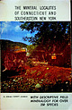
 | | Book (edition) | | THE MINERAL LOCALITIES OF CONNECTICUT AND SOUTHEASTERN NEW YORK * «-• r ** K* ysf^ :' •'’S >- n...250 SPECIES iBooks by Ronald Everett Januzzi CONNECTICUT MINERALS ON PARADE NEW YORK STATE MINERALS ON...THE MINERALOGICAL PRESS 83 Elm Street Danbury. Connecticut IIOIPW MINERALS ON PARAt>E F.tMSTltIP* THREE...to enrich our knowledge of the mineralogy of Connecticut: James Dwight Dana Samuel L. Penfield Edward...Minerals from the Principal Localities in Western Connecticut and Southeastern New York State............. |  | | Report (issue) | | ROGER P. ASH LEY The Republic Gold District, Ferry County, Washington By MORTIMER H. STMTZ and ROBERT C....ores-Wash1ngton-Ferry County 3 Hydrothermal deposits-Nevada 4 Hydrothermal depos1ts-Wash1ngton-Ferry County I Geologrcal...cited HU H11 The Republic gold district, Ferry County, Washington Abstract H14 Introduction H14 Geologic...Generalized geology of the Republic graben, Ferry County, H16 Washington H6 Index map showing the mines...is an epithermal prec1ous metal depos1t of the quartz-alunrte type. Gold ore bod1es are assoc1ated spatially |  | | Journal (issue) | | f1011it111l4. Jo. .,QUARRY .................................................this collection presented me with a quartz crystal from Herkimer County, N ew York, and from that day to...small vug or pocket in a g lacial boulder of white quartz exposed at low tide on the shore of Narragansett...spirit of nature truthfully. ~ The Portand, Connecticut, pegmatite Ll quarries have always been of interest...of a large pink .r beryl crystal by one of the quarry work:; men. Soon after alonJ,? came a teacher with |  | | Book | | First published in 1975 by Cordilleran 18 Holly Hill Drive Mercer Island, Washington 98040 COVER ILLUSTRATION:...scepter heads growing upon milky quartz stems. Denny Mountain area of King County. Specimen from the collection...DESCRIPTIONS 21 ABBREVIATIONS 24 GLOSSARY 25 COUNTY INDEX OF MINERAL OCCURRENCES 29 MINERAL DESCRIPTIONS...tal). Colorless or white, six sided crystals of quartz are a familiar and obvious example of a mineral...(using a code explained on page 21) and a county by county list mentioning the nature of their occurrence |  | | Report (volume) | | Quadrangle and a Part of the Aeneas Quadrangle Ferry County, Washington By SIEGFRIED MUESSIG GEOLOGICAL SURVEY..._-_-____-__-__ Quartz latite porphyry_________________________________________ Quartz monzonite east...65 66 68 70 70 71 71 73 73 74 74 75 Granophyric quartz monzonite._____-__________-___---___---___- 75...Republic and a part of the Aeneas quadrangles, Ferry County, Wash.._-In pocket Page FIGURE 1. Index map_______________..._ 8. Fine-grained quartz monzonite.______________ 9. Typical medium-grained quartz monzonite from east |  | | Journal (article/letter/editorial) | | Eocene Stonerose Fossil Beds, Republic, Washington, USA George E. Mustoe Geology Department, Western Washington...Washington University, Bellingham WA 98225, USA; E-Mail: mustoeg@wwu.edu; Tel.: +1-360-650-3582 Academic...Stonerose Interpretive Center in Republic, Washington, USA are one of the most important Cenozoic fossil sites...Columbia and Washington. Figure 2. Republic Boot Hill locality fossils: (A) Macginitea gracilis (Stonerose...collection, which is freely open for study. The main Boot Hill site is periodically mechanically excavated to reveal |  | | Book (edition) | | very old origin, often without lrnown source. e.g. quartz or cinnabar. Current practice most often names...polished mineral surface, expressed in clase. 7 - quartz. 8 - topaz, 9 - corundum, 10 - dia- percentage...abbreviations: Rep. (republic), prov. (province), co. (county), munic. (municipio), pref. (prefecture), dept...always included in text, except in the cases of the USA, UK, and the provinces Ontario and Quebec in Canada...purine-porphyrine group). a nickel porphyrine. With quartz. rutile, piemontite, sursassite, ardennite, Triclinic |  | | Report (issue) | | of stocks and roof pendants. . . . . . . . . . . Quartz-silver-lead-copper velns . . . . . . . . . . ....Fissure veins In andesile and quartz latite. . . . . . Breccialed zones in quartz latite and associated volcanics.... . . . . . . . . . . . . . . 73 P end Oreille County . . . . . . . . . . . . . . . . . . . . . . . .... . . . . . . . . . . . . . . . . . . S tevens County . . . . . . . . . . . . . . . . . . . . . . . .... . . . . . . . . . 151 Other mines In Stevens County . . . . . . . . . . . . . . . . . . . . . . . |  | | Report (volume) | | glaciation 2 Itkillik glaciation 2 Johnston Hill glaciation 2 Mak Hill glaciation 2 Mount Osborn glaciation...clay) 2 Shubuta member (of Yazoo clay) 2 Shubuta Hill clay « Eocene, middle fChoctaw buhrstone l Claiborne...formation l fNaheola marl l fOak Hill-Pine Barren group l Oak Hill member (of Naheola formation)2 Pine...Devonian (see also Cambrian Devonian) Yellow Leaf quartz schist 1 Middle Devonian Ragland sandstone 1 Lower...Continued Burls Creek shale member ' (of Sentinel Hill member (of SchraKatalla formation) der Bluff formation) |  | | Report (volume) | | zones in quartz latite........................................ Fissure veins in andesite and quartz latite............................... 27 Copper-bearing quartz veins........................................ 27......................................... Stevens County..................................................mining districts and ore deposits Continued. Stevens County Continued. Northport district Continued. Page....districts and ore deposits Continued - . Stevens County Continued. Chewelah district Continued. " Pag6 |  | | Report (volume) | | Bull. 1060-D, p. 193, 252-253, pl. 7. In Nemaha County, Kans., member is basal unit of Howard limestone...Aarde farm, sec. 4, T. 26 S., R. 11 E., Greenwood County. Aaron Slatet Precambrian or Paleozoic: Central...Pittsylvania and Halifax Counties, overlies Hyco quartz porphyry. Varies from nearly pure greenstone to...Central Railroad, sees. 5-7, T. 11 S., R. 5 E., Pope County. Named for Abbott Station. Abbyville Gabbrol Precambrian...map. Occurs in vicinity of Abbyville, Mecklenburg County. Abercrombie Formationl Middle Cambrian: Western |  | | Report (issue) | | L. mines..., D2. Geologic sketch map of the Knob Hill mine............... D3. Geologic sketch map...granodiorite (Precambrian X); and 1.4-b.y.-old quartz monzonite (Precambrian Y). Exposures of Paleozoic...9. Smaller and Mary L. Mines Hansen Ore Body Knob Hill Mine Rainbow Moose Mine Picnic Tree Ore Body Picnic...1979a; 1979b and Wobus, Epis, and Scott, 1979.) Knob Hill Mine Rainbow Moose Mine Picnic Tree Ore Body...graben (0-350 m) Proterozoic X and Y undivided: Quartz monzonite (1.4 b.y.) Granodiorite (1.8 b.y.) Schist |  | | Report (issue) | | Canada on the north. It includes all of Pend Oreille County and large portions of Douglas, Ferry, Okanogan...volcanic or hypabyssal rocks and • gold occurs in quartz veins or disseminations. Additional characteristics...and lead ore deposits in carbonate rocks, Stevens County, Washington: Washington Division of Geology and...MRDS ID. NO. MAS ID. NO. LATITUDE LONGITUDE COUNTY STATE COMMODITIES PRESENT USGS MODEL1 PRODUCTION...WA AU AG 25c No production Prospect 11 FLAG HILL M056032,SP00069 48.6522 -118.7536 FERRY WA |  | | Report (volume) | | follows: Canada. Central America. Newark formation (Connecticut to North Carolina). Western United States. Nomenclature...Society, Proceedings, vol. 3, part 2. Denver. Connecticut Academy of Arts and Sciences, Transactions, vol...CLAYPOLE. Trap ridges of East Haven, Bran ford, Connecticut, HOVEV, E. 0. Devonian of Devonshire, WILLIAMS...Texas, HILL. Igneous rocks of central Texas, HILL and DUMBLE. Staked Plains formation,Texas,HILL. Valley...Upper Canadian, TexasNew Mexico, HILL. Topographic features of Texas, HILL. Zircon rocks in Archean of New |  | | Journal (article/letter/editorial) | | Piew Haven, 1965; in revised form 2 November Connecticut 1965) Abstract-A new technique of Ar analysis...are of Jurassic and early Cretaceous age. The Ruby Hill stock, Eureka mining dist)rict is latest Cretaceous...Bristol and Searchlight, Nevada; San Francisco, Gold Hill, Tintic, Desert Mountain, and all the intrusives...(1963) has questioned the fundamental nature of the quartz diorite line of MooRE (1959). He suggested from...Mountain Boulder City River Mountains Three Peaks Knob Kill Dolly Varden Railroad Frenehie Creek ~~tehorso |  | | Report (issue) | | 101.2 99.80 100.0 100.00 (1) Silver City, Idaho, USA. (2) Guanajuato, Mexico. (3) San Carlos mine, Guanajuato...silver, stephanite, proustite, pearceite, calcite, quartz. Distribution: In Mexico, from Guanajuato, in...at the Chontalpan mine, Taxco, Guerrero. In the USA, in Idaho, from Silver City, Owyhee Co., and at the...at the L-D mine, Wenatchee, Chelan Co. and the Knob Hill mine, Republic, Ferry Co.; and from Cuchillo, |  | | Journal (article/letter/editorial) | | Calaverite is known from the Star mine in Montgomery County, North Carolina, where it occurs rarely in coarsely...Haralson County, and the Consolidated and Singleton mines of the Dahlonega district, Lumpkin County, Georgia...as 5-mm lathlike crytstals in quartz at Rib Mountain, Marathon County, Wisconsin. Calaverite is an important...districts. It is best known from Cripple Creek, Teller County, where it is the most abundant telluride in those...crystals from the Cresson mine, Cripple Creek, Teller County, Colorado. Dave Bunk specimen, Jesse LaPlante photo |  | | Report (Issue volume) | | ............................. . Copper-Stevens County ....................... . Lode gold ....................................... . Lode gold-Stevens County ..................... . Placer gold ................ .. Lead-Pend Oreille County ..................... . Lead-Stevens County ........................................................ . Silver-Stevens County ........................ . Tin, titanium ........... . Zinc-Pend Oreille County ...................... . Zinc-Stevens County ........................ |  | | Report (volume) | | 5 in., inch or inches. Circ., Circular. Co., County or Company. Indus., Industrial. Inst., Institute...publication). Ptg, Printing. Pub., Publication. qtz, quartz. qtzite, quartzite. qtzites, quartzites. qtzitic...called "sandy tuff." It immediately overlies Hyco quartz porphyry. Is well exposed at many places along...Rocks consist of gneissoids, granite, syenite, quartz, mica and hornblende schists and slates, qtzite...gabbro, trachyte, porphyries, sericite schists, quartz monzonite schists, diorite slates, diorite, trachyte |  | | Report (Issue volume) | | State mineral production and mineral production by county were prepared in the Division of Statistics and...Geological Survey. Connecticut: State Geological and Natural History Survey of Connecticut, Department of.... . . . . . . . . . . . . . . . . . . . 109 Connecticut, by Donald K. Harrison and Robert J . Altamura...this report. Name State____________ SECTION 2. County _ __ _ _ _ _ _ _ _ __ Stocks. production, end...779,799 2 8.34 Colorado 386,192 27 l.16 Connecticut 117,893 41 .35 Stone (crushed and broken) |  | | Report (issue) | | INTERIOR GEOLOGICAL SURVEY MINERAL RESOURCES OF ELKO COUNTY, NEVADA By Roscoe M. Smith Prepared in cooperation...Illustrations . Plate 1. Mineral resources map of Elko County. Figure 1. Index-map of mining districts 2. Exploratory...petroleum, through 1973 9 Temperatures of some Elko County hot springs- -- 12 Distribution of mineral deposits...ELKO COUNTY, NEVADA By Roscoe M. Smith ABSTRACT Of the 66 named mining districts in Elko County, 56 have...Elko areas. INTRODUCTION Mineral deposits in Elko County were described in Nevada Bureau of Mines Bulletin |  | | Report (issue) | | accurate work. Locality Quadrangle Elevation County A Feet 13, 736 4,271 6,480 13,882 Adin. .......-.. ................ ... Alto "Poalr Alturas Hill. ...... ... .......... ......... Tehipite. ......Bishop ................ San Francisco ......... Ant Hill........... ............................ Bakersfleld...166 4,216 114 6,222 8,422 2,662 11, 264 B Bald Hill..... ........ ........................ Bidwell Bar........ Banner Hill....... _ * __ . __ . _ .. __ ... Banner Hill Special ... Banner Hill __ . ____ - . |  | | Book | | Gem serpentine, actinolite, silver, gold, and quartz crystals are also found in this area. Grayling...more interesting and more productive. Also, local, county, and State Chambers of Commerce 23 throughout...SISKIYOU COUNTY GOLD EXHIBITS 33— CALAVERAS COUNTY MUSEUM 34— ANGELS CAMP MUSEUM 35— AMADOR COUNTY MUSEUM...CALICO (MAGGIE MINE) LA BREA TAR PITS 31— KERN COUNTY MUSEUM 32-— H.C.BAKER MEMORIAL MUSEUM 0 5510 20...in Kern County has been an important source of gold; the eastern part in San Bernardino County has been |  | | Report (volume) | | Colo. Connecticut State Geological and Natural History Survey: Bulletin, nos. 19, 21. Hartford, Conn...Conn. Delaware County Institute of Science: Proceedings, vol. 6, nos. 3-4. Media, Pa. Deuison University...Scientific Society: Journal, vol. 28, nos. 1-3. Chapel Hill, N. C. Engineering Association of the South: Proceedings...Olympia, Wash. West Virginia Geological Survey: County reports Doddridge-and Harrison counties. Morgantown...Sketch of the geological history of Green Lake County, Wisconsin : School x Quart., Berlin, Wis., vol |  | | Book (edition) | | Willard Lincoln. Encyclopedia of minerals ~~cbe County Public Library Saguache, Colorado OEMCO For Refere...Calcite 4 Fluorite 5 Apatite 6 7 8 9 10 Orthoclase Quartz Topaz Corundum Diamond In a few descriptions we...crystallize with right- or left-handed forms (e.g., quartz). epitaxy Overgrowth of one crystal on another...(4) fluorite, (5) apatite, (6) orthoclase, (7) quartz, (8) topaz, (9) corundum, (10) diamond. monochromatic...the Fuemrol No. 2 mine, Temple Mountain, Emery County, Utah; also sparsely disseminated in uraniferous |
|


