| Locality type: | Mine |
| Classification |
|---|
|
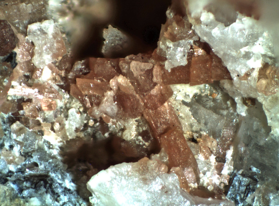
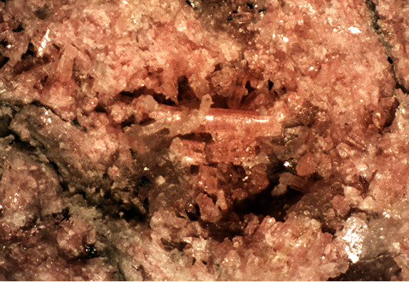
| Species: | Clinozoisite |
| Formula: | (CaCa)(AlAlAl)O[Si2O7][SiO4](OH) |
| Confirmation |
|---|
|
| Validity: | Confirmed |
| Confirmation Methods: | Visually Identified |
| Associated Minerals Based on Photo Data: |
|---|
|
| Quartz | ⓘ1 photo of Clinozoisite associated with Quartz at this locality. |
| Data |
|---|
|
| Mineral Data: | Click here to view Clinozoisite data |
| Locality Data: | Click here to view El Tigre Mine (Sampson Mine), California Mining District (Chiricahua Mining District), Chiricahua Mountains, Cochise County, Arizona, USA |
| Photo Gallery | View Gallery (5 photos) |
| Data Identifiers |
|---|
|
| Mindat Occurrence Record ID: | 764050 |
| Long-form Identifier: | 1:3:764050:6 |
| GUID (UUID V4): | b0fc53b9-0b3b-4232-8593-a6b1f5cab6e7 |
| Nearest other occurrences of Clinozoisite |
|---|
|
|
| 1.5km (0.9 miles) | ⓘUnnamed Cu-Zn-Pb-Ag prospect, California Mining District (Chiricahua Mining District), Chiricahua Mountains, Cochise County, Arizona, USA |
| 5.7km (3.5 miles) | ⓘHilltop Mine, California Mining District (Chiricahua Mining District), Chiricahua Mountains, Cochise County, Arizona, USA |
| 6.5km (4.0 miles) | ⓘLead Lily shaft, California Mining District (Chiricahua Mining District), Chiricahua Mountains, Cochise County, Arizona, USA |
| 63.0km (39.2 miles) | ⓘMiddlemarch Mine, Middle Pass Mining District, Cochise County, Arizona, USA |
| 63.4km (39.4 miles) | ⓘThe Pit prospect, Middle Pass Mining District, Cochise County, Arizona, USA |
| 63.5km (39.5 miles) | ⓘStronghold Canyon, Cochise Stronghold area, Middle Pass Mining District, Cochise County, Arizona, USA |
| 63.8km (39.7 miles) | ⓘStandard Tungsten Mine (Head Center Mine; Black Prince Mine; Johnny Boy Mine; Johnnie Boy No. 1 Mine; Barite prospect; Kreis Mine), Black Diamond Peak, Middle Pass Mining District, Cochise County, Arizona, USA |
| 76.0km (47.2 miles) | ⓘJohnson Camp, Gunnison Copper Project, Cochise Mining District, Cochise County, Arizona, USA |
| 78.1km (48.5 miles) | ⓘToughnut Mine, Tombstone, Tombstone Mining District, Cochise County, Arizona, USA |
| 79.0km (49.1 miles) | ⓘLucky Cuss Mine, Tombstone Mining District, Cochise County, Arizona, USA |
| References |
|---|
|
|


El Tigre Mine, California Mining District, Chiricahua Mountains, Cochise County, Arizona, USA