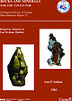
 | | Report (issue) | | COLLECTOR Geological Survey of Canada Miscellaneous Report 32 Kingston, Ontario to Lac St-Jean, Quebec Ann...Collection specimen (No. 36384). National Museum of Canada photo. Right: Serandite with analcime and mangan-neptunite...Collection specimen (No. 37124). National Museum of Canada photo. Miscellaneous Report 32 ROCKS AND MINERALS...MINERALS FOR THE COLLECTOR Kingston, Ontario to Lac St-Jean, Quebec Ann P. Sabina Originally published... © Minister of Supply and Services Canada 1983 A vailable in Canada through authorized bookstore agents |  | | Book | | enOLOGIOAT SURVEY OF CANADA. AALFRED R C.SELWYN, C. M. G., LL.D. F.RS., Director GEOLOGICAL SURVEY...17 20 v1 GEOLOGICAL TABLE OF SURVEY OF CANADA. CONTENTS— Continued. OXYGEN saLTs—Continued... TABLE METALS oe AND OF THEIR SURVEY OF CANADA. CONTENTS—Continued. ORES—Continued. . Tron...sory wb AS 113 SURVEY GEOLOGICAL MINERALS CANADA. CONTENTS—Continued. OF TABLE OF AND TO COMMON...SBHCTION ONH GEOLOGICAL OF THE SURVEY MUSEUM OF CANADA Embracing the Systematic Collection of Minerals | | | Report (issue) | | BR THE COLLECTOR ie AnnP. Sabina \ Kingston, Ontario to - . Lac St-Jean, Quebec, Digitized by the...ROCKS AND MINERALS FOR THE COLLECTOR Kingston, Ontario to Lac St-Jean, Quebec Ann P. Sabina Originally... © Minister of Supply and Services Canada 1983 Available in Canada through authorized bookstore agents...and Services Canada Hull, Québec, Canada K1A 0S9 and from Geological Survey of Canada 601 Booth Street...Street Ottawa, Canada K1A 0E8 A deposit copy of this publication is also available for reference in public |  | | Report (issue) | | SURVEY OF CANADA CANADA PAPER 67-51 ROCKS AND MINERALS FOR THE COLLECTOR Kingston, Ontario to Lac St-Jean...Queen's Printer, Ottawa, from Geological Survey of Canada, 601 Booth St., Ottawa, and at the followin$ Canadian...Queen's Printer and Controller of Stationery Ottawa, Canada 1968 - iii - Plate I. Mont St-Hilaire quarry...Section 1: Kingston - Island of Montreal Kingston township quarry . . . . . . . . . . . . . . . . . . . .... . . . . . . . . . . . . . . . . Freebern mica mine . . . . . . . . . . . . . . . . . . . . . . . . |  | | Report (issue) | | PAPER 69-45 GEOLOGICAL SURVEY OF CANADA DEPARTMENT OF ENERGY, MINES AND RESOURCES A CATALOGUE OF...MINERALS R. J. Traill ' GEOLOGICAL SURVEY OF CANADA CANADA PAPER 69-45 A CATALOGUE OF CANADIAN MINERALS...n's Printer, Ottawa from the Geological Survey of Canada 601 Booth St., Ottawa and Canadian Government bookshops...to change without notic e Queen ' s Printer for Canada Ottawa 1970 A CATALOGUE OF CANADIAN MINERALS...has elapsed since T . Sterry Hunt in Geology of Canada, 1863 , presented the first descriptive list of |  | | Book | | @ ’ ay AY t Se AM ; , fu ‘ ) ; ‘ CANADA DEPARTMENT OF Hon. ALBERT SEvicNy, AcTING Minister;...MINES PH.D., DIRECTOR. Occurrences Eis in ; Canada ‘IN TWO VOLUMES COMPILED Ww BY E. Lindeman,...fale ‘> e166 Je (eter 6) 6, er 6 ue fe Prescott mine SUGter G6) wi 4\Fe)0\ Bilolses wiiel elie) eee)... Jey WARES. as ga oe oS ea A ee re TS ws Ontario— foun aye PRIMI TIOR h od 7 fe Neato so 2 as a...og | ee Se ee Eo Se Cee CORUM SROIee eee Coehill mine aule nia sels hey 92 2 eniwi SEM SECT 2) See |  | Benko, Z., Mogessie, A., Molnar, F., Severson, M. J., Hauck, S. A., Rai , S. (2015) Partial Melting Processes and Cu-Ni-PGE Mineralization in the Footwall of the South Kawishiwi Intrusion at the Spruce Road Deposit, Duluth Complex, Minnesota. Economic Geology, 110 (5) 1269-1293 doi:10.2113/econgeo.110.5.1269 | Journal (article/letter/editorial) | | Cu-Ni-PGE Mineralization in the Footwall of the South Kawishiwi Intrusion at the Spruce Road Deposit,...footwall at the Spruce Road Cu-Ni sulfide deposit (South Kawishiwi intrusion, Duluth Complex) between the...basal contact of the Partridge River, Bathtub, and South Kawishiwi intrusions in the Mesoproterozoic (1.1...known in the footwall of the Sudbury structure, Canada (Li et al., 1992; Morrison et al., 1994; Molnár...mineralization in the charnockitic footwall of the South Kawishiwi intrusion in two drill holes (WM-001 and |  | | Journal (article/letter/editorial) | | 0-200ø C, and the diaAnimikie and Sibley Groups,Ontario: CanadaGeol. Surgenesis of siliceous sediments:...range in the vicinity 38, 92 p. of Port Arthur: Ontario Dept. Mines Bull., v. 69, no. 7, White, D. E.,...Cosmochim. Acta, v. 10, p. 27-59. Morey, G. W., Fournier,R. O., ttemley, J. J., and Rowe, J. J., 1961,...Survey Prof. Paper 458-B, 63 p. Morey, G. W., Fournier, R. O., and Rowe, J. J., 1964,The p. 319-338....Little Cottonsample from the Last Chance stock. The augite wood,and Mineral Range. SCIENTIFIC COMMUNICATIONS |  | | Journal (article/letter/editorial) | | 22'30" I INDIAN HOLLOW PLUG F•gure 1 UTAH ONTARIO STOCK 400 37' ALTA STOCK MAYFLOWER STOCK MzPz...mineralogy,and hydrothermal Near the Park Premier mine, the Park Premier alteration(Table 1, Fig. 2). Major...feederfor partof the Keetley sions.Near the Park Premier mine, two pervasively TABLE 1. Unit Characteristics...EXPLANATION Alluvium (Quaternary) Porphyry of ParkKonold mine(Tertiar Qal [] Porphyry o! BoneHollow (Tertiary)...(Tertiary) Park Premier Intrusions 1 and2 (Tertiary) mine ThaynesFormation (Triassic) Hydrothermalactinolite |  | | Report (issue) | | Miscellaneous Report 36 IGCP-CCSS SYMPOSIUM OTTAWA, CANADA SEPTEMBER 1983 FIELD TRIP GUIDEBOOK TO STRATABOUND...STRATABOUND SULPHIDE DEPOSITS, BATHURST AREA, N.B., CANADA AND WEST-CENTRAL NEW ENGLAND, U.S.A. Editor : D...Survey of Canada United States Geological Survey 1983 © Minister of Supply and Services Canada 1983 ... Available in Canada through authorized bookstore agents and other bookstores or by mail from Canadian...and Services Canada Ottawa, Ontario, Canada K I A OS9 and from Geological Survey of Canada 601 Booth Street |  | | Report (issue) | | GEOLOGICAL SURVEV OF CANADA COMMISSION GEOLOGIQUE DU CANADA CATALOGUE OF CANADIAN MINERALS Revised 1980... Minister of Supply and Services Canada 1983 Available i n Canada through authorized bookstore agents...and Services Canada Hull, QuCbec, Canada K I A OS9 and from Geological Survey of Canada 601 Booth Street...Street Ottawa, Canada K 1A OE8 A deposit copy of this publication is also available for reference in public...public libraries across Canada Cat. No. M44-801 l8E Canada: $10.00 ISBN 0-660-11271-6 Other countries: |  | | Journal (article/letter/editorial) | | and host gabbros from the Fournier oceanic fragment, New Brunswick, Canada: a field evaluation of some...processes. The Ordovician Fournier oceanic fragment, New Brunswick, Canada, contains MOR gabbro-hosted...of these predicted features are observed in the Fournier plagiogranites. Assuming an initial source rock...the Ordovician age Fournier oceanic fragment located in northern New Brunswick, Canada. The goal of the...(2009) for hydration melting of MOR gabbro. The Fournier plagiogranites were first studied by Flagler and |  | | Journal (issue) | | Wilson sandstone. ARCO next drilled the Columbia County 11-34-65 to a total depth of 1,950 ft and has also...program. The next well to be drilled is the Columbia County 31-17-65, permitted to a 7,OOO-ft depth, a relatively...PHOTO Bear Creek Butte area, southwestern Crook County, Oregon, looking west toward Bear Creek Butte....36-009-00229 NE\4 sec. 20 T. 6 N., R. 5 W. Columbia County Location; 2,850. 393 ARCO Col. Co. 21-35-65...36-009-00230 NW\4 sec. 35 T. 6 N., R. 5 W. Columbia County Location; 1,900. 394 ARCO Foster 42-30-65 36-009-00231 |  | Buse, Ben, Schumacher, John C., Sparks, R. Stephen J., Field, Matthew (2010) Growth of bultfonteinite and hydrogarnet in metasomatized basalt xenoliths in the B/K9 kimberlite, Damtshaa, Botswana: insights into hydrothermal metamorphism in kimberlite pipes. Contributions to Mineralogy and Petrology, 160 (4) 533-550 doi:10.1007/s00410-010-0492-4 | Journal (article/letter/editorial) | | Bultfonteinite and chlorite partially replace the original augite-plagioclase assemblage, driven by the serpentinisation...B/K9 kimberlite with kimberlites from Venetia, South Africa suggests that the composition and mineralogy...dolerite and shale megablocks at the Lac de Gras (Canada), Bultfontein, Dutoitspan and Jagersfontein (RSA)...consists of three coalesced pipes (north, central and south), which separate at a depth of 250 m below the surface...display ophitic to sub-ophitic textures; they contain augite (0.5–1 mm) enclosing plagioclase laths and intersertal |  | Lesage, G., Richards, J. P., Muehlenbachs, K., Spell, T. L. (2013) Geochronology, Geochemistry, and Fluid Characterization of the Late Miocene Buritica Gold Deposit, Antioquia Department, Colombia. Economic Geology, 108 (5) 1067-1097 doi:10.2113/econgeo.108.5.1067 | Journal (article/letter/editorial) | | Sciences, University of Alberta, Edmonton, AB T6G 2E3, Canada Isotope Geochronology Laboratory, University of...mining began in 1992 at the Yaragua mine, located approximately 2 km south of the town of Buriticá. Subsequent...E-dipping subduction of the Caribbean plate below South America (Pardo-Casas and Molnar, 1987; Pindell and...of small oceanic terranes were accreted to the South American continent during this period. The first...1995). The Gorgona terrane began colliding with South America along the Buenaventura fault at ~45 Ma (Fig |  | | Journal (article/letter/editorial) | | three recognizable lava flows dipping approximately south-west at 20 degrees and conformably intruded by a...vitrophyric lavas are crowded with large zoned augite phenocrysts plus lesser hypersthene, serpentinized...rims of hypersthene (2V = 69°-ve) enclose cores of augite (2V = 40°). The groundmass of the Segamat basalt...this is highly potassic so that although granular augite, hypersthene, (potassic) oligoclase, and apatite...oligoclase-andesine laths (An31), occasional nepheline, augite (2V = 52°), hypersthene (2V = 63 to 69°), abundant |  | | Journal (article/letter/editorial) | | rimward increase in XJd, locally with cores of relict augite. Numerous inclusions of clinopyroxene, lawsonite...preserved (Mattauer et al., 1981; Durand Delga, 1984; Fournier et al., 1991; Caron, 1994; Brunet et al., 2000)...below the oceanic nappes (Mattauer et al., 1981; Fournier et al., 1991). The age of the HPLT metamorphism...a mélange correlated with the Ligurian domain south of St Florent. Both of these klippen lack HPLT metamorphic...Corsica in the Monte San Petrone Complex, further south in the Castagniccia antiform, within a meta-ophiolitic |  | | Journal (article/letter/editorial) | | Island, Tasmania; Pine Creek, California; Sangdong, South Korea; Tyrnyauz, Russia; Kwak 1987; Newberry 1982;...from other Southern Tien Shan structures to the south by another suture marked by the Zeravshan Fault...the syncline. The pluton contact generally dips south at 50–60°; however, local fluctuations from vertical...e., subparallel to the pluton contact), dipping south at 50–75° and intersecting the beddingconcordant...by the presence of pyroxene (diopside–augite, enstatite–augite) (0–5 vol%), amphibole (15–20 vol%), and |  | | Journal (article/letter/editorial) | | AC CE P 189 – Scripps Landing N.W. Calgary, AB Canada T3L 1W1 **Russian Central Geological Prospecting...paleocontinent. This continental margin occurs in the south to south-west of the Altaid orogenic collage (Sengor...to depths of about 4-4.5 km and 3-3.5 km (cf. Fournier, 1999), respectively, assuming lithostatic conditions...about 1.2-1.5 km, assuming lithostatic conditions (Fournier, 1999), consistent with the hypabyssal environment...about 1.1-1.3 km, assuming lithostatic conditions (Fournier, 1999), and are also consistent with the porphyry |  | | Report (issue) | | no OIL ORO OIG ZoZ 292 Boulder County Tellurides .... 294 Boulder County Tungsten ...... eeoeeesee 296...csansieterchersrersiovaie Pewee reser eres ereceseses 490 SOUTH DAKOTA CO meme eee eerenreeneerererrereseseseceses...seecee FOP sMOUMIE ATE cers cs bie 6)sine 6 SOUTH AMERICA 6 5 5wis xjecssace eeeeeeeeesoeeee AV GOMICTM...Venezuelan Guayana ..ccceeeee MAPS Western Canada ..... eoeeoeeeeoeeeeoos 548 550 550 556 556...IN THE BIBLIOGRAPHIES AND NOT INDEXED RECEIVED Canada Snow Lake, Coats, MANITOBA C.J.A., and others |  | | Report (volume) | | Institute Review. Agricultural Institute of Canada. Ottawa, Ont., Canada. Alaska Dept. Health and Welfare Water-Hydrol...Petroleum Resources Annual Report. Victoria, B.C., Canada. Bull. Marine Sci. Gulf and Caribbean-Bulletin...Water Resources Center Report. Berkeley, Calif. Canada Defence Research Board, Directorate Sci. Inf. Services...Report. Ottawa, Ont., Canada. Canada Dept. Mines and Tech. Surveys Geog. Br. Mem.--Canada Department of Mines...Geographical Branch Memoir. Ottawa, Ont., Canada. VIII Canada Dept. Mines and Tech. Surveys Mineral Resources |  | Soloviev, Serguei G., Kryazhev, Sergey G., Dvurechenskaya, Svetlana S. (2019) Geology, mineralization, and fluid inclusion characteristics of the Meliksu reduced tungsten skarn deposit, Alai Tien Shan, Kyrgyzstan: Insights into conditions of formation and regional links to gold mineralization. Ore Geology Reviews, 111. 103003 doi:10.1016/j.oregeorev.2019.103003 | Journal (article/letter/editorial) | | mineralization is present in the Alai Segment of South Tien Shan (Fig. 2), where a number of small to medium-sized...the north and an inferred oceanic basin to the south. The terrigenous-carbonate formations accumulated...Carlin-type Au mineralization in the Alai Segment of South Tien Shan, with characteristically intense Hg and...depth of ~5-10 km assuming lithostatic conditions (Fournier, 1999). Similarly, the gas bubble homogenization...depth of ~5-9 km assuming lithostatic conditions (Fournier, 1999). The presence of coexisting gaseous type |  | | Journal (article/letter/editorial) | | T e x a s . 7 9 9 8 9 45840. Interstate and County Road 1 4 0 north mile. Vz April 29, 30, 1972...w h o l e s a l e c a t a l o g . Van Antwerp-Fournier, 2 6 2 8 Beechwood St., G r e e n s b o r o ,...flawless s p e c i m e n s , guaranteed. Mull's, 2203 South Court, Palo Alto, California 9 4 3 0 1 T H E GREEN... for or only $ 7 . 5 0 postpaid. Andalusite, augite, azurite, cassiterite, chalcanthite, cinnabar,...n e r of S t . F r a n c i s v i l l e g e o d e mine. Beautiful quartz lining w i t h subsequent g r |  | | Journal (article/letter/editorial) | | of gypsum and black ore depositsin the Wanibuchi Mine, Shimane Prefecture, and dividedthe aureoleintothreezones...distributed on Miyaoku deposit, biotite the with south . Kami granite is Wall exposed Alterations...graphite schist sericite‑graphite of crystalline of south in Saijo‑shi, consists north Sanbagawa glomerate...distributed schist is running roughly E‑W. In to its south, several bodies or SE. Geology schist and the...to consistchieflyof plagioclase, hyperstheneand augite,accompanied by magnetiteas an accessorymineral |  | | Report (issue) | | 98 Mineralogy Clay minerals, Longfellow mine, San Juan County, Colo., by R. G. Luedke and J. W. Hosterman...from hybrid granitoid rocks of the Mount Wheeler mine area, Nevada, by D. E. Lee, R. E. Mays, R. E. Van...sampling fluids in geothermal wells, by R. 0. Fournier and A. H. Truesdell ............................and gas samples in geothermal wells, by R. 0. Fournier and J. C. Morgenstern C146 151 Geophysics Microearthquakes...gold deposits in the Teton National Forest, Teton County, Wyo., by L. A. Anderson •.•• • • · • • · Reset |
|


