| Locality type: | Mine |
| Classification |
|---|
|
| Species: | Dolomite |
| Formula: | CaMg(CO3)2 |
| Confirmation |
|---|
|
| Validity: | Believed Valid |
| Data |
|---|
|
| Mineral Data: | Click here to view Dolomite data |
| Locality Data: | Click here to view Pfennigbach gypsum mine, Puchberg am Schneeberg, Neunkirchen District, Lower Austria, Austria |
| Data Identifiers |
|---|
|
| Mindat Occurrence Record ID: | 845604 |
| Long-form Identifier: | 1:3:845604:5 |
| GUID (UUID V4): | 8f48fdb5-0087-4184-b969-381157323d56 |
| Nearest other occurrences of Dolomite |
|---|
|
|
| 14.1km (8.7 miles) | ⓘSemmering basis tunnel, Gloggnitz, Neunkirchen District, Lower Austria, Austria |
| 15.5km (9.6 miles) | ⓘMagnesite deposit, Eichberg, Gloggnitz, Neunkirchen District, Lower Austria, Austria |
| 15.6km (9.7 miles) | ⓘWeißenbach, Gloggnitz, Neunkirchen District, Lower Austria, Austria |
| 15.9km (9.9 miles) | ⓘAue, Schottwien, Neunkirchen District, Lower Austria, Austria |
| 19.2km (11.9 miles) | ⓘEugenlager, Haidbachgraben (Myrthengraben; Myrtengraben; Heidbachgraben), Semmering, Neunkirchen District, Lower Austria, Austria |
| 19.3km (12.0 miles) | ⓘHaidbachgraben (Myrthengraben; Myrtengraben; Heidbachgraben), Semmering, Neunkirchen District, Lower Austria, Austria |
| 19.7km (12.3 miles) | ⓘKatharinalager, Haidbachgraben (Myrthengraben; Myrtengraben; Heidbachgraben), Semmering, Neunkirchen District, Lower Austria, Austria |
| 23.5km (14.6 miles) | ⓘZöchling Quarry, Gaupmannsgraben, Ramsau, Lilienfeld District, Lower Austria, Austria |
| 23.9km (14.9 miles) | ⓘZöchner quarry, Altenmarkt an der Triesting, Baden District, Lower Austria, Austria |
| 24.8km (15.4 miles) | ⓘKnappenkeusche, Steinhaus am Semmering, Spital am Semmering, Bruck-Mürzzuschlag District, Styria, Austria |
| References |
|---|
|
|
| Reference Search (possible matching items) |
|---|
 | | Journal (article/letter/editorial) | | Permo-Triassic evaporites in the Northern Calcareous Alps, Austria Christoph Spi3tl a,* Edwin Pak b a lnstitutfiir...Universitiit Innsbruck, Innrain 52, A-6020 Innsbruck, Austria b Institutf~r Radiumforschung und Kernphysik, Universitiit...Universitiit Wien, Boltzmanngasse 3, A-f090 Vienna, Austria Received 29 August 1995; accepted 9 February 1996...burial diagenesis. Concentrations of Sr tend to be lower and Ba values show a tendency toward values higher...and are characterized by marine Upper Scythian to Lower Anisian S and Sr isotope values. In three localities |  | | Journal (article/letter/editorial) | | Haselgebirge mélange in the Northern Calcareous Alps (Austria) Received: 11 November 1997 / Accepted: 25 June...Universität Innsbruck, Innrain 52, A-6020 Innsbruck, Austria e-mail: christoph.spoetl@uibk.ac.at C. Hasenhüttl...Leoben, Peter-Tunner Strasse 5, A-8700 Leoben, Austria Introduction The importance of evaporite successions...belt of the Northern Calcareous Alps (NCA) of Austria and southernmost Germany contains a thick succession...Austroalpine thrust wedge extending all across Austria and passing over into equivalent units of the western |
|
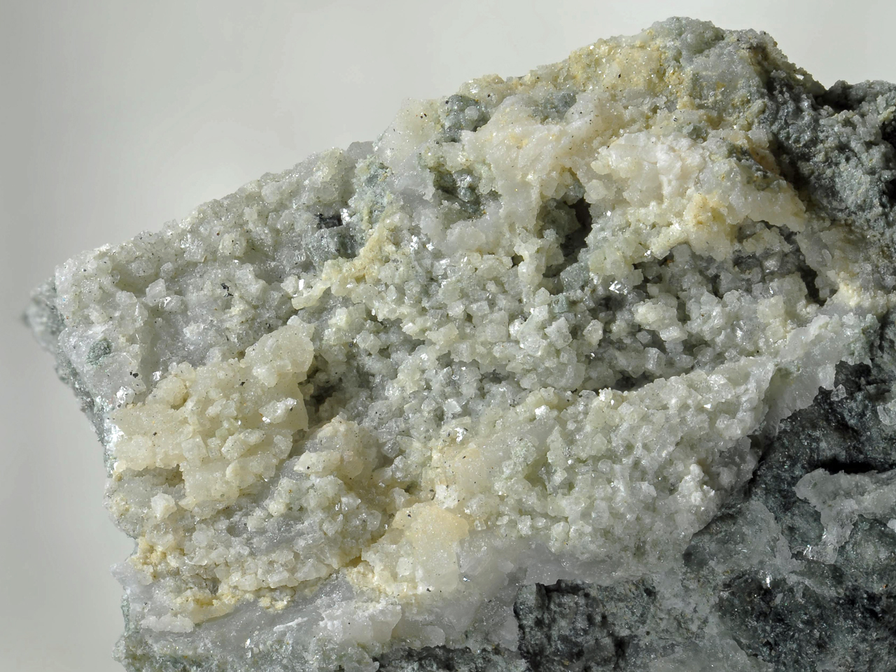


Pfennigbach gypsum mine, Puchberg am Schneeberg, Neunkirchen District, Lower Austria, Austria