| Locality type: | Road |
| Classification |
|---|
|
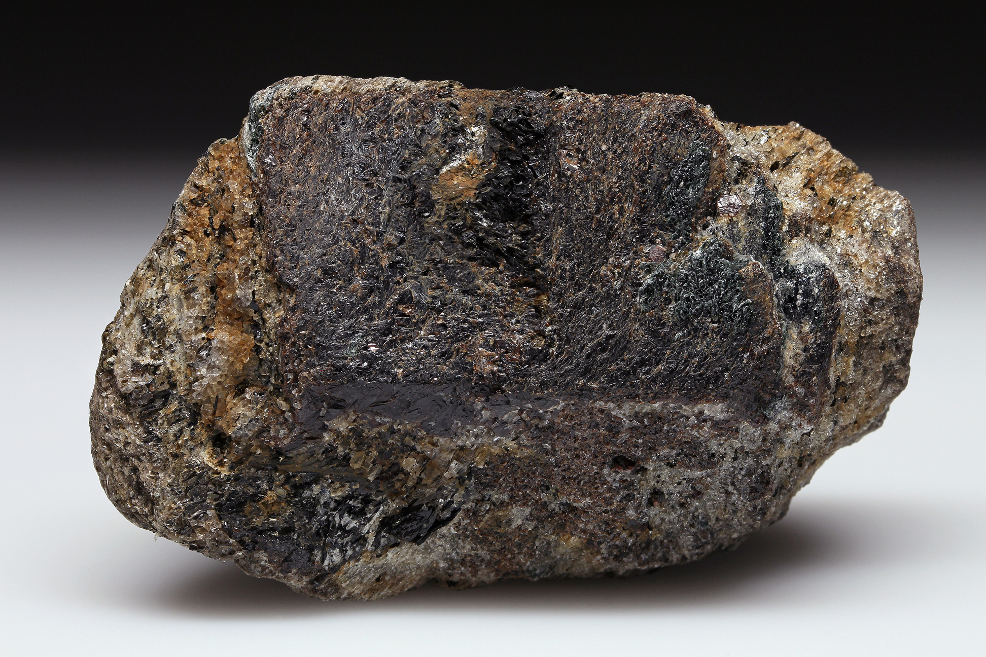
| Species: | Staurolite |
| Formula: | Fe22+Al9Si4O23(OH) |
| Comments: | 7.5 to 10 cm as anhedral to subhedral crystals |
| Habit: | prismatic |
| Colour: | dark brown |
| Quality for species: | Good crystals or rich for species - important (!) |
| Abundance at site: | Common |
| Confirmation |
|---|
|
| Validity: | Believed Valid |
| Data |
|---|
|
| Mineral Data: | Click here to view Staurolite data |
| Locality Data: | Click here to view Town Farm Road, Litchfield, Litchfield County, Connecticut, USA |
| Data Identifiers |
|---|
|
| Mindat Occurrence Record ID: | 849999 |
| Long-form Identifier: | 1:3:849999:8 |
| GUID (UUID V4): | 9938b717-67d5-4319-8786-d42f1530b616 |
| Nearest other occurrences of Staurolite |
|---|
|
|
| 3.7km (2.3 miles) | ⓘState Route 118 Bantam River bridge, Litchfield, Litchfield County, Connecticut, USA |
| 9.2km (5.7 miles) | ⓘHarwinton, Litchfield County, Connecticut, USA |
| 12.5km (7.8 miles) | ⓘThomaston Dam railroad cut, Thomaston Dam, Thomaston, Litchfield County, Connecticut, USA |
| 16.0km (10.0 miles) | ⓘReynolds Bridge, Thomaston, Litchfield County, Connecticut, USA |
| 21.7km (13.5 miles) | ⓘState Route 8 exit 37, Watertown, Litchfield County, Connecticut, USA |
| 23.4km (14.5 miles) | ⓘRatlum Mountain, Canton, Hartford County, Connecticut, USA |
| 24.4km (15.2 miles) | ⓘUnnamed quartz mine (Judd's Bridge kyanite locality), Washington, Litchfield County, Connecticut, USA |
| 32.3km (20.1 miles) | ⓘGreen's Farm locality (Roxbury garnet mine; Roxbury Falls garnet mine; Garnet Hill), Roxbury, Litchfield County, Connecticut, USA |
| 33.2km (20.6 miles) | ⓘBerry Road kyanite locality, Roxbury, Litchfield County, Connecticut, USA |
| 33.2km (20.7 miles) | ⓘSouthbury, New Haven County, Connecticut, USA |
| References |
|---|
|
|
| Reference Search (possible matching items) |
|---|
 | | Journal (article/letter/editorial) | | William Brunet, Roxbury Road, Washington, Connecticut 06793. The area of Litchfield County immediately north...north of the Litchfield town center contains a number of occurrences of fine minerals. The country bounded...bounded by Town Farm Road on the west and the high road to Torrington on the northeast is generally underlain...garnet, staurolite, plagioclase, and biotite. T o the south, it contains spectacular staurolite crystals...large quartz quarry just to the north of the staurolite area proved to be barren of minerals of interest |  | | Journal (article/letter/editorial) | | Mineral Localities.) Connecticut Hematite Mr. William Brunet of Washington, Connecticut, sent a note on an...an unusual specimen found in Litchfield in the fall of 1983. It contains tabular specular hematite crystals;...(1951) lists some sixty different species from the town (including West Farms) but does not mention specular... The site is about 300 meters northeast of Town Farm Road, 3 kilometers from Route 202 leading from Litch... The schist outcrop has very large weathered staurolite crystals (up to 15 cm long and 5 cm wide). This |
|


Town Farm Road, Litchfield, Litchfield County, Connecticut, USA