| Locality type: | Mountain |
| Classification |
|---|
|
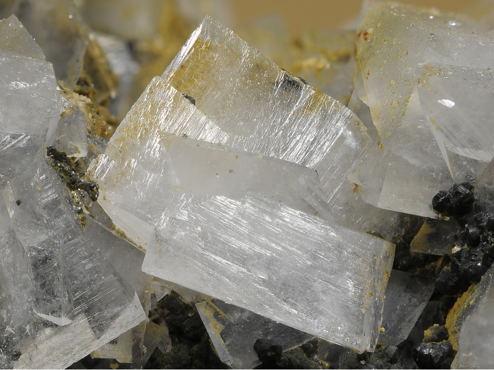
| Species: | K Feldspar var: Adularia |
| Formula: | KAlSi3O8 |
| Confirmation |
|---|
|
| Validity: | Confirmed |
| Confirmation Methods: | Visually Identified |
| Data |
|---|
|
| Mineral Data: | Click here to view Adularia data |
| Locality Data: | Click here to view Kleiner Ankogel, Mallnitz, Spittal an der Drau District, Carinthia, Austria |
| Data Identifiers |
|---|
|
| Mindat Occurrence Record ID: | 853727 |
| Long-form Identifier: | 1:3:853727:0 |
| GUID (UUID V4): | 7c5fe0a0-1e36-4427-bc6c-a5a6e91874c8 |
| Nearest other occurrences of Adularia |
|---|
|
|
| 0.4km (0.3 miles) | ⓘPlattenkogel south slope, Mallnitz, Spittal an der Drau District, Carinthia, Austria |
| 0.4km (0.3 miles) | ⓘRadeckscharte (south slope), Mallnitz, Spittal an der Drau District, Carinthia, Austria |
| 0.7km (0.4 miles) | ⓘLassach glacier, Mallnitz, Spittal an der Drau District, Carinthia, Austria |
| 0.9km (0.5 miles) | ⓘSchwarzkopf, Bad Gastein, St. Johann im Pongau District, Salzburg, Austria |
| 0.9km (0.6 miles) | ⓘGroßelendscharte, Malta, Spittal an der Drau District, Carinthia, Austria |
| 2.3km (1.4 miles) | ⓘArnoldhöhe, Mallnitz, Spittal an der Drau District, Carinthia, Austria |
| 2.4km (1.5 miles) | ⓘArnoldhöhe, Bad Gastein, St. Johann im Pongau District, Salzburg, Austria |
| 2.6km (1.6 miles) | ⓘGrauleitenspitze south slope, Mallnitz, Spittal an der Drau District, Carinthia, Austria |
| 2.7km (1.7 miles) | ⓘZwischenelendscharte, Malta, Spittal an der Drau District, Carinthia, Austria |
| 2.9km (1.8 miles) | ⓘSchwußner Alp (Schwußnerhütte), Seebach valley, Mallnitz, Spittal an der Drau District, Carinthia, Austria |
| References |
|---|
|
|
| Reference Search (possible matching items) |
|---|
 | | Book | | melting to a white glass. The in in "zein" was dropped, an 0 was inserted, and lithos was changed to lite and...studies from this period in his eighteen-volume Atlas der Kristallformen (1913-1923). Dana (1898) defined...the center of some of the tetrahedra and produce an electrical imbalance in the framework that must be...cations (Ca, K, Na, Li, Mg, Sr, Ba, Cs) to produce an electrically neutral stable mineral. The feldspars...corners of aluminum-bearing tetrahedra. This is called an "interrupted structure" since the oxygen molecules | | | Book | | melting to a white glass. The in in "zein" was dropped, an 0 was inserted, and lithos was changed to lite and...studies from this period in his eighteen-volume Atlas der Kristallformen (1913-1923). Dana (1898) defined...the center of some of the tetrahedra and produce an electrical imbalance in the framework that must be...cations (Ca, K, Na, Li, Mg, Sr, Ba, Cs) to produce an electrically neutral stable mineral. The feldspars...corners of aluminum-bearing tetrahedra. This is called an "interrupted structure" since the oxygen molecules |
|


Kleiner Ankogel, Mallnitz, Spittal an der Drau District, Carinthia, Austria