| Locality type: | Hill |
| Classification |
|---|
|
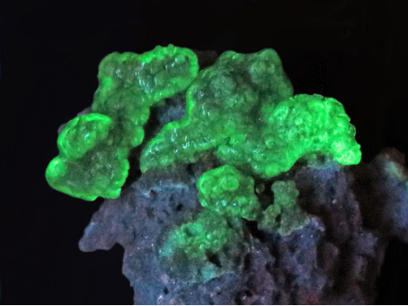
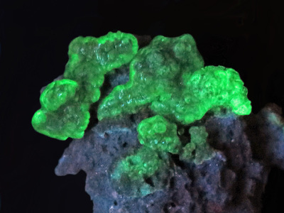
| Species: | Opal var: Opal-AN |
| Formula: | SiO2 · nH2O |
| Confirmation |
|---|
|
| Validity: | Believed Valid |
| Associated Minerals Based on Photo Data: |
|---|
|
| Aegirine-augite | ⓘ2 photos of Opal-AN associated with Aegirine-augite at this locality. |
| Pseudobrookite | ⓘ1 photo of Opal-AN associated with Pseudobrookite at this locality. |
| Quartz | ⓘ1 photo of Opal-AN associated with Quartz at this locality. |
| Data |
|---|
|
| Mineral Data: | Click here to view Opal-AN data |
| Locality Data: | Click here to view Eastern Hill, Mount Anakie, Anakie, City of Greater Geelong, Victoria, Australia |
| Photo Gallery | View Gallery (4 photos) |
| Data Identifiers |
|---|
|
| Mindat Occurrence Record ID: | 897419 |
| Long-form Identifier: | 1:3:897419:8 |
| GUID (UUID V4): | 3fa60e2c-d5c8-43c1-bebd-8a9520b27523 |
| Nearest other occurrences of Opal-AN |
|---|
|
|
| 0.2km (0.2 miles) | ⓘMount Anakie, Anakie, City of Greater Geelong, Victoria, Australia |
| 53.3km (33.1 miles) | ⓘSunbury, City of Hume, Victoria, Australia |
| 59.8km (37.2 miles) | ⓘTrentham Falls, Trentham, Hepburn Shire, Victoria, Australia |
| 63.3km (39.3 miles) | ⓘCorporation quarries, Clifton Hill, Collingwood, City of Yarra, Victoria, Australia |
| 66.2km (41.1 miles) | ⓘSpring Hill, Macedon Ranges, Victoria, Australia |
| 70.3km (43.7 miles) | ⓘBoral Limited quarry, Bundoora, City of Whittlesea, Victoria, Australia |
| 81.7km (50.7 miles) | ⓘRollinsons quarry, Malmsbury, Macedon Ranges Shire, Victoria, Australia |
| 82.6km (51.3 miles) | ⓘMalmsbury Quarry, Malmsbury, Macedon Ranges Shire, Victoria, Australia |
| 92.8km (57.7 miles) | ⓘCave Hill Quarry (David Mitchell Limestone Quarry; Lilydale Quarry), Lilydale, Yarra Ranges Shire, Victoria, Australia |
| References |
|---|
|
|


Eastern Hill, Mount Anakie, Anakie, City of Greater Geelong, Victoria, Australia