| Classification |
|---|
|
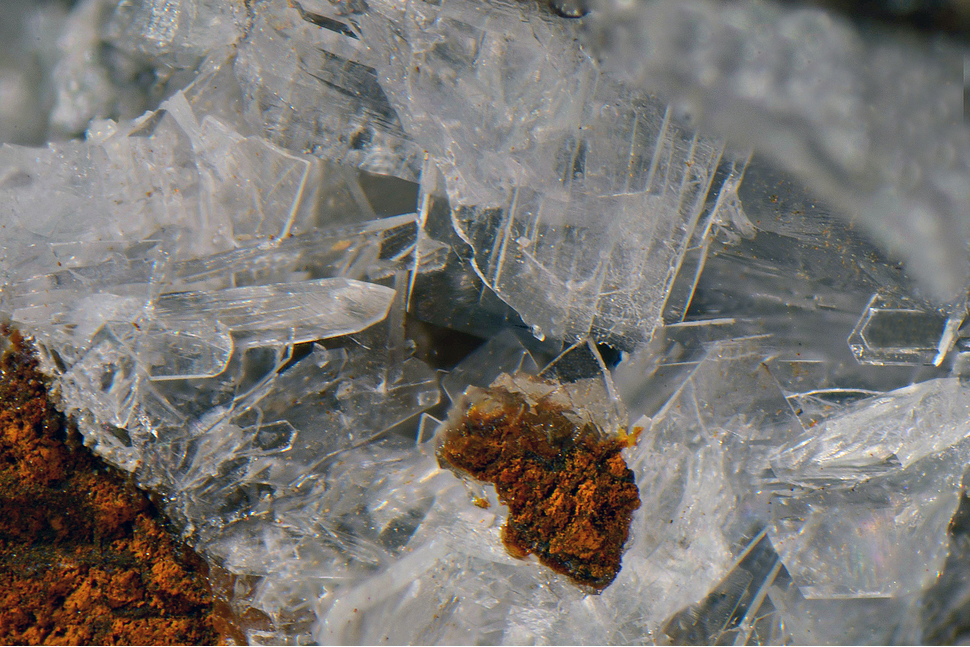
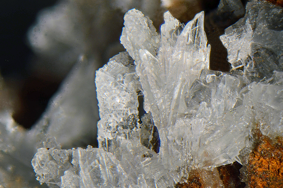
| Species: | Aragonite |
| Formula: | CaCO3 |
| Confirmation |
|---|
|
| Validity: | Confirmed |
| Confirmation Methods: | Visually Identified |
| Data |
|---|
|
| Mineral Data: | Click here to view Aragonite data |
| Locality Data: | Click here to view Erfurt way, Grieswies-Schafkar, Grieswies - Krumlkeeskopf area, Rauris, Zell am See District, Salzburg, Austria |
| Photo Gallery | View Gallery (2 photos) |
| Data Identifiers |
|---|
|
| Mindat Occurrence Record ID: | 921653 |
| Long-form Identifier: | 1:3:921653:2 |
| GUID (UUID V4): | 3c256936-dda1-4440-9cf0-c87faa7a79a5 |
| Nearest other occurrences of Aragonite |
|---|
|
|
| 3.6km (2.3 miles) | ⓘSlag localities, Kolm-Saigurn, Alteck - Hoher Sonnblick area, Rauris, Zell am See District, Salzburg, Austria |
| 4.5km (2.8 miles) | ⓘAlteck - Hoher Sonnblick area, Rauris, Zell am See District, Salzburg, Austria |
| 5.2km (3.2 miles) | ⓘAstenschmiede slag locality, Rauris, Zell am See District, Salzburg, Austria |
| 6.4km (4.0 miles) | ⓘLohning quarry (Lohninger quarry), Rauris, Zell am See District, Salzburg, Austria |
| 7.1km (4.4 miles) | ⓘKaiserer quarry (Deisl quarry), Rauris, Zell am See District, Salzburg, Austria |
| 7.6km (4.7 miles) | ⓘSiglitz adit (Imhof-Unterbau adit; Imhof adit), Siglitz - Bockhart gold mining district, Bad Gastein, St. Johann im Pongau District, Salzburg, Austria |
| 7.7km (4.8 miles) | ⓘOberer Burgstall, Schareck, Naßfeld valley, Bad Gastein, St. Johann im Pongau District, Salzburg, Austria |
| 8.4km (5.2 miles) | ⓘPower station, Sportgastein, Naßfeld valley, Bad Gastein, St. Johann im Pongau District, Salzburg, Austria |
| 10.5km (6.5 miles) | ⓘBrennkogel north slope (Gold district), Fusch an der Grossglocknerstrasse, Zell am See District, Salzburg, Austria |
| 11.3km (7.0 miles) | ⓘPalik, Winkl, Heiligenblut am Großglockner, Spittal an der Drau District, Carinthia, Austria |
| References |
|---|
|
|


Erfurt way, Grieswies-Schafkar, Grieswies - Krumlkeeskopf area, Rauris, Zell am See District, Salzburg, Austria