| Locality type: | Mountain Area |
| Classification |
|---|
|
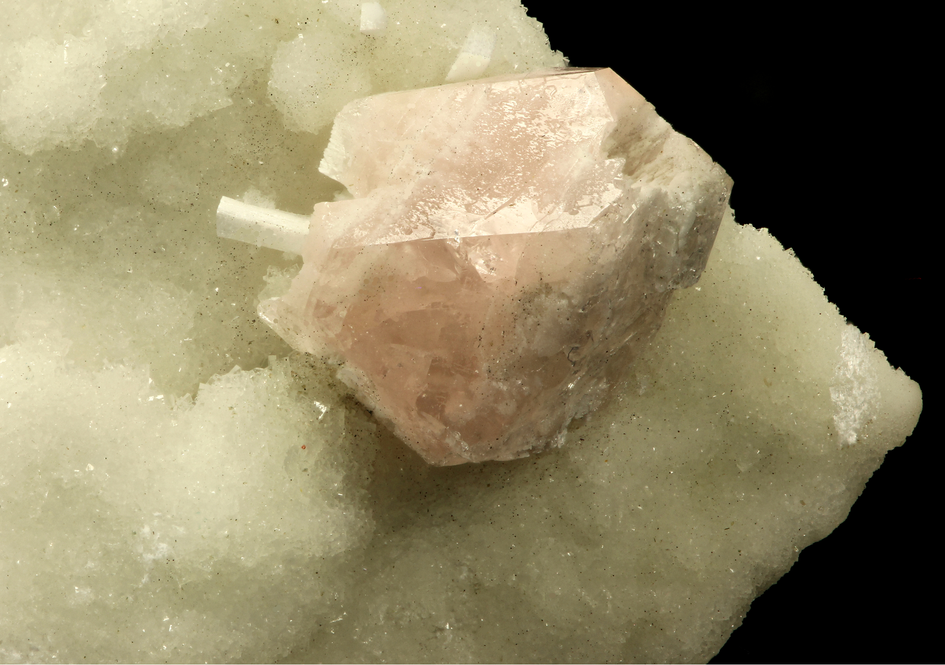
| Species: | 'Apophyllite Group' (not an IMA approved species) |
| Formula: | AB4[Si8O22]X · 8H2O |
| Confirmation |
|---|
|
| Validity: | Confirmed |
| Confirmation Methods: | Visually Identified |
| Associated Minerals Based on Photo Data: |
|---|
|
| Laumontite | ⓘ1 photo of Apophyllite Group associated with Laumontite at this locality. |
| Data |
|---|
|
| Mineral Data: | Click here to view Apophyllite Group data |
| Locality Data: | Click here to view Prehnitinsel, Kratzenberg, Bramberg am Wildkogel, Zell am See District, Salzburg, Austria |
| Data Identifiers |
|---|
|
| Mindat Occurrence Record ID: | 942861 |
| Long-form Identifier: | 1:3:942861:4 |
| GUID (UUID V4): | 71b55fdf-51a8-44a1-9974-be6f71c4c6b2 |
| Nearest other occurrences of Apophyllite Group |
|---|
|
|
| 5.3km (3.3 miles) | ⓘMoar Alp (Moa Alp), Bramberg am Wildkogel, Zell am See District, Salzburg, Austria |
| 14.1km (8.8 miles) | ⓘSöllnkar, Krimml, Zell am See District, Salzburg, Austria |
| 75.3km (46.8 miles) | ⓘLe Cave (Grasstein), Franzensfeste (Fortezza), Wipptal (Alta Vall'Isarco), South Tyrol, Trentino-Alto Adige (Trentino-South Tyrol), Italy |
| 81.3km (50.5 miles) | ⓘTiso (Teis; Theis), Villnöß (Funes), Eisacktal (Valle Isarco), South Tyrol, Trentino-Alto Adige (Trentino-South Tyrol), Italy |
| 85.6km (53.2 miles) | ⓘMontefondoli (Pfunderer Berg), Klausen (Chiusa), Eisacktal (Valle Isarco), South Tyrol, Trentino-Alto Adige (Trentino-South Tyrol), Italy |
| 87.3km (54.3 miles) | ⓘZemmerloch (Saltaria Gorge), Saltaria Valley (Jender Valley), Kastelruth (Castelrotto), Salten-Schlern (Salto-Sciliar), South Tyrol, Trentino-Alto Adige (Trentino-South Tyrol), Italy |
| 88.6km (55.0 miles) | ⓘCol Rodella (Mt Gabbia), Duron Valley, Campitello di Fassa, Trento Province (Trentino), Trentino-Alto Adige (Trentino-South Tyrol), Italy |
| 89.1km (55.3 miles) | ⓘForra di Bulla (Puflerloch; Pufler Loch; Pufelserloch; Pufelser Loch; Bulla; Pufels), Kastelruth (Castelrotto), Salten-Schlern (Salto-Sciliar), South Tyrol, Trentino-Alto Adige (Trentino-South Tyrol), Italy |
| 90.9km (56.5 miles) | ⓘLa Palaccia-Orli di Fassa (Palacia-Auf der Schneid), Duron Valley, Campitello di Fassa, Trento Province (Trentino), Trentino-Alto Adige (Trentino-South Tyrol), Italy |
| 91.5km (56.9 miles) | ⓘCiampai, Duron Valley, Campitello di Fassa, Trento Province (Trentino), Trentino-Alto Adige (Trentino-South Tyrol), Italy |
| References |
|---|
|
|
| Reference Search (possible matching items) |
|---|
 | | Book | | a few such specimens have been found after 1960 (see the Amity-Edenville entry for Edenite and Spine!)...Mount Malosa, Chilwa alkaline province, Zomba district. "Illite" is the name of a series of incompletely...to 2 cm which are pseudomorphs after bastnasite--see photo in Guastoni, Pezzotta and Zorzi (2008). ILMENITE...euhedral, pale tan to white rnicrocline crystals-see photos in Dupuis and David (2013). ffighway 5 extension...molybdenite specimens showing crystals to 6 cm (see this entry for Molybdenite), and in a second roadcut |
|


Prehnitinsel, Kratzenberg, Bramberg am Wildkogel, Zell am See District, Salzburg, Austria