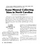
 | | Journal (article/letter/editorial) | | large variety of minerals and gemstones in North Carolina annually attracts thousands of collectors to...the world. Some Mineral Collecting Sites in North Carolina T H E C O L L E C T I N G L O C A L I T I E...McKenzie's publication Mineral Collecting Sites in North Carolina: Information Circular 24 (1978). For a more...locations on county road maps, refer to this publication, which can be ordered from the North Carolina Department...27687, Raleigh, North Carolina 27611. The price is $5.00 plus 4% sales tax. Individual county road maps can |  | | Report (issue) | | NORTH CAROLINA DEPARTMENT OF CONSERVATION WILLIAM DIVISION JASPER P. OF L. SAUNDERS, MINERAL...RESOURCES GEOLOGIST Circular 16 LOCALITIES NORTH OF CAROLINA BY JAMES F. CONLEY Doc NC DENR LIBRARY...... ACKNOWLEDGEMENTS MINERAL COLLECTING IN NORTH CAROLINA , . . . . # . WHERE TO COLLECT f ... f ......THE MINERAL LOCALITIES OF NORTH CAROLINA BY COUNTIES . . ALAMANCE COUNTY 5 5 Pyrophyllite ......... f .......... 5 ALEXANDER COUNTY ................. 7 Emerald, Hiddenite and Associated Minerals |  | | Report (issue) | | Geology of the Eastern Great Smoky Mountains North Carolina and Tennessee By JARVIS B. HADLEY and RICHARD...OF THE GREAT SMOKY MOUNTAINS, TENNESSEE AND NORTH CAROLINA GEOLOGICAL SURVEY PROFESSIONAL PAPER 349-B...ement complex _____________________________ _ Carolina gneiss_ ______________ ___________ - Definition...Amphibolite _________ - ___ --- __ -- __ -Origin of the Carolina gneiss ___________ -Plutonic rocks ___________________...deposits ___________________________________ _ Redmond lead-zinc mine ________________________ _ History ___ |  | | Report (issue) | | .'.' .., Mineral Collecting Sites in North Carolina By W. F. Wilson and B. J. McKenzie RUTILE GUMMITE...Information Circular 24 Mineral Collecting Sites in North Carolina By W. F. Wilson and B. J. McKenzie Raleigh...copies of this publication may be obtained from: North CarOlina Department of Natural Resources and Community...for the general welfare of the citizens of North Carolina. The Section conducts a number of basic and...Geological Survey Section, P. O. Box 27687, Raleigh, North Carolina 27611. Eldon P. Allen, Chief Geologist FRONT | | | Report (issue) | | Information Circular 24 Mineral Collecting Sites in North Carolina By W. F. Wilson and B. J. McKenzie Raleigh...copies of this publication may be obtained from: North Carolina Department of Natural Resources and Community...Geological Survey Section, P. O. Box 27687, Raleigh, North Carolina 27611. Eldon P. Allen, Chief Geologist i ...FRONT COVER PHOTO Twinned emerald crystal from North Carolina, photo from Smithsonian Institution (slide...viable mineral collecting sites through out North Carolina. Some sites are commercially operated during |  | | Report (volume) | | Knoxville 1 °X2° Quadrangle, Tennessee, North Carolina, and South Carolina U.S. GEOLOGICAL SURVEY BULLETIN...Knoxville 1°X2° Quadrangle, Tennessee, North Carolina, and South Carolina By G.R. ROBINSON, Jr., F.G. LESURE...Knoxville 1°X2° quadrangle Tennessee, North Carolina, and South Carolina I by G.R. Robinson, Jr. ... [et al...Geology- Tennessee. 2. Geology-North Carolina. 3. Geology-South Carolina. 4. Mines and mineral resources-...and mineral resources-North Carolina. 6. Mines and mineral resourcesSouth Carolina. I. Robinson, G.R. II |  | Robinson, Gilpin R., Lesure, Frank G., Marlowe, J. I., Foley, Nora K., Clark, S.H. (2004) Bedrock geology and mineral resources of the Knoxville 1° x 2° quadrangle, Tennessee, North Carolina, and South Carolina. Open-File Report 2004-1075. US Geological Survey doi:10.3133/ofr20041075 | Report (issue) | | Knoxville 1°x2° Quadrangle, Tennessee, North Carolina, and South Carolina By G.R. ROBINSON, Jr., F.G. LESURE...Knoxville 1°x2° quadrangle Tennessee, North Carolina, and South Carolina / by G.R. Robinson, Jr. ... [etaf...Geology—Tennessee. 2. Geology—North Carolina. 3. Geology—South Carolina. 4. Mines and mineral resources—Tennessee...and mineral resources—North Carolina. 6. Mines and mineral resourcesSouth Carolina. I. Robinson, G.R. II...Knoxville l°x2° quadrangle, Tennessee, North Carolina, and South Carolina 2. Paleozoic metamorphic facies map |  | | Journal (article/letter/editorial) | | mineralization in the North Range (Coleman Mine) and the South Range (Creighton Mine). The Sudbury Breccia...titanite. Titanite-chlorite assemblages in the North Range footwall of the SIC overprint metalliferous...Chieflakian orogeny. In the South Range at the Creighton Mine, the Sudbury Breccia hosting the Creighton Deep...in the Sudbury Breccia have been confined to the North and East Range of the Sudbury Basin (in particular...mineralogical changes around mineral zones in the North and South Ranges and to constrain the P-T conditions |  | | Journal (article/letter/editorial) | | g., northern Chile-southern Peru, southwestern North America) or Au (northern Peru; Sillitoe, 2008)....Andes (Sillitoe and Perelló, 2005), southwestern North America (Titley, 1993; Barra et al., 2005), and...wider (160 km) Texas lineament of southwestern North America (Schmitt, 1966) being oft-quoted examples...to Paleocene (Laramide) province of southwestern North America, middle Eocene to early Oligocene (Fig....Yerington (Proffett, 2009), and four at Bingham (Redmond et al., 2001). The immediately premineral, early |  | Yang, Yan, Chen, Yan-Jing, Zhang, Jing, Zhang, Cheng (2013) Ore geology, fluid inclusions and four-stage hydrothermal mineralization of the Shangfanggou giant Mo–Fe deposit in Eastern Qinling, central China. Ore Geology Reviews, 55. 146-161 doi:10.1016/j.oregeorev.2013.05.007 | Journal (article/letter/editorial) | | world. The Shangfanggou giant Mo deposit, Luanchuan County, Henan Province, is a porphyry-skarn system hosted...system developed during 158–134 Ma when the Yangtze–North China continental collision began to evolve from...the Mesozoic collision between the Yangtze and North China continents. The eastern Qinling Orogen hosts...2007). The Shangfanggou Mo–Fe deposit in Luanchuan County, Henan Province, is one of the six giant Mo deposits...Fault to the south and the San-Bao Fault to the north, comprising of the Precambrian Huaxiong block and |  | | Report (issue) | | Church (Salt Lake City) built with Nugget Sandstone Utelite expanded shale plant, Summit County, Utah Holnam’s...Holnam’s Devil’s Slide plant, Morgan County, Utah !7IB5F7-jbgfej! Utah Geological Survey MP 01-2 ISBN...- THE INTERMOUNTAIN WEST FORUM 1999 Salt Lake City County Building constructed of Kyune Sandstone Proceedings... Krukowski Meeting held: May 2-7, 1999 in Salt Lake City, Utah Miscellaneous Publication 01-2 Utah...T. Krukowski Meeting held May 2-7, 1999 in Salt Lake City, UT ISBN 1-55791-654-3 MISCELLANEOUS PUBLICATION |  | Lang, Xinghai, Wang, Xuhui, Deng, Yulin, Tang, Juxing, Xie, Fuwei, Yang, Zongyao, Yin, Qing, Jiang, Kai (2019) Hydrothermal evolution and ore precipitation of the No. 2 porphyry Cu–Au deposit in the Xiongcun district, Tibet: Evidence from cathodoluminescence, fluid inclusions, and isotopes. Ore Geology Reviews, 114. 103141 doi:10.1016/j.oregeorev.2019.103141 | Journal (article/letter/editorial) | | transmitted light microscopy (Rusk and Reed, 2002; Redmond et al., 2004; Müller et al., 2010; Rusk, 2012;...times in an individual vein (Rusk and Reed, 2002; Redmond et al., 2004; Landtwing et al., 2005; Klemm et...systems has recently been reconstructed in detail (Redmond et al., 2004; Landtwing et al., 2005, 2010; Rusk...et al., 2004). It can be divided from south to north into the Himalayas, the Lhasa terrane, and the Qiangtang...Sodic-calcic alteration is characterized by albite and actinolite and minor magnetite, chlorite, and tourmaline | | | Report (issue) | | Schwartz (1947) from the study of 12 deposits in North America (table 4), the hydrothermal alteration and...minerals are garnet, pyroxene, epidote, quartz, actinolite, chlorite, biotite, calcite, dolomite, K-feldspar...copper deposits are tourmaline, andalusite, and actinolite. Table 3 summarizes alteration minerals in selected...(1968) and later applied to many deposits in the North American Cordillera (Lowell and Guilbert, 1970)...distinguish between mineralized and barren systems in North America (Farmer and DePaolo, 1984). The osmium isotope |  | | Report (issue) | | Geologic map of the Laporte quadrangle, Larimer County, Colorado. U.S. Geological Survey, 1988. M(271)2...Geologic map of the Poudre Park quadrangle, Larimer County, Colorado. Va. : U.S. Geological Survey, 1988....the Mt. Killers Wilderness Study Area, Garfield County, Utah. Washington, D.C. : U.S. G.P.O., 1988. (200)...1985 geological expedition to central and western North Greenland, Copenhagen : Granlands geologiske undersagelse...Geologic map of Norwegian Bay quadrangle, St. Louis County, Minnesota. [St. Paul, Minn.] : University of Minnesota |  | | Report (issue) | | beryl production from the Harding pegmatite, Taos County. Current drilling in the Apache Warm Springs deposit...were discovered in the Victorio Mountains, Luna County in the early 1900s. Gulf Minerals Resources, Inc...porphyry Mo and W-Mo-Be skarn deposits northwest of Mine Hill and south of Middle Hills. At a cut-off grade...Mountain, Otero County and in the molybdenum porphyry deposit at Questa, Taos County, although not in...prospects in the Victorio mining district, Luna County. ........... 38 FIGURE 17. Simplified geologic |  | Lucci, Federico, Della Ventura, Giancarlo, Conte, Alessandra, Nazzari, Manuela, Scarlato, Piergiorgio (2018) Naturally Occurring Asbestos (NOA) in Granitoid Rocks, A Case Study from Sardinia (Italy) Minerals, 8 (10) 442 doi:10.3390/min8100442 | Journal (article/letter/editorial) | | existing regulation on asbestos hazard, i.e., actinolite, tremolite, anthophyllite, crocidolite and amosite...Isadalu complex belong compositionally to the actinolite-tremolite series. They were generated by metasomatic...represents a high-value case study, since the actinolite-bearing felsic rocks outcrop in a strongly anthropized...occurrences in natural environments. Keywords: actinolite; tremolite; asbestos; granite; late variscan...nature of fibrous amphiboles (anthophyllite, actinolite, tremolite, crocidolite and amosite), and chrysotile |  | | Journal (article/letter/editorial) | | richer in gold (1.5–4.5 g/t). At the Hannan South mine, the skarns consist of epidote, calcite, chlorite...breccia skarns are composed of multistage epidote, actinolite, albite, magnetite (5%), and minor biotite, calcite...destruction of igneous magnetite by subsolidus actinolite–albite alteration. At the Shea prospect, main-stage...international nomenclature, and related propylitic actinolite and sodic–calcic alteration is described. Particular...time-equivalent with main-stage skarn if epidote and actinolite constitute a major component (>10%) of the outer |  | | Book (edition) | | Resource Reviews Series editor John Slack, Reston, VA, USA More information about this series at http://www...Australia, Brazil, China, Greece, Iran, Mongolia, North America, Russia, and Turkey, including new maps...in Santiago; North Limited in Parkes; Kanowna Belle Gold Mines in Kalgoorlie; PT North Mining Indonesia... 6.4.2 Bingham Copper-Molybdenum Deposit, Utah, USA. . . . . . . . . . . . . . . . . . . . . . . 6.4.... . 6.4.4 Cripple Creek Gold Deposit, Colorado, USA. . . . . . . . . . . . . . . . . . . . 6.4.5 Skouries |  | | Journal (article/letter/editorial) | | batholith in Nevada, and associated with the Yerington mine and the AnnMason deposit, provide a basis of comparison...Burnham, 1979; Dilles, 1987; Carten et al., 1988; Redmond et al., 2004). The magmatic systems likely continue... FIG. 1. Location maps. A. Map of southwestern North America, showing the limit of the Basin and Range... 1984; Dilles et al., 2000). Both the Yerington mine and Ann-Mason deposits are exposed continuously...inferred to be the source of both the Yerington mine system (Fig. 2A) and the Ann-Mason system (Fig. |  | | Report (issue) | | Gold, base-metal, and related deposits of North Carolina 1011 by Gwendolyn W. Luttrell 12 U.S. Geological... Gold, base-metal, and related deposits of North Carolina Abstract Gold, silver, copper, lead, zinc,...barite, and rare-earths have been mined in North Carolina. Gold, with by-product silver, occurs in veins...along the borders of a granite body in Halifax 18 County. 19 and Vanoe Counties. 20- Tungsten minerals...occur with sulfides in vein|j deposits in Cabarrus County. 21 22 23 24 25- U. S. GOVERNMENT PRINTING OFFICE: |  | Stefanova, E., Driesner, T., Zajacz, Z., Heinrich, C. A., Petrov, P., Vasilev, Z. (2014) Melt and Fluid Inclusions in Hydrothermal Veins: The Magmatic to Hydrothermal Evolution of the Elatsite Porphyry Cu-Au Deposit, Bulgaria. Economic Geology, 109 (5) 1359-1381 doi:10.2113/econgeo.109.5.1359 | Journal (article/letter/editorial) | | Quiroga, 1995; Redmond et al., 2001; Proffett, 2003, 2009; Masterman et al., 2005; Redmond and Einaudi,...quartz with fluid inclusion petrography (e.g., Redmond et al., 2004; Rusk et al., 2004, 2008; Landtwing...formation of the main mass of vein quartz and sulfide (Redmond et al., 2004; Landtwing et al., 2005; Rusk et al...the temperature of magmatic fluid exsolution (Redmond et al., 2004; Landtwing et al., 2005, 2010; Klemm...Cu-Au deposit is the largest operating open-pit mine in Bulgaria, located on the Etropole ridge of the |  | | Journal (article/letter/editorial) | | is consuming the Philippine Sea plate. Farther north, the bathymetric depression of the east Luzon trough...depression defined by the Surigao lowlands in the north and the Tubay Valley in the south separates the...freshwater Lake Mainit. The volcanic Maniayao highlands occur at the northern edge of Lake Mainit. They...underlies much of the Western Range, west and south of Lake Mainit, and occurs in the eastern Diwata Range (Fig...and in an isolated occurrence east of the Mapawa mine (United Nations Development Program, 1987). The |  | | Report (issue) | | Geological Survey editorial standards or with the North American Stratigraphic Code. Any use of trade, product...and eastern California centered at the latitude of Lake Tahoe (fig. 1). Granitic rocks are widely distributed...A. Armin in the northwestern part of the Walker Lake 1° by 2° quadrangle, about 70 unpublished analyses...exposures in the central Wassuk Range on the south and north sides of ML Grant, respectively. Several other plutons...Early Jurassic metavolcanic rocks in the Walker Lake area. However, a zircon U-Pb age of about 242 Ma |  | | Journal (article/letter/editorial) | | et al., 2015). MPSA is currently constructing a mine and has slated production to begin at the Botija...Quiroga, 1995; Proffett, 2003; Harris et al., 2004; Redmond and Einaudi, 2010) have concluded that porphyry...tabular bodies that dip gently 20° to 40° to the north-northwest. Globally, other porphyry deposits that...Bingham Canyon and Haquira: Gruen et al., 2010; Redmond and Einaudi, 2010; Cernuschi, 2015). Unlike Bingham...0.8 Ma from the southern end of the batholith, north of the porphyry copper deposits. More recently, |  | Rees, C., Riedell, K. B., Proffett, J. M., Macpherson, J., Robertson, S. (2015) The Red Chris Porphyry Copper-Gold Deposit, Northern British Columbia, Canada: Igneous Phases, Alteration, and Controls of Mineralization. Economic Geology, 110 (4) 857-888 doi:10.2113/econgeo.110.4.857 | Journal (article/letter/editorial) | | abundant A veins. Chlorite-carbonate-epidote-actinolite replaced hornblende peripheral to biotitic alteration...and 129°47' W), 80 km south of the town of Dease Lake (Fig. 1). The deposit is 12 km east of Highway 37... 140 o ! ! ! ! ! ! ! ! ! ! ! Dease Lake N.W.T. o ! ! ! B.C. ! ! Yukon 120 ! ...in northern British Columbia, Canada. from where mine concentrate will be shipped. The Red Chris property...assessment reviews in 2005 and 2006, respectively, but mine feasibility at that time was precluded by the lack |
|


