| Locality type: | Mine |
| Classification |
|---|
|
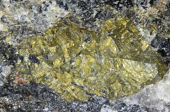
| Species: | Chalcopyrite |
| Formula: | CuFeS2 |
| Confirmation |
|---|
|
| Validity: | Believed Valid |
| Associated Minerals Based on Photo Data: |
|---|
|
| Samarskite-(Y) | ⓘ1 photo of Chalcopyrite associated with Samarskite-(Y) at this locality. |
| Smoky Quartz | ⓘ1 photo of Chalcopyrite associated with Smoky Quartz at this locality. |
| Microcline | ⓘ1 photo of Chalcopyrite associated with Microcline at this locality. |
| Data |
|---|
|
| Mineral Data: | Click here to view Chalcopyrite data |
| Locality Data: | Click here to view McKinney Mine (Power Mill Creek Mine), Spruce Pine, Mitchell County, North Carolina, USA |
| Data Identifiers |
|---|
|
| Mindat Occurrence Record ID: | 96629 |
| Long-form Identifier: | 1:3:96629:2 |
| GUID (UUID V4): | c5746c87-1787-4f6d-9d9f-d3aaa232131d |
| Nearest other occurrences of Chalcopyrite |
|---|
|
|
| 9.7km (6.0 miles) | ⓘDeer Park Mine, Penland, Mitchell County, North Carolina, USA |
| 11.3km (7.0 miles) | ⓘAutrey Mine, Yancey County, North Carolina, USA |
| 12.5km (7.8 miles) | ⓘNorth Cove Prospect, McDowell County, North Carolina, USA |
| 12.8km (7.9 miles) | ⓘTolley Bend Mine, Yancey County, North Carolina, USA |
| 18.9km (11.8 miles) | ⓘUnnamed Zn prospect, Linville Falls, McDowell County, North Carolina, USA |
| 20.8km (12.9 miles) | ⓘChamp Rock Mine, Avery County, North Carolina, USA |
| 21.5km (13.3 miles) | ⓘLick Ridge Mine, Mitchell County, North Carolina, USA |
| 22.6km (14.1 miles) | ⓘThomas Mine (Balsam Gap kyanite location; Parkway kyanite location), Buncombe County, North Carolina, USA |
| 33.6km (20.9 miles) | ⓘUranium Prospect (MRDS - 10151415), North Harper Creek, Avery County, North Carolina, USA |
| 35.4km (22.0 miles) | ⓘCranberry Mine, Cranberry Magnetite Mining District, Avery County, North Carolina, USA |
| References |
|---|
|
|


McKinney Mine, Spruce Pine, Mitchell County, North Carolina, USA