| Locality type: | Quarry |
| Classification |
|---|
|
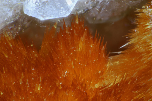
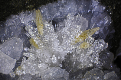
| Species: | Calcite |
| Formula: | CaCO3 |
| Confirmation |
|---|
|
| Validity: | Confirmed |
| Confirmation Methods: | Visually Identified |
| Associated Minerals Based on Photo Data: |
|---|
|
| Chabazite | ⓘ6 photos of Calcite associated with Chabazite at this locality. |
| Analcime | ⓘ2 photos of Calcite associated with Analcime at this locality. |
| Thomsonite Subgroup | ⓘ2 photos of Calcite associated with Thomsonite Subgroup at this locality. |
| Natrolite | ⓘ1 photo of Calcite associated with Natrolite at this locality. |
| Data |
|---|
|
| Mineral Data: | Click here to view Calcite data |
| Locality Data: | Click here to view Oakville Quarries, Oakville, Grays Harbor County, Washington, USA |
| Photo Gallery | View Gallery (6 photos) |
| Data Identifiers |
|---|
|
| Mindat Occurrence Record ID: | 971192 |
| Long-form Identifier: | 1:3:971192:1 |
| GUID (UUID V4): | 182bf9e3-585c-455d-9afe-35d31e118366 |
| Nearest other occurrences of Calcite |
|---|
|
|
| 11.1km (6.9 miles) | ⓘC-line Quarry, Porter, Grays Harbor County, Washington, USA |
| 11.7km (7.3 miles) | ⓘF Line pit, Doty Hills, Lewis County, Washington, USA |
| 13.4km (8.3 miles) | ⓘWeyerhaeuser Lincoln Creek Quarry, Doty Hills, Lewis County, Washington, USA |
| 15.2km (9.4 miles) | ⓘTop of the Hill Quarry, Doty Hills, Brooklyn, Pacific County, Washington, USA |
| 17.5km (10.8 miles) | ⓘDNR Lincoln Creek Quarry, Doty Hills, Lewis County, Washington, USA |
| 20.4km (12.7 miles) | ⓘRock Candy Mountain, Black Hills, Thurston County, Washington, USA |
| 32.9km (20.4 miles) | ⓘLucky Strike Pit, Mason County, Washington, USA |
| 34.2km (21.2 miles) | ⓘInterstate 420 roadcuts, Olympia, Thurston County, Washington, USA |
| 38.1km (23.7 miles) | ⓘRobertson Pit, Mason County, Washington, USA |
| 40.7km (25.3 miles) | ⓘSkookumchuck Dam, Bucoda, Thurston County, Washington, USA |
| References |
|---|
|
|


Oakville Quarries, Oakville, Grays Harbor County, Washington, USA