| Locality | Latitude | Longitude | Distance | Bearing |
|---|
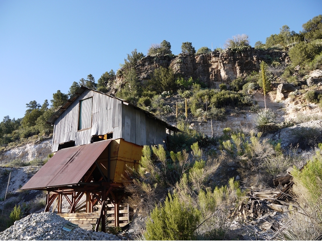
| Rock Canyon deposit (Atomic Ores lease), Cibecue Creek-Salt River Draw confluence with the Salt River area, Salt River, Salt River Mining District, Gila County, Arizona, USA | 33° 49' 59" N | 110° 31' 59" W | 0.0km (0.0 miles) | |
| Punto Negro group, Salt River, Salt River Mining District, Gila County, Arizona, USA | 33° 49' 31" N | 110° 33' 24" W | 2.3km (1.5 miles) | |
| Oso claim, Mule Hoof Bend area (Oxbow Bend area), Salt River, Salt River Mining District, Gila County, Arizona, USA | 33° 48' 36" N | 110° 32' 2" W | 2.6km (1.6 miles) | |
| Crosthwaite-Steward group, Chrysotile, Salt River Mining District, Gila County, Arizona, USA | 33° 48' 41" N | 110° 33' 2" W | 2.9km (1.8 miles) | |
| Canadian Mines (Asbestos King Mine), Mule Hoof Bend (Oxbow Bend), Salt River, Salt River Mining District, Gila County, Arizona, USA | 33° 48' 20" N | 110° 32' 30" W | 3.1km (1.9 miles) | |
| Enders Mine (White Tail group; MS 1921 claims; Horse Shoe group), Mule Hoof Bend area (Oxbow Bend area), Salt River, Salt River Mining District, Gila County, Arizona, USA | 33° 48' 46" N | 110° 30' 32" W | 3.2km (2.0 miles) | |
| Salt Banks-Orange Spring, Salt River, Salt River Mining District, Gila County, Arizona, USA | 33° 49' 35" N | 110° 34' 0" W | 3.2km (2.0 miles) | |
| Dream Girl Mine (Soren-Williams Mine; Long and Wright group), Mule Hoof Bend (Oxbow Bend), Salt River, Salt River Mining District, Gila County, Arizona, USA | 33° 48' 2" N | 110° 31' 23" W | 3.7km (2.3 miles) | |
| River Claims, Mule Hoof Bend area (Oxbow Bend area), Salt River, Salt River Mining District, Gila County, Arizona, USA | 33° 48' 42" N | 110° 33' 56" W | 3.9km (2.4 miles) | |
| Mule Hoof Bend Erythrite occurrence (Mule Shoe Bend Erythrite occurrence), Mule Hoof Bend area (Oxbow Bend area), Salt River, Salt River Mining District, Gila County, Arizona, USA | 33° 48' 10" N | 110° 30' 15" W | 4.3km (2.7 miles) | |
| Loey and Lena Mine (Lorie and Lena Mine; Claim MS 3929), Salt River draw, Fort Apache Indian Reservation, Gila County, Arizona, USA | 33° 51' 29" N | 110° 34' 9" W | 4.3km (2.7 miles) | |
| Apache Extension Mine (Apache Extension group of claims), Salt River Draw, Fort Apache Indian Reservation, Gila County, Arizona, USA | 33° 51' 2" N | 110° 34' 36" W | 4.5km (2.8 miles) | |
| Mule Hoof Bend (Oxbow Bend), Salt River, Salt River Mining District, Gila County, Arizona, USA | 33° 47' 40" N | 110° 31' 3" W | 4.5km (2.8 miles) | |
| Apache Manganese deposit, Salt River Draw, Fort Apache Indian Reservation, Gila County, Arizona, USA | 33° 51' 6" N | 110° 34' 41" W | 4.6km (2.9 miles) | |
| Phillips Asbestos Mine (Crosthwaite-Steward group; Grandview claims; Ladder Mine; Golden Fiber claims), Mule Hoof Bend (Oxbow Bend), Salt River, Salt River Mining District, Gila County, Arizona, USA | 33° 47' 27" N | 110° 32' 25" W | 4.7km (2.9 miles) | |
| Seventy Two and Monte Christo claims, Mule Hoof Bend (Oxbow Bend), Salt River, Salt River Mining District, Gila County, Arizona, USA | 33° 47' 17" N | 110° 32' 3" W | 5.0km (3.1 miles) | |
| Roadside Mine (Prochnow workings; Old Prochnow property; Cibecue Mining Co. property; Cibecue workings; Lost Mines claims), Mule Hoof Bend area (Oxbow Bend area), Salt River, Salt River Mining District, Gila County, Arizona, USA | 33° 49' 5" N | 110° 28' 49" W | 5.2km (3.2 miles) | |
| Salt River Mine (Salt River Asbestos Mine; Salt River claims/group; Sorenson-Williams claims), Salt River Canyon, Salt River, Salt River Mining District, Gila County, Arizona, USA | 33° 47' 57" N | 110° 29' 35" W | 5.3km (3.3 miles) | |
| Great View Mine, Mule Hoof Bend (Oxbow Bend), Salt River, Salt River Mining District, Gila County, Arizona, USA | 33° 47' 26" N | 110° 30' 14" W | 5.4km (3.4 miles) | |
| Bluff Mine (Bluff prospect; Bluff claims; Oange (Orange ?) Grove group; Big 3 No. 1; Cyax group; Bluff group; Big 3 group), Salt River Canyon, Salt River Mining District, Gila County, Arizona, USA | 33° 47' 53" N | 110° 29' 21" W | 5.6km (3.5 miles) | |
| Fiber King Mine (Salt Bank Mine; Riverside Mine; Salt Bank group; Riverside group; Fiber King group of claims), Salt River Canyon Campgrounds area, Salt River Canyon, Salt River Mining District, Gila County, Arizona, USA | 33° 50' 6" N | 110° 35' 43" W | 5.8km (3.6 miles) | |
| Golden Fiber 1 and 2 claims, Mule Hoof Bend area (Oxbow Bend area), Salt River, Salt River Mining District, Gila County, Arizona, USA | 33° 47' 3" N | 110° 30' 43" W | 5.8km (3.6 miles) | |
| Emsco Mine (Emsco property; Accident claims), Mule Hoof Bend (Oxbow Bend), Salt River, Salt River Mining District, Gila County, Arizona, USA | 33° 46' 50" N | 110° 31' 27" W | 5.9km (3.6 miles) | |
| Snake Hill Mine, Salt River Canyon, Salt River Mining District, Gila County, Arizona, USA | 33° 48' 6" N | 110° 28' 54" W | 5.9km (3.7 miles) | |
| Regal Mine (Regal group; Corral Creek; Walnut Creek group; Navajo workings; Old Regal; Patented claims MS 4479; New Regal), Salt River, Blue House Mountain quadrangle, Salt River Mining District, Gila County, Arizona, USA | 33° 49' 4" N | 110° 35' 44" W | 6.0km (3.7 miles) | |
| Cliffbestos group, Salt River Mining District, Gila County, Arizona, USA | 33° 48' 20" N | 110° 35' 39" W | 6.4km (4.0 miles) | |
| Pinetop Mine (Pine Top Mine; Pinetops deposits; Falls group of claims; Falls group prospect; Lucky Seven), Mule Hoof Bend (Oxbow Bend), Salt River, Salt River Mining District, Gila County, Arizona, USA | 33° 46' 36" N | 110° 31' 0" W | 6.5km (4.0 miles) | |
| Apache Mine (Apache Mines Nos. 1 & 2; Seven Star group; Seven Star group of claims; Mcintyre Mine; Crown Asbestos Mine), Salt River Draw, Fort Apache Indian Reservation, Gila County, Arizona, USA | 33° 52' 23" N | 110° 35' 3" W | 6.5km (4.0 miles) | |
| Cobb & Dunaway group, Seneca, Gila County, Arizona, USA | 33° 46' 50" N | 110° 29' 52" W | 6.7km (4.2 miles) | |
| Tomato Juice deposit, Cibecue Creek-Salt River Draw confluence with the Salt River area, Salt River, Salt River Mining District, Gila County, Arizona, USA | 33° 49' 12" N | 110° 36' 20" W | 6.9km (4.3 miles) | |
Minerals recorded nearby (within 6.9 km)
Rock types recorded nearby (within 6.9 km)
Entries shown in red are rocks recorded for this region.


Regal Mine, Salt River, Blue House Mountain quadrangle, Salt River Mining District, Gila County, Arizona, USA