| Locality | Latitude | Longitude | Distance | Bearing |
|---|
| Black Hole Mine, Eyam, Derbyshire Dales District, Derbyshire, England, UK | 53° 17' 34" N | 1° 41' 43" W | 0.0km (0.0 miles) | |
| Broadlow Mine, Eyam, Derbyshire Dales District, Derbyshire, England, UK | 53° 17' 42" N | 1° 41' 6" W | 0.7km (0.5 miles) | |
| Moorwood Mine, Eyam, Derbyshire Dales District, Derbyshire, England, UK | 53° 17' 48" N | 1° 42' 16" W | 0.7km (0.5 miles) | |
| Hanging Flats mine, Stoney Middleton, Derbyshire Dales District, Derbyshire, England, UK | 53° 16' 49" N | 1° 41' 38" W | 1.4km (0.9 miles) | |
| Ladywash Mine, Eyam, Derbyshire Dales District, Derbyshire, England, UK | 53° 17' 41" N | 1° 40' 20" W | 1.6km (1.0 miles) | |
| Glebe Mine, Eyam, Derbyshire Dales District, Derbyshire, England, UK | 53° 17' 5" N | 1° 40' 22" W | 1.7km (1.1 miles) | |
| New Engine Mine, Eyam, Derbyshire Dales District, Derbyshire, England, UK | 53° 17' 35" N | 1° 39' 53" W | 2.0km (1.3 miles) | |
| Cavendish Mill, Stoney Middleton, Derbyshire Dales District, Derbyshire, England, UK | 53° 16' 26" N | 1° 41' 41" W | 2.1km (1.3 miles) | |
| Darlton Quarry, Stoney Middleton, Derbyshire Dales District, Derbyshire, England, UK | 53° 16' 35" N | 1° 40' 28" W | 2.3km (1.4 miles) | |
| Hucklow Edge, Great Hucklow, Derbyshire Dales District, Derbyshire, England, UK | 53° 18' 0" N | 1° 43' 51" W | 2.5km (1.6 miles) | |
| Milldam Mine, Great Hucklow, Derbyshire Dales District, Derbyshire, England, UK | 53° 17' 56" N | 1° 44' 13" W | 2.9km (1.8 miles) | |
| High Rake, Great Hucklow, Derbyshire Dales District, Derbyshire, England, UK | 53° 17' 53" N | 1° 44' 40" W | 3.3km (2.1 miles) | |
| Netherwater Mine, Hazlebadge, Derbyshire Dales District, Derbyshire, England, UK | 53° 18' 29" N | 1° 44' 35" W | 3.6km (2.2 miles) | |
| White Rake, Great Longstone, Derbyshire Dales District, Derbyshire, England, UK | 53° 15' 43" N | 1° 42' 54" W | 3.7km (2.3 miles) | |
| Sallet Hole Mine, Great Longstone, Derbyshire Dales District, Derbyshire, England, UK | 53° 15' 52" N | 1° 40' 0" W | 3.7km (2.3 miles) | |
| High Rake Quarry (Bow Rake; Longstone Edge West), Great Longstone, Derbyshire Dales District, Derbyshire, England, UK | 53° 15' 31" N | 1° 40' 52" W | 3.9km (2.4 miles) | |
| High Rake Mine, Little Hucklow, Derbyshire Dales District, Derbyshire, England, UK | 53° 17' 48" N | 1° 45' 20" W | 4.0km (2.5 miles) | |
| Watersaw mine, Longstone Edge, Great Longstone, Derbyshire Dales District, Derbyshire, England, UK | 53° 15' 24" N | 1° 42' 11" W | 4.1km (2.5 miles) | |
| Arthurton West Extension, Longstone Edge, Great Longstone, Derbyshire Dales District, Derbyshire, England, UK | 53° 15' 20" N | 1° 42' 10" W | 4.2km (2.6 miles) | |
| Arthurton West Open Pit, Longstone Edge, Great Longstone, Derbyshire Dales District, Derbyshire, England, UK | 53° 15' 19" N | 1° 41' 48" W | 4.2km (2.6 miles) | |
| Revell's Pipe, Hazlebadge, Derbyshire Dales District, Derbyshire, England, UK | 53° 19' 6" N | 1° 44' 37" W | 4.3km (2.7 miles) | |
| Deep Rake, Great Longstone, Derbyshire Dales District, Derbyshire, England, UK | 53° 15' 30" N | 1° 39' 51" W | 4.3km (2.7 miles) | |
| Moor Road Quarry, Longstone Edge, Great Longstone, Derbyshire Dales District, Derbyshire, England, UK | 53° 15' 13" N | 1° 42' 0" W | 4.4km (2.7 miles) | |
| Orchard Mine (Wortley Mine), Bradwell, Derbyshire Dales District, Derbyshire, England, UK | 53° 19' 32" N | 1° 44' 4" W | 4.5km (2.8 miles) | |
| Shuttle Rake, Hazlebadge, Derbyshire Dales District, Derbyshire, England, UK | 53° 18' 49" N | 1° 45' 21" W | 4.6km (2.9 miles) | |
| Jeffrey Lane open cut, Bradwell, Derbyshire Dales District, Derbyshire, England, UK | 53° 19' 14" N | 1° 44' 51" W | 4.7km (2.9 miles) | |
| Harrybecca Lead Mine, Hassop, Derbyshire Dales District, Derbyshire, England, UK | 53° 15' 18" N | 1° 39' 45" W | 4.7km (2.9 miles) | |
| Bagshaw Cavern, Bradwell, Derbyshire Dales District, Derbyshire, England, UK | 53° 19' 27" N | 1° 44' 36" W | 4.7km (3.0 miles) | |
| Backdale Quarry, Longstone Edge, Great Longstone, Derbyshire Dales District, Derbyshire, England, UK | 53° 15' 27" N | 1° 39' 11" W | 4.8km (3.0 miles) | |
| Earl Rake (Hill Rake; Hills Rake), Hazlebadge, Derbyshire Dales District, Derbyshire, England, UK | 53° 19' 1" N | 1° 45' 27" W | 4.9km (3.1 miles) | |
Minerals recorded nearby (within 4.9 km)
Rock types recorded nearby (within 4.9 km)
Entries shown in red are rocks recorded for this region.
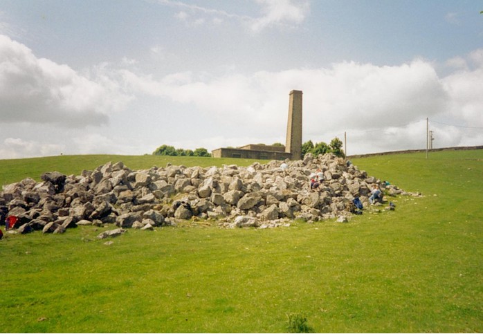


Ladywash Mine, Eyam, Derbyshire Dales District, Derbyshire, England, UK