| Locality | Latitude | Longitude | Distance | Bearing |
|---|
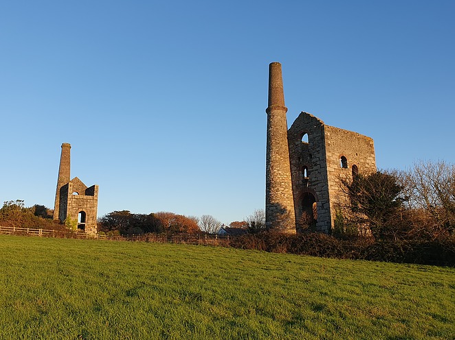
| Wheal Daniell, Chacewater, Cornwall, England, UK | 50° 15' 37" N | 5° 9' 41" W | 0.0km (0.0 miles) | |
| Wheal Seymour (Wheal Ann), Chacewater, Cornwall, England, UK | 50° 15' 49" N | 5° 10' 17" W | 0.8km (0.5 miles) | |
| Great Wheal Busy (Chacewater Mine), Chacewater, Cornwall, England, UK | 50° 15' 29" N | 5° 10' 26" W | 0.9km (0.6 miles) | |
| Carnhot Mine, Chacewater, Cornwall, England, UK | 50° 16' 5" N | 5° 10' 8" W | 1.0km (0.6 miles) | |
| Killifreth Mine, Chacewater, Cornwall, England, UK | 50° 15' 18" N | 5° 10' 35" W | 1.2km (0.8 miles) | |
| Creegbrawse and Penkevil Mine (Flat Rod Shaft), Creegbrawse, Chacewater, Cornwall, England, UK | 50° 14' 55" N | 5° 9' 44" W | 1.3km (0.8 miles) | |
| Creegbrawse and Penkevil Mine, Creegbrawse, Chacewater, Cornwall, England, UK | 50° 14' 54" N | 5° 9' 42" W | 1.3km (0.8 miles) | |
| Wheal Harriet, Creegbrawse and Penkevil Mine, Creegbrawse, Chacewater, Cornwall, England, UK | 50° 14' 55" N | 5° 9' 28" W | 1.3km (0.8 miles) | |
| Creegbrawse, Chacewater, Cornwall, England, UK | 50° 14' 54" N | 5° 9' 51" W | 1.3km (0.8 miles) | |
| Creegbrawse and Penkevil Mine (Flakey's Shaft), Creegbrawse, Chacewater, Cornwall, England, UK | 50° 14' 53" N | 5° 9' 48" W | 1.4km (0.8 miles) | |
| North Wheal Busy, Wheal Truro, Chacewater, Cornwall, England, UK | 50° 16' 4" N | 5° 10' 48" W | 1.6km (1.0 miles) | |
| Wheal Ree, Creegbrawse and Penkevil Mine, Creegbrawse, Chacewater, Cornwall, England, UK | 50° 14' 45" N | 5° 9' 47" W | 1.6km (1.0 miles) | |
| East Wheal Chance, Chacewater, Cornwall, England, UK | 50° 15' 22" N | 5° 11' 0" W | 1.6km (1.0 miles) | |
| Boscawen Mine (Wheal Andrew and Boscawen), Wheal Truro, Chacewater, Cornwall, England, UK | 50° 15' 48" N | 5° 11' 2" W | 1.6km (1.0 miles) | |
| Burra Burra Mine, Three Burrows, Kenwyn, Cornwall, England, UK | 50° 16' 32" N | 5° 9' 44" W | 1.7km (1.1 miles) | |
| Wheal Prosper (Tregothnan United Mines; New Wheal Clifford), Twelveheads, Chacewater, Cornwall, England, UK | 50° 14' 46" N | 5° 9' 2" W | 1.7km (1.1 miles) | |
| Three Burrows, Kenwyn, Cornwall, England, UK | 50° 16' 33" N | 5° 9' 45" W | 1.7km (1.1 miles) | |
| Prince Coburg Mine, Blackwater, St Agnes, Cornwall, England, UK | 50° 16' 27" N | 5° 10' 23" W | 1.8km (1.1 miles) | |
| Blackwater, St Agnes, Cornwall, England, UK | 50° 16' 18" N | 5° 10' 47" W | 1.8km (1.1 miles) | |
| Wheal Unity Wood (Tolgullow United Mine; West Poldice Mine), Chacewater, Cornwall, England, UK | 50° 14' 53" N | 5° 10' 48" W | 1.9km (1.2 miles) | |
| Wheal Gimp, Blackwater, St Agnes, Cornwall, England, UK | 50° 16' 17" N | 5° 10' 54" W | 1.9km (1.2 miles) | |
| Poldice Mine, St Day United Mines (Poldice Mines), St Day, Gwennap, Cornwall, England, UK | 50° 14' 32" N | 5° 9' 56" W | 2.0km (1.3 miles) | |
| Wheal Comfort, Three Burrows, Kenwyn, Cornwall, England, UK | 50° 16' 27" N | 5° 8' 33" W | 2.1km (1.3 miles) | |
| Bissa Pool Mine (Bissoe Pool Mine), Poldice Mine, St Day United Mines (Poldice Mines), St Day, Gwennap, Cornwall, England, UK | 50° 14' 29" N | 5° 9' 31" W | 2.1km (1.3 miles) | |
| Hallenbeagle Mine, Chacewater, Cornwall, England, UK | 50° 15' 28" N | 5° 11' 26" W | 2.1km (1.3 miles) | |
| Wheal Unity, St Day, Gwennap, Cornwall, England, UK | 50° 14' 34" N | 5° 10' 32" W | 2.2km (1.4 miles) | |
| Eastdowns Mine, Wheal Rose village, St Agnes, Cornwall, England, UK | 50° 15' 37" N | 5° 11' 31" W | 2.2km (1.4 miles) | |
| Wheal Briton, East Treskerby Mine, Skinners Bottom, St Agnes, Cornwall, England, UK | 50° 16' 7" N | 5° 11' 24" W | 2.2km (1.4 miles) | |
| Wheal Henry, Twelveheads, Chacewater, Cornwall, England, UK | 50° 14' 27" N | 5° 9' 11" W | 2.2km (1.4 miles) | |
| East Wheal Fortune, Twelveheads, Chacewater, Cornwall, England, UK | 50° 14' 34" N | 5° 8' 41" W | 2.3km (1.4 miles) | |


Wheal Unity Wood, Chacewater, Cornwall, England, UK