| Locality | Latitude | Longitude | Distance | Bearing |
|---|
| Amy-Matchless Mine, Pine Creek Mining District, Shoshone County, Idaho, USA | 47° 30' 34" N | 116° 14' 25" W | 0.0km (0.0 miles) | |
| Pine Creek, Shoshone County, Idaho, USA | 47° 30' 49" N | 116° 14' 34" W | 0.5km (0.3 miles) | |
| Pine Creek Mining District, Shoshone County, Idaho, USA | 47° 30' 50" N | 116° 14' 31" W | 0.5km (0.3 miles) | |
| Bobby Anderson Mine, Pine Creek Mining District, Shoshone County, Idaho, USA | 47° 30' 52" N | 116° 14' 23" W | 0.6km (0.4 miles) | |
| Northern Light Mine, Pine Creek Mining District, Shoshone County, Idaho, USA | 47° 30' 51" N | 116° 14' 42" W | 0.7km (0.4 miles) | |
| Carbonate Mine, Pine Creek Mining District, Shoshone County, Idaho, USA | 47° 30' 8" N | 116° 14' 20" W | 0.8km (0.5 miles) | |
| Gold Eagle Mine, Pine Creek Mining District, Shoshone County, Idaho, USA | 47° 31' 4" N | 116° 14' 21" W | 0.9km (0.6 miles) | |
| Liberal King Mine, Pine Creek Mining District, Shoshone County, Idaho, USA | 47° 29' 57" N | 116° 14' 17" W | 1.1km (0.7 miles) | |
| East Hypotheek Mine, Pine Creek Mining District, Shoshone County, Idaho, USA | 47° 29' 56" N | 116° 14' 33" W | 1.2km (0.7 miles) | |
| King Mine, Pine Creek Mining District, Shoshone County, Idaho, USA | 47° 29' 53" N | 116° 14' 33" W | 1.2km (0.8 miles) | |
| Corby prospect, Pine Creek Mining District, Shoshone County, Idaho, USA | 47° 31' 18" N | 116° 14' 20" W | 1.4km (0.9 miles) | |
| Silverstone, Pine Creek Mining District, Shoshone County, Idaho, USA | 47° 31' 17" N | 116° 14' 37" W | 1.4km (0.9 miles) | |
| Corby Mine, Pine Creek Mining District, Shoshone County, Idaho, USA | 47° 31' 19" N | 116° 14' 18" W | 1.4km (0.9 miles) | |
| Center Star, Pine Creek Mining District, Shoshone County, Idaho, USA | 47° 29' 59" N | 116° 13' 37" W | 1.5km (0.9 miles) | |
| Shoup Adit, Pine Creek Mining District, Shoshone County, Idaho, USA | 47° 31' 21" N | 116° 14' 36" W | 1.5km (0.9 miles) | |
| McKinely Extensions, Pine Creek Mining District, Shoshone County, Idaho, USA | 47° 29' 43" N | 116° 14' 18" W | 1.6km (1.0 miles) | |
| Silver prospects and adits, Pine Creek Mining District, Shoshone County, Idaho, USA | 47° 29' 48" N | 116° 13' 41" W | 1.7km (1.0 miles) | |
| Big Eight Prospect, Shoshone County, Idaho, USA | 47° 31' 30" N | 116° 13' 36" W | 2.0km (1.3 miles) | |
| Lookout Mountain Mine, Pine Creek Mining District, Shoshone County, Idaho, USA | 47° 29' 30" N | 116° 13' 58" W | 2.0km (1.3 miles) | |
| Great Helena, Pine Creek Mining District, Shoshone County, Idaho, USA | 47° 29' 41" N | 116° 13' 18" W | 2.1km (1.3 miles) | |
| Shetland Mining Company prospect, Pine Creek Mining District, Shoshone County, Idaho, USA | 47° 29' 45" N | 116° 13' 9" W | 2.2km (1.4 miles) | |
| Pine Creek Basin, Shoshone County, Idaho, USA | 47° 29' 46" N | 116° 16' 3" W | 2.5km (1.6 miles) | |
| Little Pine Creek prospect, Shoshone County, Idaho, USA | 47° 30' 28" N | 116° 12' 14" W | 2.7km (1.7 miles) | |
| Hypotheek Mine, Shoshone County, Idaho, USA | 47° 30' 41" N | 116° 16' 35" W | 2.7km (1.7 miles) | |
| Idaho prospect, Pine Creek Mining District, Shoshone County, Idaho, USA | 47° 29' 42" N | 116° 12' 35" W | 2.8km (1.7 miles) | |
| Great Dunkard Mine, Pine Creek Mining District, Shoshone County, Idaho, USA | 47° 29' 34" N | 116° 16' 10" W | 2.9km (1.8 miles) | |
| Fourth of July Sourdough Mine, Pine Creek Mining District, Shoshone County, Idaho, USA | 47° 32' 8" N | 116° 14' 38" W | 2.9km (1.8 miles) | |
| Pearson prospect, Pine Creek Mining District, Shoshone County, Idaho, USA | 47° 29' 32" N | 116° 16' 12" W | 2.9km (1.8 miles) | |
| Tiberius prospect, Shoshone County, Idaho, USA | 47° 29' 40" N | 116° 16' 22" W | 3.0km (1.8 miles) | |
| Coeur d'Alene Antimony Mine, Pine Creek Mining District, Shoshone County, Idaho, USA | 47° 32' 8" N | 116° 14' 48" W | 3.0km (1.8 miles) | |
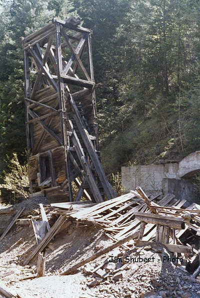


Constitution Mine, Pine Creek Mining District, Shoshone County, Idaho, USA