| Locality | Latitude | Longitude | Distance | Bearing |
|---|
| White Rocks, Killiney, Dublin County, Leinster, Ireland | 53° 16' 14" N | 6° 5' 43" W | 2.2km (1.4 miles) | |
| Ballycorus mine, Dublin County, Leinster, Ireland | 53° 12' 59" N | 6° 9' 30" W | 8.2km (5.1 miles) | |
| Barnacullia, Dublin County, Leinster, Ireland | 53° 15' 16" N | 6° 13' 53" W | 8.4km (5.2 miles) | |
| Bray Beach, Bray, Wicklow County, Leinster, Ireland | 53° 12' 10" N | 6° 5' 49" W | 9.3km (5.8 miles) | |
| Djouce Mt, Wicklow County, Leinster, Ireland | 53° 7' 48" N | 6° 14' 22" W | 19.2km (11.9 miles) | |
| Newtonmountkennedy, Wicklow County, Leinster, Ireland | 53° 5' 19" N | 6° 6' 39" W | 21.9km (13.6 miles) | |
| Luggala, Wicklow County, Leinster, Ireland | 53° 6' 4" N | 6° 15' 46" W | 22.7km (14.1 miles) | |
| Cloghleagh mine (Cloghlea mine), Kilbride, Blessington, Wicklow County, Leinster, Ireland | 53° 11' 40" N | 6° 25' 27" W | 22.9km (14.2 miles) | |
| Callowhill Upper, Newtonmountkennedy, Wicklow County, Leinster, Ireland | 53° 3' 36" N | 6° 8' 12" W | 25.1km (15.6 miles) | |
| Lough Dan mine, Lough Dan, Wicklow County, Leinster, Ireland | 53° 4' 36" N | 6° 18' 14" W | 26.4km (16.4 miles) | |
| Vesuvianite locality, Brown Mountain, Lough Dan, Wicklow County, Leinster, Ireland | 53° 4' 13" N | 6° 18' 33" W | 27.2km (16.9 miles) | |
| Copper mine, Loughshinny, Dublin County, Leinster, Ireland | 53° 32' 30" N | 6° 4' 45" W | 28.6km (17.8 miles) | |
| West Ruplagh lode, Glendasan, Wicklow County, Leinster, Ireland | 53° 2' 12" N | 6° 22' 24" W | 32.6km (20.2 miles) | |
| Ruplagh mine (Rupla mine), Glendasan, Wicklow County, Leinster, Ireland | 53° 2' 7" N | 6° 22' 13" W | 32.6km (20.3 miles) | |
| Foxrock mine, Glendasan, Wicklow County, Leinster, Ireland | 53° 1' 24" N | 6° 21' 18" W | 33.2km (20.6 miles) | |
| Hollyrock lode, Glendasan, Wicklow County, Leinster, Ireland | 53° 1' 23" N | 6° 21' 32" W | 33.4km (20.7 miles) | |
| Moll Doyle mine, Glendasan, Wicklow County, Leinster, Ireland | 53° 1' 18" N | 6° 21' 34" W | 33.5km (20.8 miles) | |
| North Hero lode, Glendasan, Wicklow County, Leinster, Ireland | 53° 1' 23" N | 6° 21' 47" W | 33.5km (20.8 miles) | |
| Camaderry Mountain, Glendalough, Wicklow County, Leinster, Ireland | 53° 1' 28" N | 6° 22' 37" W | 33.8km (21.0 miles) | |
| Old Luganure mine, Glendasan, Wicklow County, Leinster, Ireland | 53° 1' 18" N | 6° 22' 31" W | 34.0km (21.2 miles) | |
| Glendalough mine, Glendalough, Wicklow County, Leinster, Ireland | 53° 0' 21" N | 6° 22' 39" W | 35.7km (22.2 miles) | |
| Van Diemen's Land mines, Glendalough, Wicklow County, Leinster, Ireland | 53° 0' 20" N | 6° 23' 44" W | 36.3km (22.6 miles) | |
| Ballynagoneen mine, Glenmalure, Wicklow County, Leinster, Ireland | 52° 59' 39" N | 6° 25' 17" W | 38.3km (23.8 miles) | |
| Baravore mine, Glenmalure, Wicklow County, Leinster, Ireland | 52° 59' 22" N | 6° 25' 18" W | 38.7km (24.1 miles) | |
| Clonkeen mine, Glenmalure, Wicklow County, Leinster, Ireland | 52° 58' 33" N | 6° 23' 36" W | 39.1km (24.3 miles) | |
| Ballinafunshoge Mine, Glenmalure, Wicklow County, Leinster, Ireland | 52° 58' 23" N | 6° 23' 21" W | 39.3km (24.4 miles) | |
| Connary mine (Connorree mine), Avoca, Wicklow County, Leinster, Ireland | 52° 53' 30" N | 6° 12' 5" W | 44.2km (27.4 miles) | |
| Cronebane Mine, Avoca, Wicklow County, Leinster, Ireland | 52° 53' 16" N | 6° 12' 18" W | 44.7km (27.8 miles) | |
| Tigroney Mine (East Avoca Open Pit; St. Patrick's Mine), Avoca, Wicklow County, Leinster, Ireland | 52° 52' 57" N | 6° 12' 48" W | 45.3km (28.2 miles) | |
| Ballymurtagh Mine, Avoca, Wicklow County, Leinster, Ireland | 52° 52' 14" N | 6° 13' 28" W | 46.7km (29.0 miles) | |
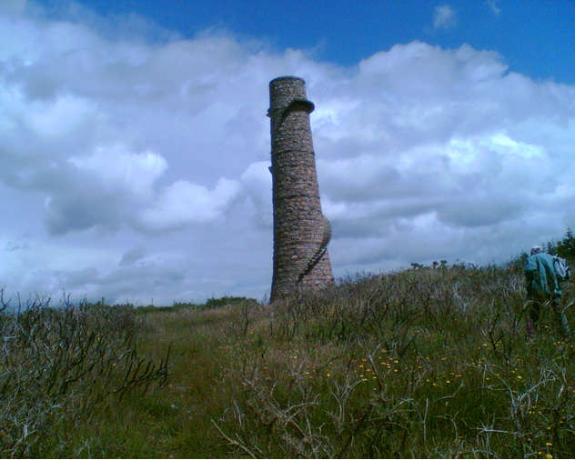


Ballycorus mine, Dublin County, Leinster, Ireland