| Locality | Latitude | Longitude | Distance | Bearing |
|---|
| Devonside Colliery, Clackmannanshire, Scotland, UK | 56° 8' 48" N | 3° 44' 41" W | 0.9km (0.5 miles) | |
| Gartmorn Colliery, Clackmannanshire, Scotland, UK | 56° 7' 56" N | 3° 44' 0" W | 0.9km (0.6 miles) | |
| Sheriffyards Colliery, Clackmannanshire, Scotland, UK | 56° 7' 55" N | 3° 43' 43" W | 1.0km (0.7 miles) | |
| Gartinkeir Colliery, Clackmannanshire, Scotland, UK | 56° 7' 54" N | 3° 43' 42" W | 1.1km (0.7 miles) | |
| Tillicoultry Colliery, Clackmannanshire, Scotland, UK | 56° 8' 53" N | 3° 43' 30" W | 1.1km (0.7 miles) | |
| Drummie Colliery, Clackmannanshire, Scotland, UK | 56° 8' 53" N | 3° 43' 30" W | 1.1km (0.7 miles) | |
| Fillicouthy Colliery, Clackmannanshire, Scotland, UK | 56° 8' 54" N | 3° 43' 30" W | 1.1km (0.7 miles) | |
| Melloch Colliery, Clackmannanshire, Scotland, UK | 56° 8' 55" N | 3° 43' 10" W | 1.4km (0.9 miles) | |
| Harviestoun Colliery, Clackmannanshire, Scotland, UK | 56° 9' 26" N | 3° 43' 37" W | 2.0km (1.2 miles) | |
| Alloa Jellyholm Pit, Clackmannanshire, Scotland, UK | 56° 7' 33" N | 3° 45' 23" W | 2.0km (1.3 miles) | |
| Devon Colliery, Clackmannanshire, Scotland, UK | 56° 7' 13" N | 3° 43' 36" W | 2.3km (1.4 miles) | |
| Menstrie Colliery, Clackmannanshire, Scotland, UK | 56° 8' 33" N | 3° 46' 31" W | 2.5km (1.5 miles) | |
| Devon Furnacebank Pits Nos 1 & 2 Colliery, Clackmannanshire, Scotland, UK | 56° 8' 34" N | 3° 46' 31" W | 2.5km (1.5 miles) | |
| Crophill Pit, Clackmannanshire, Scotland, UK | 56° 8' 30" N | 3° 46' 49" W | 2.7km (1.7 miles) | |
| Meta Colliery, Clackmannanshire, Scotland, UK | 56° 8' 30" N | 3° 46' 49" W | 2.8km (1.7 miles) | |
| Devon No.3 Meta Pit, Clackmannanshire, Scotland, UK | 56° 8' 30" N | 3° 46' 49" W | 2.8km (1.7 miles) | |
| Zetland Colliery, Clackmannanshire, Scotland, UK | 56° 6' 51" N | 3° 44' 48" W | 3.0km (1.9 miles) | |
| Sauchie Colliery, Clackmannanshire, Scotland, UK | 56° 7' 35" N | 3° 46' 48" W | 3.2km (2.0 miles) | |
| Tulligarth No.2 Pit, Clackmannanshire, Scotland, UK | 56° 6' 44" N | 3° 43' 32" W | 3.2km (2.0 miles) | |
| Castlebridge Colliery, Clackmannanshire, Scotland, UK | 56° 6' 53" N | 3° 42' 20" W | 3.4km (2.1 miles) | |
| Silver Glen, Alva, Clackmannanshire, Scotland, UK | 56° 9' 28" N | 3° 47' 4" W | 3.6km (2.2 miles) | |
| Collyland Colliery, Clackmannanshire, Scotland, UK | 56° 8' 14" N | 3° 47' 36" W | 3.6km (2.2 miles) | |
| Alva Silver Mine, Silver Glen, Alva, Clackmannanshire, Scotland, UK | 56° 9' 32" N | 3° 47' 3" W | 3.6km (2.2 miles) | |
| Tulligarth No.3 Pit, Clackmannanshire, Scotland, UK | 56° 6' 38" N | 3° 42' 37" W | 3.7km (2.3 miles) | |
| Alva, Clackmannanshire, Scotland, UK | 56° 9' 10" N | 3° 47' 57" W | 4.2km (2.6 miles) | |
| King O'Muirs No.1 Colliery, Clackmannanshire, Scotland, UK | 56° 8' 14" N | 3° 48' 17" W | 4.3km (2.7 miles) | |
| Brucefield Colliery, Clackmannanshire, Scotland, UK | 56° 6' 9" N | 3° 43' 17" W | 4.3km (2.7 miles) | |
| Craigrie b Colliery, Clackmannanshire, Scotland, UK | 56° 6' 13" N | 3° 45' 47" W | 4.4km (2.7 miles) | |
| Meadowhill Opencast coal mine, Clackmannanshire, Scotland, UK | 56° 7' 40" N | 3° 40' 3" W | 4.5km (2.8 miles) | |
| Alva Colliery, Clackmannanshire, Scotland, UK | 56° 8' 41" N | 3° 48' 36" W | 4.6km (2.9 miles) | |


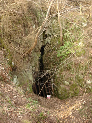


Alva Silver Mine, Silver Glen, Alva, Clackmannanshire, Scotland, UK