| Locality | Latitude | Longitude | Distance | Bearing |
|---|
| Steindorf, Niedernsill, Zell am See District, Salzburg, Austria | 47° 17' 12" N | 12° 38' 39" E | 0.8km (0.5 miles) | |
| Mühlbach, Niedernsill, Zell am See District, Salzburg, Austria | 47° 15' 46" N | 12° 39' 35" E | 2.3km (1.4 miles) | |
| Walchen, Piesendorf, Zell am See District, Salzburg, Austria | 47° 17' 21" N | 12° 41' 21" E | 2.8km (1.7 miles) | |
| Rifts near Mühlbach bridge, Niedernsill, Zell am See District, Salzburg, Austria | 47° 15' 1" N | 12° 39' 39" E | 3.7km (2.3 miles) | |
| Schaunberg Alp, Niedernsill, Zell am See District, Salzburg, Austria | 47° 13' 42" N | 12° 39' 28" E | 6.1km (3.8 miles) | |
| Grub Alp mines, Kaprun, Zell am See District, Salzburg, Austria | 47° 14' 20" N | 12° 42' 56" E | 6.8km (4.2 miles) | |
| Viertal Alp (Puderlehen Alp), Uttendorf, Zell am See District, Salzburg, Austria | 47° 18' 35" N | 12° 34' 7" E | 7.1km (4.4 miles) | |
| Lechnerberg slag locality, Kaprun, Zell am See District, Salzburg, Austria | 47° 15' 29" N | 12° 44' 26" E | 7.1km (4.4 miles) | |
| Lower Ferschbach Alp, Ferschbach valley, Fellern, Uttendorf, Zell am See District, Salzburg, Austria | 47° 15' 27" N | 12° 33' 56" E | 7.2km (4.5 miles) | |
| Reichersberg Alp, Hackbrettl, Enzingerboden, Uttendorf, Zell am See District, Salzburg, Austria | 47° 15' 27" N | 12° 33' 56" E | 7.2km (4.5 miles) | |
| Mooseggkarl, Dorfer Öd, Schneiderau, Uttendorf, Zell am See District, Salzburg, Austria | 47° 15' 27" N | 12° 33' 56" E | 7.2km (4.5 miles) | |
| Upper Ferschbach Alp, Ferschbach valley, Fellern, Uttendorf, Zell am See District, Salzburg, Austria | 47° 15' 27" N | 12° 33' 56" E | 7.2km (4.5 miles) | |
| Schrempf (Schrempf Alp; Gastegg Alp), Schneiderau, Uttendorf, Zell am See District, Salzburg, Austria | 47° 15' 27" N | 12° 33' 56" E | 7.2km (4.5 miles) | |
| Lakarscharte, Kaprun, Zell am See District, Salzburg, Austria | 47° 12' 59" N | 12° 40' 51" E | 7.7km (4.8 miles) | |
| Innerwiesen, Fellern, Uttendorf, Zell am See District, Salzburg, Austria | 47° 13' 58" N | 12° 34' 49" E | 7.9km (4.9 miles) | |
| Kaprun, Zell am See District, Salzburg, Austria | 47° 16' 20" N | 12° 45' 32" E | 8.0km (5.0 miles) | |
| Hofer Alp, Guggernbach valley (Lützlstubach), Uttendorf, Zell am See District, Salzburg, Austria | 47° 14' 8" N | 12° 34' 11" E | 8.2km (5.1 miles) | |
| Schrattwand, Guggernbach valley (Lützlstubach), Uttendorf, Zell am See District, Salzburg, Austria | 47° 14' 7" N | 12° 34' 10" E | 8.3km (5.1 miles) | |
| Steinkar, Guggernbach valley (Lützlstubach), Uttendorf, Zell am See District, Salzburg, Austria | 47° 14' 6" N | 12° 34' 4" E | 8.4km (5.2 miles) | |
| Fellern, Uttendorf, Zell am See District, Salzburg, Austria | 47° 13' 1" N | 12° 35' 59" E | 8.4km (5.2 miles) | |
| Geiger, Guggernbach valley (Lützlstubach), Uttendorf, Zell am See District, Salzburg, Austria | 47° 14' 6" N | 12° 34' 4" E | 8.4km (5.2 miles) | |
| Guggernbach stream, Guggernbach valley (Lützlstubach), Uttendorf, Zell am See District, Salzburg, Austria | 47° 14' 5" N | 12° 33' 54" E | 8.6km (5.3 miles) | |
| Guggernbach valley (Lützlstubach), Uttendorf, Zell am See District, Salzburg, Austria | 47° 14' 4" N | 12° 33' 52" E | 8.6km (5.4 miles) | |
| Scheibelberg, Stuhlfelden, Zell am See District, Salzburg, Austria | 47° 16' 2" N | 12° 32' 4" E | 9.2km (5.7 miles) | |
| Limberg mining area, Zell am See, Zell am See District, Salzburg, Austria | 47° 17' 19" N | 12° 46' 31" E | 9.2km (5.7 miles) | |
| Holland Alp, Guggernbach valley (Lützlstubach), Uttendorf, Zell am See District, Salzburg, Austria | 47° 13' 46" N | 12° 33' 18" E | 9.5km (5.9 miles) | |
| Schmieding glacier, Kaprun, Zell am See District, Salzburg, Austria | 47° 11' 39" N | 12° 40' 51" E | 10.1km (6.3 miles) | |
| Brandlscharte, Kaprun, Zell am See District, Salzburg, Austria | 47° 13' 42" N | 12° 45' 55" E | 10.4km (6.4 miles) | |
| Imbachhorn, Fusch an der Grossglocknerstrasse, Zell am See District, Salzburg, Austria | 47° 13' 55" N | 12° 46' 15" E | 10.5km (6.5 miles) | |
| Hirzbach water tunnel, Kaprun, Zell am See District, Salzburg, Austria | 47° 11' 55" N | 12° 43' 29" E | 10.8km (6.7 miles) | |
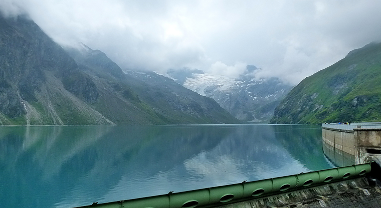


Mooser dam, Mooserboden reservoir, Kaprun, Zell am See District, Salzburg, Austria