| Locality | Latitude | Longitude | Distance | Bearing |
|---|
| Meerbrook Sough mine, Wirksworth, Derbyshire Dales District, Derbyshire, England, UK | 53° 5' 5" N | 1° 33' 50" W | 0.7km (0.4 miles) | |
| Bage Mine, Wirksworth, Derbyshire Dales District, Derbyshire, England, UK | 53° 4' 32" N | 1° 33' 56" W | 0.9km (0.6 miles) | |
| Middle Peak Quarry, Wirksworth, Derbyshire Dales District, Derbyshire, England, UK | 53° 5' 20" N | 1° 34' 57" W | 0.9km (0.6 miles) | |
| Ranter Mine (Rent Tor Mine), Wirksworth, Derbyshire Dales District, Derbyshire, England, UK | 53° 5' 27" N | 1° 34' 32" W | 1.0km (0.6 miles) | |
| Wallclose Mine, Wirksworth, Derbyshire Dales District, Derbyshire, England, UK | 53° 5' 30" N | 1° 33' 55" W | 1.2km (0.8 miles) | |
| Steeplehouse Quarry, Wirksworth, Derbyshire Dales District, Derbyshire, England, UK | 53° 5' 40" N | 1° 34' 10" W | 1.4km (0.9 miles) | |
| Bolehill, Cromford, Derbyshire Dales District, Derbyshire, England, UK | 53° 5' 38" N | 1° 33' 45" W | 1.5km (0.9 miles) | |
| Black Rocks, Cromford, Derbyshire Dales District, Derbyshire, England, UK | 53° 5' 53" N | 1° 33' 50" W | 1.9km (1.2 miles) | |
| Middleton Mine, Wirksworth, Derbyshire Dales District, Derbyshire, England, UK | 53° 5' 33" N | 1° 35' 51" W | 2.0km (1.2 miles) | |
| Adventure mine, Cromford, Derbyshire Dales District, Derbyshire, England, UK | 53° 6' 0" N | 1° 34' 0" W | 2.0km (1.3 miles) | |
| Level mine, Cromford, Derbyshire Dales District, Derbyshire, England, UK | 53° 6' 0" N | 1° 34' 0" W | 2.0km (1.3 miles) | |
| Shining Cloud mine, Hopton, Derbyshire Dales District, Derbyshire, England, UK | 53° 5' 2" N | 1° 36' 15" W | 2.0km (1.3 miles) | |
| Gallows Knoll, Wirksworth, Derbyshire Dales District, Derbyshire, England, UK | 53° 5' 12" N | 1° 36' 15" W | 2.1km (1.3 miles) | |
| Dene Quarry, Cromford, Derbyshire Dales District, Derbyshire, England, UK | 53° 6' 8" N | 1° 34' 21" W | 2.2km (1.4 miles) | |
| Hopton cross-roads, Hopton, Derbyshire Dales District, Derbyshire, England, UK | 53° 5' 12" N | 1° 36' 30" W | 2.4km (1.5 miles) | |
| Hoptonwood Quarry, Middleton, Derbyshire Dales District, Derbyshire, England, UK | 53° 5' 44" N | 1° 36' 24" W | 2.7km (1.6 miles) | |
| Doglow Wood, Hopton, Derbyshire Dales District, Derbyshire, England, UK | 53° 4' 46" N | 1° 36' 53" W | 2.7km (1.7 miles) | |
| Good Luck Mine, Via Gellia, Middleton, Derbyshire Dales District, Derbyshire, England, UK | 53° 6' 15" N | 1° 35' 47" W | 2.9km (1.8 miles) | |
| Chance mine, Hopton, Derbyshire Dales District, Derbyshire, England, UK | 53° 5' 18" N | 1° 36' 58" W | 2.9km (1.8 miles) | |
| Cromford Sough, Cromford, Derbyshire Dales District, Derbyshire, England, UK | 53° 6' 26" N | 1° 33' 33" W | 2.9km (1.8 miles) | |
| Bone Mill Quarry, Hopton, Derbyshire Dales District, Derbyshire, England, UK | 53° 5' 21" N | 1° 37' 2" W | 3.0km (1.9 miles) | |
| Cromford Rock mine, Cromford, Derbyshire Dales District, Derbyshire, England, UK | 53° 6' 29" N | 1° 33' 28" W | 3.1km (1.9 miles) | |
| Middleton Flats, Via Gellia, Middleton, Derbyshire Dales District, Derbyshire, England, UK | 53° 6' 33" N | 1° 35' 20" W | 3.1km (2.0 miles) | |
| Ball Eye Quarry, Bonsall, Derbyshire Dales District, Derbyshire, England, UK | 53° 6' 44" N | 1° 34' 15" W | 3.4km (2.1 miles) | |
| Slaley Quarry (Parish Quarry), Bonsall, Derbyshire Dales District, Derbyshire, England, UK | 53° 6' 42" N | 1° 35' 26" W | 3.5km (2.2 miles) | |
| Alderwasley Colliery, Amber Valley, Derbyshire, England, UK | 53° 5' 4" N | 1° 31' 18" W | 3.5km (2.2 miles) | |
| Ball Eye Mine, Bonsall, Derbyshire Dales District, Derbyshire, England, UK | 53° 6' 50" N | 1° 34' 27" W | 3.5km (2.2 miles) | |
| Dido's Cave, Matlock, Derbyshire Dales District, Derbyshire, England, UK | 53° 6' 45" N | 1° 33' 27" W | 3.5km (2.2 miles) | |
| Wapping Mine, Matlock Bath, Derbyshire Dales District, Derbyshire, England, UK | 53° 6' 48" N | 1° 33' 38" W | 3.6km (2.2 miles) | |
| Griffe Grange, Hopton, Derbyshire Dales District, Derbyshire, England, UK | 53° 5' 27" N | 1° 37' 35" W | 3.6km (2.3 miles) | |
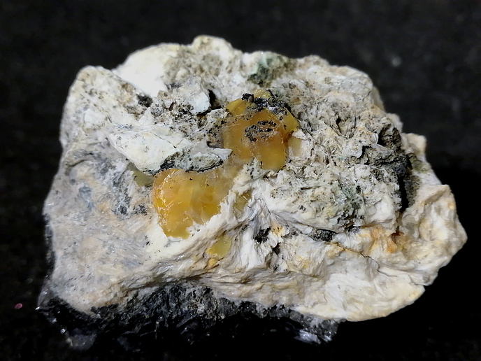


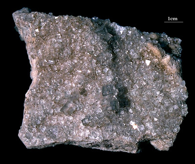


Bage Mine, Wirksworth, Derbyshire Dales District, Derbyshire, England, UK