| Locality | Latitude | Longitude | Distance | Bearing |
|---|
| Torphins, Banchory, Aberdeenshire, Scotland, UK | 57° 6' 18" N | 2° 37' 22" W | 4.6km (2.9 miles) | |
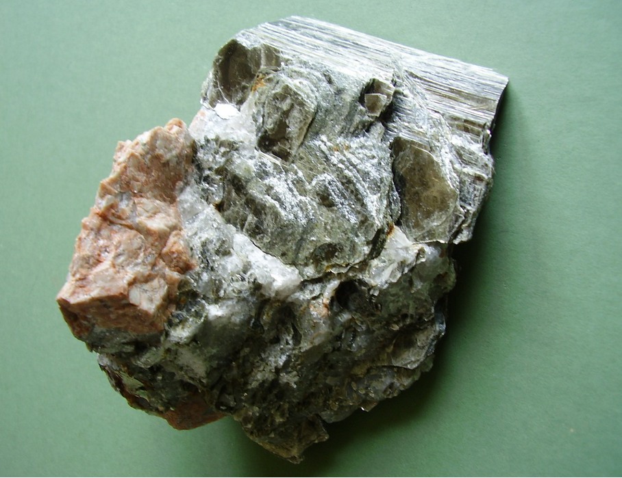
| Craiglash Quarry, Torphins, Banchory, Aberdeenshire, Scotland, UK | 57° 4' 40" N | 2° 37' 30" W | 6.6km (4.1 miles) | |
| Alford, Aberdeenshire, Scotland, UK | 57° 13' 59" N | 2° 42' 17" W | 11.9km (7.4 miles) | |
| Auchintoul, Alford, Aberdeenshire, Scotland, UK | 57° 14' 15" N | 2° 46' 18" W | 13.3km (8.3 miles) | |
| Banchory, Aberdeenshire, Scotland, UK | 57° 3' 13" N | 2° 29' 27" W | 14.4km (9.0 miles) | |
| Don river bridge, Keig, Alford, Aberdeenshire, Scotland, UK | 57° 15' 25" N | 2° 38' 5" W | 14.9km (9.2 miles) | |
| Keig, Alford, Aberdeenshire, Scotland, UK | 57° 15' 36" N | 2° 38' 37" W | 15.1km (9.4 miles) | |
| Brindy Hill south slope, Aberdeenshire, Scotland, UK | 57° 16' 48" N | 2° 38' 29" W | 17.3km (10.8 miles) | |
| Queel Burn, Aberdeenshire, Scotland, UK | 57° 4' 42" N | 2° 59' 7" W | 18.7km (11.6 miles) | |
| Culblean Hill, Ballater, Aberdeenshire, Scotland, UK | 57° 4' 59" N | 3° 0' 0" W | 19.4km (12.1 miles) | |
| Mount Battock, Aberdeenshire, Scotland, UK | 56° 56' 57" N | 2° 44' 31" W | 20.0km (12.4 miles) | |
| Mill of Johnston, Insch, Aberdeenshire, Scotland, UK | 57° 18' 32" N | 2° 42' 25" W | 20.3km (12.6 miles) | |
| Leslie, Aberdeenshire, Scotland, UK | 57° 18' 41" N | 2° 40' 11" W | 20.6km (12.8 miles) | |
| Lumsden, Rhynie, Aberdeenshire, Scotland, UK | 57° 17' 8" N | 2° 52' 26" W | 20.9km (13.0 miles) | |
| Premnay, Aberdeenshire, Scotland, UK | 57° 18' 48" N | 2° 37' 55" W | 21.1km (13.1 miles) | |
| Clova, Lumsden, Rhynie, Aberdeenshire, Scotland, UK | 57° 17' 14" N | 2° 53' 50" W | 21.9km (13.6 miles) | |
| Bennachie, Inverurie, Aberdeenshire, Scotland, UK | 57° 18' 40" N | 2° 33' 47" W | 21.9km (13.6 miles) | |
| Pass of Ballater, Ballater, Aberdeenshire, Scotland, UK | 57° 3' 42" N | 3° 2' 31" W | 22.6km (14.0 miles) | |
| Creag an t-Seabhaig, Ballater, Aberdeenshire, Scotland, UK | 57° 3' 42" N | 3° 2' 31" W | 22.6km (14.0 miles) | |
| Ballater, Aberdeenshire, Scotland, UK | 57° 2' 57" N | 3° 2' 24" W | 22.9km (14.2 miles) | |
| Upper Middleton, Chapel of Garioch, Inverurie, Aberdeenshire, Scotland, UK | 57° 17' 16" N | 2° 26' 57" W | 23.0km (14.3 miles) | |
| Abergairn Mine, Glen Gairn, Ballater, Aberdeenshire, Scotland, UK | 57° 3' 44" N | 3° 3' 37" W | 23.6km (14.6 miles) | |
| Clashnarae Hill, Clova, Lumsden, Rhynie, Aberdeenshire, Scotland, UK | 57° 16' 32" N | 2° 58' 14" W | 23.7km (14.8 miles) | |
| Chapel of Garioch, Inverurie, Aberdeenshire, Scotland, UK | 57° 18' 18" N | 2° 28' 16" W | 23.8km (14.8 miles) | |
| Insch, Aberdeenshire, Scotland, UK | 57° 20' 29" N | 2° 36' 42" W | 24.3km (15.1 miles) | |
| Rhynie, Aberdeenshire, Scotland, UK | 57° 19' 59" N | 2° 50' 7" W | 24.6km (15.3 miles) | |
| Craig Wood, Glenbuchat, Strathdon, Aberdeenshire, Scotland, UK | 57° 14' 13" N | 3° 2' 34" W | 24.7km (15.3 miles) | |
| Green Burn, North Esk, Aberdeenshire, Scotland, UK | 56° 54' 14" N | 2° 44' 5" W | 24.9km (15.5 miles) | |
| Strathdon, Aberdeenshire, Scotland, UK | 57° 11' 59" N | 3° 4' 44" W | 24.9km (15.5 miles) | |
| Rhynie chert lagerstätte, Rhynie, Aberdeenshire, Scotland, UK | 57° 20' 16" N | 2° 50' 17" W | 25.2km (15.6 miles) | |


Craiglash Quarry, Torphins, Banchory, Aberdeenshire, Scotland, UK