| Locality | Latitude | Longitude | Distance | Bearing |
|---|
| Sedbusk Colliery, Richmondshire, North Yorkshire, England, UK | 54° 19' 11" N | 2° 11' 4" W | 1.9km (1.2 miles) | |
| Raygill Level, Hawes, Richmondshire, North Yorkshire, England, UK | 54° 18' 16" N | 2° 9' 2" W | 2.9km (1.8 miles) | |
| Storth a Colliery, Hawes, Richmondshire, North Yorkshire, England, UK | 54° 16' 25" N | 2° 12' 34" W | 3.5km (2.1 miles) | |
| Hearne Coal Road Colliery, Richmondshire, North Yorkshire, England, UK | 54° 20' 28" N | 2° 13' 56" W | 4.8km (3.0 miles) | |
| Bank Gill Colliery, Hawes, Richmondshire, North Yorkshire, England, UK | 54° 15' 48" N | 2° 13' 30" W | 4.9km (3.0 miles) | |
| Mossdale Gill Colliery, Hawes, Richmondshire, North Yorkshire, England, UK | 54° 19' 2" N | 2° 16' 27" W | 5.3km (3.3 miles) | |
| Willy Coal Pit, Richmondshire, North Yorkshire, England, UK | 54° 21' 6" N | 2° 11' 57" W | 5.3km (3.3 miles) | |
| Cotterdale Pits, Richmondshire, North Yorkshire, England, UK | 54° 20' 54" N | 2° 14' 42" W | 5.9km (3.7 miles) | |
| West Pits, Richmondshire, North Yorkshire, England, UK | 54° 21' 23" N | 2° 13' 39" W | 6.2km (3.9 miles) | |
| Hearne Pit Level, Richmondshire, North Yorkshire, England, UK | 54° 21' 22" N | 2° 13' 58" W | 6.3km (3.9 miles) | |
| Hearne Pits, Richmondshire, North Yorkshire, England, UK | 54° 21' 26" N | 2° 13' 58" W | 6.4km (4.0 miles) | |
| Turney Fell Colliery, Richmondshire, North Yorkshire, England, UK | 54° 21' 26" N | 2° 13' 58" W | 6.4km (4.0 miles) | |
| Oughtershaw Side Mine, Buckden, Craven, North Yorkshire, England, UK | 54° 14' 58" N | 2° 13' 59" W | 6.5km (4.0 miles) | |
| Cotterdale Colliery, Richmondshire, North Yorkshire, England, UK | 54° 21' 18" N | 2° 14' 56" W | 6.6km (4.1 miles) | |
| Sikes Pits, Hawes, Richmondshire, North Yorkshire, England, UK | 54° 18' 18" N | 2° 19' 3" W | 7.9km (4.9 miles) | |
| Moorcock Pits, Hawes, Richmondshire, North Yorkshire, England, UK | 54° 19' 46" N | 2° 18' 37" W | 7.9km (4.9 miles) | |
| Worton Hall Level, Askrigg, Richmondshire, North Yorkshire, England, UK | 54° 18' 22" N | 2° 4' 14" W | 8.1km (5.1 miles) | |
| Beezy String, Askrigg, Richmondshire, North Yorkshire, England, UK | 54° 20' 38" N | 2° 5' 10" W | 8.4km (5.2 miles) | |
| Garsdale Coal Pits, Garsdale, South Lakeland, Cumbria, England, UK | 54° 18' 17" N | 2° 19' 46" W | 8.7km (5.4 miles) | |
| Cross Pits, Dent, South Lakeland, Cumbria, England, UK | 54° 16' 22" N | 2° 19' 15" W | 8.8km (5.5 miles) | |
| Stockdale Colliery, Muker, Richmondshire, North Yorkshire, England, UK | 54° 23' 0" N | 2° 12' 0" W | 8.8km (5.5 miles) | |
| Cowgill Head Coal Pit, Dent, South Lakeland, Cumbria, England, UK | 54° 17' 39" N | 2° 19' 54" W | 8.9km (5.5 miles) | |
| Lousegill Pits, Dent, South Lakeland, Cumbria, England, UK | 54° 17' 52" N | 2° 20' 0" W | 8.9km (5.6 miles) | |
| Great Sleddale (Great Sled Dale), Muker, Richmondshire, North Yorkshire, England, UK | 54° 23' 3" N | 2° 16' 4" W | 10.1km (6.3 miles) | |
| Windgates Colliery, Grinton, Richmondshire, North Yorkshire, England, UK | 54° 20' 54" N | 2° 3' 16" W | 10.4km (6.5 miles) | |
| Yockenthwaite Colliery, Buckden, Craven, North Yorkshire, England, UK | 54° 12' 43" N | 2° 8' 37" W | 10.7km (6.7 miles) | |
| Disher Force Level, Carperby-cum-Thoresby, Richmondshire, North Yorkshire, England, UK | 54° 18' 29" N | 2° 1' 45" W | 10.8km (6.7 miles) | |
| Thackthwaite Beck Hush, Carperby-cum-Thoresby, Richmondshire, North Yorkshire, England, UK | 54° 18' 42" N | 2° 1' 34" W | 11.1km (6.9 miles) | |
| Brownfield Mine, Carperby-cum-Thoresby, Richmondshire, North Yorkshire, England, UK | 54° 19' 46" N | 2° 1' 50" W | 11.1km (6.9 miles) | |
| Ivy Scar, Carperby-cum-Thoresby, Richmondshire, North Yorkshire, England, UK | 54° 18' 32" N | 2° 1' 23" W | 11.2km (7.0 miles) | |
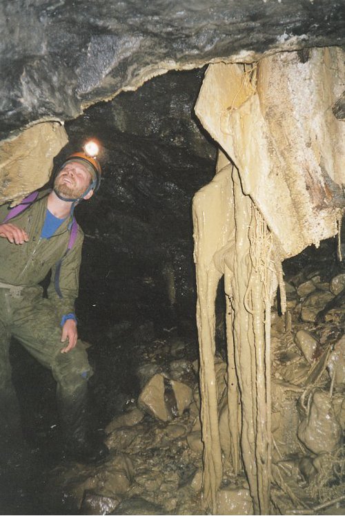


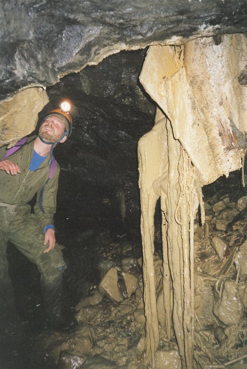


Raygill Level, Hawes, Richmondshire, North Yorkshire, England, UK