| Locality | Latitude | Longitude | Distance | Bearing |
|---|
| Ballachulish, Fort William and Ardnamurchan, Highland, Scotland, UK | 56° 40' 26" N | 5° 8' 1" W | 0.4km (0.2 miles) | |
| Slate quarry, Ballachulish, Fort William and Ardnamurchan, Highland, Scotland, UK | 56° 40' 34" N | 5° 7' 35" W | 0.7km (0.5 miles) | |
| Allt Guibhsachain, Ballachulish, Fort William and Ardnamurchan, Highland, Scotland, UK | 56° 40' 26" N | 5° 9' 39" W | 1.4km (0.9 miles) | |
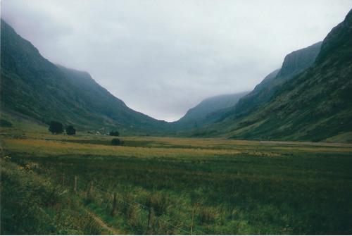
| Glen Coe, Fort William and Ardnamurchan, Highland, Scotland, UK | 56° 40' 8" N | 5° 1' 33" W | 6.9km (4.3 miles) | |
| Sron Gharbh (Sron Garbh), Fort William and Ardnamurchan, Highland, Scotland, UK | 56° 40' 56" N | 4° 58' 35" W | 9.9km (6.2 miles) | |
| Glen Creran, Argyll and Bute, Scotland, UK | 56° 34' 59" N | 5° 12' 0" W | 10.9km (6.8 miles) | |
| Glen Etive, Fort William and Ardnamurchan, Highland, Scotland, UK | 56° 34' 0" N | 5° 2' 59" W | 13.3km (8.3 miles) | |
| Coire Buidhe, Glen Creran, Argyll and Bute, Scotland, UK | 56° 32' 35" N | 5° 11' 53" W | 15.2km (9.4 miles) | |
| Coire an Lochain, Fort William and Ardnamurchan, Highland, Scotland, UK | 56° 44' 49" N | 4° 54' 15" W | 16.4km (10.2 miles) | |
| Clashgorm Mine, Strontian, Fort William and Ardnamurchan, Highland, Scotland, UK | 56° 44' 16" N | 5° 22' 53" W | 16.4km (10.2 miles) | |
| Coire an Lubhair, Glen Tarbert, Fort William and Ardnamurchan, Highland, Scotland, UK | 56° 42' 40" N | 5° 24' 25" W | 16.9km (10.5 miles) | |
| Banavie Quarry, Caol and Mallaig, Highland, Scotland, UK | 56° 50' 58" N | 5° 5' 52" W | 19.5km (12.1 miles) | |
| Glen Tarbert, Fort William and Ardnamurchan, Highland, Scotland, UK | 56° 41' 18" N | 5° 28' 8" W | 20.2km (12.6 miles) | |
| Fee Donald mine, Strontian, Fort William and Ardnamurchan, Highland, Scotland, UK | 56° 44' 24" N | 5° 30' 1" W | 23.2km (14.4 miles) | |
| Bellsgrove Mine (Bellsgrove Opencut), Strontian, Fort William and Ardnamurchan, Highland, Scotland, UK | 56° 44' 1" N | 5° 31' 58" W | 24.9km (15.5 miles) | |
| Bellsgrove Quarry (Strontian Barytes Mine; Middleshop mine), Strontian, Fort William and Ardnamurchan, Highland, Scotland, UK | 56° 44' 1" N | 5° 32' 17" W | 25.2km (15.7 miles) | |
| Glen Loy, Loch Eil, Caol and Mallaig, Highland, Scotland, UK | 56° 54' 13" N | 5° 5' 27" W | 25.5km (15.9 miles) | |
| Strontian, Fort William and Ardnamurchan, Highland, Scotland, UK | 56° 41' 45" N | 5° 34' 8" W | 26.4km (16.4 miles) | |
| Whitesmith Mine, Strontian, Fort William and Ardnamurchan, Highland, Scotland, UK | 56° 44' 2" N | 5° 33' 33" W | 26.5km (16.5 miles) | |
| Glensanda Quarry (Glensanda Superquarry), Morvern, East Sutherland and Edderton, Highland, Scotland, UK | 56° 35' 14" N | 5° 33' 33" W | 27.6km (17.1 miles) | |
| Unidentified Quarry, Caol and Mallaig, Highland, Scotland, UK | 56° 54' 30" N | 4° 57' 59" W | 27.9km (17.3 miles) | |
| Gairlochy Quarry, Caol and Mallaig, Highland, Scotland, UK | 56° 54' 46" N | 4° 58' 53" W | 28.1km (17.4 miles) | |
| Corrantee Mine, Strontian, Fort William and Ardnamurchan, Highland, Scotland, UK | 56° 44' 1" N | 5° 35' 49" W | 28.7km (17.9 miles) | |
| Glen Orchy, Argyll and Bute, Scotland, UK | 56° 28' 2" N | 4° 49' 57" W | 29.8km (18.5 miles) | |
| Beinn Udlaidh, Glen Orchy, Argyll and Bute, Scotland, UK | 56° 28' 23" N | 4° 47' 22" W | 31.1km (19.3 miles) | |
| Beinn Resipol, Strontian, Fort William and Ardnamurchan, Highland, Scotland, UK | 56° 43' 40" N | 5° 38' 44" W | 31.5km (19.6 miles) | |
| Sgurr a Choire Riabhaich, Loch Morar, Caol and Mallaig, Highland, Scotland, UK | 56° 55' 37" N | 5° 26' 5" W | 33.3km (20.7 miles) | |
| Carnan Cruithneachd, Glen Elchaig, Wester Ross, Strathpeffer and Lochalsh, Highland, Scotland, UK | 56° 22' 55" N | 5° 14' 52" W | 33.3km (20.7 miles) | |
| Lurga Mine, Morvern, East Sutherland and Edderton, Highland, Scotland, UK | 56° 38' 8" N | 5° 41' 32" W | 34.1km (21.2 miles) | |
| Cononish Gold mine, Tyndrum, Stirling, Scotland, UK | 56° 25' 7" N | 4° 46' 17" W | 36.4km (22.6 miles) | |
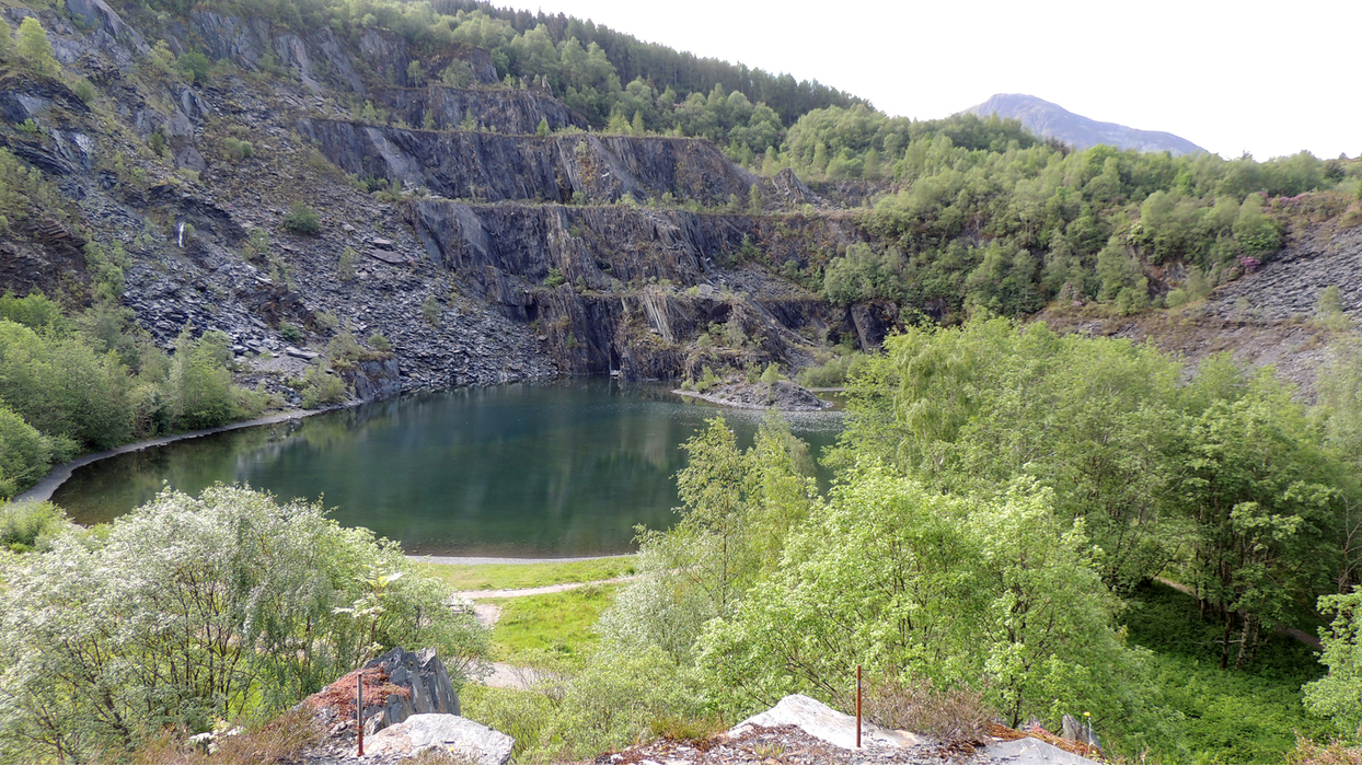


Slate quarry, Ballachulish, Fort William and Ardnamurchan, Highland, Scotland, UK