| Locality | Latitude | Longitude | Distance | Bearing |
|---|
| Old Meuse River meanders, Dilsen-Stokkem, Limburg, Flanders, Belgium | 51° 2' 7" N | 5° 44' 31" E | 2.6km (1.6 miles) | |
| Elen borehole, Elen, Dilsen-Stokkem, Limburg, Flanders, Belgium | 51° 4' 6" N | 5° 45' 8" E | 3.3km (2.0 miles) | |
| Rotem slag locality, Rotem, Dilsen-Stokkem, Limburg, Flanders, Belgium | 51° 2' 58" N | 5° 41' 46" E | 5.7km (3.5 miles) | |
| Dragetra pit, Aldeneik, Maaseik, Limburg, Flanders, Belgium | 51° 5' 56" N | 5° 48' 55" E | 6.7km (4.2 miles) | |
| Eisden colliery, Eisden, Maasmechelen, Limburg, Flanders, Belgium | 51° 0' 7" N | 5° 42' 18" E | 6.8km (4.2 miles) | |
| Aldeneik, Maaseik, Limburg, Flanders, Belgium | 51° 6' 10" N | 5° 48' 19" E | 6.9km (4.3 miles) | |
| Neeroeteren borehole, Neeroeteren, Maaseik, Limburg, Flanders, Belgium | 51° 5' 33" N | 5° 42' 8" E | 7.5km (4.7 miles) | |
| Maurits mine, Geleen, Sittard-Geleen, Limburg, Netherlands | 50° 58' 26" N | 5° 48' 38" E | 8.1km (5.0 miles) | |
| Scharberg, Elsloo, Stein, Limburg, Netherlands | 50° 57' 16" N | 5° 45' 46" E | 9.9km (6.2 miles) | |
| Hermans quarry, As, Limburg, Flanders, Belgium | 51° 0' 29" N | 5° 35' 45" E | 13.2km (8.2 miles) | |
| Spaubeek quarry, Spaubeek, Beek, Limburg, Netherlands | 50° 55' 52" N | 5° 50' 52" E | 13.4km (8.3 miles) | |
| Kikbeekbron quarry, Mechelen-aan-de-Maas, Maasmechelen, Limburg, Flanders, Belgium | 50° 57' 20" N | 5° 38' 5" E | 13.9km (8.6 miles) | |
| Nagelbeek quarry, Schinnen, Beekdaelen, Limburg, Netherlands | 50° 55' 42" N | 5° 51' 31" E | 14.0km (8.7 miles) | |
| Panheel, Maasgouw, Limburg, Netherlands | 51° 10' 34" N | 5° 52' 19" E | 16.2km (10.1 miles) | |
| Waterschei colliery, Waterschei, Genk, Limburg, Flanders, Belgium | 51° 0' 43" N | 5° 32' 31" E | 16.7km (10.4 miles) | |
| Emma mine, Brunssum, Limburg, Netherlands | 50° 55' 54" N | 5° 56' 52" E | 17.3km (10.7 miles) | |
| Hendrik mine, Brunssum, Limburg, Netherlands | 50° 56' 18" N | 5° 58' 41" E | 18.3km (11.4 miles) | |
| Waterschei, Genk, Limburg, Flanders, Belgium | 50° 59' 45" N | 5° 31' 19" E | 18.6km (11.5 miles) | |
| Boschhoef, Ravensbos forest, Valkenburg aan de Geul, Limburg, Netherlands | 50° 52' 38" N | 5° 48' 52" E | 18.7km (11.6 miles) | |
| Oranje-Nassau-III mine, Heerlen, Limburg, Netherlands | 50° 55' 16" N | 5° 57' 49" E | 18.9km (11.7 miles) | |
| Houthem, Valkenburg aan de Geul, Limburg, Netherlands | 50° 52' 20" N | 5° 47' 42" E | 19.0km (11.8 miles) | |
| Bronsdael quarry, Berg en Terblijt, Valkenburg aan de Geul, Limburg, Netherlands | 50° 52' 14" N | 5° 46' 36" E | 19.2km (11.9 miles) | |
| Zwartberg, Genk, Limburg, Flanders, Belgium | 51° 0' 28" N | 5° 30' 27" E | 19.2km (11.9 miles) | |
| Beaujean sand pit, Heerlen, Limburg, Netherlands | 50° 55' 2" N | 5° 58' 2" E | 19.4km (12.0 miles) | |
| Geulhem, Berg en Terblijt, Valkenburg aan de Geul, Limburg, Netherlands | 50° 52' 7" N | 5° 47' 0" E | 19.4km (12.1 miles) | |
| Curfs quarry, Berg en Terblijt, Valkenburg aan de Geul, Limburg, Netherlands | 50° 52' 6" N | 5° 46' 0" E | 19.4km (12.1 miles) | |
| Marl quarry, Geulhem, Berg en Terblijt, Valkenburg aan de Geul, Limburg, Netherlands | 50° 52' 6" N | 5° 47' 6" E | 19.5km (12.1 miles) | |
| Hendrik-Emma dumps, Brunssum, Limburg, Netherlands | 50° 56' 47" N | 6° 0' 30" E | 19.5km (12.1 miles) | |
| Amor quarry, Geulhem, Berg en Terblijt, Valkenburg aan de Geul, Limburg, Netherlands | 50° 52' 4" N | 5° 47' 13" E | 19.5km (12.1 miles) | |
| Bret-Gelieren, Genk, Limburg, Flanders, Belgium | 50° 58' 25" N | 5° 31' 9" E | 19.6km (12.2 miles) | |
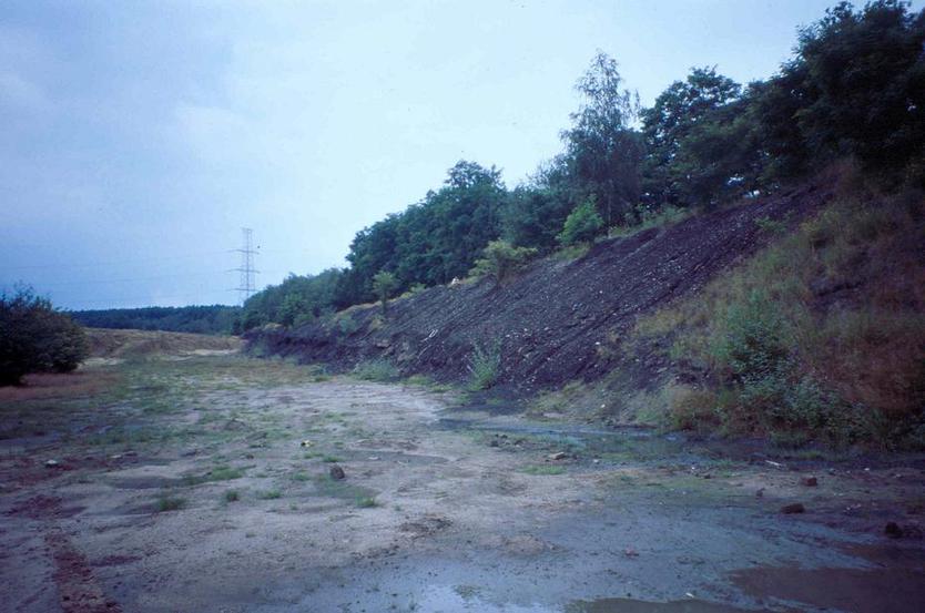


Rotem slag locality, Rotem, Dilsen-Stokkem, Limburg, Flanders, Belgium