| Locality | Latitude | Longitude | Distance | Bearing |
|---|
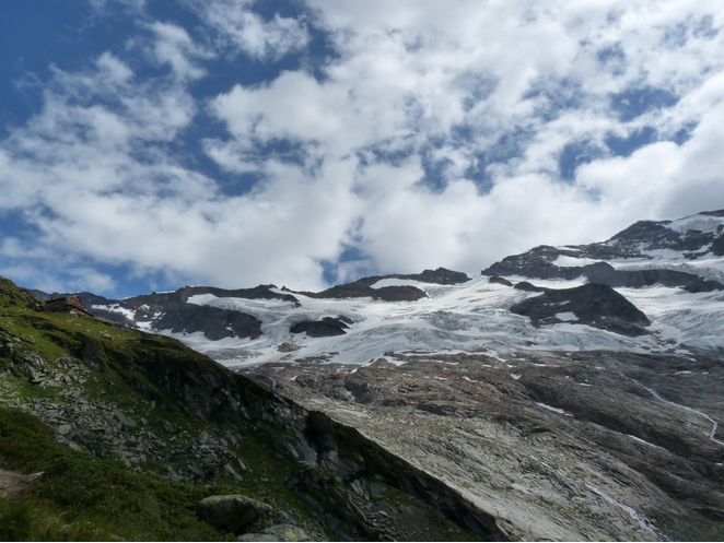
| Hinterer Maurerkeeskopf south slope, Maurerbach valley, Ströden, Hinterbichl, Prägraten am Großvenediger, Lienz District, Tyrol, Austria | 47° 5' 33" N | 12° 17' 0" E | 0.0km (0.0 miles) | |
| Hinterer Maurerkeeskopf north slope, Krimml, Zell am See District, Salzburg, Austria | 47° 5' 30" N | 12° 16' 59" E | 0.1km (0.1 miles) | |
| Mauerkeeskopf, Neukirchen am Großvenediger, Zell am See District, Salzburg, Austria | 47° 5' 38" N | 12° 17' 6" E | 0.2km (0.1 miles) | |
| Gamsspitzl, Krimml, Zell am See District, Salzburg, Austria | 47° 5' 57" N | 12° 16' 7" E | 1.3km (0.8 miles) | |
| Krimmler Törl, Warnsdorfer Hütte, Krimml, Zell am See District, Salzburg, Austria | 47° 6' 25" N | 12° 15' 52" E | 2.2km (1.3 miles) | |
| Großer Happ (Hoher Happ), Maurerbach valley, Ströden, Hinterbichl, Prägraten am Großvenediger, Lienz District, Tyrol, Austria | 47° 5' 4" N | 12° 18' 42" E | 2.3km (1.4 miles) | |
| Warnsdorfer Hütte, Krimml, Zell am See District, Salzburg, Austria | 47° 5' 34" N | 12° 15' 5" E | 2.4km (1.5 miles) | |
| Bleidächer, Neukirchen am Großvenediger, Zell am See District, Salzburg, Austria | 47° 6' 37" N | 12° 18' 19" E | 2.6km (1.6 miles) | |
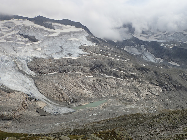
| Dorf glacier, Dorferbach valley, Prägraten am Großvenediger, Lienz District, Tyrol, Austria | 47° 6' 2" N | 12° 19' 9" E | 2.9km (1.8 miles) | |
| Schliefertürme, Oberer Keesboden, Neukirchen am Großvenediger, Zell am See District, Salzburg, Austria | 47° 6' 52" N | 12° 15' 20" E | 3.2km (2.0 miles) | |
| Schlieferkar, Krimml, Zell am See District, Salzburg, Austria | 47° 6' 50" N | 12° 15' 14" E | 3.3km (2.0 miles) | |
| Dreiherrenspitze (Picco dei Tre Signori), Prettau (Predoi), Puster Valley District, South Tyrol, Trentino-Alto Adige (Trentino-South Tyrol), Italy | 47° 4' 8" N | 12° 14' 26" E | 4.2km (2.6 miles) | |
| Prettau glacier, South Tyrol, Trentino-Alto Adige (Trentino-South Tyrol), Italy | 47° 4' 18" N | 12° 14' 9" E | 4.3km (2.7 miles) | |
| Innerkees Alp, Krimml, Zell am See District, Salzburg, Austria | 47° 5' 54" N | 12° 13' 35" E | 4.4km (2.7 miles) | |
| Grasleitenscharte, Krimml, Zell am See District, Salzburg, Austria | 47° 4' 43" N | 12° 13' 43" E | 4.4km (2.8 miles) | |
| Schlieferspitze, Krimml, Zell am See District, Salzburg, Austria | 47° 7' 20" N | 12° 14' 33" E | 4.5km (2.8 miles) | |
| Keeskar, Keeskogel, Neukirchen am Großvenediger, Zell am See District, Salzburg, Austria | 47° 7' 59" N | 12° 18' 24" E | 4.8km (3.0 miles) | |
| Großvenediger northwest slope, Neukirchen am Großvenediger, Zell am See District, Salzburg, Austria | 47° 6' 33" N | 12° 20' 39" E | 5.0km (3.1 miles) | |
| Großvenediger south slope, Dorferbach valley, Prägraten am Großvenediger, Lienz District, Tyrol, Austria | 47° 6' 32" N | 12° 20' 45" E | 5.1km (3.1 miles) | |
| Forcella del Picco (Birnlücke), South Tyrol, Trentino-Alto Adige (Trentino-South Tyrol), Italy | 47° 5' 6" N | 12° 12' 59" E | 5.2km (3.2 miles) | |
| Johanneshütte, Dorferbach valley, Prägraten am Großvenediger, Lienz District, Tyrol, Austria | 47° 3' 36" N | 12° 20' 3" E | 5.3km (3.3 miles) | |
| Keeskogel, Neukirchen am Großvenediger, Zell am See District, Salzburg, Austria | 47° 8' 11" N | 12° 18' 44" E | 5.3km (3.3 miles) | |
| Althaus glacier (Rosshuf glacier), Hoher Rosshuf, Umbal valley, Prägraten am Großvenediger, Lienz District, Tyrol, Austria | 47° 3' 38" N | 12° 13' 52" E | 5.3km (3.3 miles) | |
| Großer Jaidbach, Neukirchen am Großvenediger, Zell am See District, Salzburg, Austria | 47° 7' 54" N | 12° 14' 14" E | 5.6km (3.5 miles) | |
| South slope, Keeskogel, Neukirchen am Großvenediger, Zell am See District, Salzburg, Austria | 47° 7' 10" N | 12° 20' 56" E | 5.8km (3.6 miles) | |
| Stierlahnerwand, Neukirchen am Großvenediger, Zell am See District, Salzburg, Austria | 47° 8' 42" N | 12° 16' 46" E | 5.8km (3.6 miles) | |
| Schwarzes Hörndl, Neukirchen am Großvenediger, Zell am See District, Salzburg, Austria | 47° 8' 2" N | 12° 19' 53" E | 5.8km (3.6 miles) | |
| Dorf Alp, Dorferbach valley, Prägraten am Großvenediger, Lienz District, Tyrol, Austria | 47° 4' 24" N | 12° 21' 20" E | 5.9km (3.6 miles) | |
| Schlüsselspitz east slope, Dorferbach valley, Prägraten am Großvenediger, Lienz District, Tyrol, Austria | 47° 2' 39" N | 12° 19' 13" E | 6.1km (3.8 miles) | |
| Mullwitzaderl, Hoher Zaun, Dorferbach valley, Prägraten am Großvenediger, Lienz District, Tyrol, Austria | 47° 5' 11" N | 12° 21' 48" E | 6.1km (3.8 miles) | |


Bleidächer, Neukirchen am Großvenediger, Zell am See District, Salzburg, Austria