| Locality | Latitude | Longitude | Distance | Bearing |
|---|
| Zechnergraben, Dorfgastein, St. Johann im Pongau District, Salzburg, Austria | 47° 14' 47" N | 13° 4' 51" E | 1.7km (1.0 miles) | |
| Harbach, Bad Hofgastein, St. Johann im Pongau District, Salzburg, Austria | 47° 13' 6" N | 13° 6' 36" E | 2.7km (1.6 miles) | |
| Sladinkopf, Rauris, Zell am See District, Salzburg, Austria | 47° 14' 43" N | 13° 2' 25" E | 4.7km (2.9 miles) | |
| Talc Mine, Harbach, Bad Hofgastein, St. Johann im Pongau District, Salzburg, Austria | 47° 12' 12" N | 13° 8' 8" E | 5.0km (3.1 miles) | |
| Laderding Alp, Bad Hofgastein, St. Johann im Pongau District, Salzburg, Austria | 47° 11' 31" N | 13° 7' 34" E | 5.8km (3.6 miles) | |
| Aigen Alp, Grossarl, St. Johann im Pongau District, Salzburg, Austria | 47° 12' 21" N | 13° 9' 46" E | 6.1km (3.8 miles) | |
| Unterberg, Grossarl, St. Johann im Pongau District, Salzburg, Austria | 47° 14' 35" N | 13° 11' 19" E | 6.5km (4.1 miles) | |
| Wiednergraben, Bad Hofgastein, St. Johann im Pongau District, Salzburg, Austria | 47° 11' 10" N | 13° 4' 24" E | 6.5km (4.1 miles) | |
| Höllwand mountain, Grossarl, St. Johann im Pongau District, Salzburg, Austria | 47° 16' 57" N | 13° 9' 53" E | 6.6km (4.1 miles) | |
| Gruber Quarry, Unterberg, Grossarl, St. Johann im Pongau District, Salzburg, Austria | 47° 15' 20" N | 13° 11' 42" E | 7.2km (4.5 miles) | |
| Brandstatt reservoir, Oberuntersberg, Sankt Veit im Pongau, St. Johann im Pongau District, Salzburg, Austria | 47° 18' 19" N | 13° 7' 48" E | 7.4km (4.6 miles) | |
| Gaisbach valley (Gaißbach valley; Gaissbach valley), Rauris, Zell am See District, Salzburg, Austria | 47° 13' 43" N | 13° 0' 20" E | 7.4km (4.6 miles) | |
| Oberuntersberg, Sankt Veit im Pongau, St. Johann im Pongau District, Salzburg, Austria | 47° 18' 26" N | 13° 7' 48" E | 7.6km (4.7 miles) | |
| Ingelsberg, Bad Hofgastein, St. Johann im Pongau District, Salzburg, Austria | 47° 10' 23" N | 13° 6' 13" E | 7.6km (4.7 miles) | |
| Kramkogel, Wörth, Rauris, Zell am See District, Salzburg, Austria | 47° 11' 19" N | 13° 2' 10" E | 7.7km (4.8 miles) | |
| Eckelgruben, Bad Hofgastein, St. Johann im Pongau District, Salzburg, Austria | 47° 10' 18" N | 13° 6' 15" E | 7.8km (4.8 miles) | |
| Leid Alp, Bad Hofgastein, St. Johann im Pongau District, Salzburg, Austria | 47° 10' 34" N | 13° 3' 20" E | 8.1km (5.0 miles) | |
| Geierwand, Ellmau valley, Grossarl, St. Johann im Pongau District, Salzburg, Austria | 47° 15' 7" N | 13° 12' 34" E | 8.2km (5.1 miles) | |
| Steinbachtal (Steinbachwände), Rauris, Zell am See District, Salzburg, Austria | 47° 15' 12" N | 12° 59' 30" E | 8.4km (5.2 miles) | |
| Türchlwand, Vorsterbach valley, Wörth, Rauris, Zell am See District, Salzburg, Austria | 47° 11' 36" N | 13° 0' 29" E | 8.9km (5.5 miles) | |
| Moosen, Rauris, Zell am See District, Salzburg, Austria | 47° 13' 2" N | 12° 59' 21" E | 8.9km (5.6 miles) | |
| Flatscher Alp, Vorsterbach valley, Wörth, Rauris, Zell am See District, Salzburg, Austria | 47° 11' 47" N | 13° 0' 7" E | 9.1km (5.6 miles) | |
| Vorsterbach valley, Wörth, Rauris, Zell am See District, Salzburg, Austria | 47° 11' 50" N | 12° 59' 57" E | 9.2km (5.7 miles) | |
| Lercheck, Vorsterbach valley, Wörth, Rauris, Zell am See District, Salzburg, Austria | 47° 11' 50" N | 12° 59' 55" E | 9.2km (5.7 miles) | |
| Böndl lake, Goldegg, St. Johann im Pongau District, Salzburg, Austria | 47° 18' 51" N | 13° 2' 34" E | 9.2km (5.7 miles) | |
| B 311 road tunnel, Schwarzach im Pongau, St. Johann im Pongau District, Salzburg, Austria | 47° 19' 24" N | 13° 8' 27" E | 9.5km (5.9 miles) | |
| Au, Lambach, Grossarl, St. Johann im Pongau District, Salzburg, Austria | 47° 16' 46" N | 13° 13' 16" E | 9.9km (6.2 miles) | |
| Lambach, Grossarl, St. Johann im Pongau District, Salzburg, Austria | 47° 16' 52" N | 13° 13' 12" E | 9.9km (6.2 miles) | |
| Talc mine, Gamskarkogel, Bad Hofgastein, St. Johann im Pongau District, Salzburg, Austria | 47° 9' 39" N | 13° 9' 30" E | 9.9km (6.2 miles) | |
| Schloss Alp, Bad Hofgastein, St. Johann im Pongau District, Salzburg, Austria | 47° 9' 21" N | 13° 3' 50" E | 10.0km (6.2 miles) | |


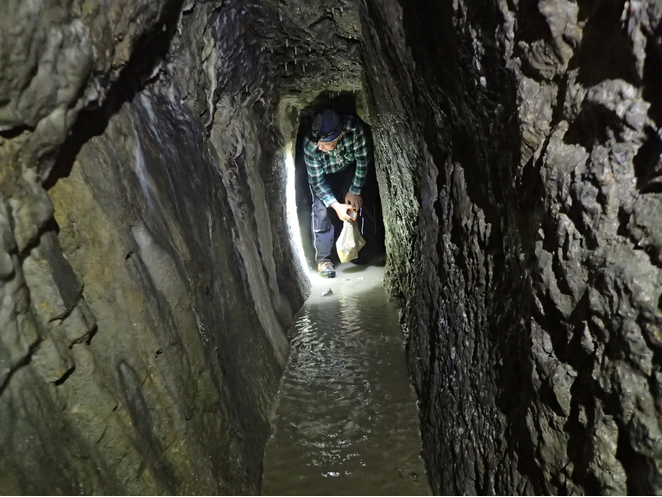


Steinbachtal, Rauris, Zell am See District, Salzburg, Austria