| Locality | Latitude | Longitude | Distance | Bearing |
|---|
| Glatschach, Dellach im Drautal, Spittal an der Drau District, Carinthia, Austria | 46° 44' 41" N | 13° 4' 33" E | 0.8km (0.5 miles) | |
| Kolm (Scheinitzen), Dellach im Drautal, Spittal an der Drau District, Carinthia, Austria | 46° 44' 38" N | 13° 4' 3" E | 1.1km (0.7 miles) | |
| Mercury mine, Glatschach, Dellach im Drautal, Spittal an der Drau District, Carinthia, Austria | 46° 45' 12" N | 13° 5' 23" E | 2.0km (1.2 miles) | |
| Amlach Alp, Dellach im Drautal, Spittal an der Drau District, Carinthia, Austria | 46° 42' 39" N | 13° 5' 34" E | 3.1km (2.0 miles) | |
| Scheinitzen, Irschen, Spittal an der Drau District, Carinthia, Austria | 46° 44' 51" N | 13° 1' 38" E | 4.0km (2.5 miles) | |
| Jaukenhöhe, Dellach, Hermagor District, Carinthia, Austria | 46° 42' 3" N | 13° 3' 47" E | 4.2km (2.6 miles) | |
| West slope, Jaukenhöhe, Dellach, Hermagor District, Carinthia, Austria | 46° 42' 3" N | 13° 3' 35" E | 4.3km (2.7 miles) | |
| South slope, Jaukenhöhe, Dellach, Hermagor District, Carinthia, Austria | 46° 41' 56" N | 13° 3' 47" E | 4.4km (2.8 miles) | |
| Irschen, Spittal an der Drau District, Carinthia, Austria | 46° 45' 19" N | 13° 1' 27" E | 4.6km (2.8 miles) | |
| Ebenberg, Berg im Drautal, Spittal an der Drau District, Carinthia, Austria | 46° 43' 26" N | 13° 8' 19" E | 4.8km (3.0 miles) | |
| Plonalmlacke, Dellach im Drautal, Spittal an der Drau District, Carinthia, Austria | 46° 42' 9" N | 13° 2' 3" E | 5.1km (3.2 miles) | |
| Ochsenschlucht, Berg im Drautal, Spittal an der Drau District, Carinthia, Austria | 46° 41' 50" N | 13° 7' 15" E | 5.5km (3.4 miles) | |
| Kristallspitze (Kristallspitz), Irschen, Spittal an der Drau District, Carinthia, Austria | 46° 47' 18" N | 13° 3' 5" E | 6.0km (3.7 miles) | |
| Rotwieland, Irschen, Spittal an der Drau District, Carinthia, Austria | 46° 47' 26" N | 13° 2' 54" E | 6.3km (3.9 miles) | |
| Reißgraben, Ebenberg, Berg im Drautal, Spittal an der Drau District, Carinthia, Austria | 46° 42' 45" N | 13° 9' 26" E | 6.6km (4.1 miles) | |
| Scharnik, Irschen, Spittal an der Drau District, Carinthia, Austria | 46° 47' 42" N | 13° 2' 36" E | 6.9km (4.3 miles) | |
| Knappenstube, Irschen, Spittal an der Drau District, Carinthia, Austria | 46° 46' 42" N | 13° 0' 36" E | 6.9km (4.3 miles) | |
| Maiengraben, Jaukenhöhe, Dellach, Hermagor District, Carinthia, Austria | 46° 40' 37" N | 13° 3' 16" E | 7.0km (4.3 miles) | |
| Lammergraben, Laas, Kötschach-Mauthen, Hermagor District, Carinthia, Austria | 46° 41' 48" N | 13° 0' 17" E | 7.2km (4.5 miles) | |
| Zwickenberg, Oberdrauburg, Spittal an der Drau District, Carinthia, Austria | 46° 45' 49" N | 12° 59' 0" E | 7.8km (4.8 miles) | |
| Dellacher Graben, Dellach, Hermagor District, Carinthia, Austria | 46° 40' 1" N | 13° 4' 46" E | 7.8km (4.9 miles) | |
| Langer prospect, Berg im Drautal, Spittal an der Drau District, Carinthia, Austria | 46° 45' 35" N | 13° 10' 37" E | 7.9km (4.9 miles) | |
| Strieden, Oberdrauburg, Spittal an der Drau District, Carinthia, Austria | 46° 46' 50" N | 12° 59' 30" E | 8.2km (5.1 miles) | |
| Striedenalmer Plaiken, Oberdrauburg, Spittal an der Drau District, Carinthia, Austria | 46° 47' 36" N | 13° 0' 17" E | 8.4km (5.2 miles) | |
| Laas, Kötschach-Mauthen, Hermagor District, Carinthia, Austria | 46° 41' 39" N | 12° 59' 17" E | 8.4km (5.2 miles) | |
| Gailbergsattel, Laas, Kötschach-Mauthen, Hermagor District, Carinthia, Austria | 46° 43' 2" N | 12° 58' 0" E | 8.8km (5.5 miles) | |
| Gurskerkammer, Zwickenberg, Oberdrauburg, Spittal an der Drau District, Carinthia, Austria | 46° 46' 10" N | 12° 57' 47" E | 9.5km (5.9 miles) | |
| Weidenburg, Kötschach-Mauthen, Hermagor District, Carinthia, Austria | 46° 38' 52" N | 13° 3' 27" E | 10.1km (6.3 miles) | |
| Assamalm ore deposit, Greifenburg, Spittal an der Drau District, Carinthia, Austria | 46° 48' 3" N | 13° 10' 27" E | 10.2km (6.3 miles) | |
| Edengang (Gloder), Zwickenberg, Oberdrauburg, Spittal an der Drau District, Carinthia, Austria | 46° 46' 12" N | 12° 57' 10" E | 10.2km (6.4 miles) | |


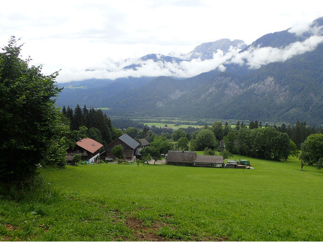


Jaukenhöhe, Dellach, Hermagor District, Carinthia, Austria