| Locality | Latitude | Longitude | Distance | Bearing |
|---|
| Stimmelhöhe, Stuhlfelden, Zell am See District, Salzburg, Austria | 47° 18' 33" N | 12° 30' 39" E | 2.7km (1.7 miles) | |
| Rettenbach (Rettenbachgraben), Mittersill, Zell am See District, Salzburg, Austria | 47° 17' 1" N | 12° 26' 49" E | 3.6km (2.2 miles) | |
| Scheibelberg, Stuhlfelden, Zell am See District, Salzburg, Austria | 47° 16' 2" N | 12° 32' 4" E | 3.7km (2.3 miles) | |
| Haidbachgraben, Mittersill, Zell am See District, Salzburg, Austria | 47° 15' 19" N | 12° 28' 32" E | 3.9km (2.4 miles) | |
| Gaiswand mine, Haidbachgraben, Mittersill, Zell am See District, Salzburg, Austria | 47° 15' 12" N | 12° 28' 5" E | 4.3km (2.7 miles) | |
| Talc mine, Großbruck farm, Mittersill, Zell am See District, Salzburg, Austria | 47° 14' 51" N | 12° 29' 53" E | 4.5km (2.8 miles) | |
| Großbruck farm, Mittersill, Zell am See District, Salzburg, Austria | 47° 14' 49" N | 12° 29' 23" E | 4.5km (2.8 miles) | |
| Schiedergraben, Mittersill, Zell am See District, Salzburg, Austria | 47° 14' 20" N | 12° 30' 4" E | 5.4km (3.4 miles) | |
| Oberreitgraben, Mittersill, Zell am See District, Salzburg, Austria | 47° 14' 8" N | 12° 30' 49" E | 5.9km (3.7 miles) | |
| Schiederlehengraben, Mittersill, Zell am See District, Salzburg, Austria | 47° 14' 6" N | 12° 28' 38" E | 6.0km (3.7 miles) | |
| Viertal Alp (Puderlehen Alp), Uttendorf, Zell am See District, Salzburg, Austria | 47° 18' 35" N | 12° 34' 7" E | 6.1km (3.8 miles) | |
| Schrempf (Schrempf Alp; Gastegg Alp), Schneiderau, Uttendorf, Zell am See District, Salzburg, Austria | 47° 15' 27" N | 12° 33' 56" E | 6.3km (3.9 miles) | |
| Mooseggkarl, Dorfer Öd, Schneiderau, Uttendorf, Zell am See District, Salzburg, Austria | 47° 15' 27" N | 12° 33' 56" E | 6.3km (3.9 miles) | |
| Upper Ferschbach Alp, Ferschbach valley, Fellern, Uttendorf, Zell am See District, Salzburg, Austria | 47° 15' 27" N | 12° 33' 56" E | 6.3km (3.9 miles) | |
| Lower Ferschbach Alp, Ferschbach valley, Fellern, Uttendorf, Zell am See District, Salzburg, Austria | 47° 15' 27" N | 12° 33' 56" E | 6.3km (3.9 miles) | |
| Reichersberg Alp, Hackbrettl, Enzingerboden, Uttendorf, Zell am See District, Salzburg, Austria | 47° 15' 27" N | 12° 33' 56" E | 6.3km (3.9 miles) | |
| Arzbachgraben, Mittersill, Zell am See District, Salzburg, Austria | 47° 13' 52" N | 12° 28' 40" E | 6.4km (4.0 miles) | |
| Pihapper east slope, Mittersill, Zell am See District, Salzburg, Austria | 47° 13' 59" N | 12° 28' 0" E | 6.4km (4.0 miles) | |
| Pihapper west slope - Lach Alp area, Hollersbach im Pinzgau, Zell am See District, Salzburg, Austria | 47° 14' 0" N | 12° 27' 33" E | 6.6km (4.1 miles) | |
| Schönaupalfen, Mittersill, Zell am See District, Salzburg, Austria | 47° 13' 41" N | 12° 29' 32" E | 6.6km (4.1 miles) | |
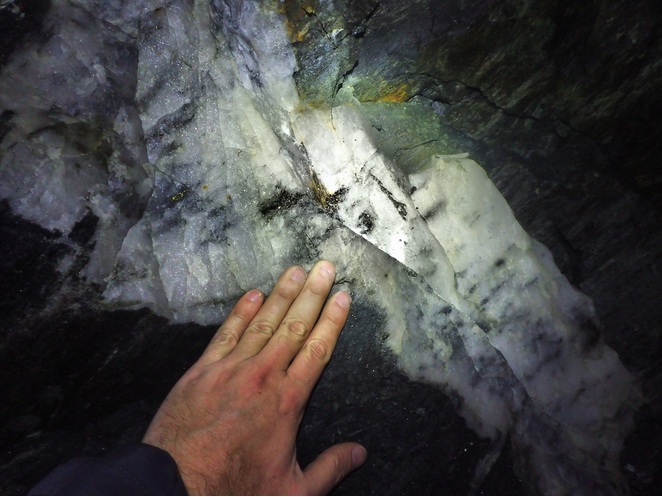
| Mittersill Scheelite deposit, Mittersill, Zell am See District, Salzburg, Austria | 47° 13' 33" N | 12° 29' 19" E | 6.9km (4.3 miles) | |
| Santen Alp, Mittersill, Zell am See District, Salzburg, Austria | 47° 13' 37" N | 12° 30' 46" E | 6.9km (4.3 miles) | |
| Thurn pass, Mittersill, Zell am See District, Salzburg, Austria | 47° 18' 30" N | 12° 24' 30" E | 6.9km (4.3 miles) | |
| Pembach, Mittersill, Zell am See District, Salzburg, Austria | 47° 13' 14" N | 12° 28' 42" E | 7.5km (4.7 miles) | |
| Schößwend Mine, Mittersill, Zell am See District, Salzburg, Austria | 47° 13' 3" N | 12° 28' 37" E | 7.9km (4.9 miles) | |
| Holland Alp, Guggernbach valley (Lützlstubach), Uttendorf, Zell am See District, Salzburg, Austria | 47° 13' 46" N | 12° 33' 18" E | 7.9km (4.9 miles) | |
| Guggernbach valley (Lützlstubach), Uttendorf, Zell am See District, Salzburg, Austria | 47° 14' 4" N | 12° 33' 52" E | 7.9km (4.9 miles) | |
| Baryte cleft, Erlbach Alp, Mittersill, Zell am See District, Salzburg, Austria | 47° 13' 0" N | 12° 30' 19" E | 7.9km (4.9 miles) | |
| Guggernbach stream, Guggernbach valley (Lützlstubach), Uttendorf, Zell am See District, Salzburg, Austria | 47° 14' 5" N | 12° 33' 54" E | 7.9km (4.9 miles) | |
| Erlbach Alp, Mittersill, Zell am See District, Salzburg, Austria | 47° 13' 0" N | 12° 30' 19" E | 7.9km (4.9 miles) | |


Western ore field, Mittersill Scheelite deposit, Mittersill, Zell am See District, Salzburg, Austria